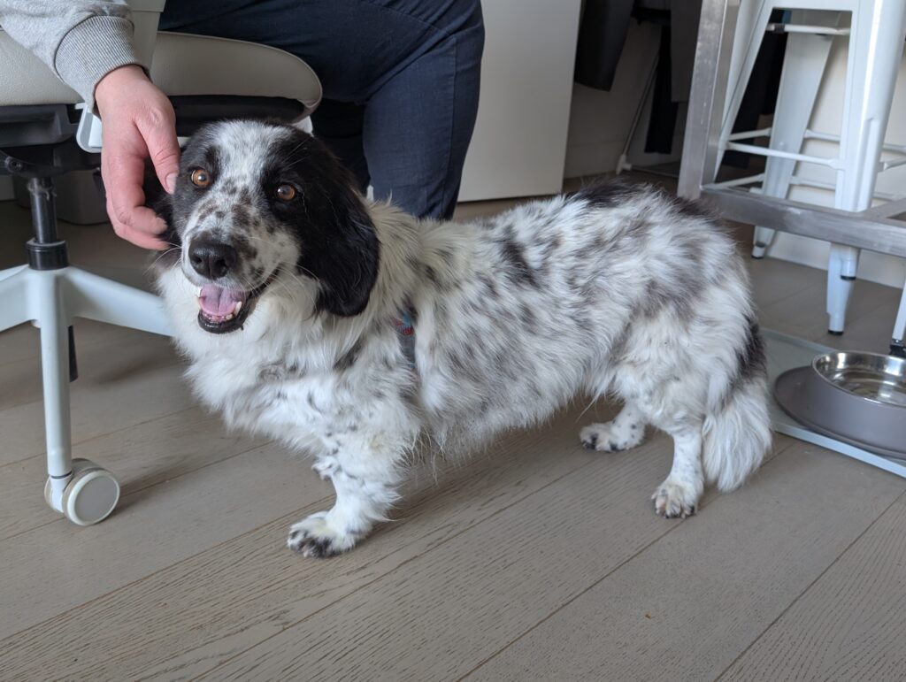
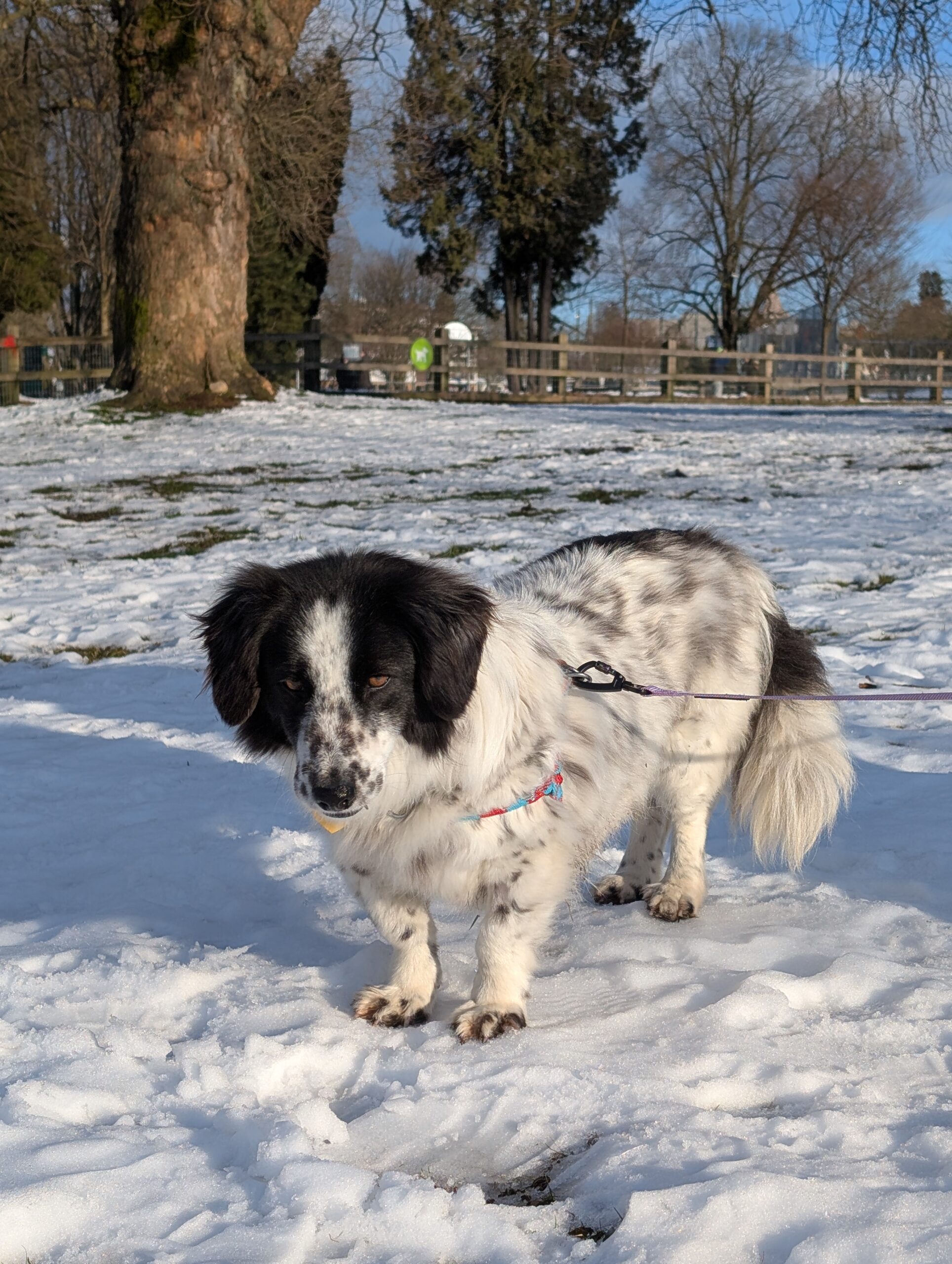
Today, Febuary 9th 2025, we adopted a dog. The name she comes with is Sunshine, which we’ve been shortening to Sunny. It’s Sunday, fittingly. Aimée found her locally fostered, her photo was most cute, and she sounded like a perfect fit. They didn’t know her age or her lineage for sure, but pegged her at ~3.5 years old and maybe an Aussie / Corgi mix.
Obviously her stature suggests corgi. Or perhaps Dachshund? Aussie was certainly believable, though she did the ‘stalking’ thing that Border Collies do towards a crow on a fence this afternoon, so now we’re calling that into question as well.
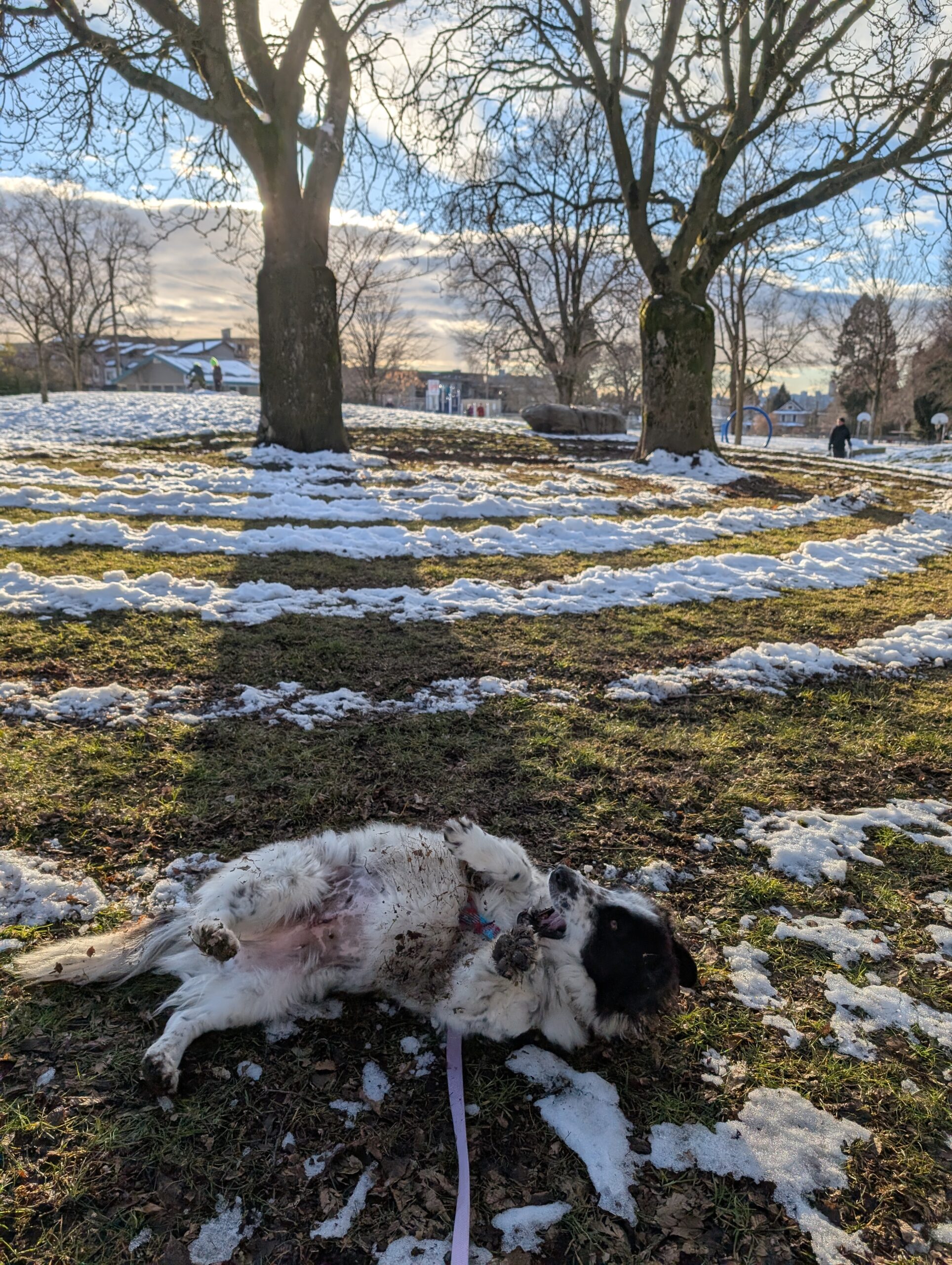
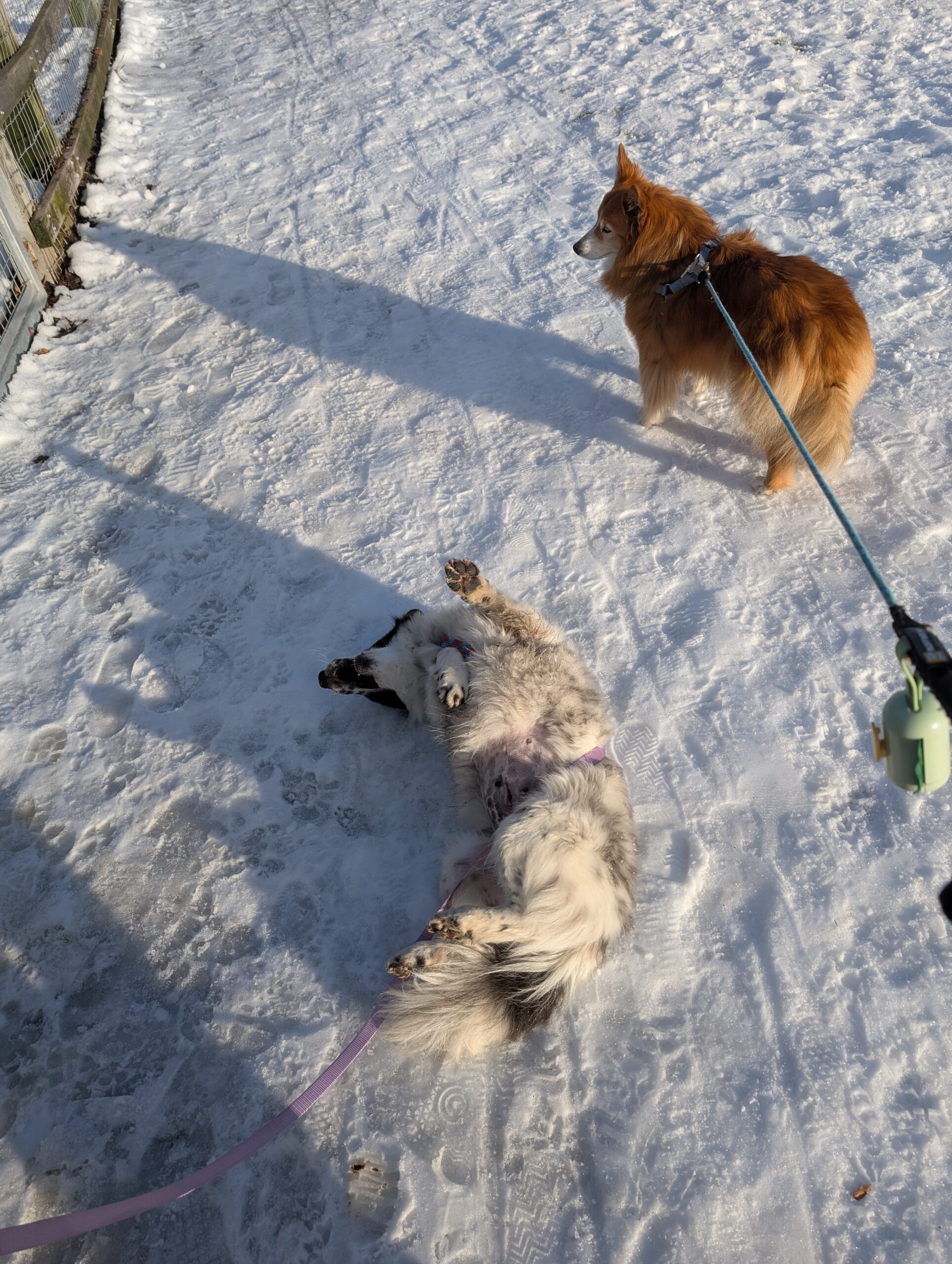
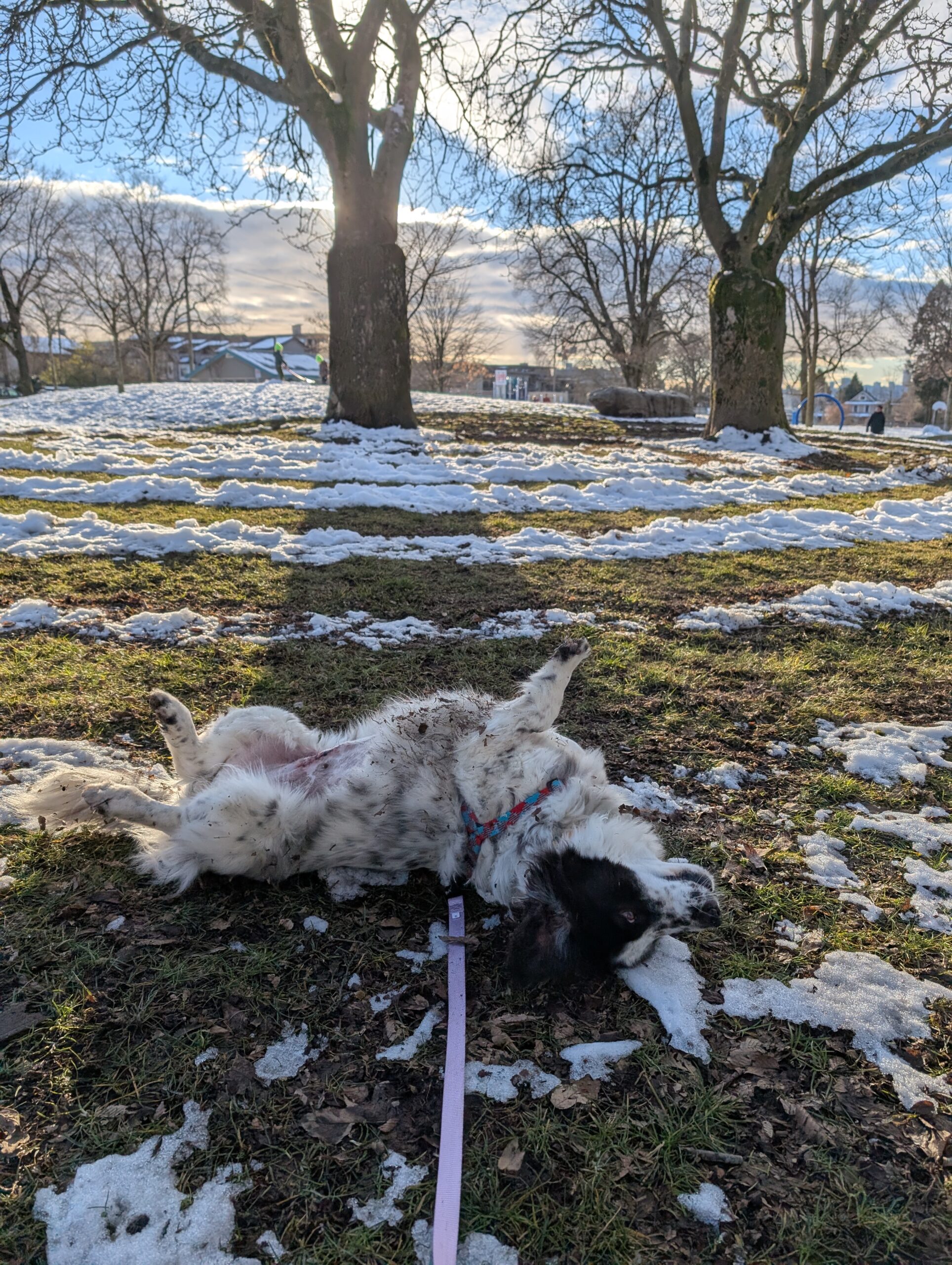
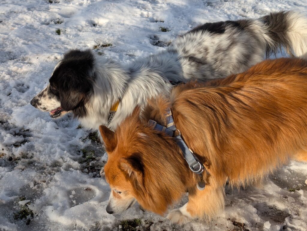
Leia has been enjoying being an only dog and we want her golden years to be as comfortable and enjoyable as possible, so her opinion was very important to us. While she is has some reservations, they’ve gotten along great – Sunny doesn’t really engage with Leia but they already seem pretty comfortable in each others’ presence. I suspect they will become bonded with time.
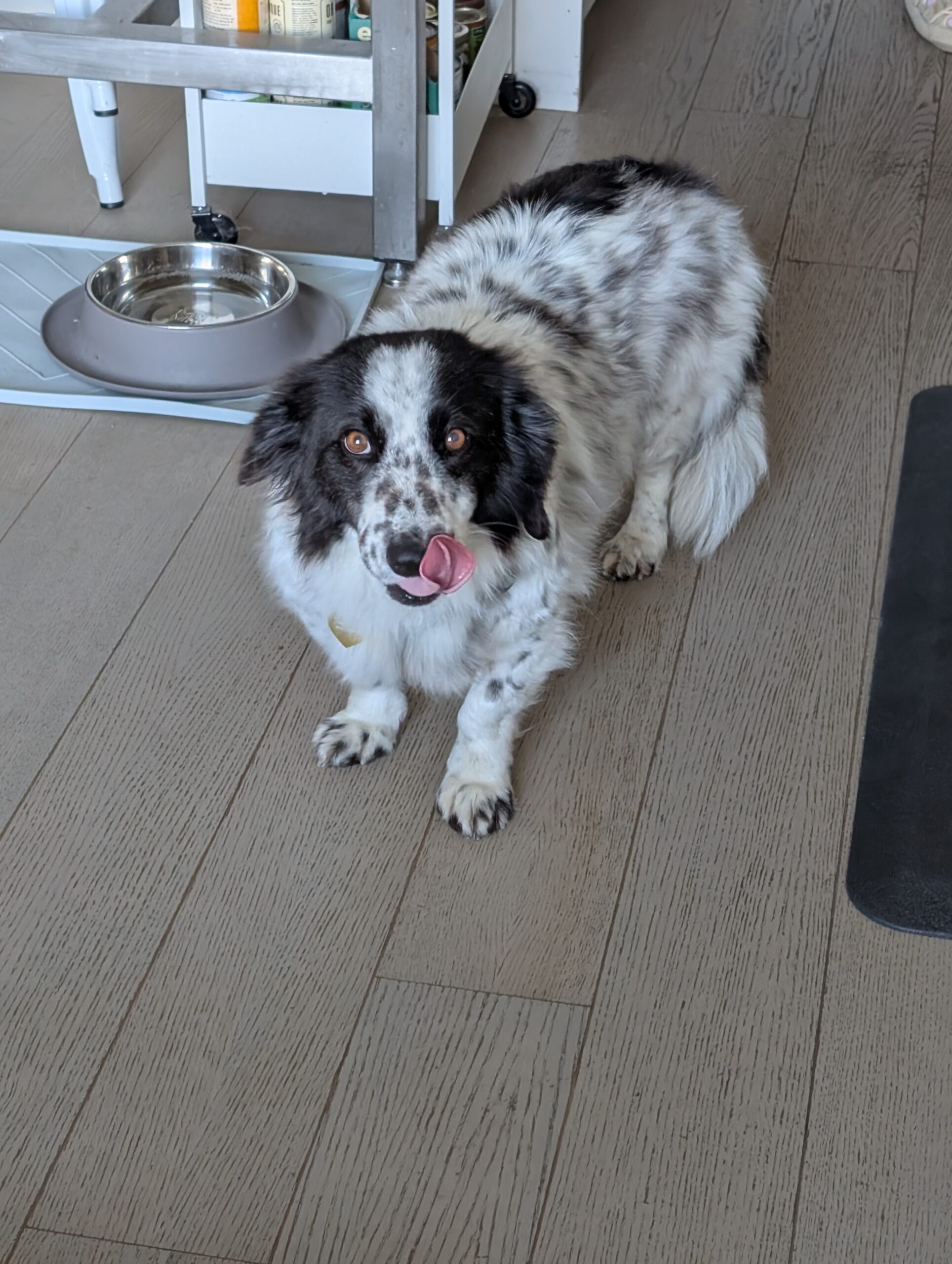
Sunny is from Turkey, rescued during the 2023 flooding in the area we’re told. She had a litter of puppies, as I understand afterwards (sometime in early 2024 maybe?), and less than two weeks ago she had a large bladder stone removed as well as full dental work including a bunch of tooth extractions. Despite all this, she seems carefree. She loves attention, and doesn’t want pets to end.
She’s already met a handful of our dog park friends (both canine and human) and no doubt will become an integral part of the community in no time.
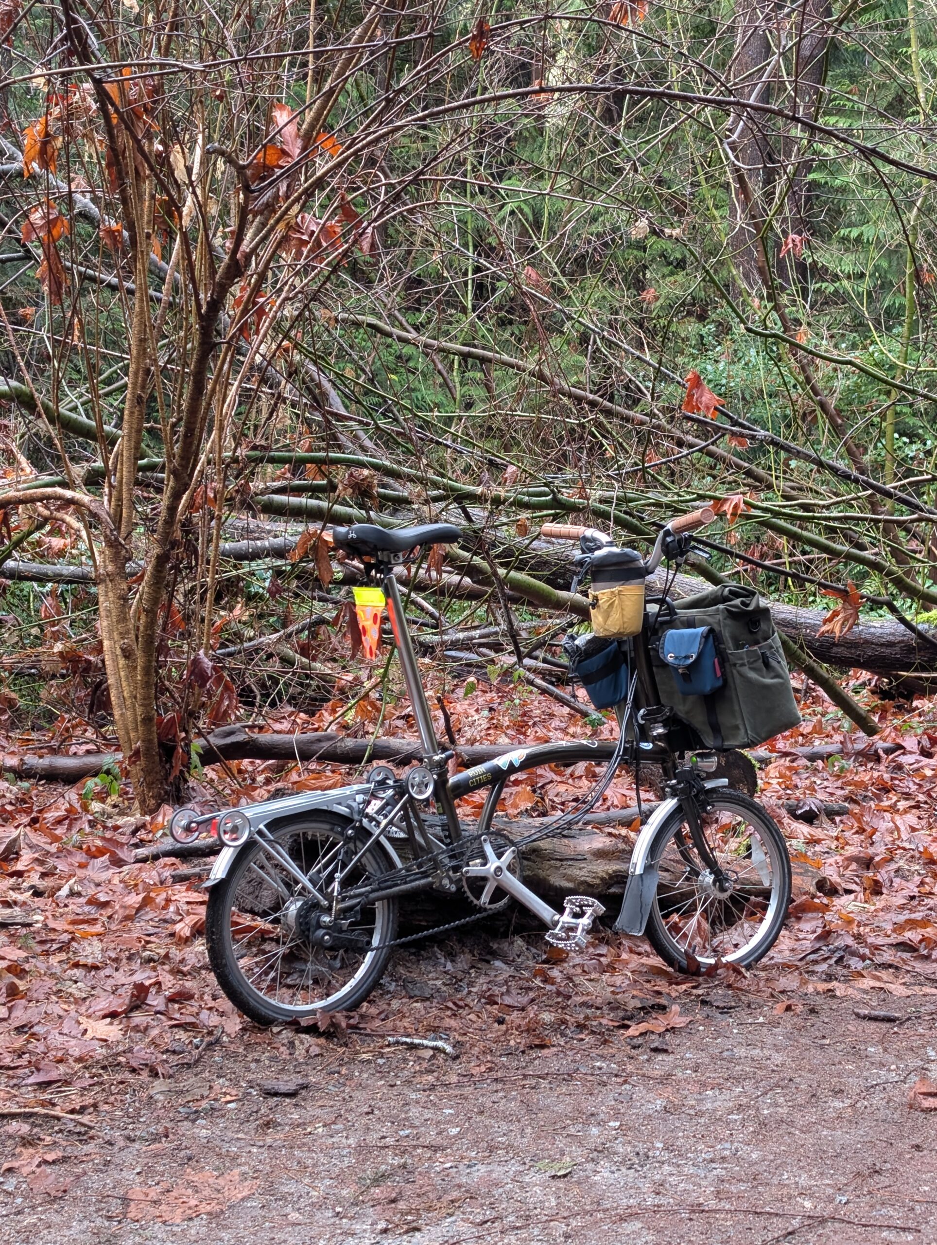
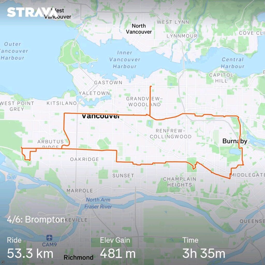
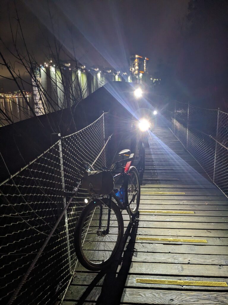
Onto my fourth bike of six, I chose the Brompton today because the weather forecast was iffy at best and the route was going to be reasonably urban. It was Saturday, Dec 28th 2024, and it was also Park Bagging. Park bagging was started by a bike pal and has been running since May 2023, the idea being that participants visit every park in Vancouver in alphabetical order and have a beverage of choice at each one. The most popular choice is beer, but non-alc and other drinks are also common and valid. The parks for this day were Musqueam and Nanaimo parks; we are about mid-way through the alphabet.
Musqueam is a large park in the southwest corner of the city; I live in the north east corner so it was about 20 km just to get to the first park. I took the Arbutus Greenway and poked into Pacific Spirit Park’s trails a little bit before reaching the meet point.
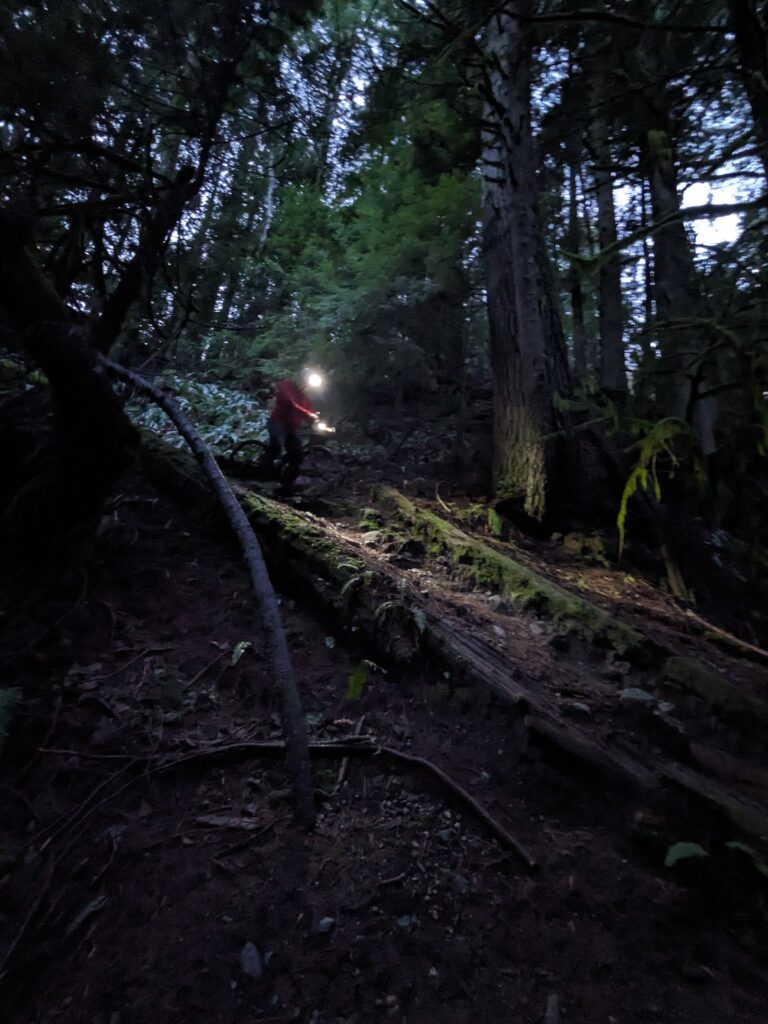
We meandered to Nanaimo Park, and from there I needed another 20+ km in order to meet my goal: so I headed east into Burnaby, bonking at around the right time to get some fast food by way of Wendys. I didn’t take a lot of photos, it was a pretty ordinary ride really. I got home just after dark; thankful for the Brompton’s dynamo lighting.
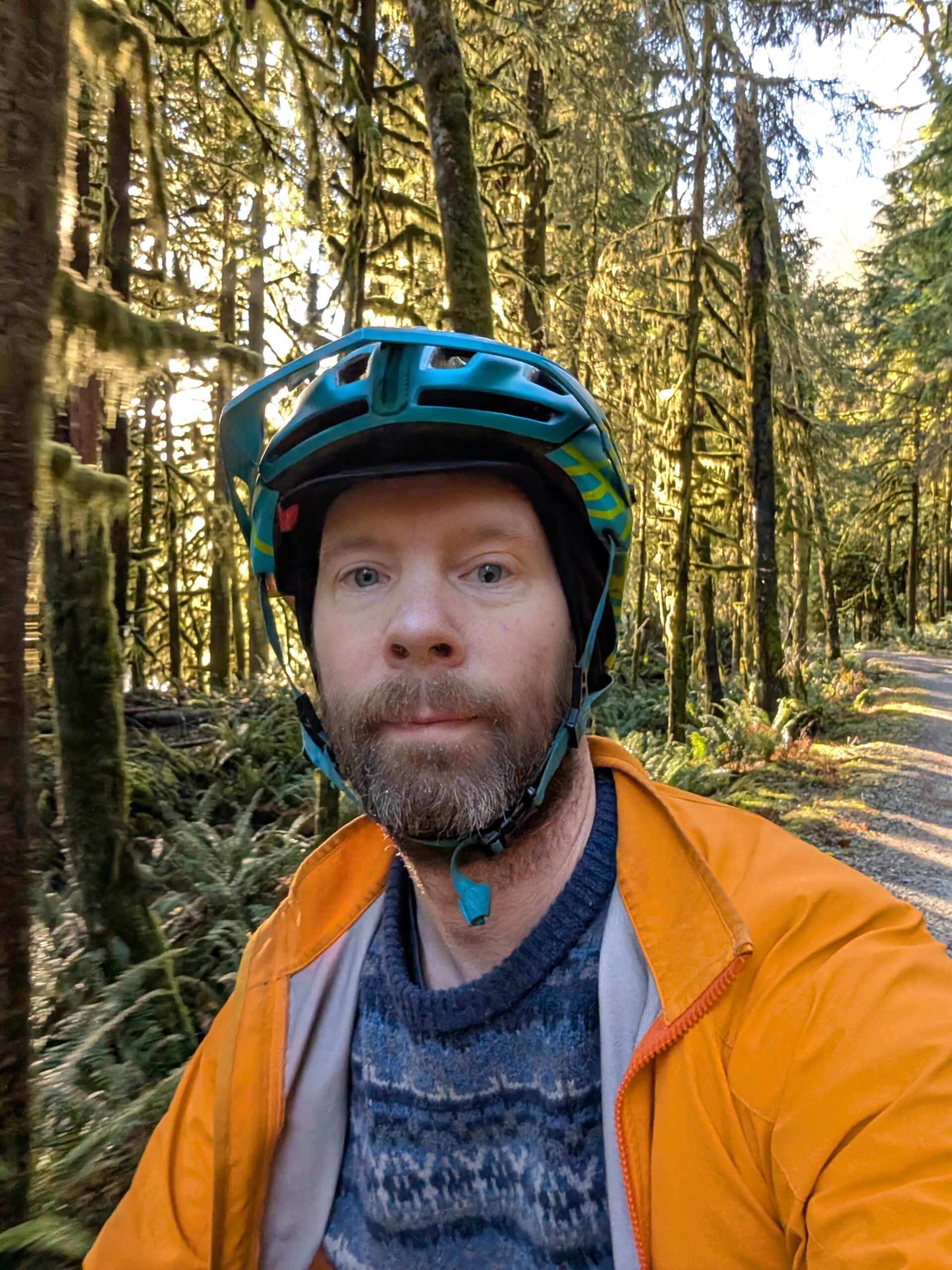
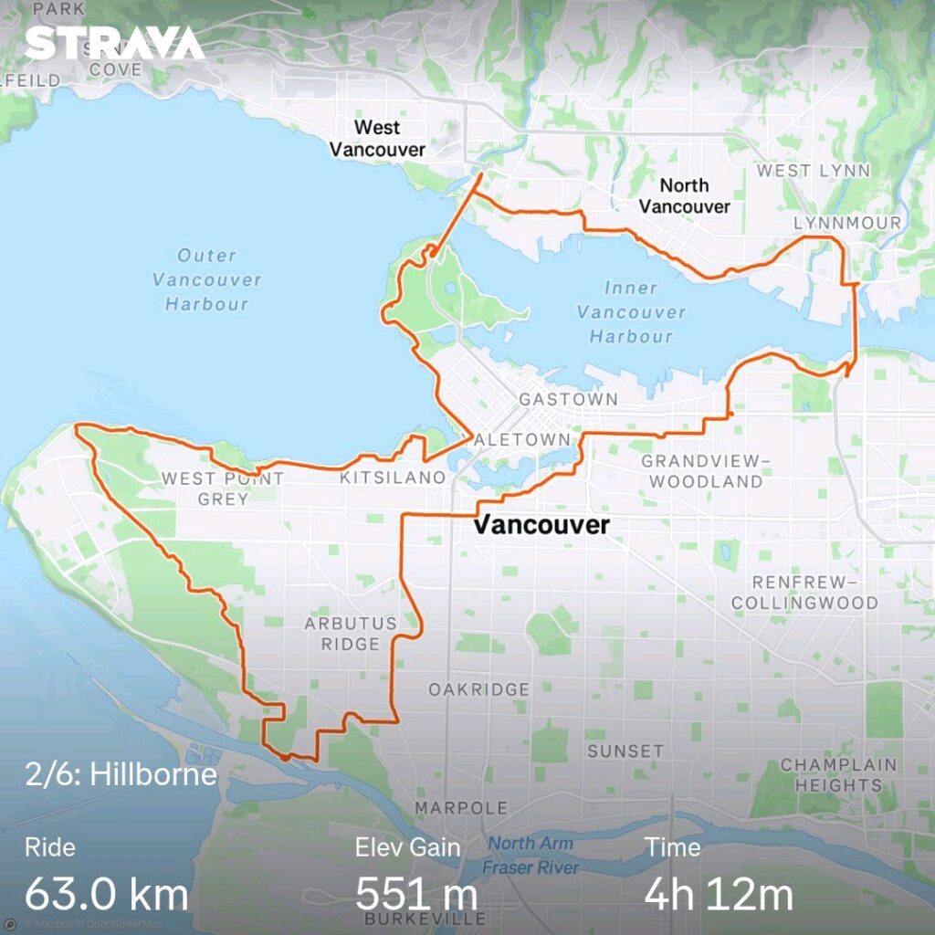
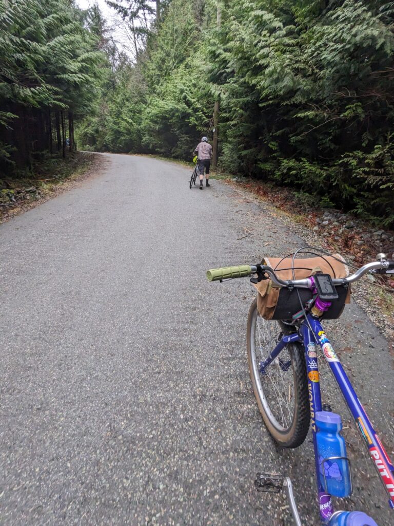
Day one was the Raleigh Twenty, day two was the Hillborne. Day three, Dec 27 2024, was also Friday: the day of Camp Coffee Club’s morning meeting. This week was at the OG location, Waterfront Park in North Van. I show up quite irregularly on account of the early hour, but I got myself out before sunrise and on site shortly after 8am.
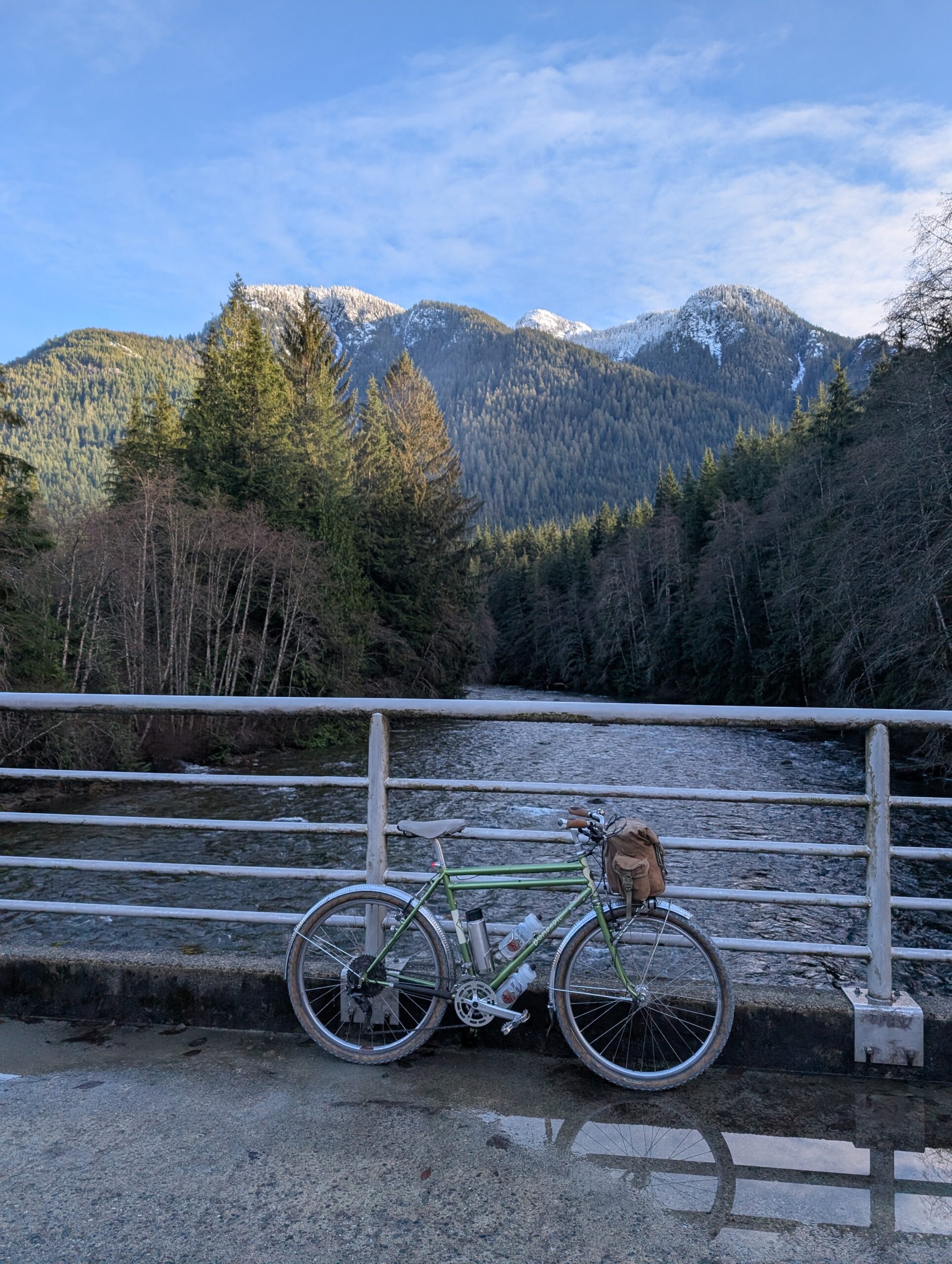
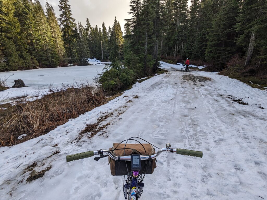
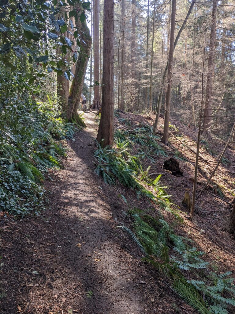
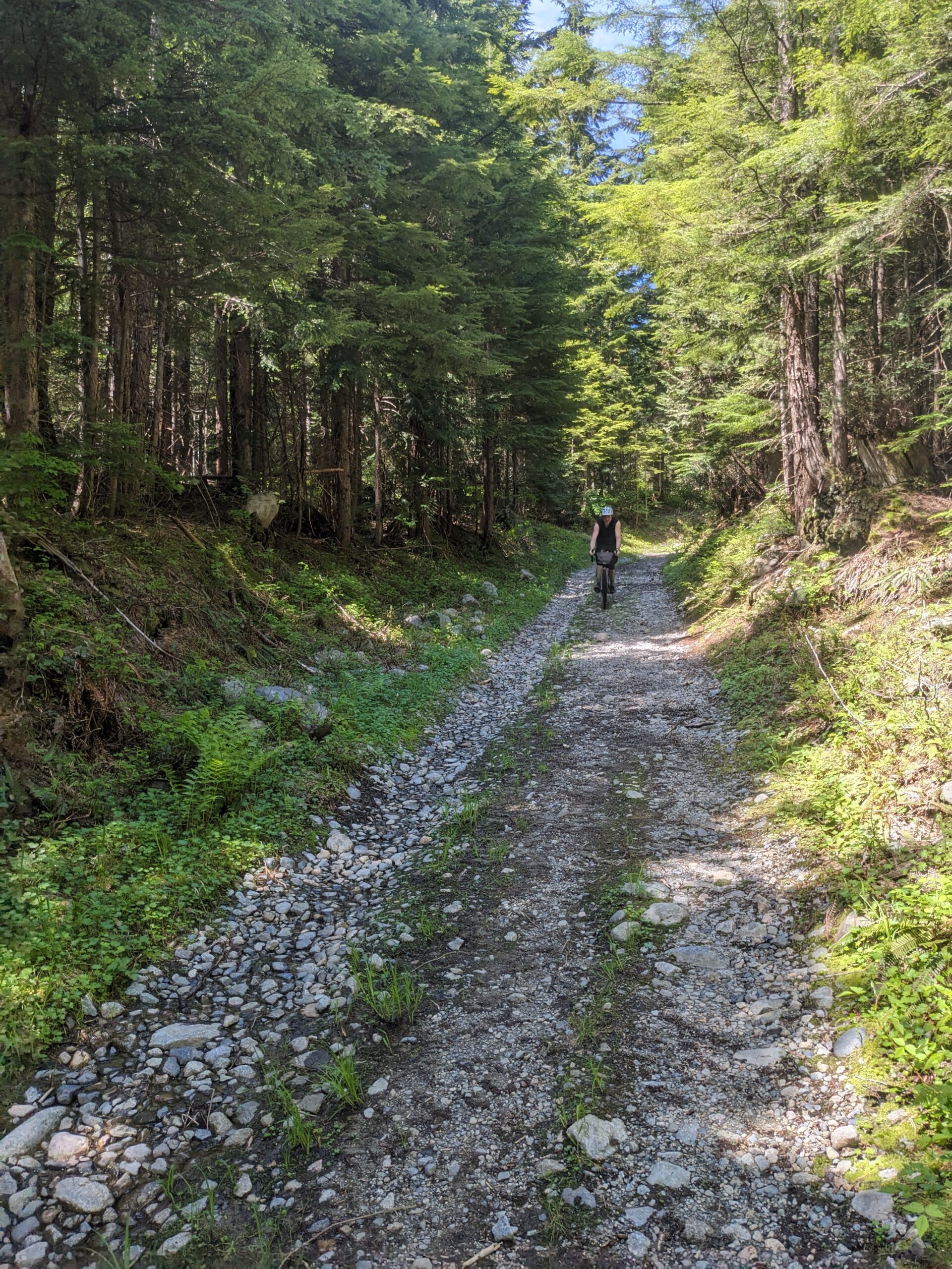
After drinking my coffee and seeing the others off, Morgan, Nathan and I headed for a Seymour valley loop. We grabbed some breakfast at A&W then headed up the path behind Capilano University which includes, as we knew, a long set of stairs near the end.
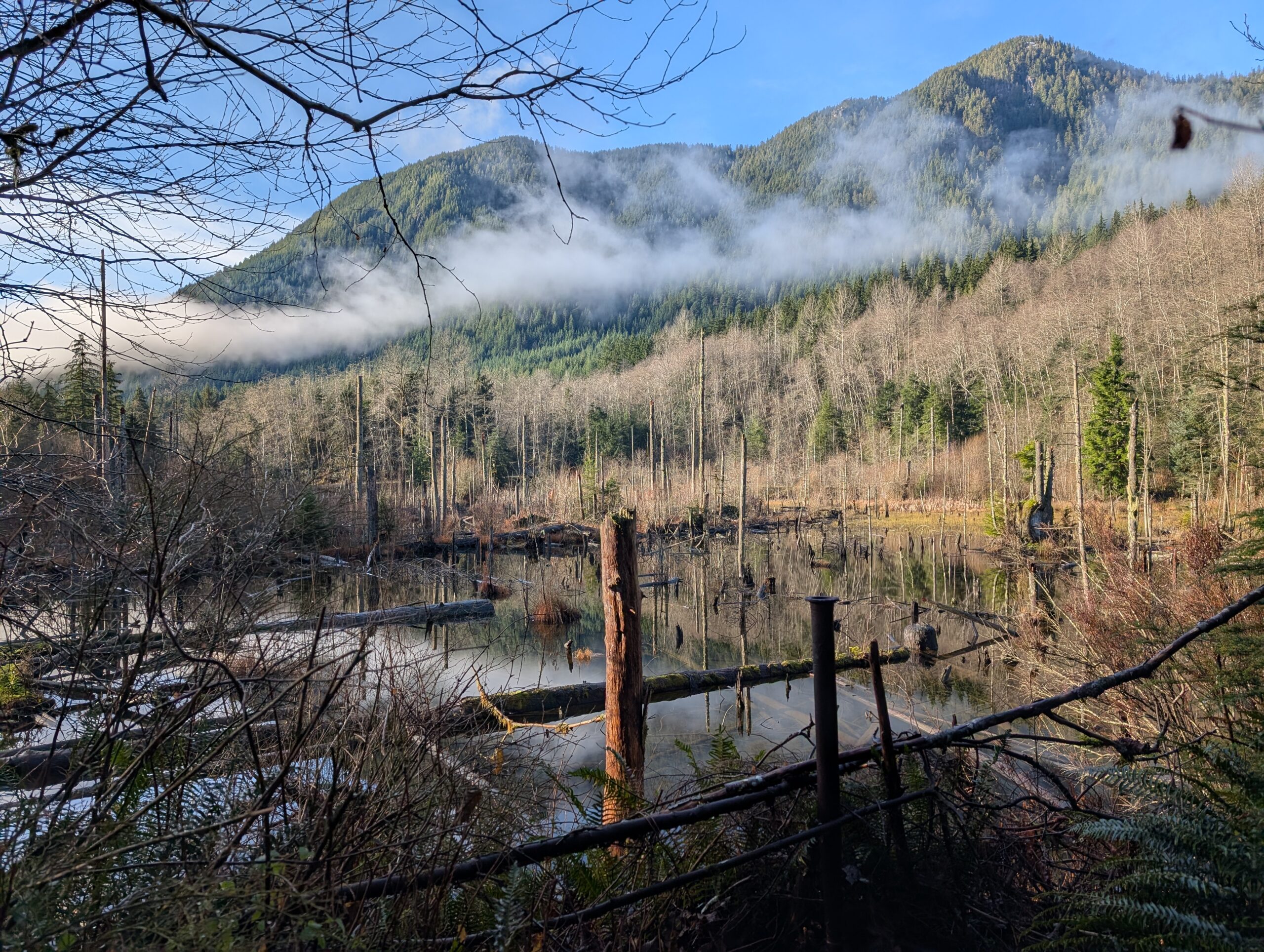
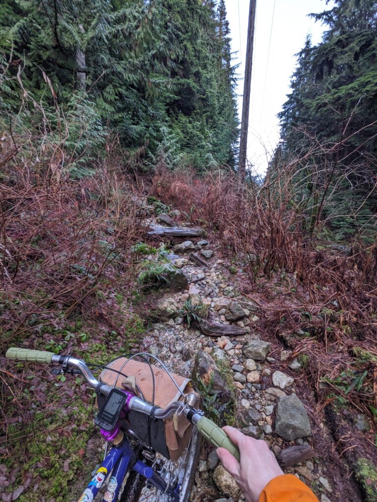
We stayed off the road as much as possible by taking Diamond trail to Baden Powell off Lillooet Rd. We stopped along the top of a ridge to bask in the forest glow.
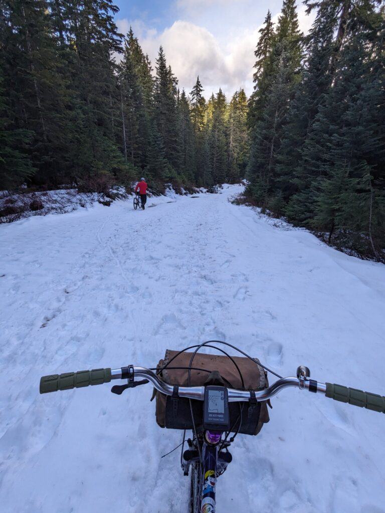
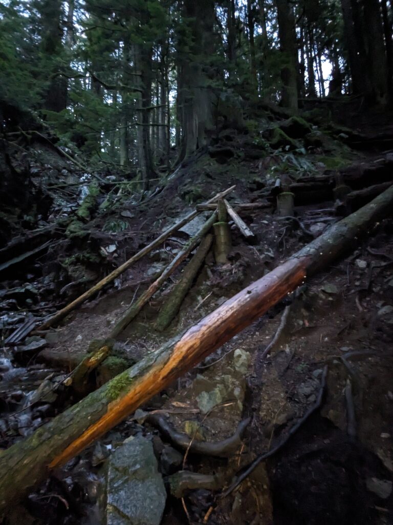
We then shed a bunch of elevation we just worked hard for by descending Baden Powell to Riverside Dr – an absolutely glorious stretch of trail that ends with a treacherously steep staircase. We were rewarded with a bit of fog against the sun for perfect light.
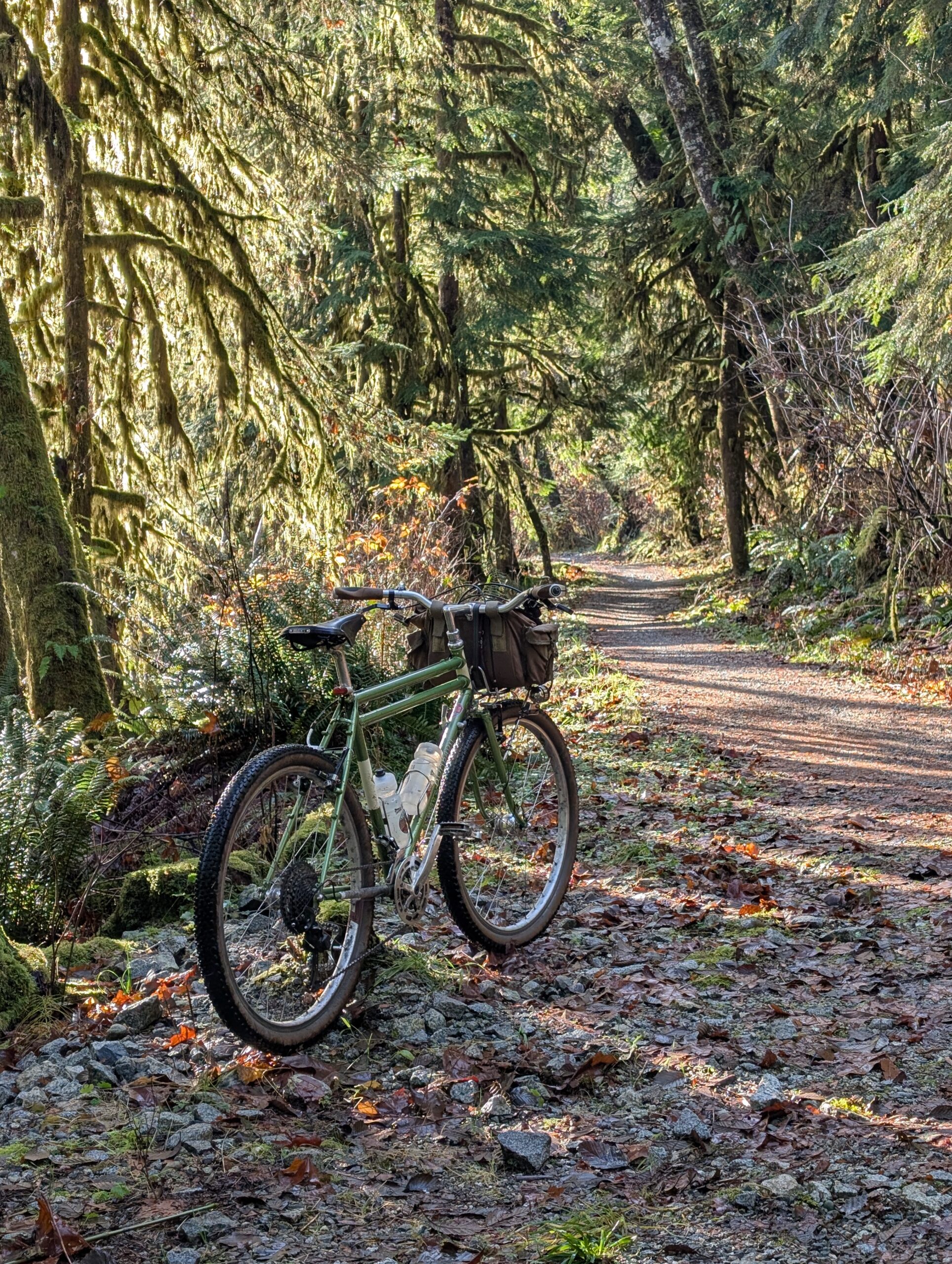
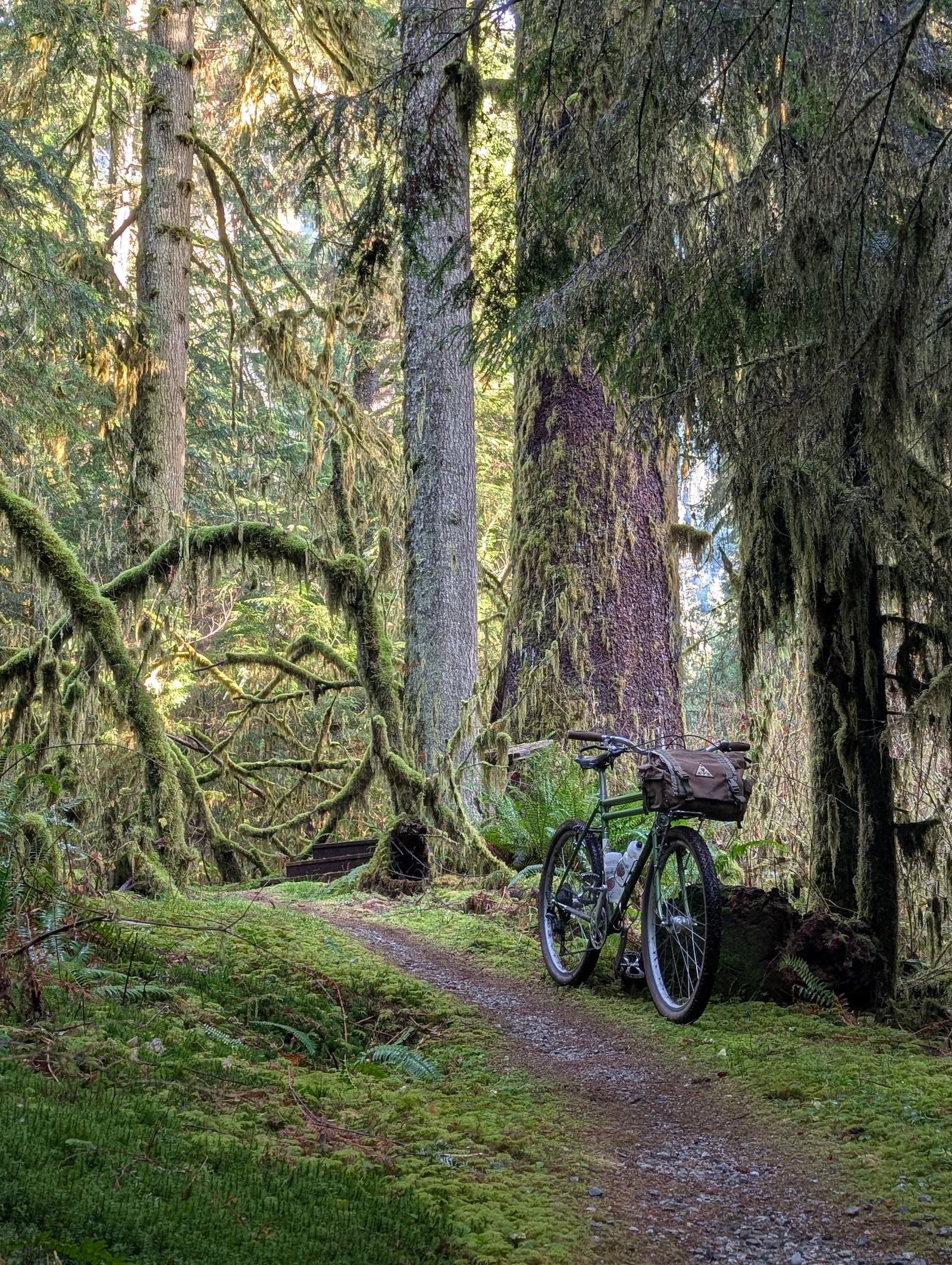
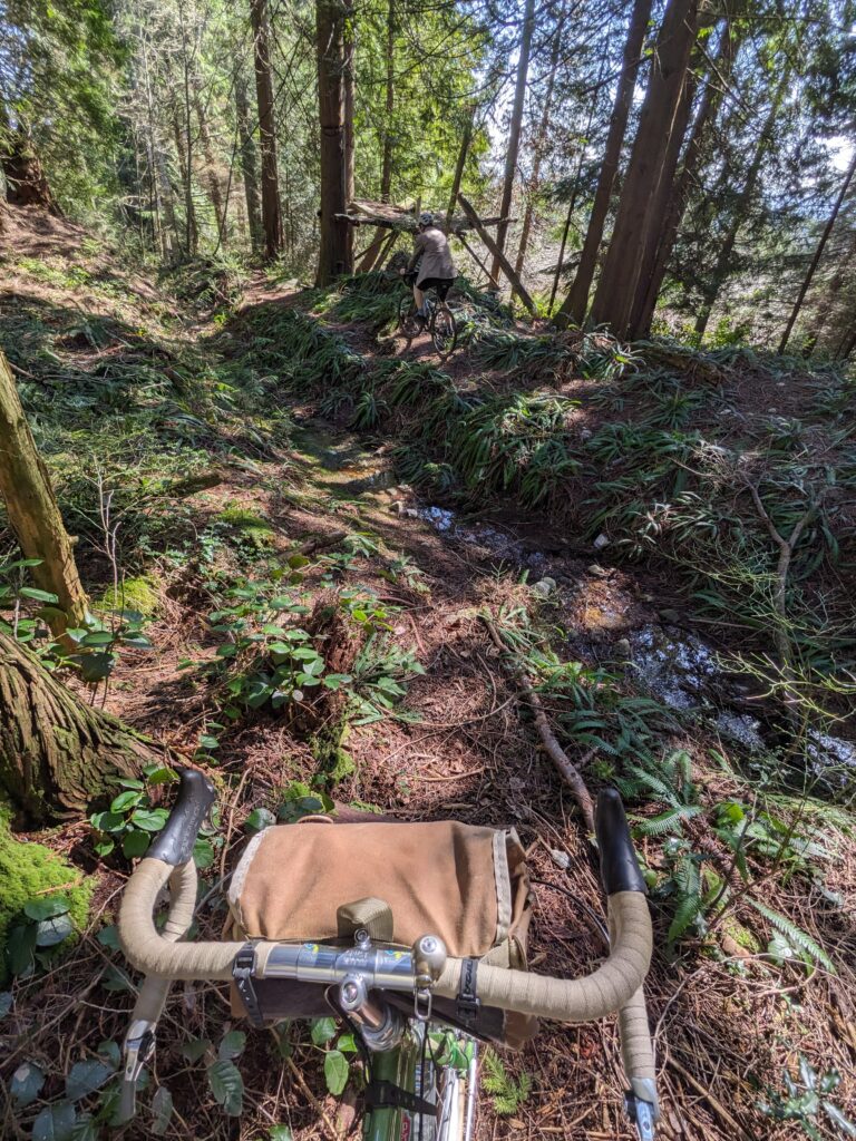
We headed up Fishermans, taking in the perfect weather. The sunshine lit up all the lichen hanging from the lower limbs of the tree canopy, which gave a green hue to the air.
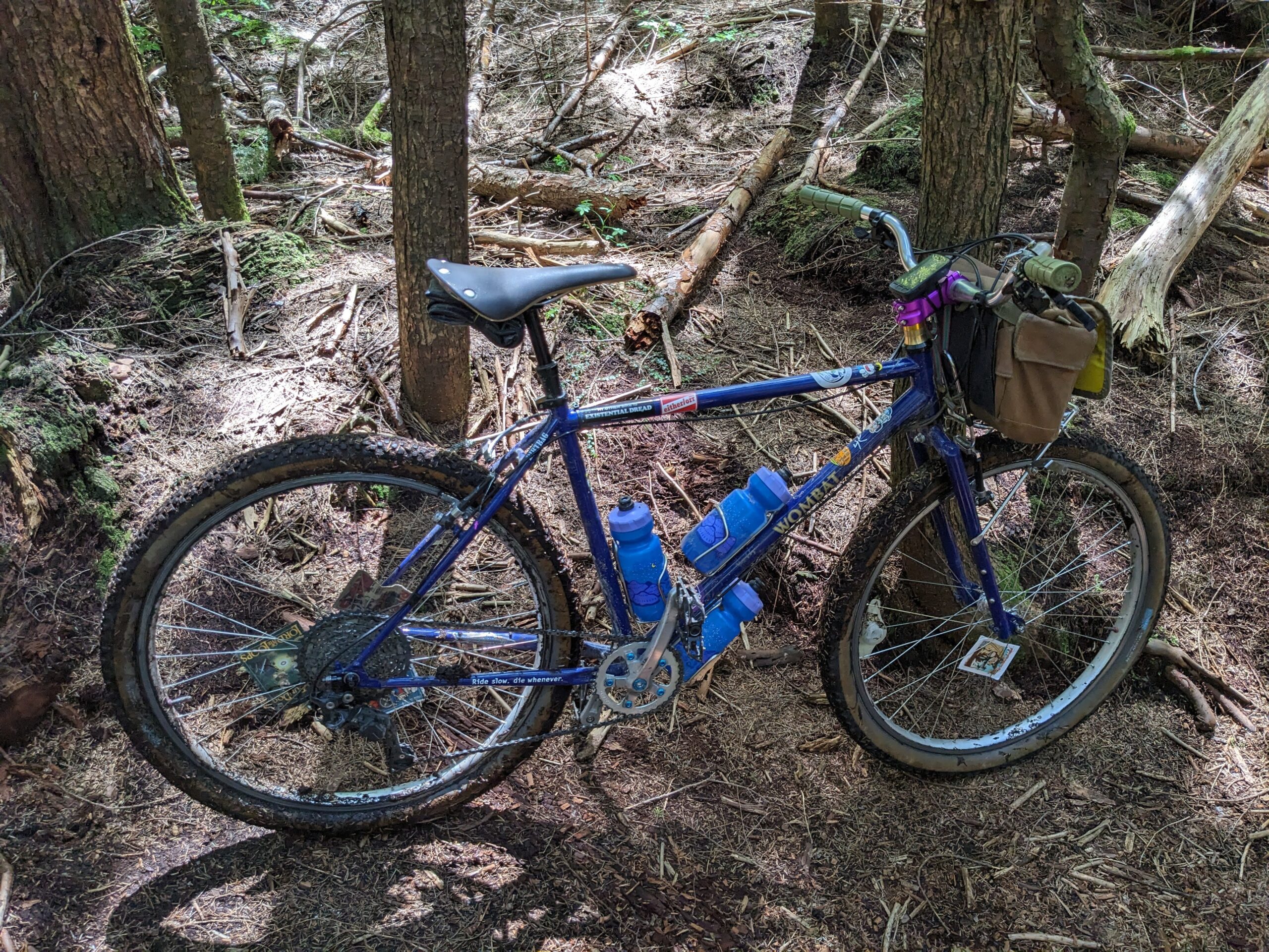
My Bombadil was purpose-built for this valley and it continues to deliver four years later.
Can you spot the bald eagle?
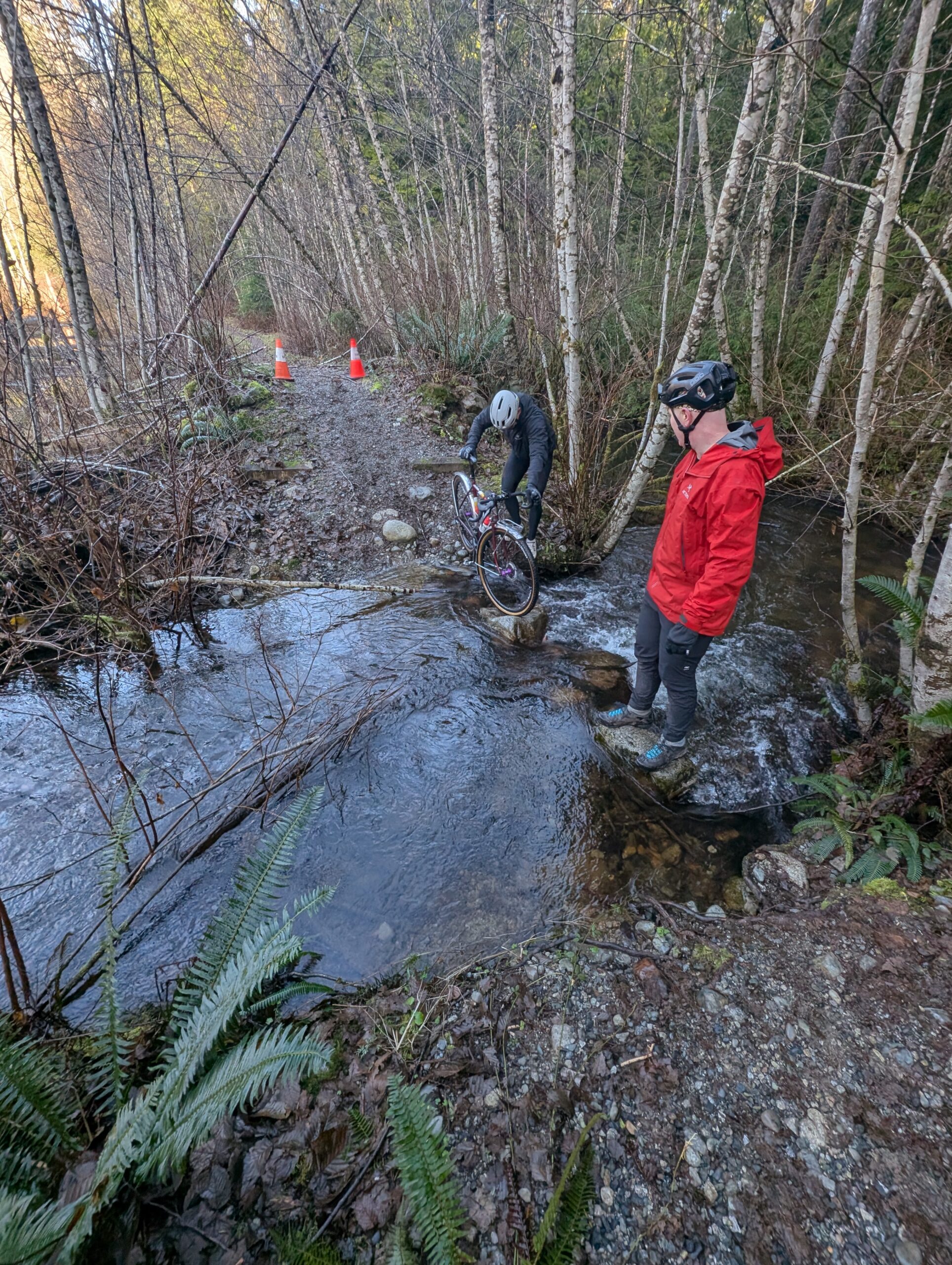
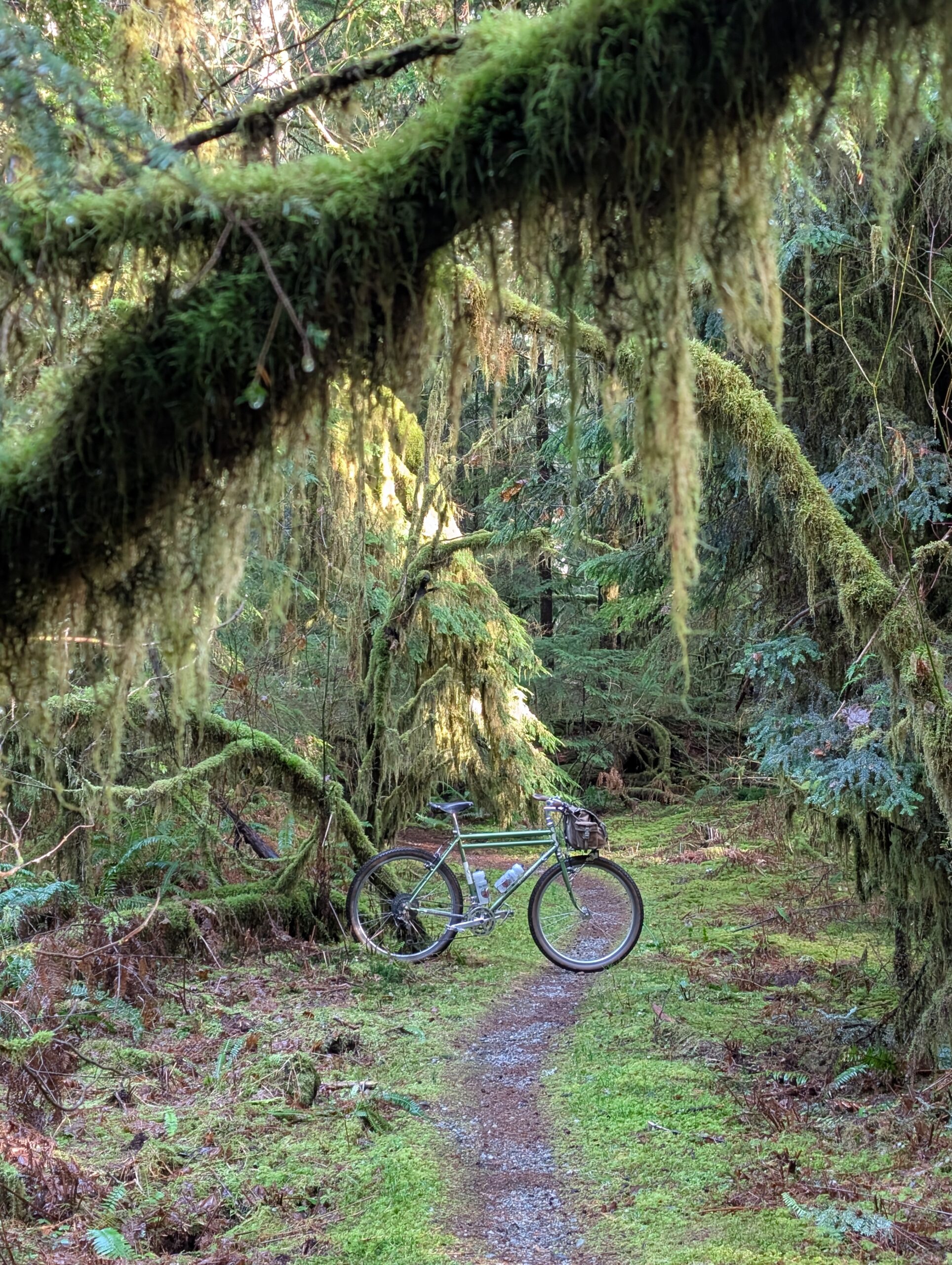
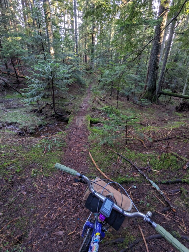
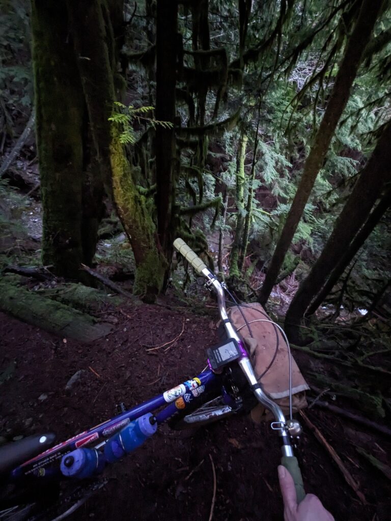
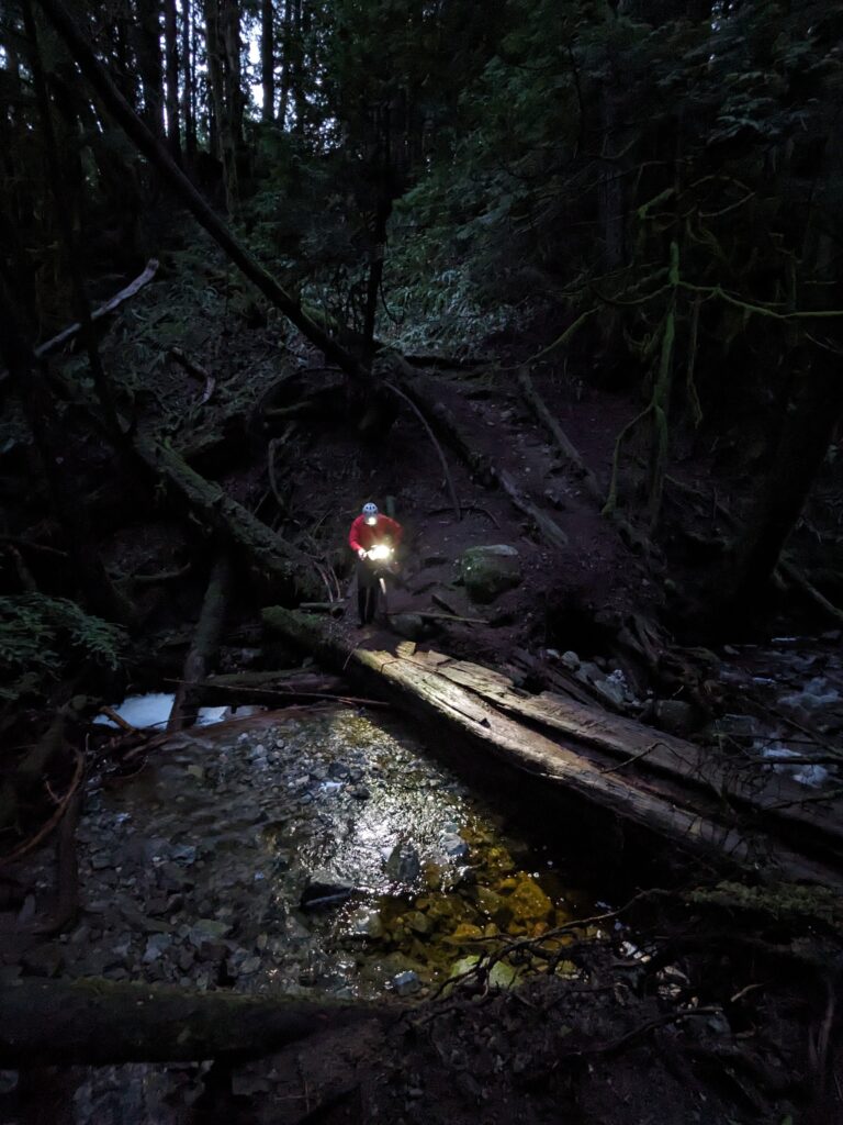
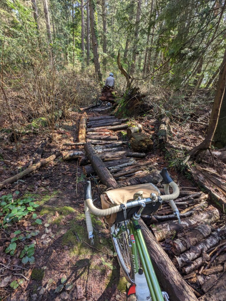
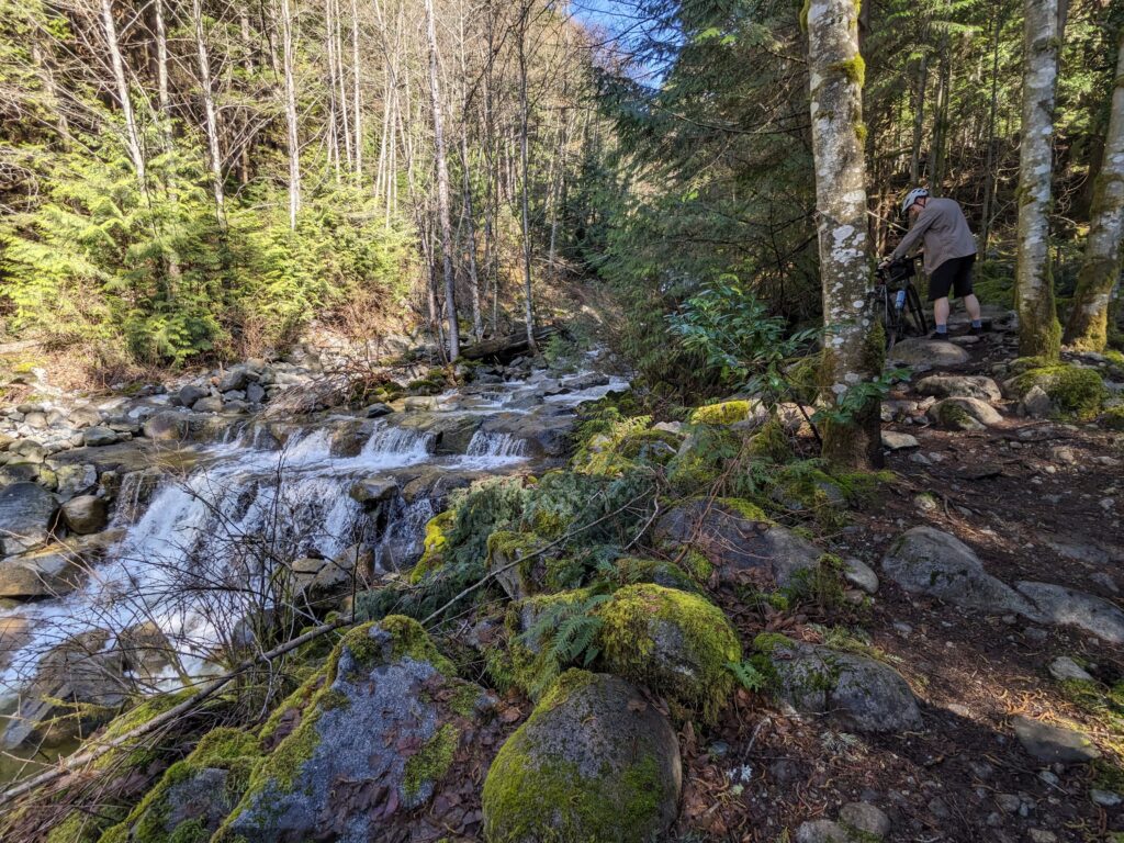
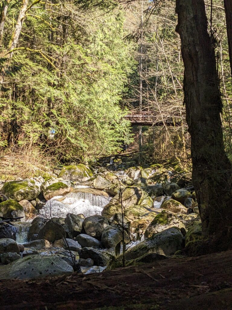
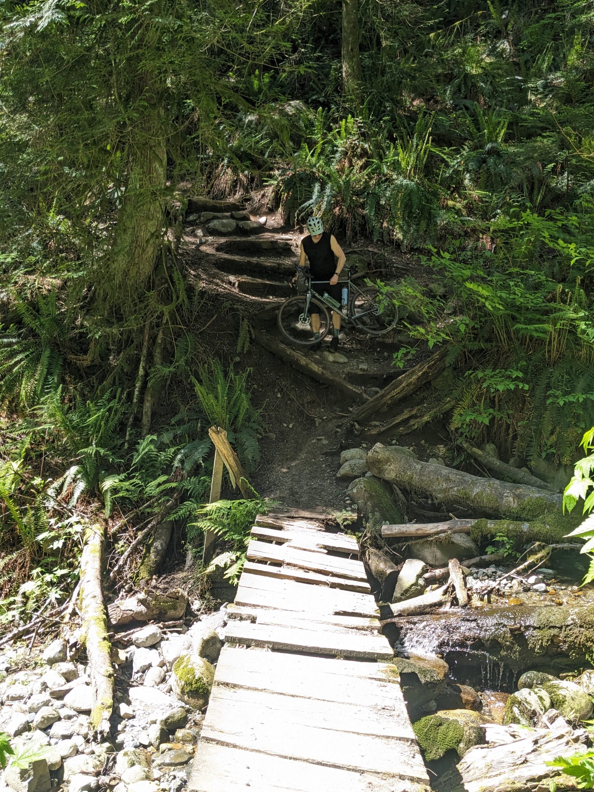
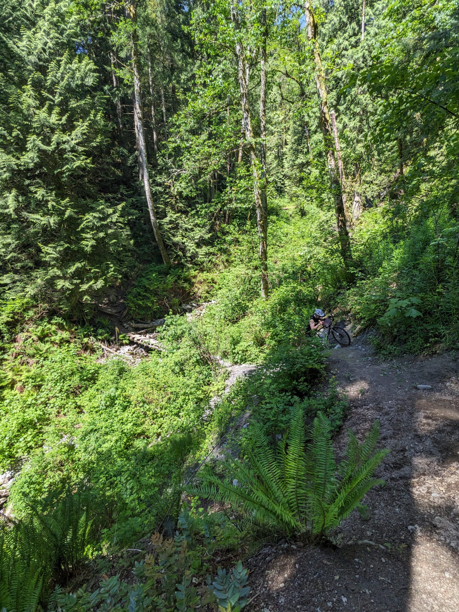
We looped around the marsh at midvalley, which is an entirely unnecessary yet worthwhile little trail. The bridge over the marsh’s outflow drain was removed a while back and nothing has been put in its place to date – and the water level was such that it was a bold jump over deep water to cross. I placed the Bombadil into the water to help balance me, and I didn’t expect to submerge the bike well past the SON hub and bottom bracket. Whoops!
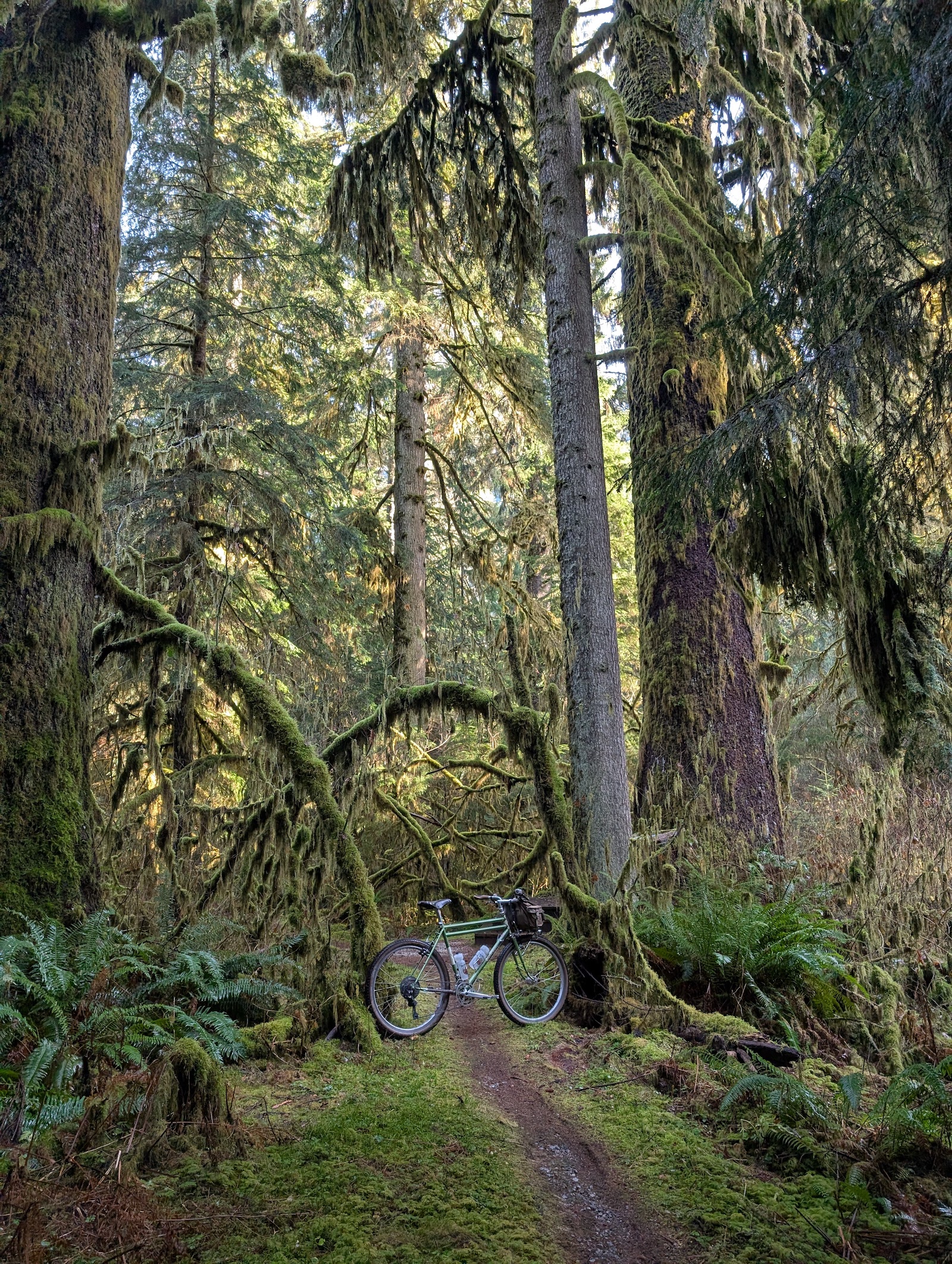
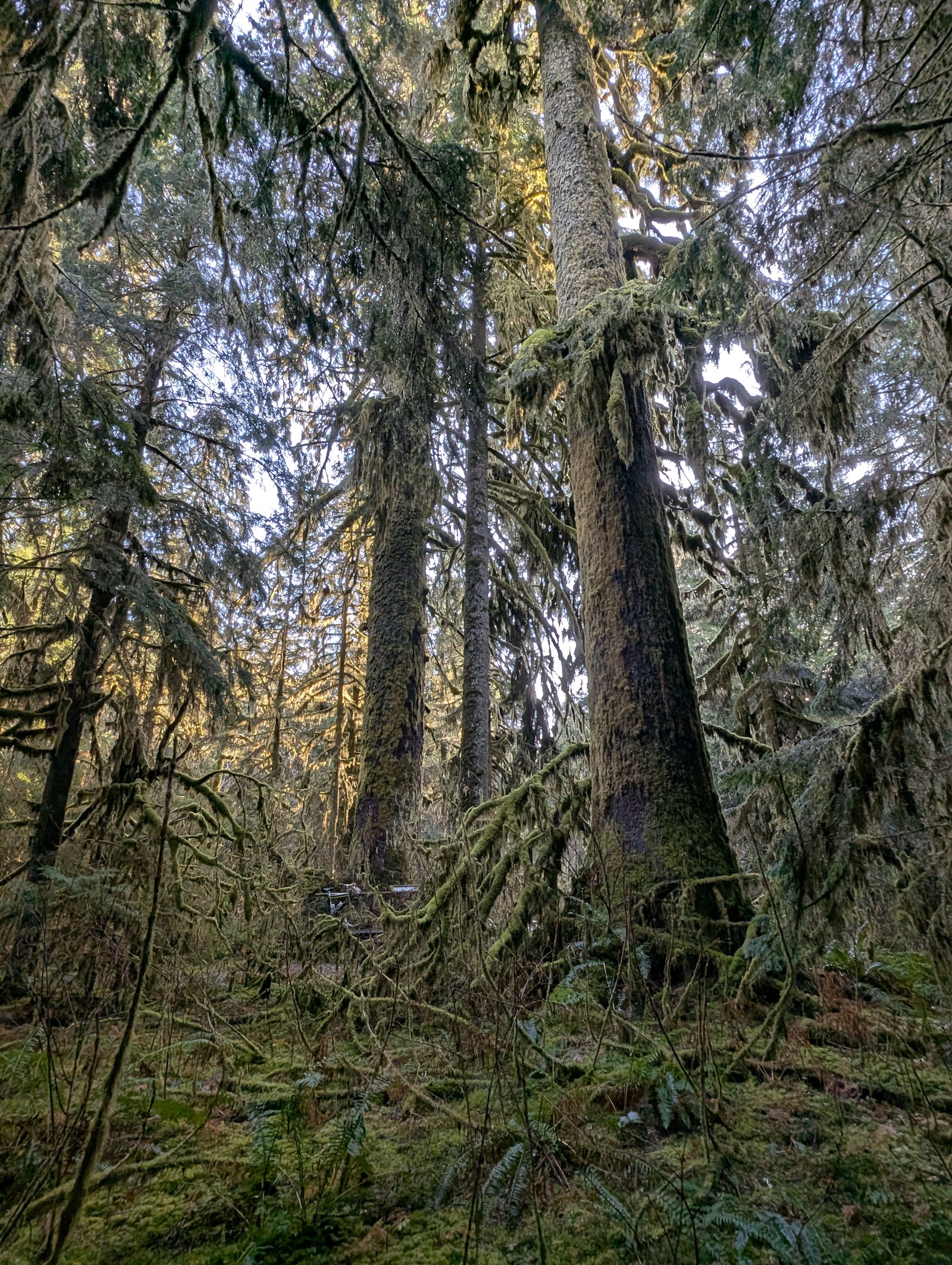
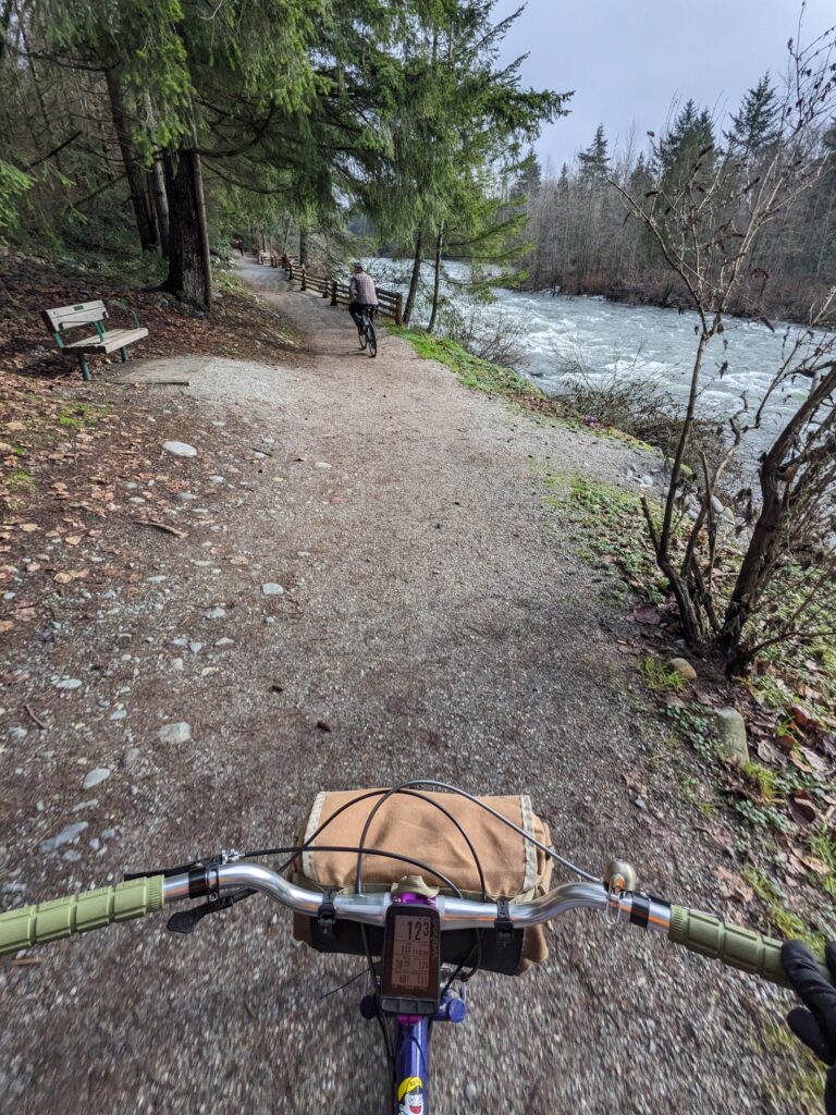
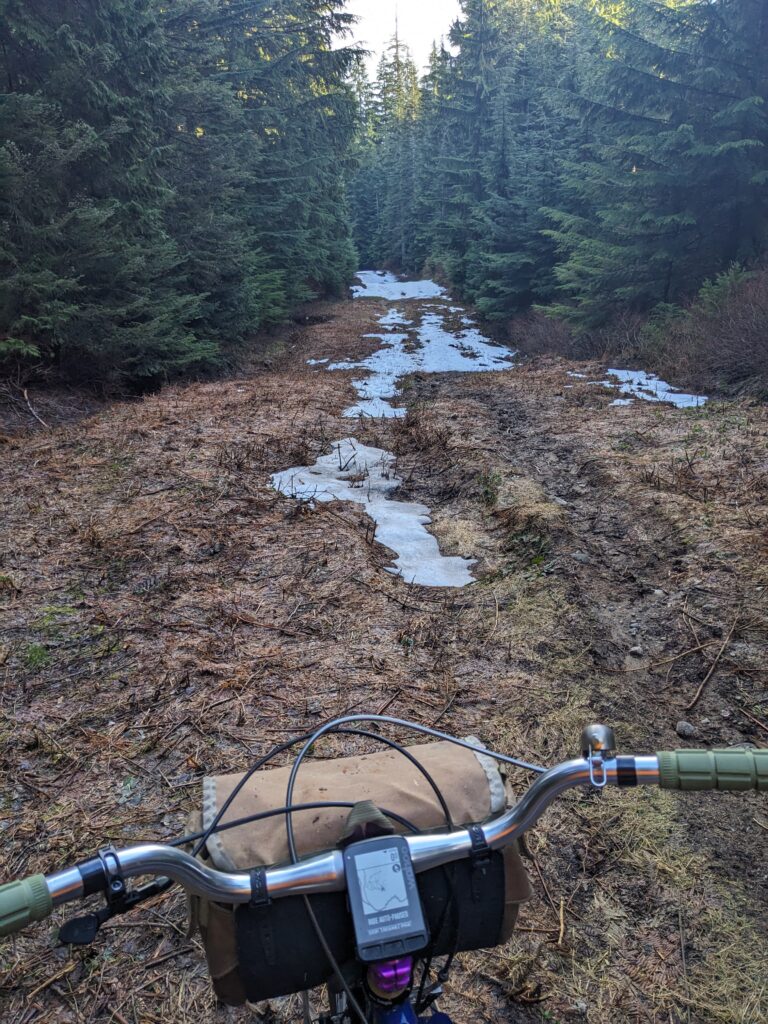
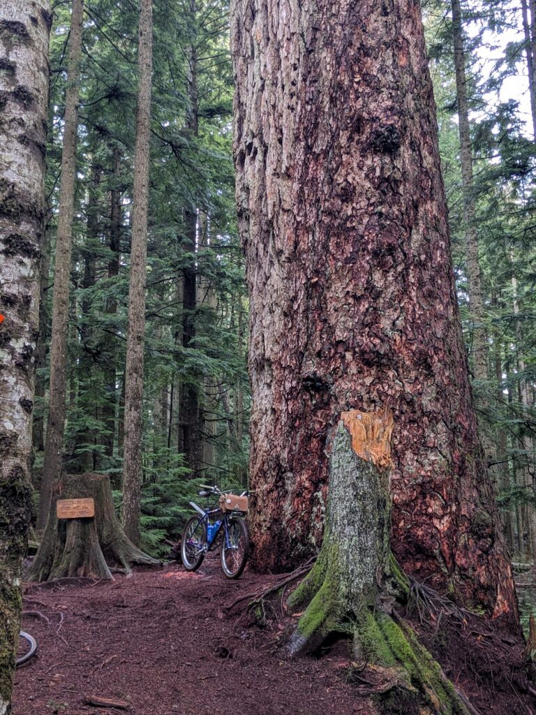
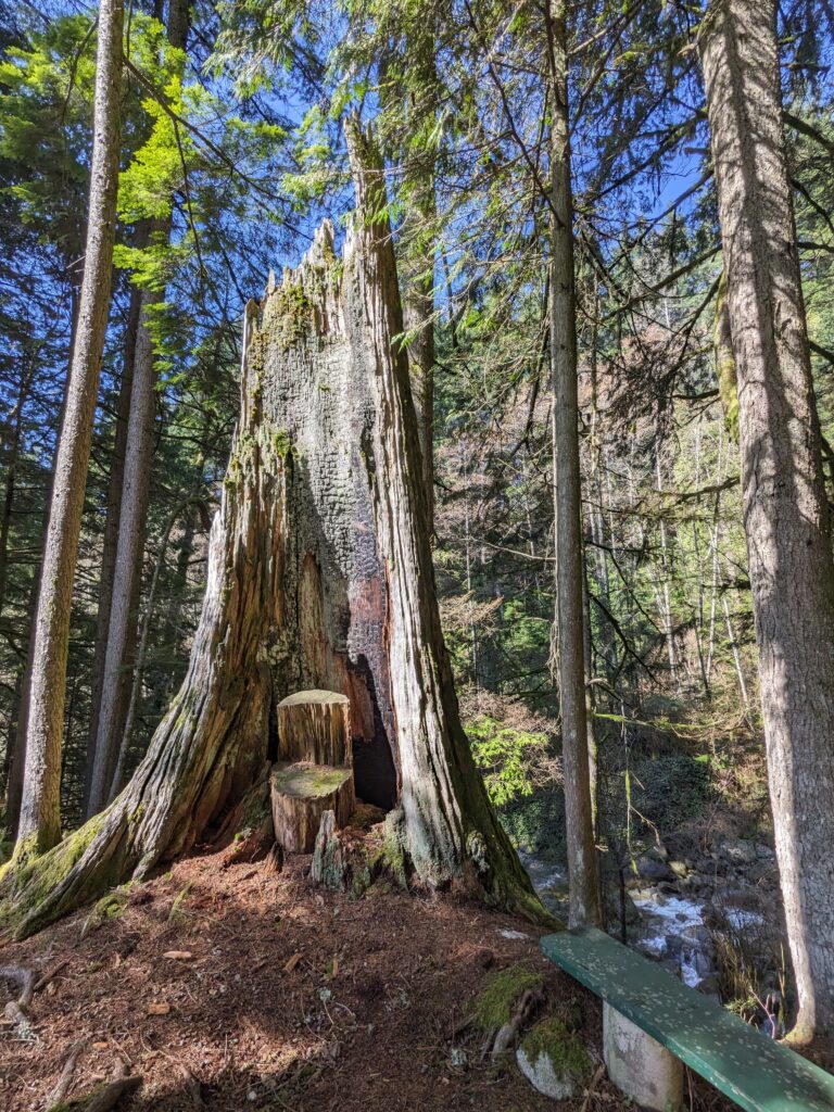
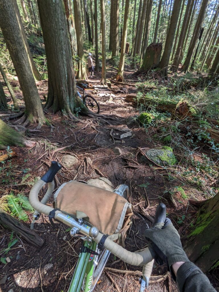
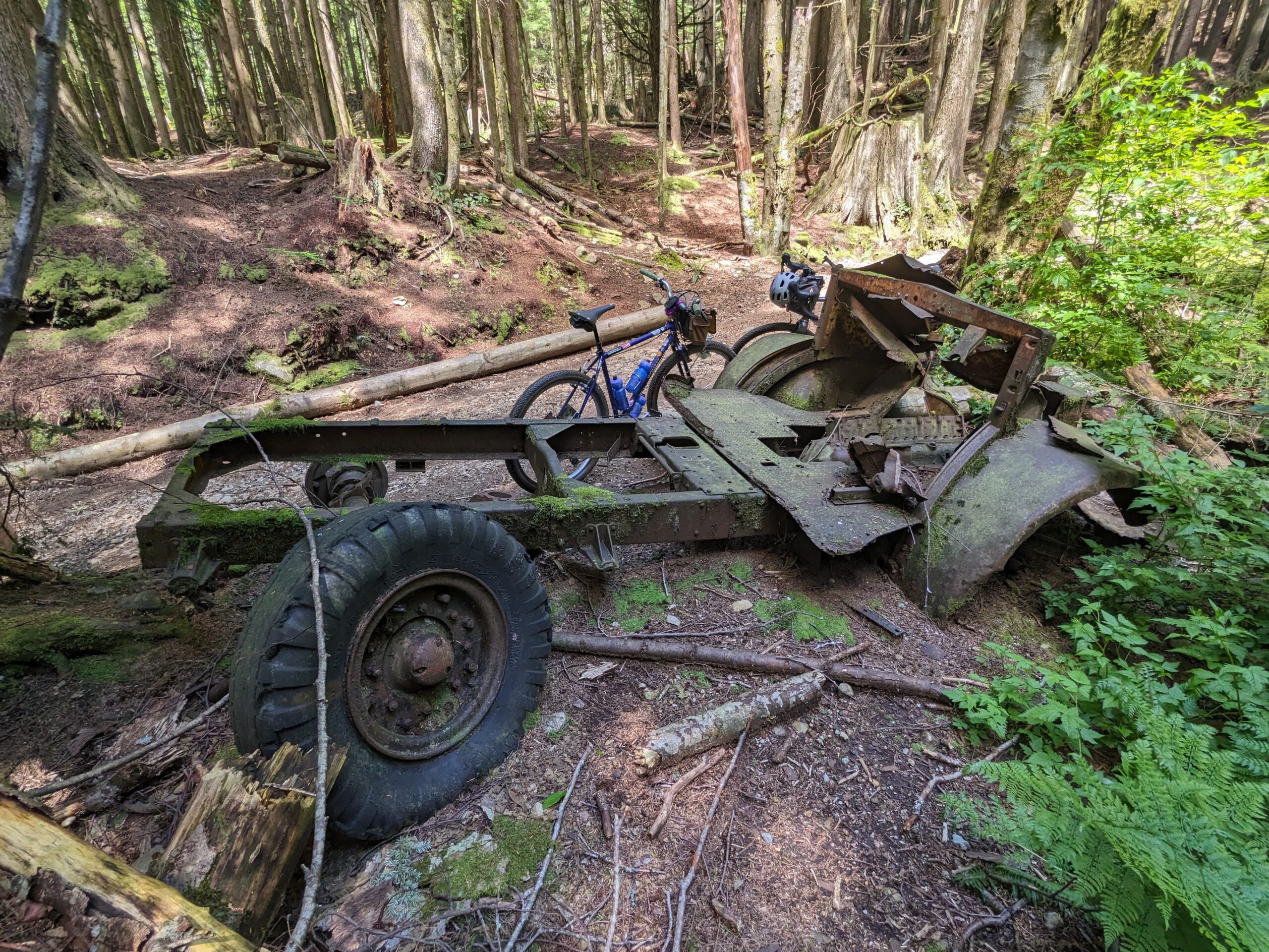
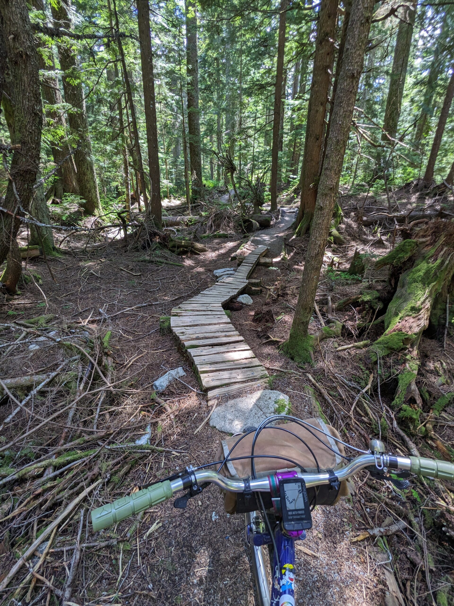
We pedalled up Spur 4, descending over Bear Island, and onto Hatchery Trail. I was excited to take Morgan and Nathan to my favourite tree on the Rainbow Creek loop.
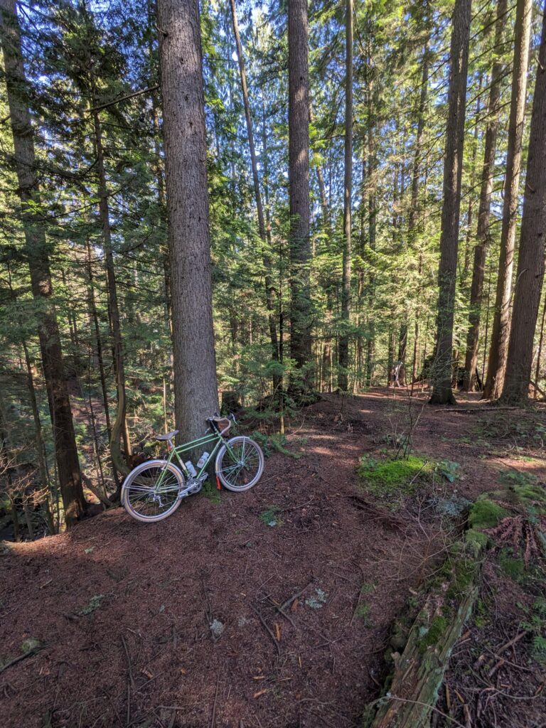
We spent a little bit of time among these giants before continuing on. This spot has become my favourite of late and I’m glad I’ve been able to get out here so regularly, considering it’s 25km from home and half of that is on trail, out of cell service.
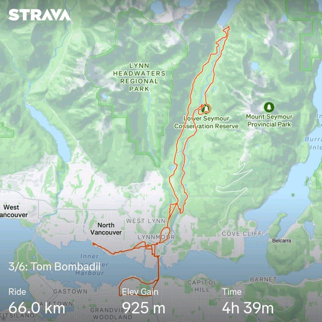
The day ended up being 66km and nearly 1000m of elevation. While it’s relatively challenging, these LSCR loops really rejuvenate my soul.
Quick recap of the challenge: instead of Festive 500 from Dec 24 to 31, I challenged myself to ride each of my six bikes a minimum a 50km over the same period.
Part 1 was my old Twenty on Christmas Eve. I took Christmas day off to spend with my partner and pupper. But as of Boxing Day I was back on it, and rolled out of the house on the Hillborne with only a loose plan in place.
I started by crossing over to North Van and heading westward via Second Narrows, generally on the Spirit Trail. The weather was pretty decent; no threat of rain and temperatures well above freezing. I rode in my sweater without a jacket!
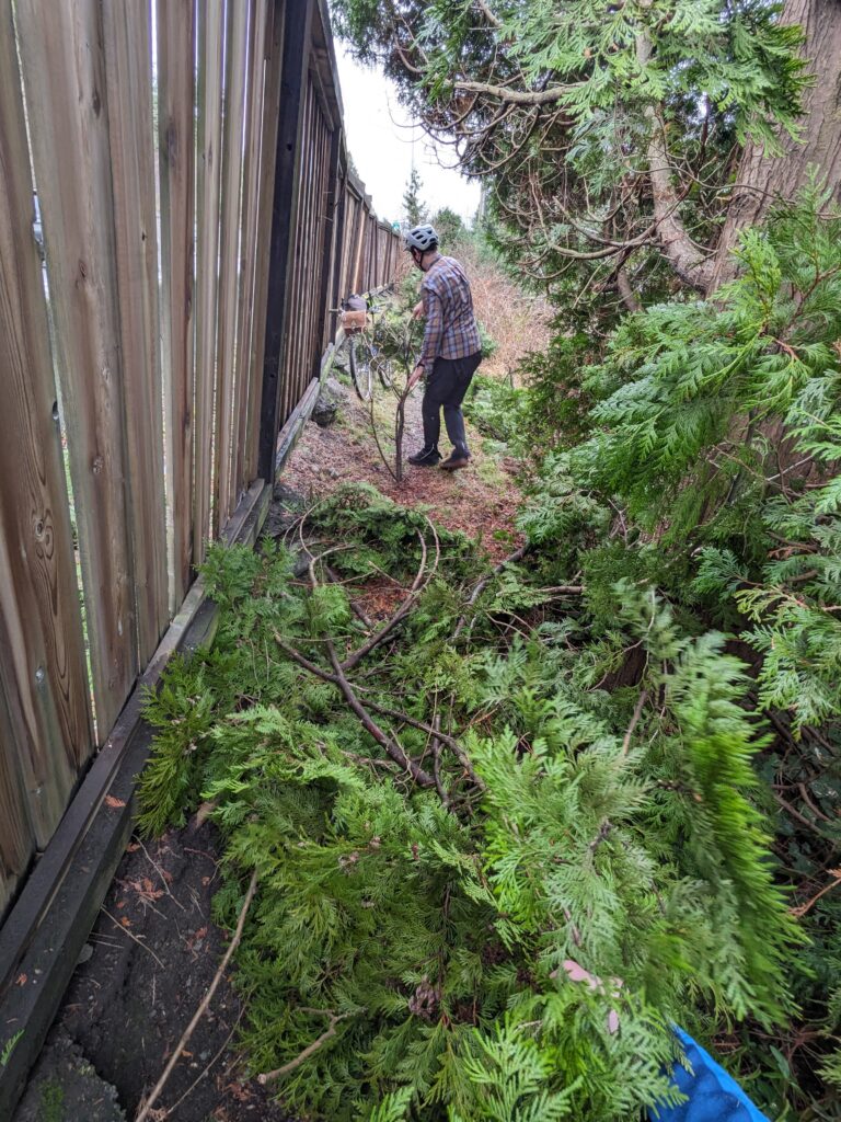
I crossed Lions Gate into Stanley Park and took Rawlings down, stopping to explore a couple side quests.
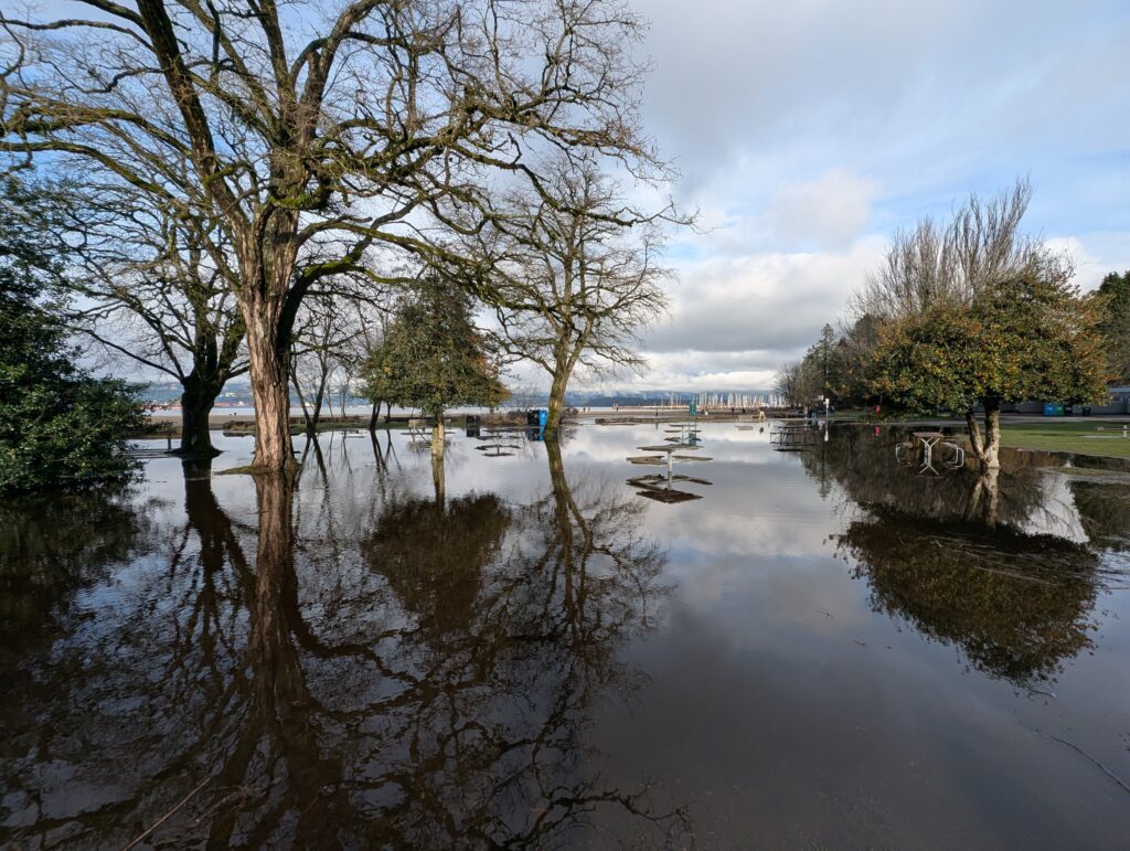
I made my way over the Burrard Bridge and headed west. Passing through Jericho, the water level was as high as I’ve ever seen it – large sections of the park were fully flooded. Great time to be a duck!
I wanted to take my favourite UBC route – Salish trail starting from the base of the NW Marine climb, which follows the east edge of a rather steep and deep ravine to start. I am happy to push up the first incline.
Salish Trail starts in a rather open, exclusively deciduous wooded area before becoming enclosed in towering Dougas Firs. While there was no rain today, recent rains were very evident – I rode though what must have been thousands of puddles.
I continued south through Musqueam Park, a quieter and beautiful bit of green space south of Marine Drive. Working my way around the golf course, I stopped at Deering Island, a favourite spot of mine and some friends for a beer. I sat and watched the sun set while and chatted with a family with two teen daughters whose dad was jealous of my beer, as well as an older lady and her sweet dog. On the way out of Deering there were three bald eagles having a bit of a domestic dispute at close range and we all watched in awe.
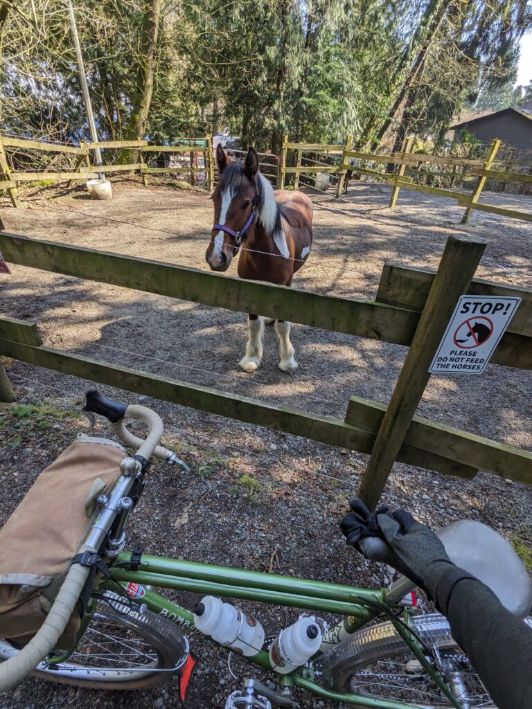
I passed through Southlands and visited the horses along the way, then made my way north via Arbutus Greenway.
Route below – a pleasant and pretty uneventful ride, though quite muddy at times.
I hadn’t considered doing the Festive 500 this year, though I’m quite familiar with the challenge. It wasn’t until a friend proclaimed they would attempt it that I realized I could put some time towards such a challenge since I had the week off work.
I wanted to put my spin on the challenge and ride each of my bikes (six in total) for one big ride. I did the math, planned some routes, and sliced up how I could meet the 500km distance in a manageable way – but then when my partner Aimée asked if we were going to spend time together while we were both off, I realized it was too much and dialed it back: 50+ km per bike for every bike.
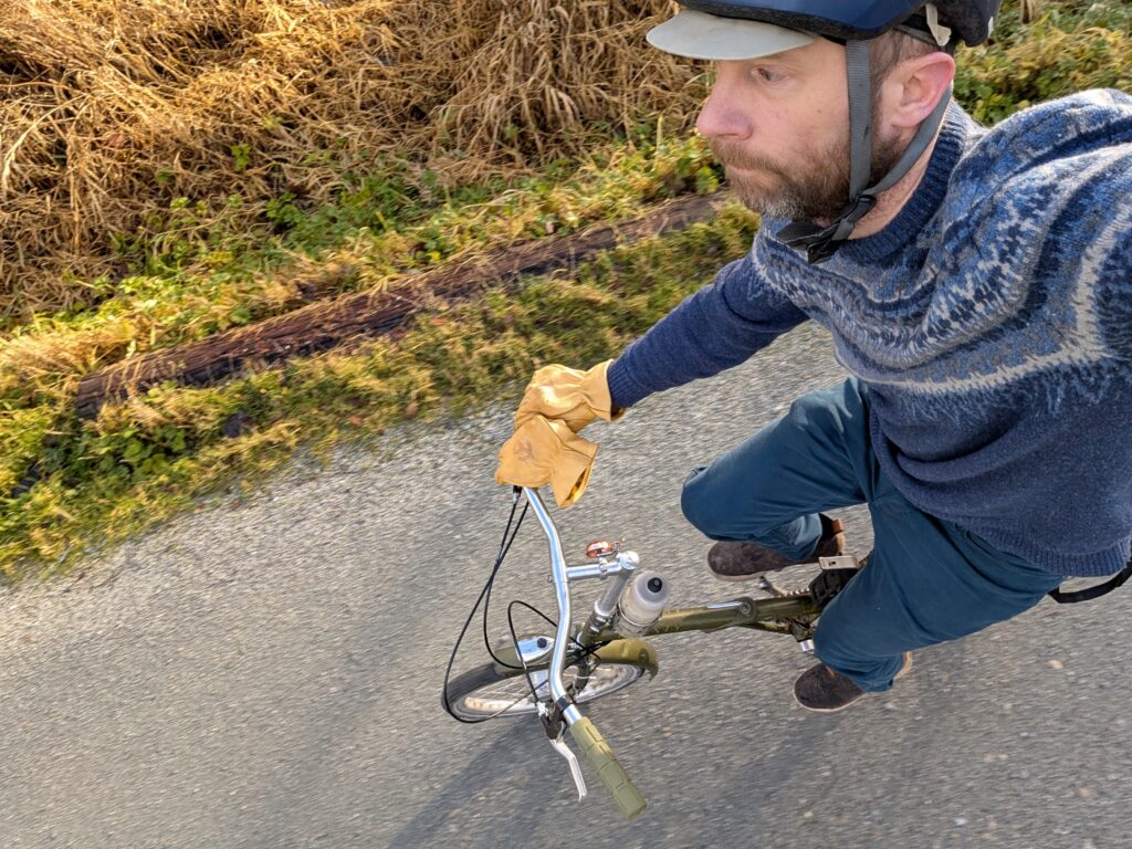
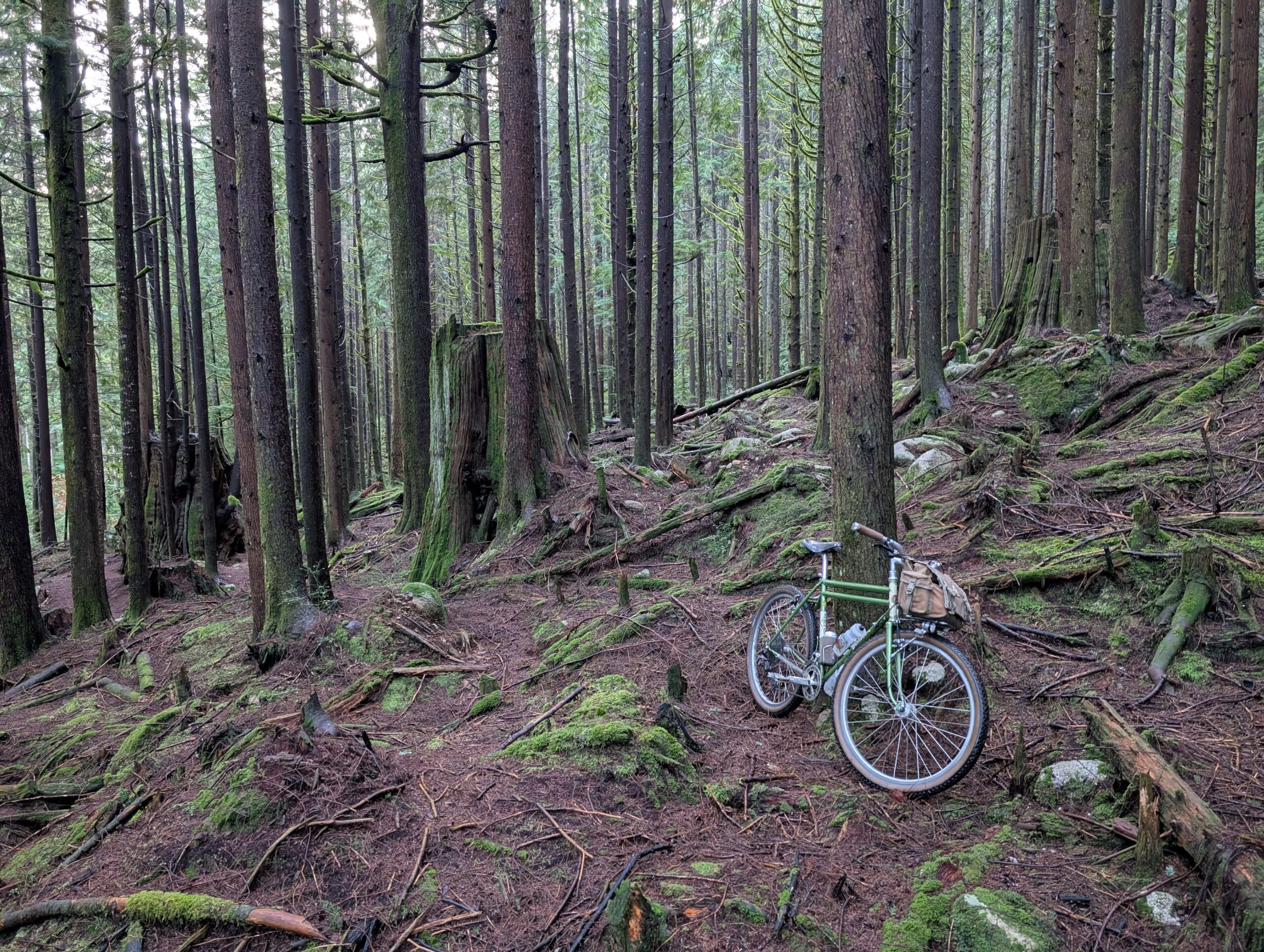
The bike I am least likely to ride 50km is my old Raleigh Twenty; it’s around 1971 give or take, heavily upgraded but in a period-correct manner such as the drum brakes. It’s very heavy and four gears are functional. Despite this it is actually very fun to ride, and doesn’t feel heavy when you’re riding it.
I headed east with the intention of a bike route loop that would take me east to the edge of Coquitlam, then south around New Westminster and home.
The day was nice, the sun was shining and I was really enjoying riding this bike. So when I reached the eastward point of my planned route, I just kept going east. I took an especially muddy connector trail to a green space in Port Coquitlam that I really enjoy.
At this point I am questioning whether the Twenty is a great bike or if I just enjoy riding any bike. In either case, it really makes me wonder why I have spent so much money on my bikes when something this modest brings me the same amount of joy!
I cruised through ƛ̓éxətəm Regional Park, stopping to take a photo with one of the long-unoccupied houses on the park grounds below. I’m curious of their history.
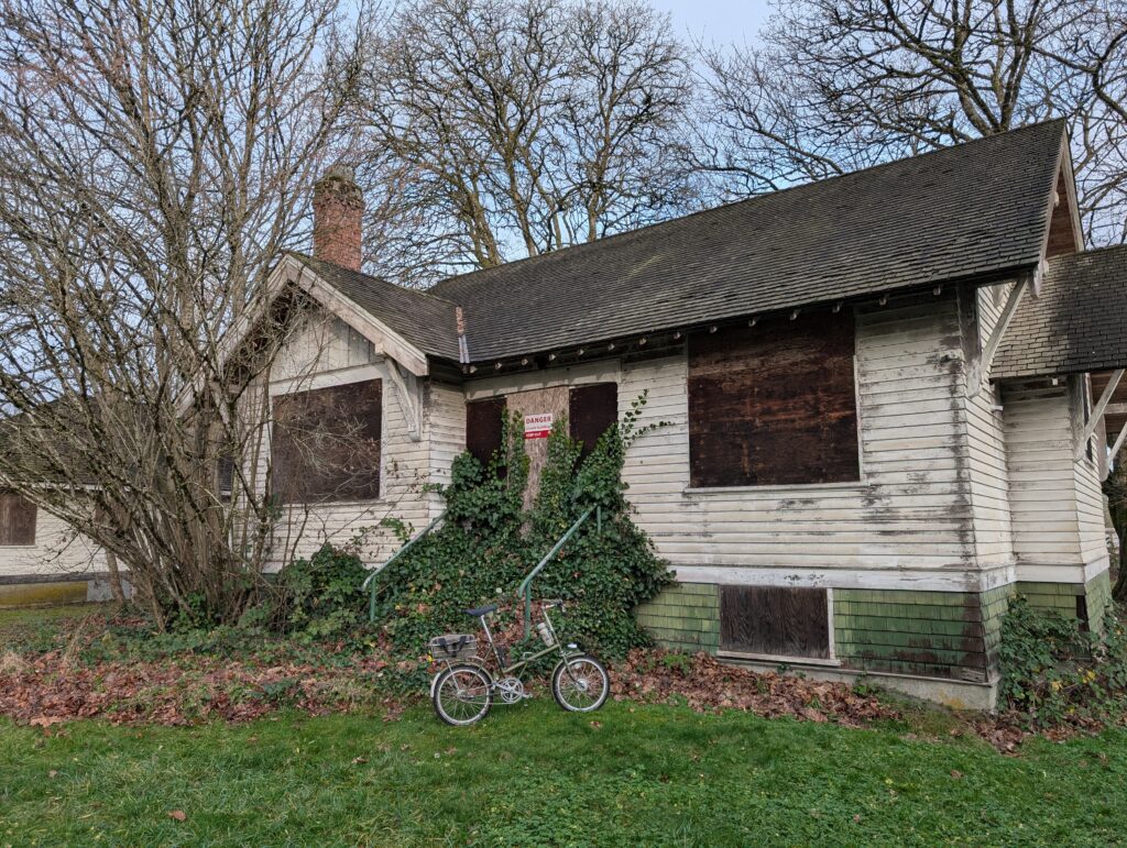
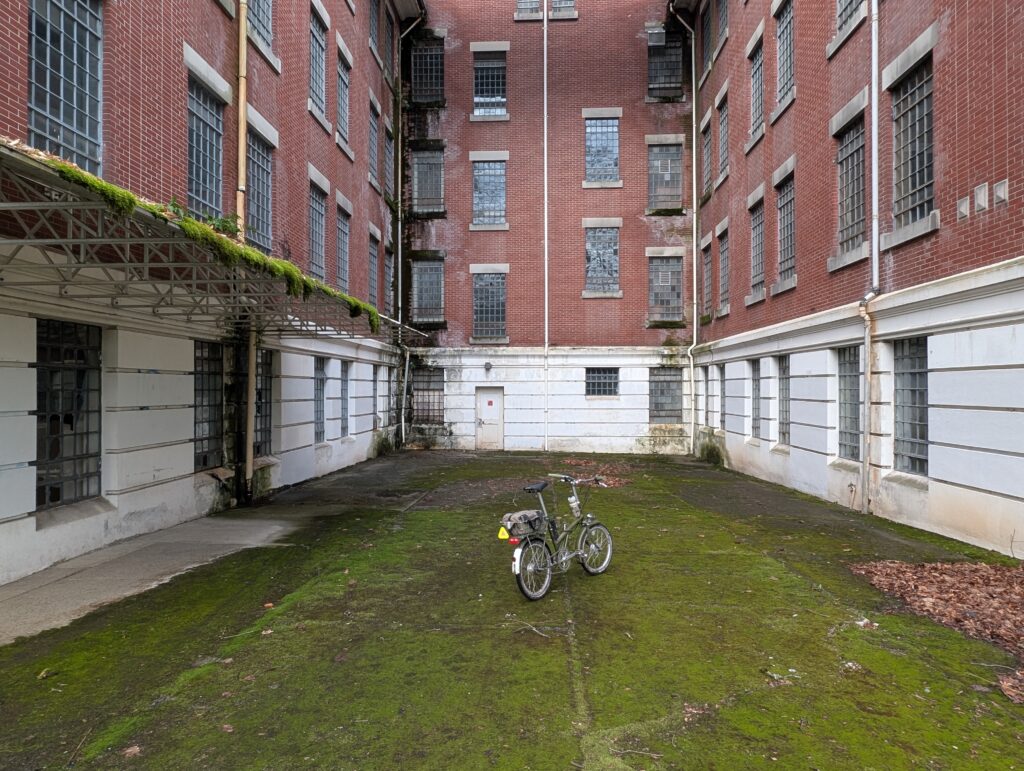
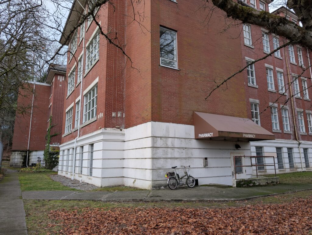
At this point the driving reason for me to continue eastward was to revisit the Riverside Hospital grounds just to the north.
Previously a psychiatric hospital, the buildings have been long abandoned. The combination of their appearance and their history are truly haunting, and a powerful experience. Going alone added to the effect, there was absolutely nobody around.
I leaned into the discomfort of this experience as I thought about what it must have been like to be kept here.
After the hairs on my neck had been sufficiently raised, I made my way out the west end of the grounds and awkwardly connected down to something remotely bike friendly. This included jumping a couple barriers and riding a decent amount of sidewalk on busy streets… Coquitlam bike infrastructure leaves much to be desired.
The light was failing by the time I was on my last 10 km of the ride, but I was treated to a very pleasant sunset.
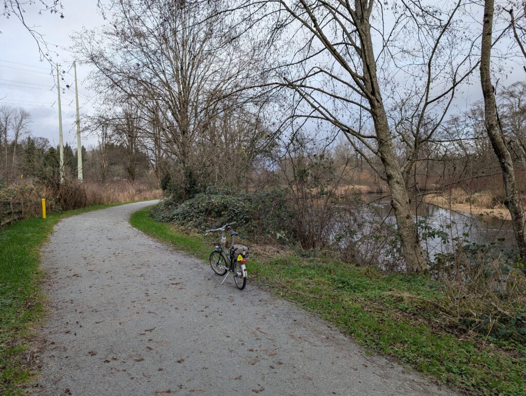
Here was the final route, going above and beyond to a total of 58.4km which I’m confident is my longest ride on this bike – I have ridden over 40km on it at least twice, but perhaps never over 50.
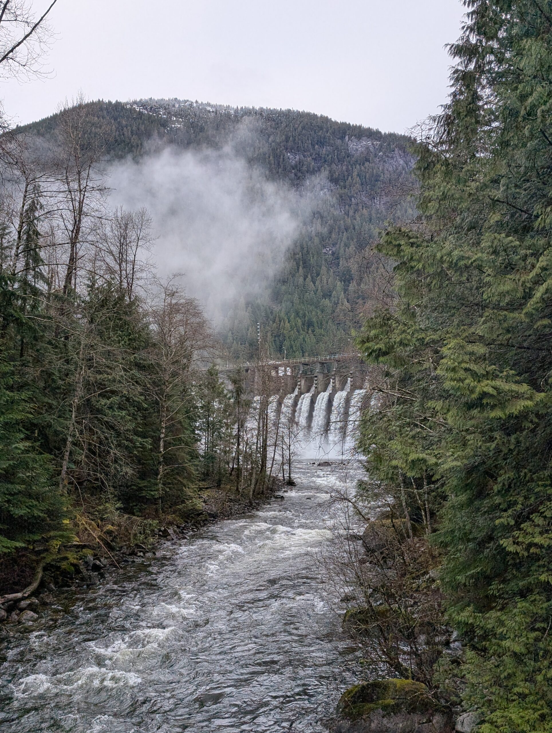
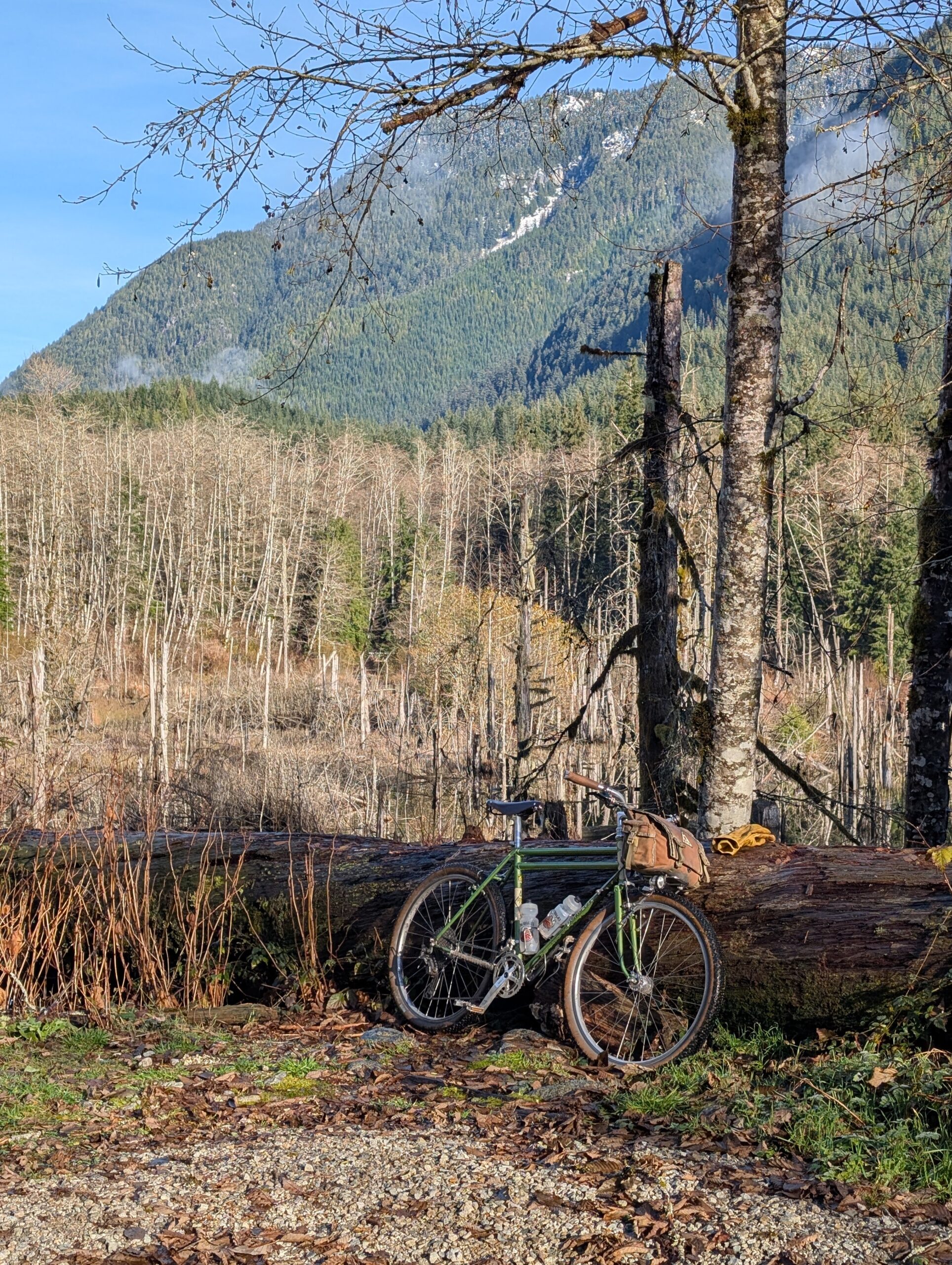
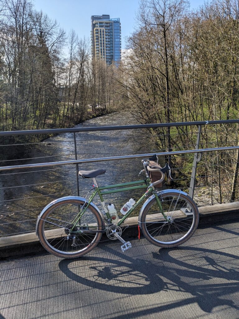
Two weeks after I rode this route on the Susie, I went back out on the Bombadil with clearer skies – thankfully, since this time I had no fenders. It was cool but not especially cold; maybe 7 or 8C. The snow line was still pretty high and I only saw the odd patch near the top of the visible hills.
The ride up Fishermans was more busy than even in the middle of summer, presumably because at this time of year you don’t pass up a sunny, above-freezing opportunity to go for a hike or bike. Fair enough, that’s what got me out here too.
As always, once at mid-valley and starting up Spur 4, the “crowds” had sharply declined, but I saw a few other riders. I was enjoying the somewhat different personality of the Bombadil with the KT bars, 11 speed trigger shifter, Rene Herse 55mm knobbies and most notably the lack of fenders. Felt a bit more like a vintage MTB, but more comfortable, and with better manners overall.
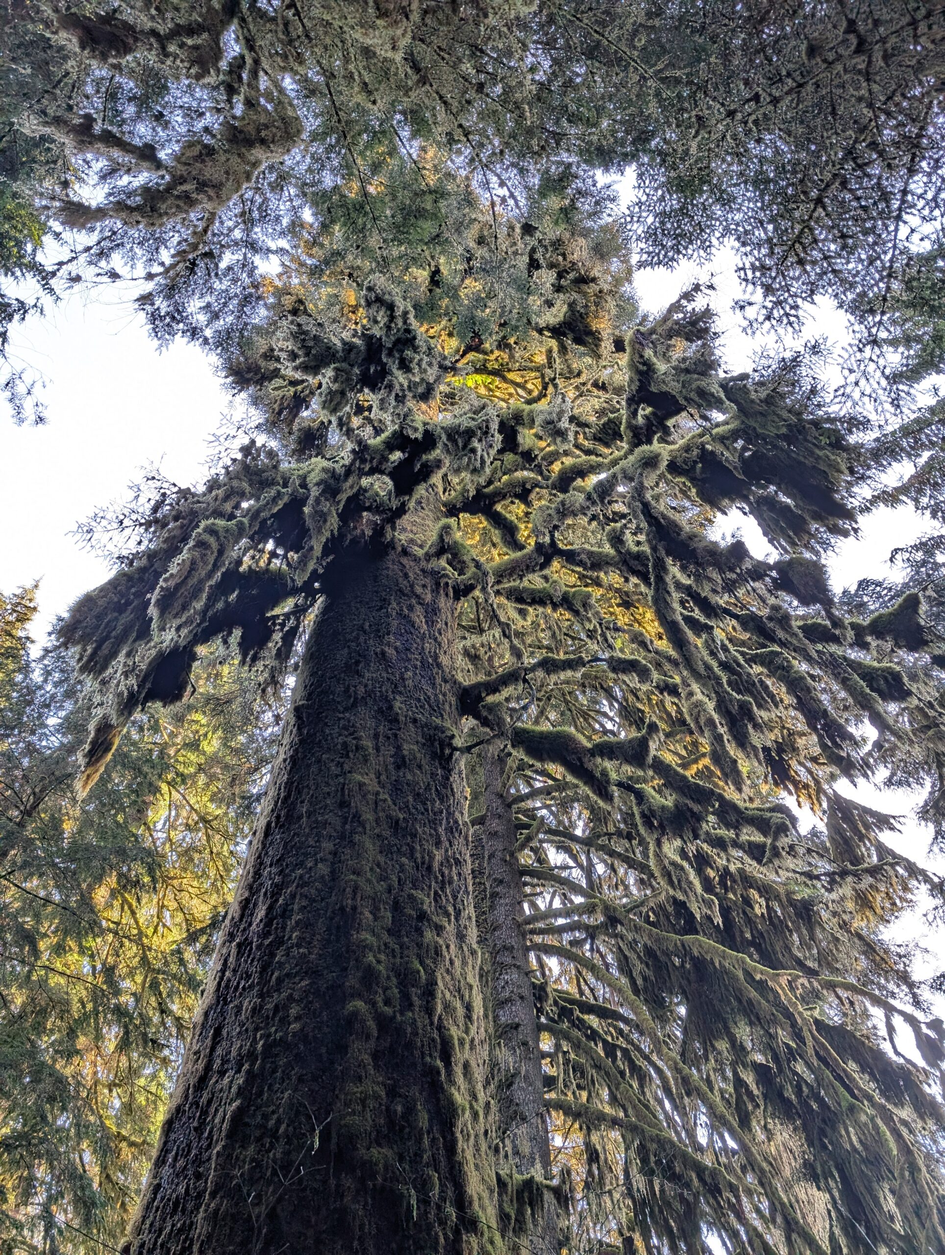
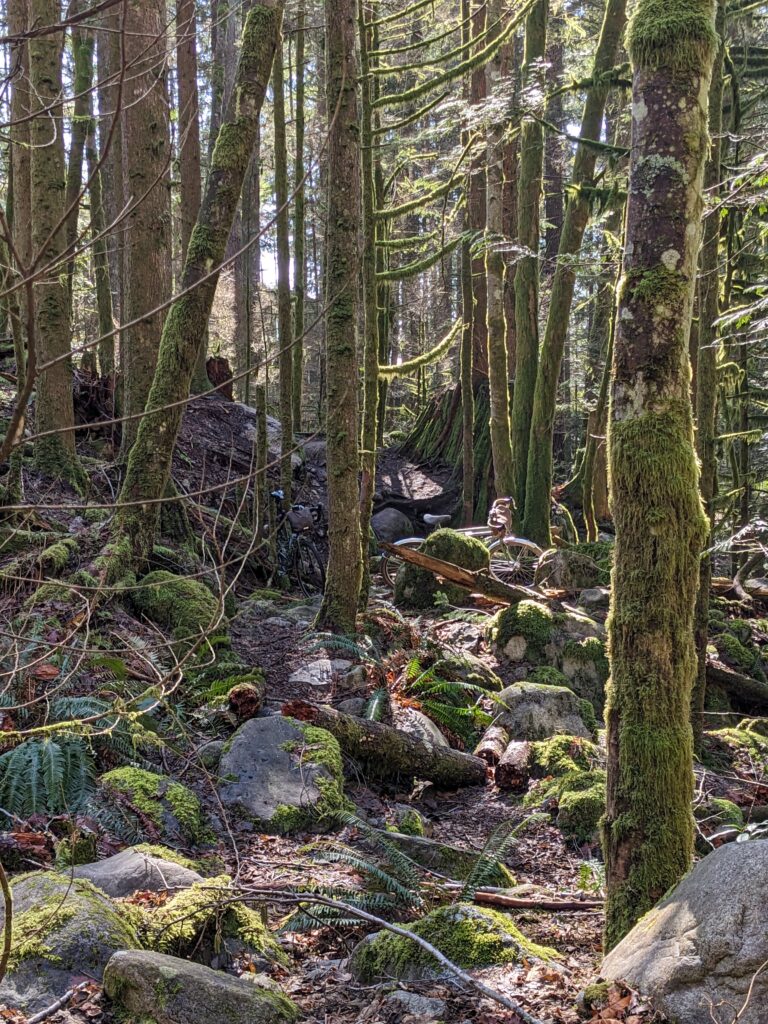
As always, the Hatchery Trail was magnificent and especially the Rainbow Creek loop – where I discovered to my bewilderment that I didn’t previously notice a second old growth tree just mere steps from the 500 year old Sitka Spruce. As far as I can tell it’s also a Sitka and approximately the same age, or close to it. It is the closer (right side) tree in the image below, left. And look at the moss covered lower limbs! I couldn’t capture the size nor statement this tree makes.
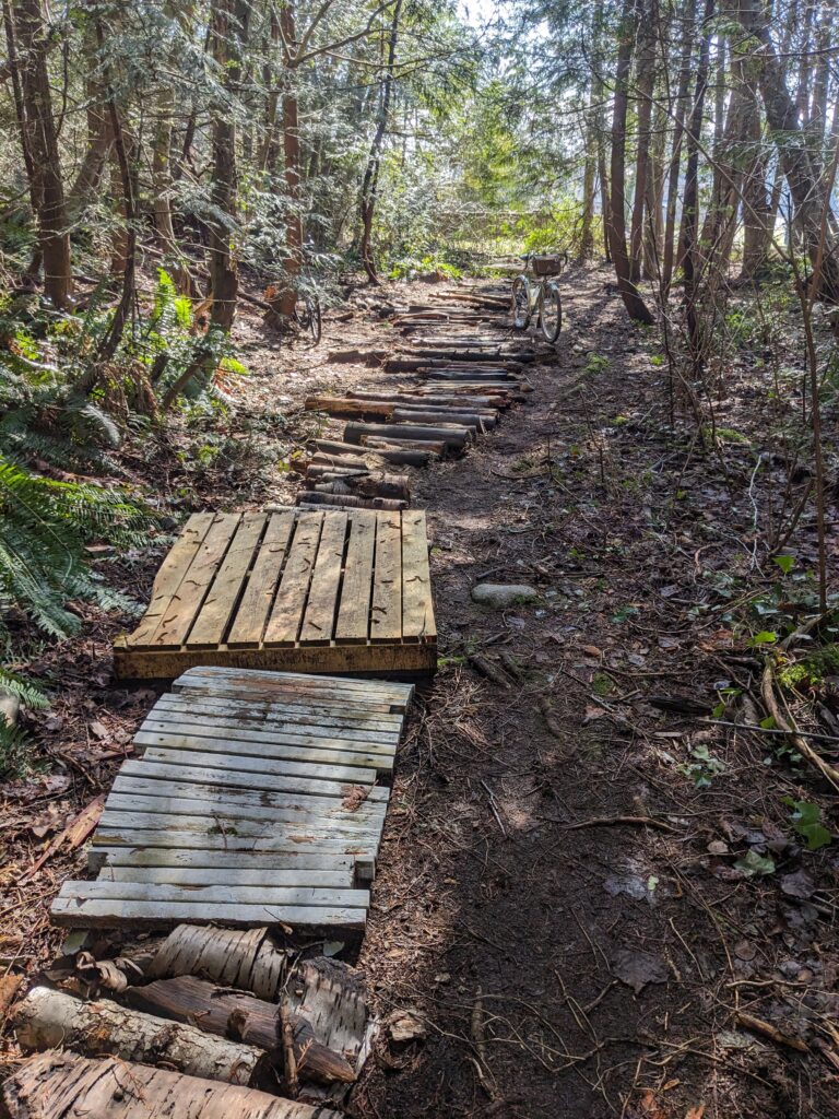
I also stopped into “See More Stumps” trail on the way back, which as you guessed, has a lot of stumps. Given how much presence the stumps still manage to have in this forest of younger trees, I can only imagine how incredible they were while they still stood tall.
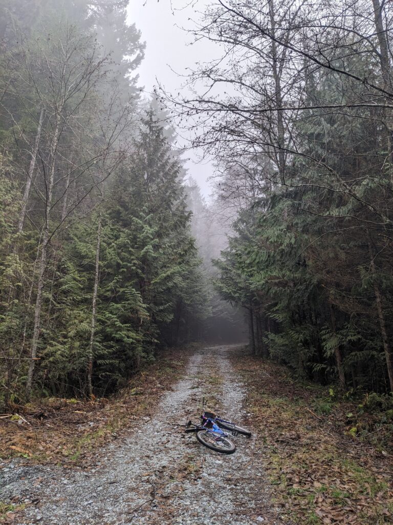
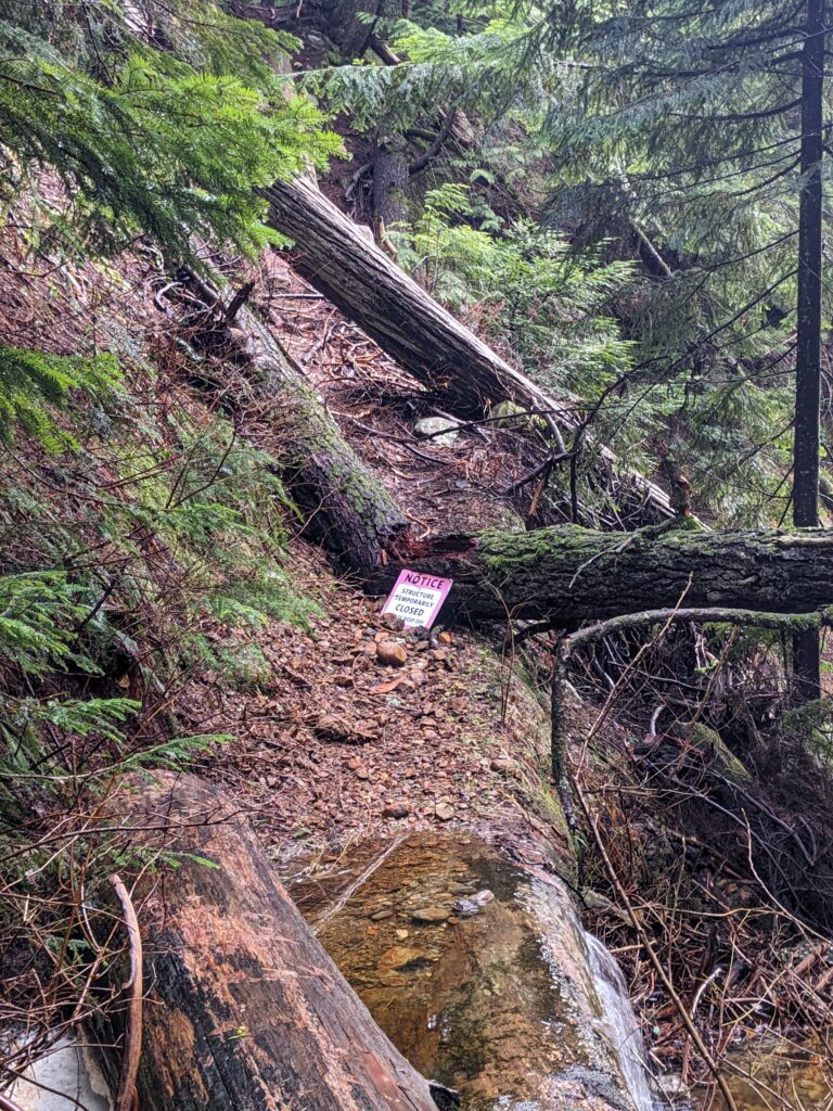
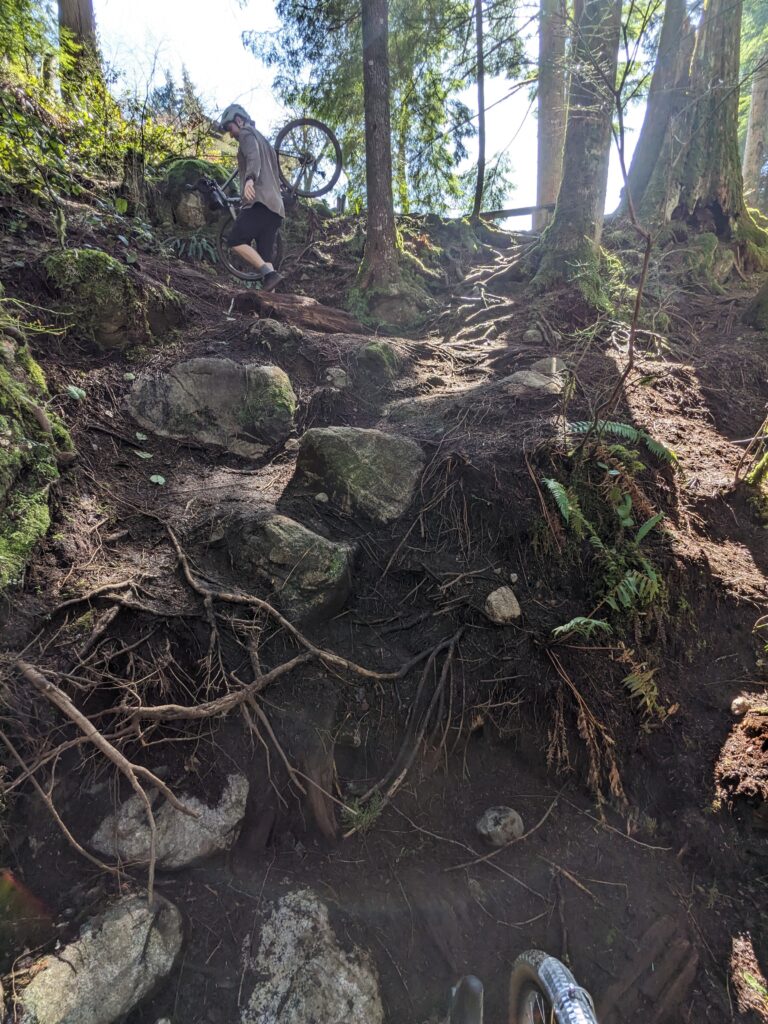
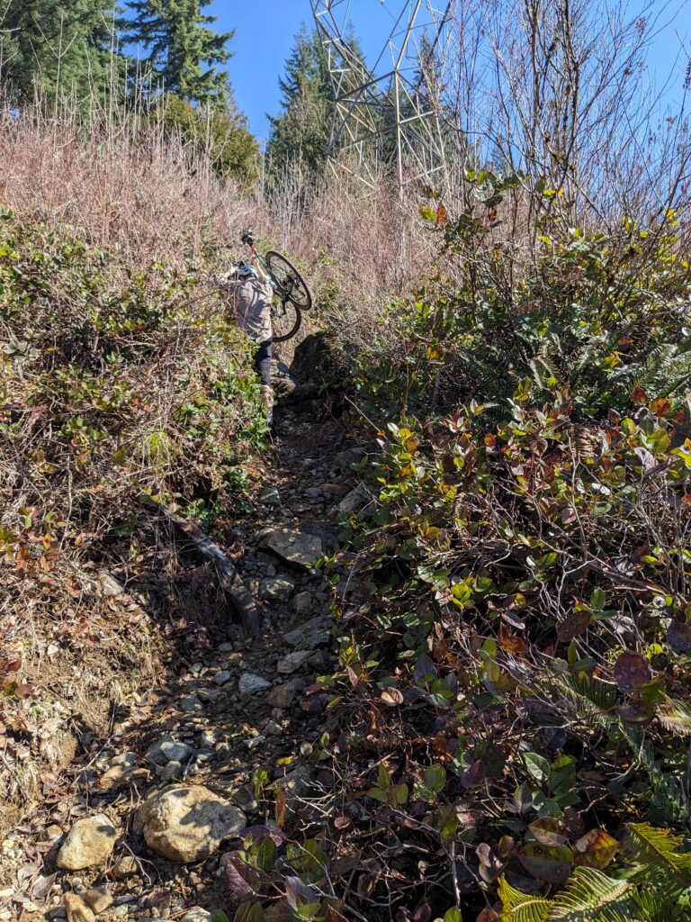
Rob and I are two peas in a very peculiar pod. These rides Rob and I have been doing where we try to find the sneakiest, least likely routes up mountains have “inspired” me to create Bike Portage Club because despite failing spectacularly on a consistent basis as rideable, they’re still really rewarding days out with a bicycle.
In terms of failing, no other ride we’ve done has failed as badly as this one. Having to hike our bikes from 400m to nearly 900m elevation was not unexpected. What was brutal about this ride was we hiked down most of that elevation as well, and I feared for my safety more than once.
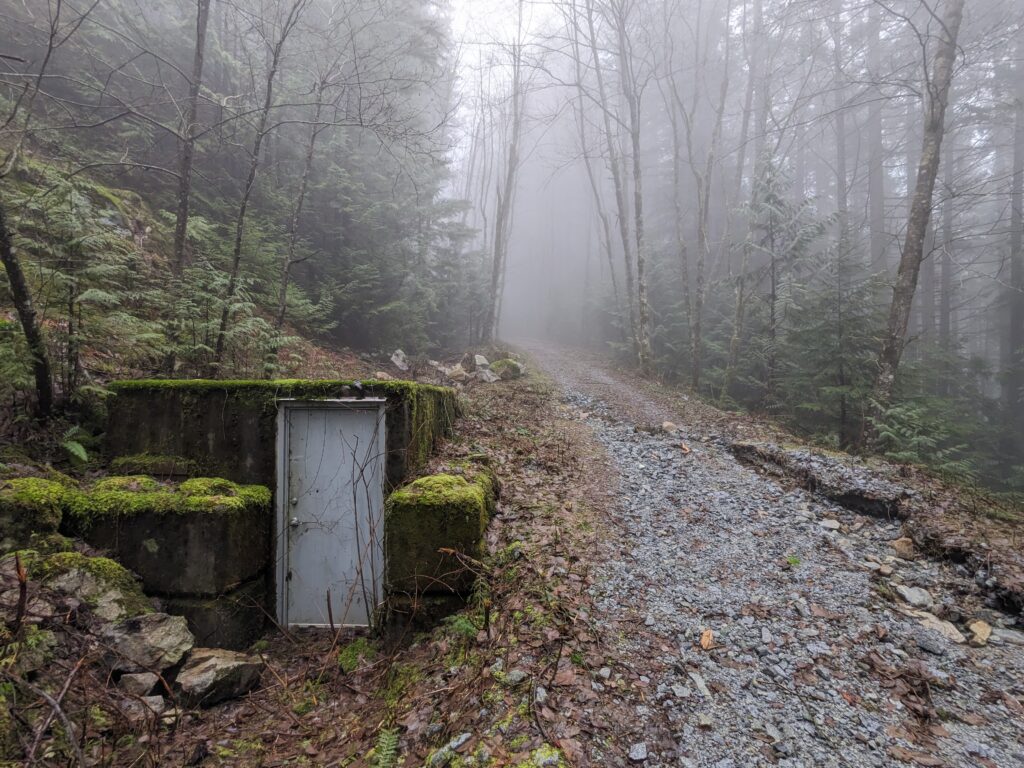
The temperature was mild for early February and had been for the past few weeks. However there had been some recent stormy weather and a lot of rainfall, so water levels were high and trees and branches have come down.
We worked our way to the first switchback on Cypress Bowl Rd via our rather optimized route, then headed to the West Cypress Creek trail.
West Cypress Creek trail ascends over 400m along the west bank of Cypress Creek. Just about every other trail is on the east bank, where the topology is significantly more hospitable.
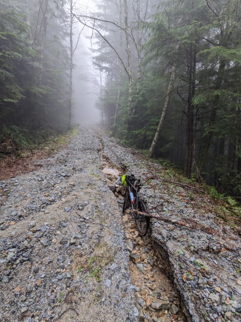
Recent rains had done a number on the road. It was too steep to ride anyway, but it was damaged to the extent it no longer served as an access road for vehicles.
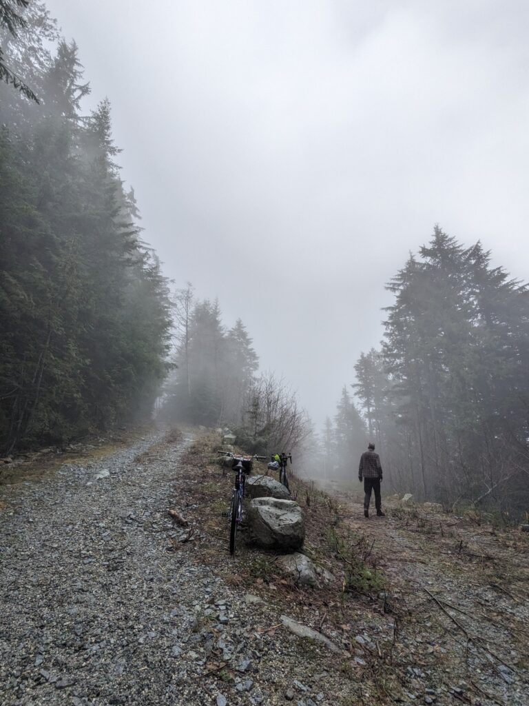
This went on for quite a while, but I’d set into a bit of a rhythm and found the elevation gain to melt away. Perhaps the ambiance of the fog along with the sound of the roaring river down to our right helped place me into a bit of a trance.
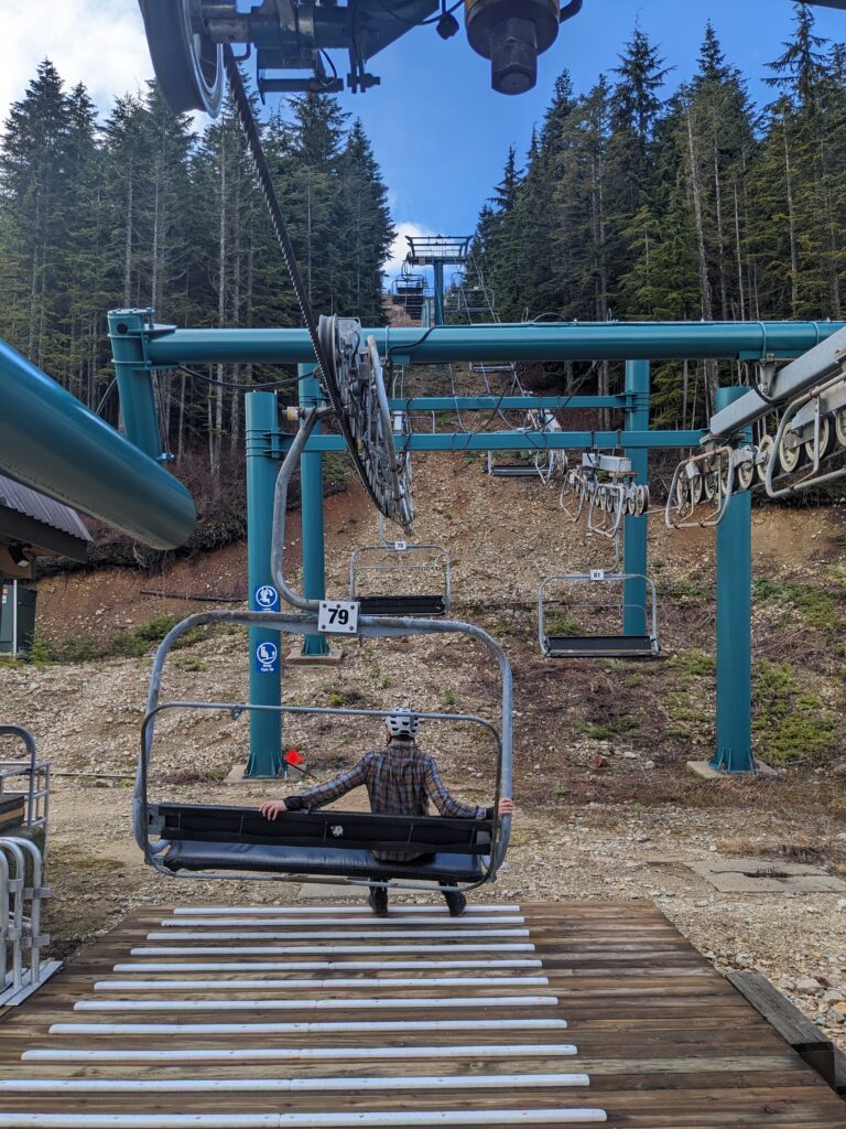
The grade eased as we neared the ski area, but the trail became especially wet. Reaching the chairlift, in early February, and there was no snow on the ground at all was eerie and scary.
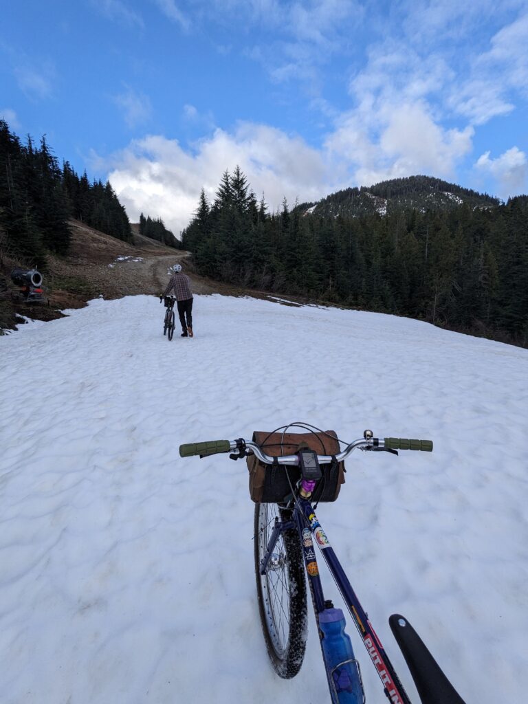
The lack of snow at the chairlift may have lulled us into a false sense of security for the next stretch, where we travelled along what are typically the XC ski trails. While too patchy to ski, they were also too snowy to ride. Rob had skied them just a week prior I believe, but the mild temps and rainfall had washed away a lot of snow in a short period of time.
It was difficult to walk along, let alone ride.
I know these rider POV photos of slushy snow are getting repetitive, but that’s how we felt at the time as well – the snow would dissipate and we’d think we’re in the clear, only to be met with another patch of snow, over and over again.
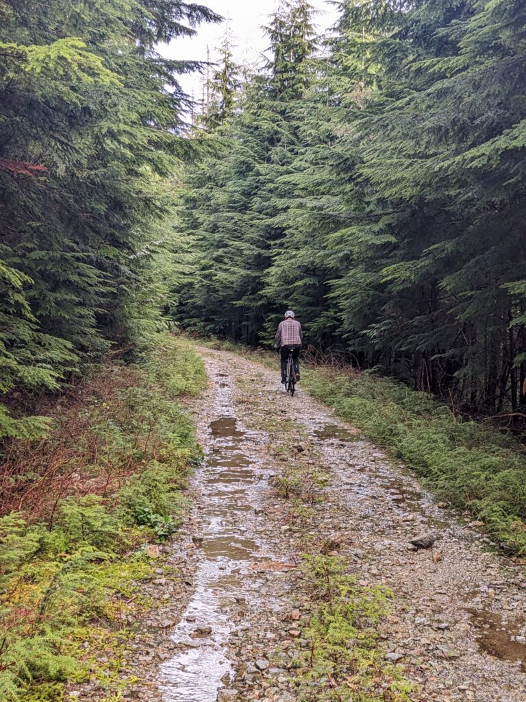
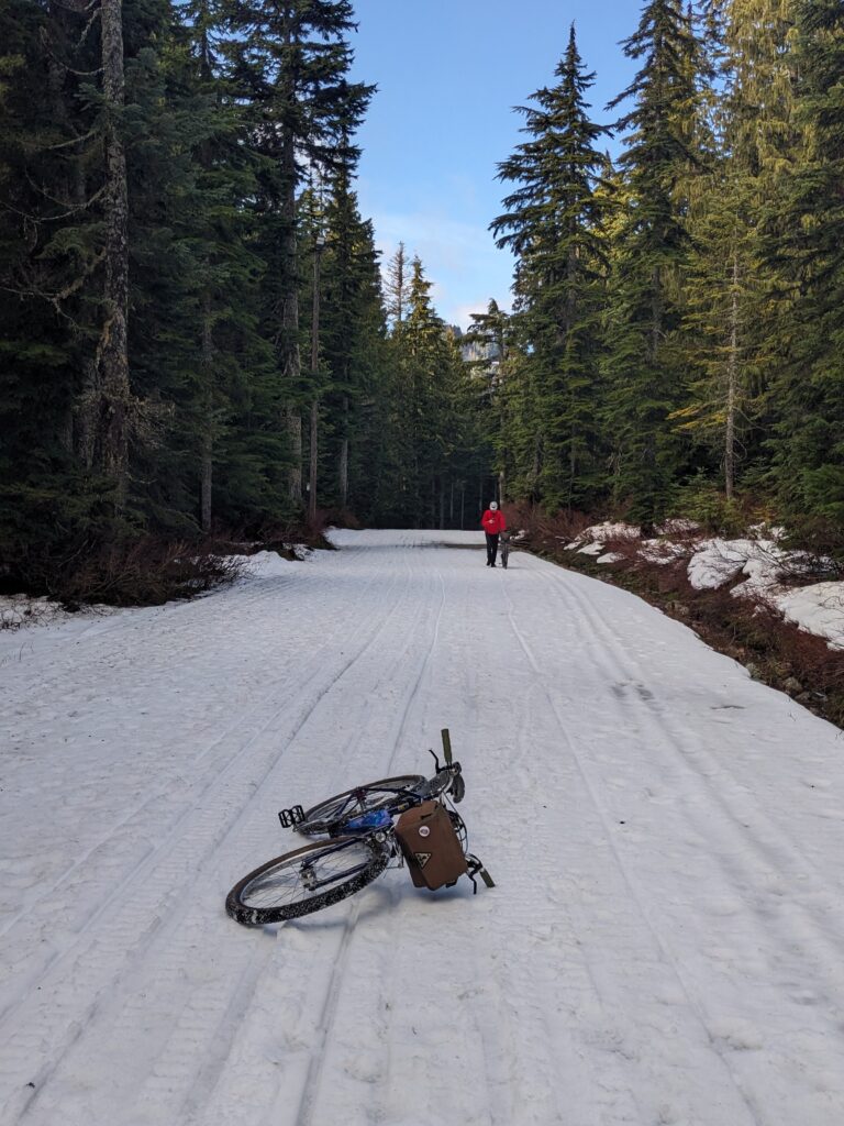
The recent snowmelt left bare areas saturated with moisture. Once we were out of the XC ski zone, we descended a section of the Cabin road we were familiar with. It was especially wet today.
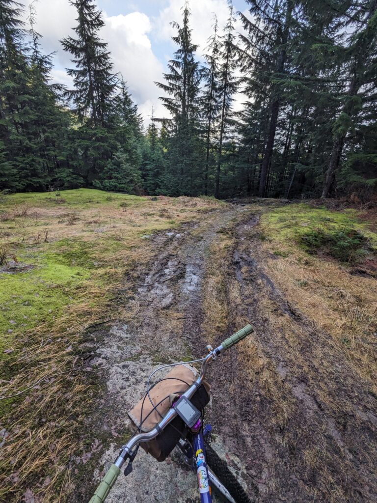
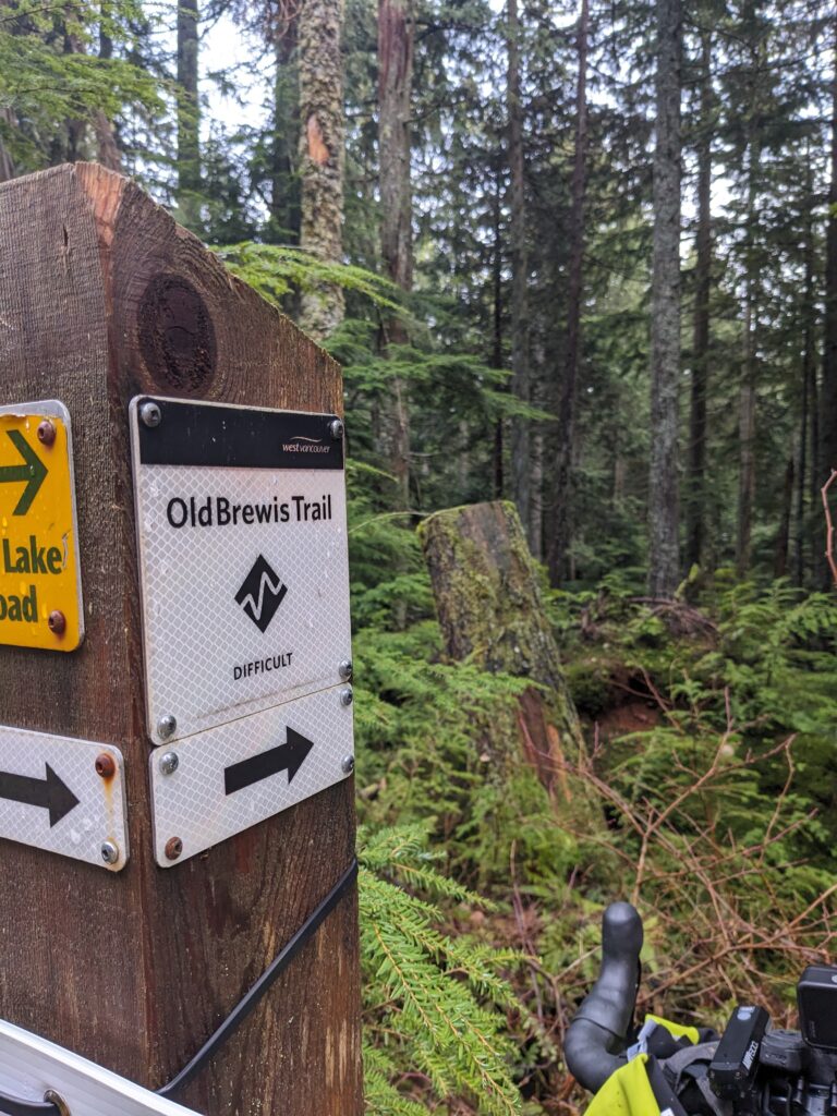
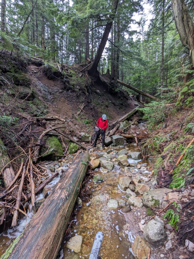
The next leg of our journey was to descend Old Brewis, an out-of-the-way hiking trail well to the east of the more popular trail network. Neither of us expected it to be this challenging.
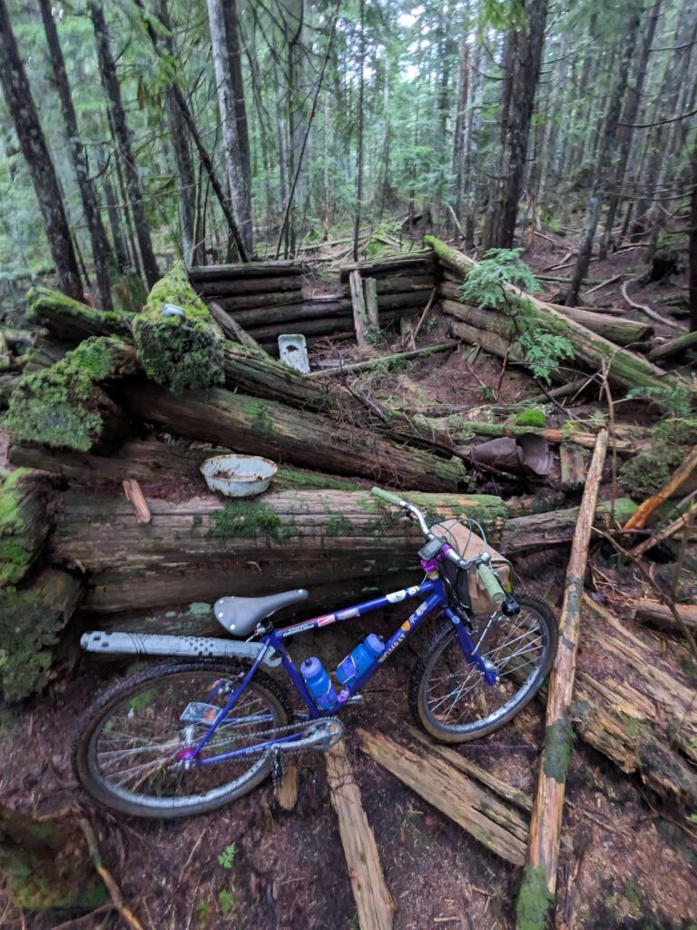
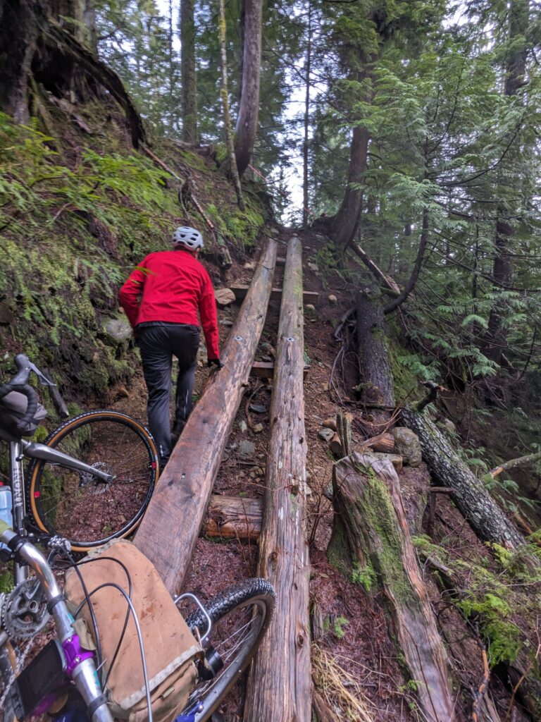
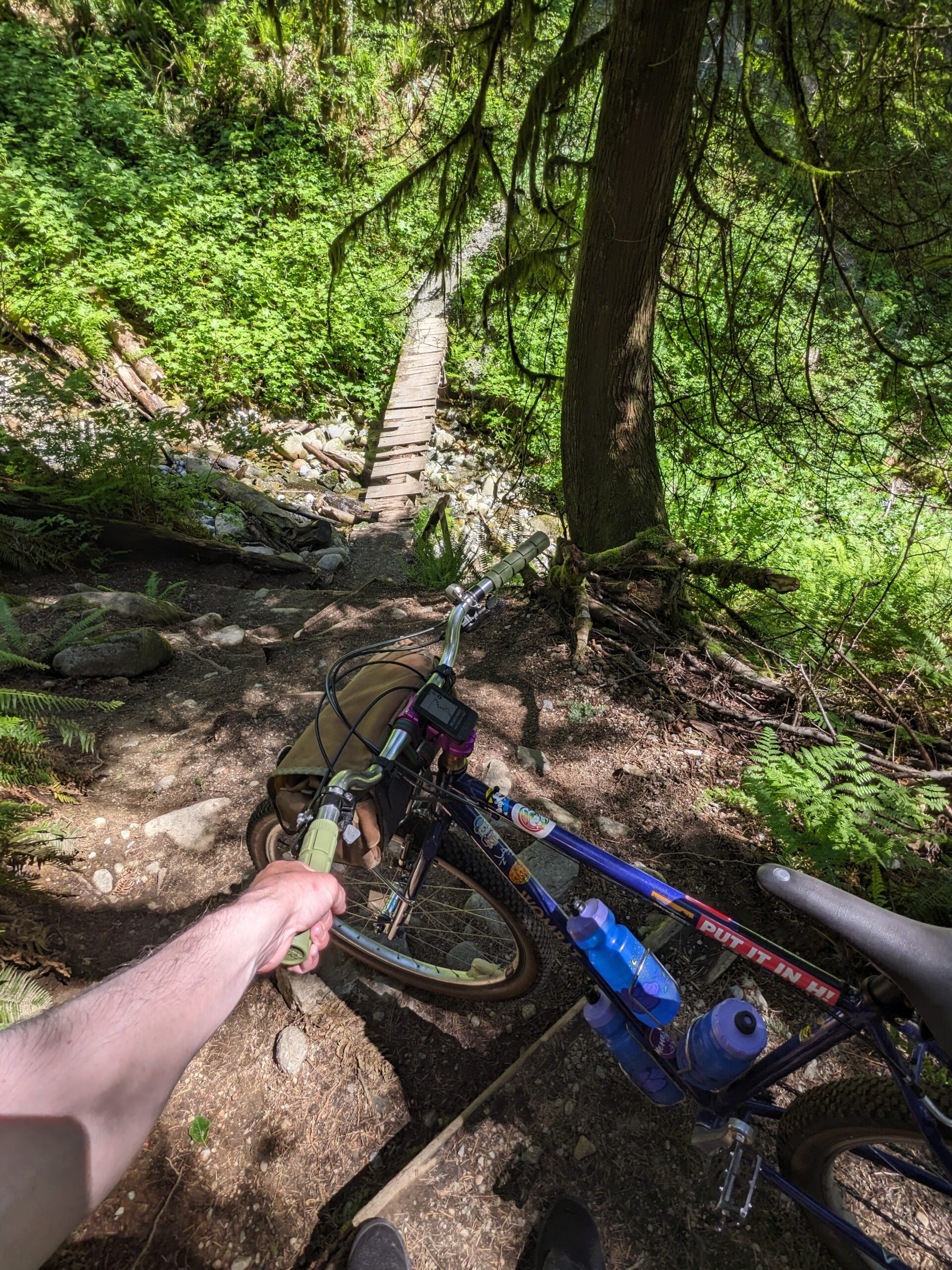
Making matters worse, the first ravine crossing on Brewis involved a destroyed bridge so we had to clamour up along the remains of the bridge.
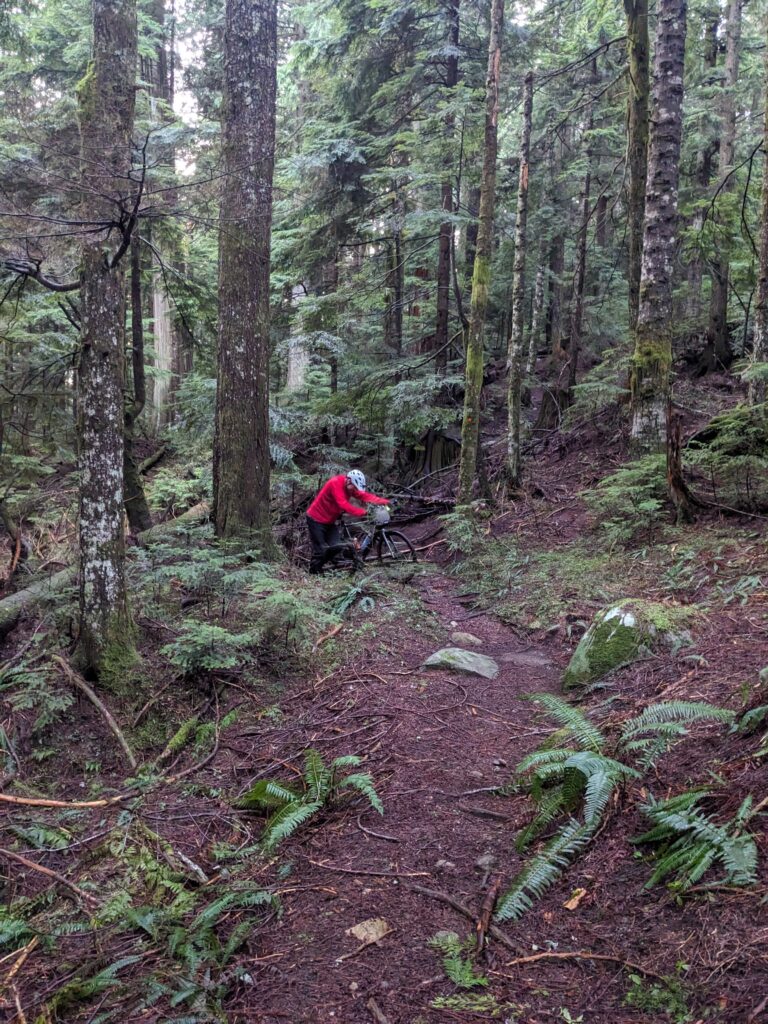
While the going was tough, the massive Hollyburn Fir rejuvenated our souls.
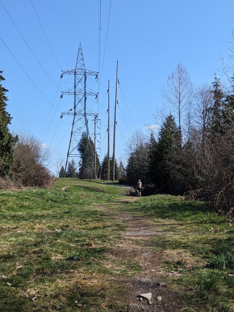
At the bottom of Brewis, we headed east along Skyline trail along the powerlines towards Lawson Creek. I honestly believed this is where things would get better, but they really did not.
When we reached the ravine that Lawson Creek was at the bottom of, we were sure we must have missed a turn. It was so steep, and such a long way down. Daylight was failing at this point and making it more difficult to see the trail, which fueled my anxiety about getting out of this challenging terrain as soon as possible.
We descended into the ravine knowing that we’ve thus committed to finding a way up the opposite bank. If hiking, this would have been a moderate scrambler – but getting the bikes up with us was a challenge.
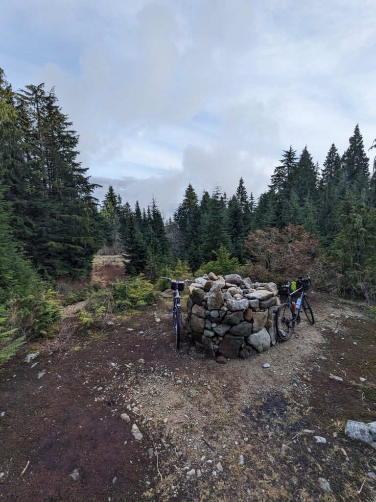
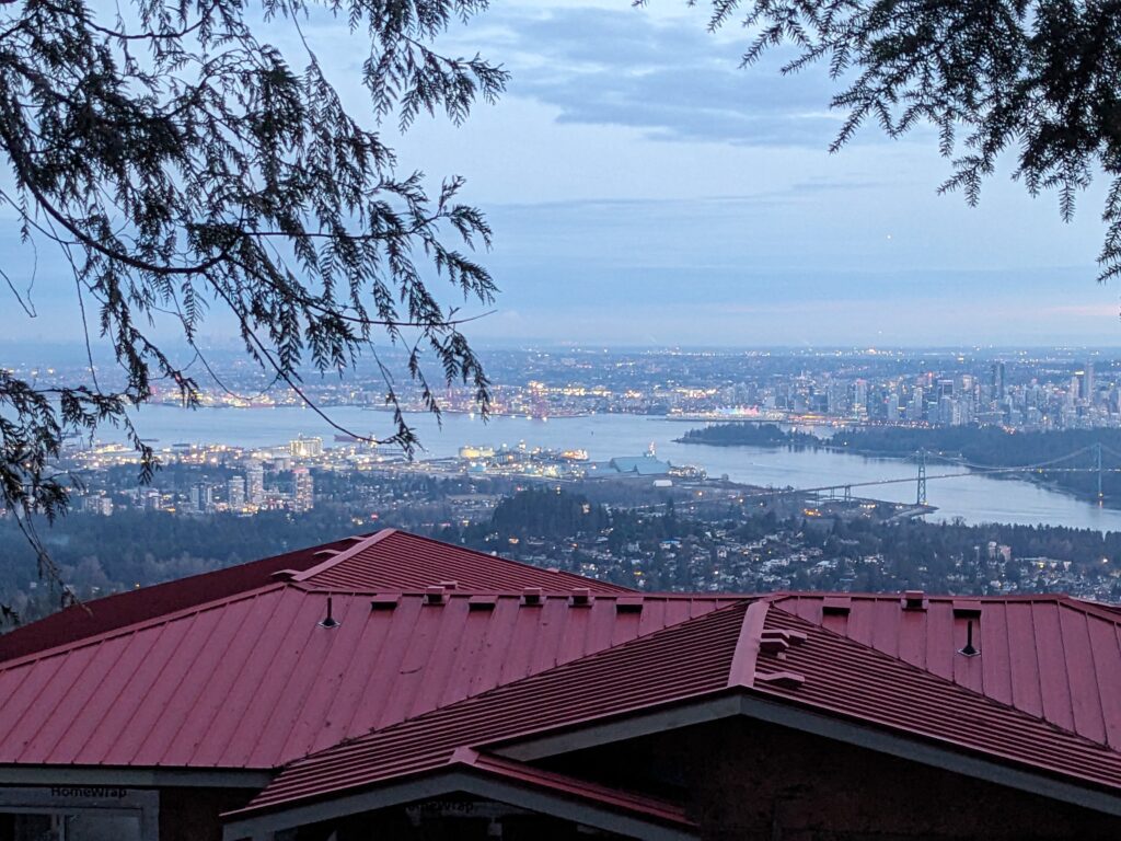
Once on the other side of that last ravine, the trail became much more hospitable and placed us back on a normal, reliable trail with views of the city below. I was extremely relieved to know that we didn’t have any more unknowns ahead of us.
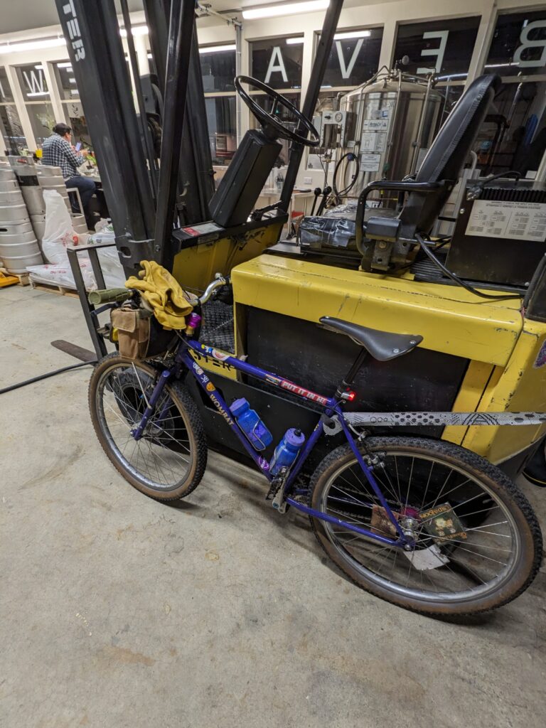
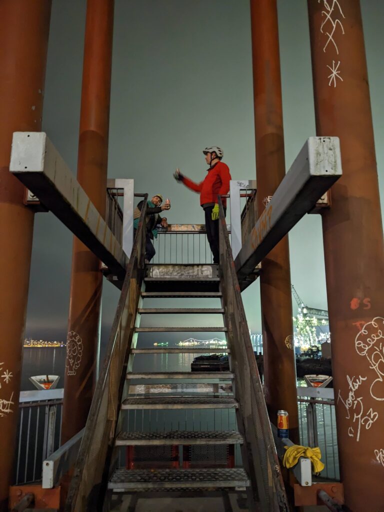
Better still, a buddy of ours was at the brewery at the bottom of the hill. We arrived at the busy brewery and parked our bikes in the brewhouse. It was jolting to go from a day of wilderness to such a busy environment. After the brewery we worked our way along the bike route to town, stopping for a cheeky drink on a pier along the way.
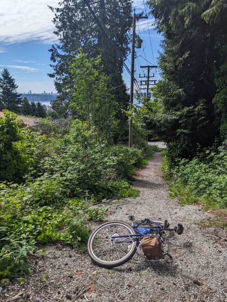
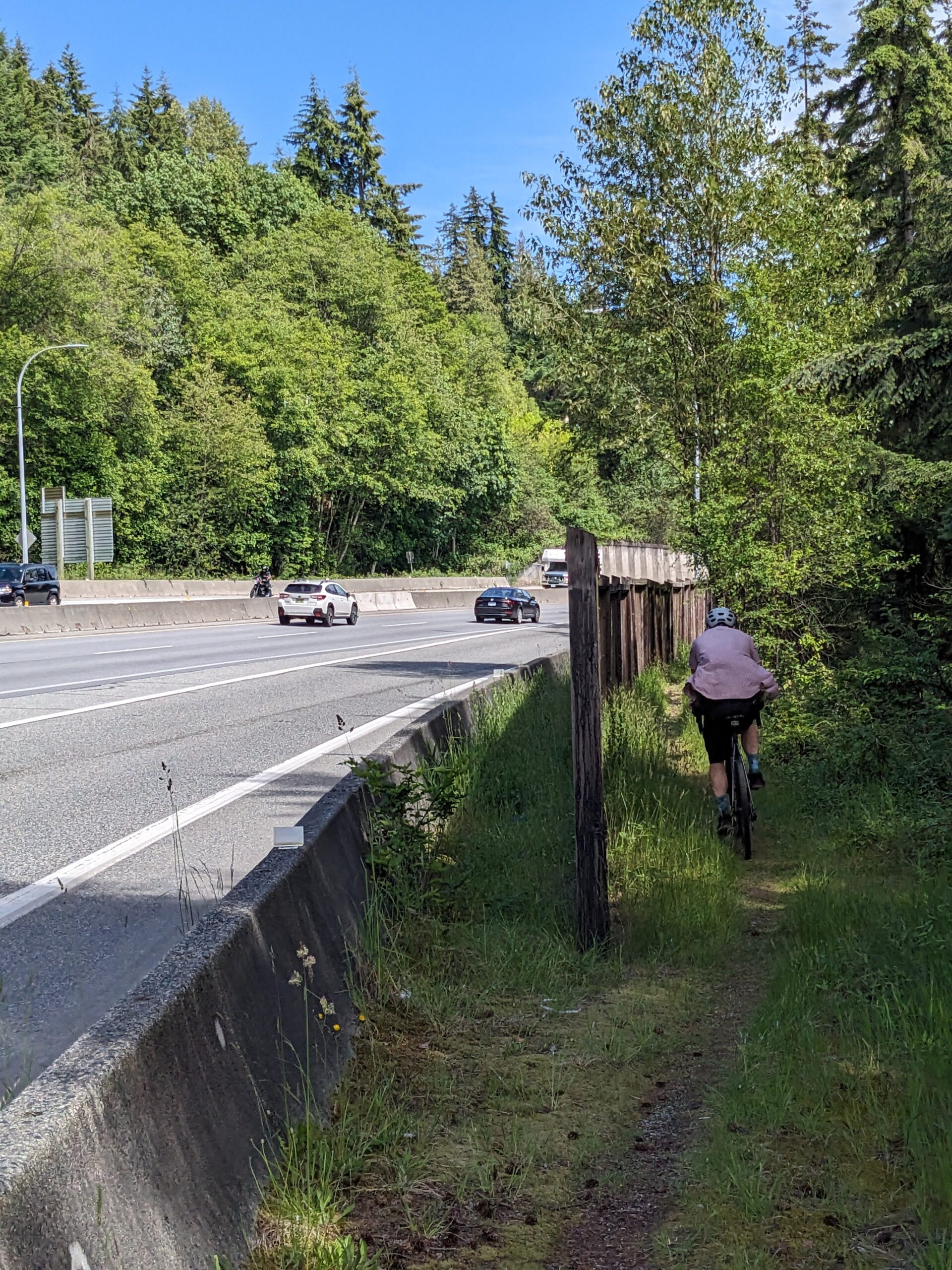
There is a popular trail along the west side of Mosquito Creek that starts just off the busy Marine Dr in North Vancouver and heads north to Montroyal Ave. Beyond that it does technically keep going to the powerlines, but it quickly devolves from wide dog-walk friendly path to technical hiking trail, complete with climbing ropes in one section due to the grade and exposure.
Even more curiously there appeared to be some sort of trail on the other side of the creek at this point that doesn’t show up on most maps, including Trailforks.
We had to go see.
I had recently outfitted my Bombadil with drop bars and this seemed like the right kind of ride to really test that out. We traveled up McKay creek to start, and then jogged over to Mosquito Creek via some trails just south of the highway. These trails had what I would consider to be the worst possible surface: logs. Keeps you out of the muck, but unrideable and nearly unwalkable.
Thankfully that didn’t last long, and we pushed up a connector trail to the highway where we were met with police cruisers with their lights on. They had someone pulled over; they hadn’t come for us.
The traverse was short but it was also steep! This was pushing the limits of my comfort zone on a bike with drop bars and no dropper post.
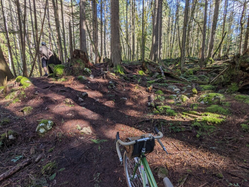
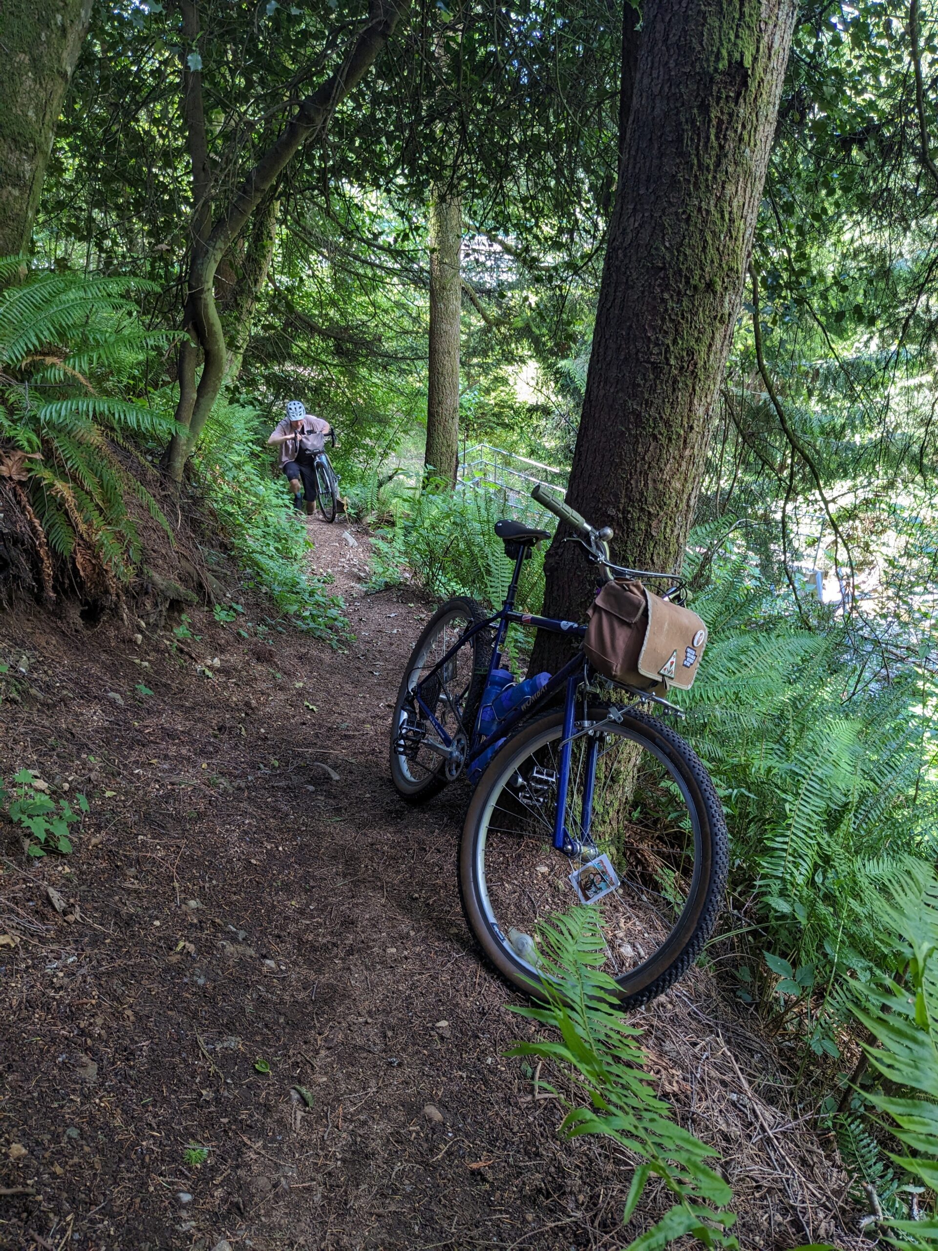
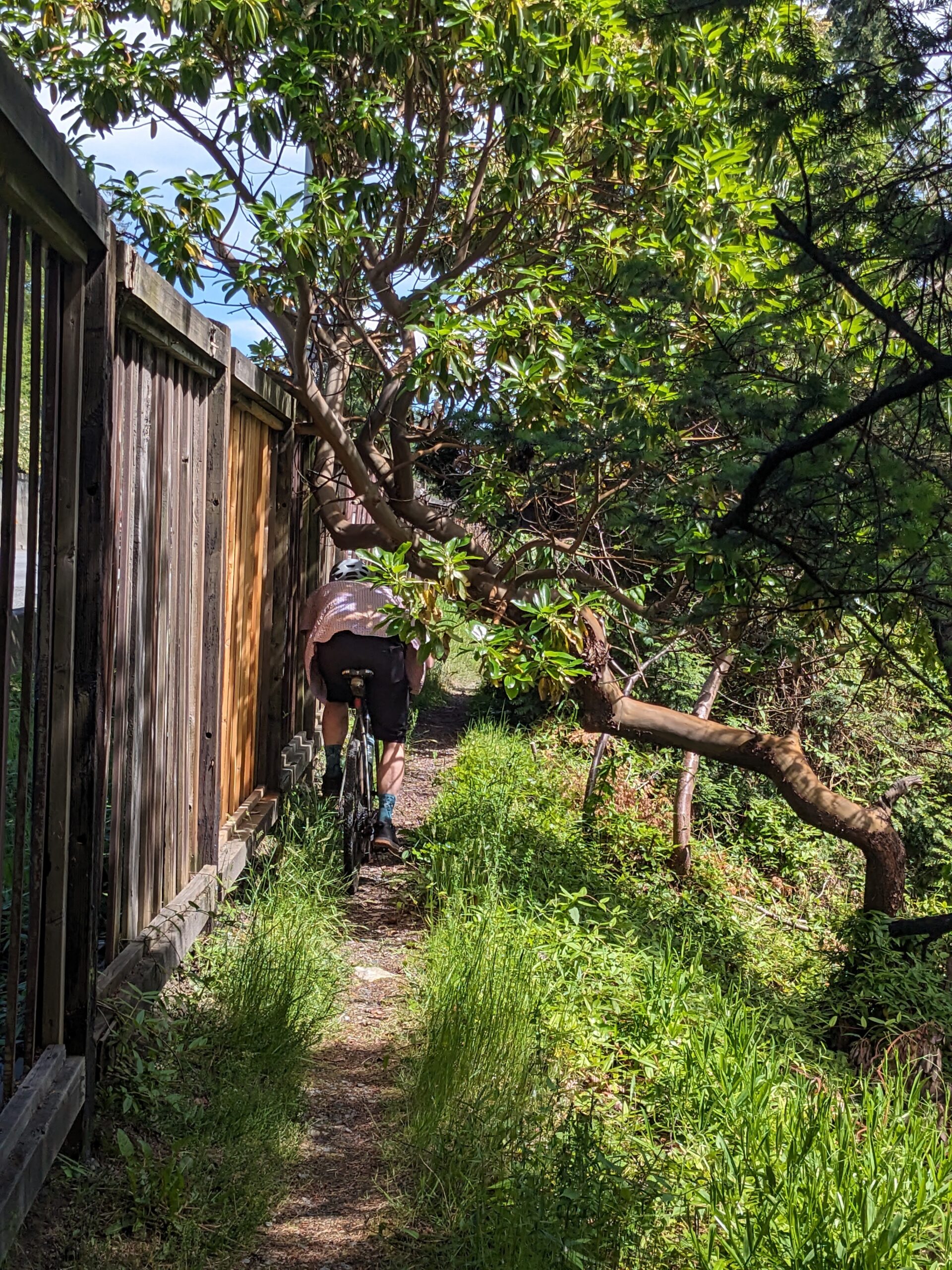
The unknown trail, the one we came for, started behind a small fire station. It was immediately beautiful but also immediately challenging.
This is the kind of trail that exists only because enough school-age kids live in the area and play in the woods.
More text
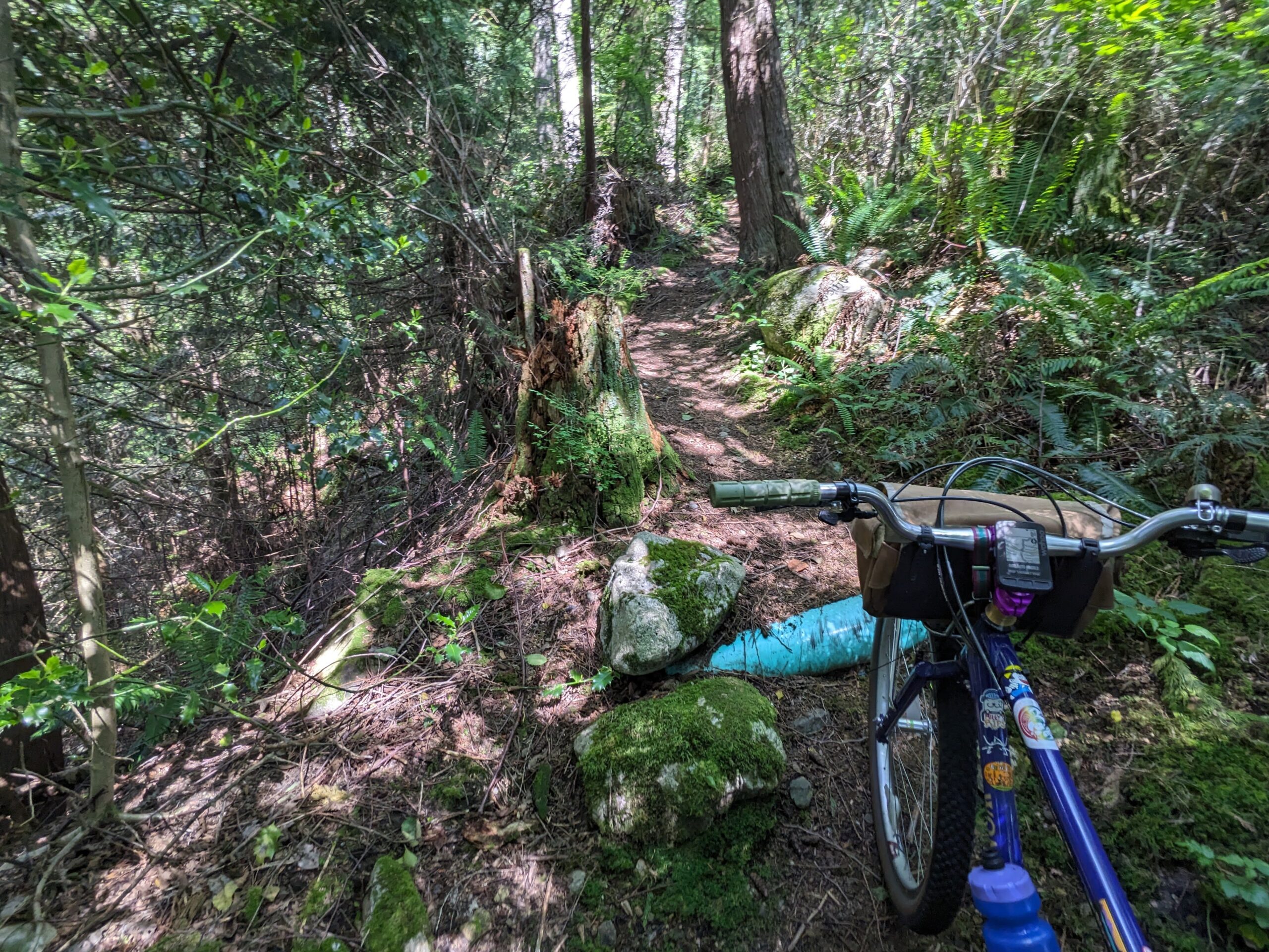
The final push to the powerlines was the worst part. The trail was very deeply eroded and loose. Was it a trail? It might have just been a waterway during storms. I think it was a trail at one time, at least.
From there, things were a lot simpler. We were done climbing. We traversed the powerlines for a bit. According to the map and my prior experience, the powerline trail doesn’t go all the way to Braemar Rd. But does it? We pressed on and found it sort of does – not something I’d necessarily do again, but we got there.
We then noodled our way down through North Vancouver, jogging over to every green space we could. It was a trip to come across an unexpected horse pasture near Princess Park. From there we passed through Hunter Park, Hastings Creek, Kirkstone, and Loutet. Time consuming and unnecessary, it was a wonderful way to get back to my neighbourhood.
We are gluttons for punishment, clearly. Armed with a fresh idea of how to get up to the sub-alpine ski area of Cypress Mountain using as few roads as possible, Rob and I took advantage of the long daylight hours and headed towards the mountain.
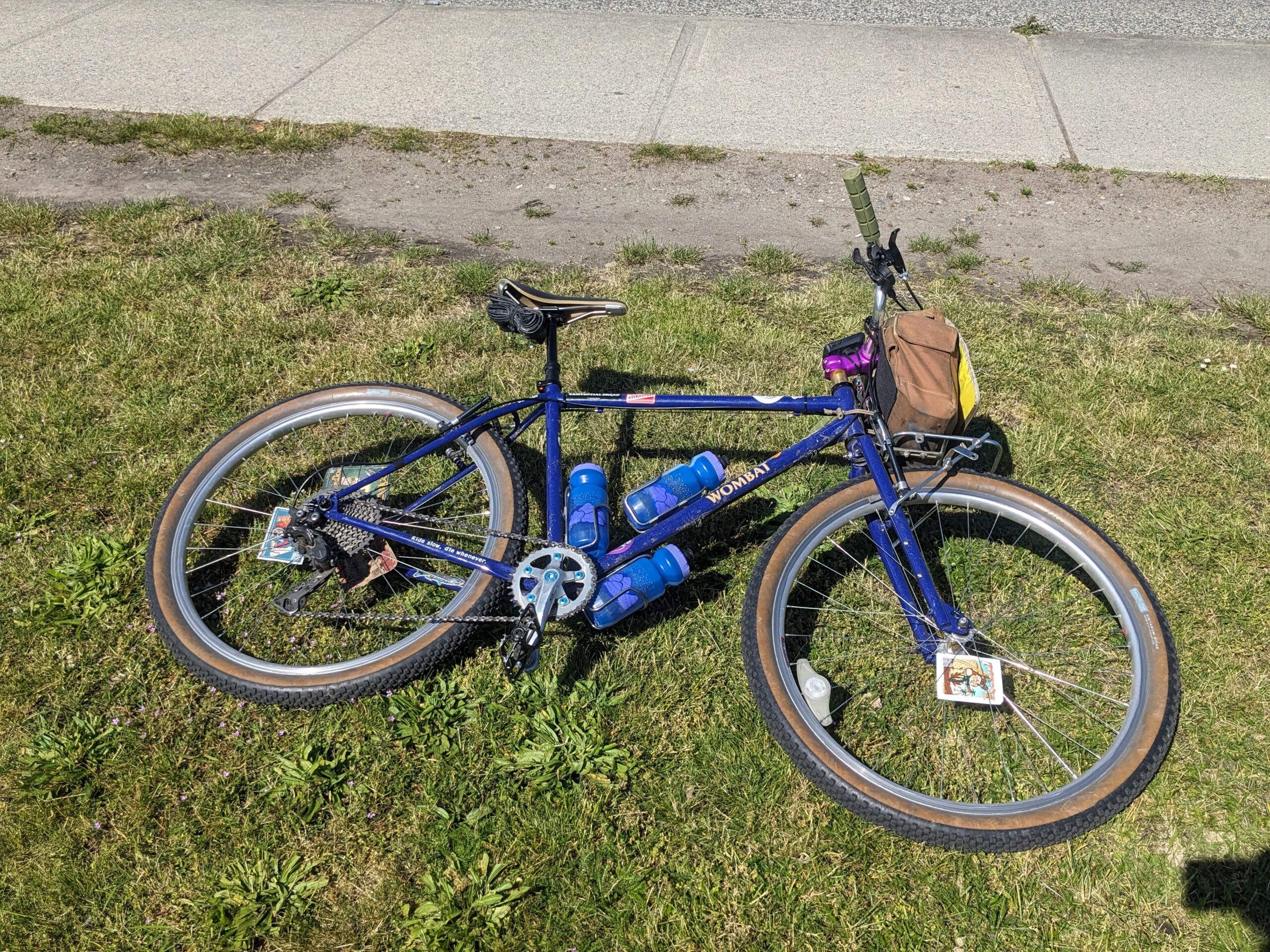
I took the trust Wombat once again, this time featuring some gears thanks to the Problem Solvers adapter to run a derailleur.
The ascent started with winding roads up through the rich neighbourhood of the British Properties along with some cheeky right-of-way paths to shortcut to the next street up.
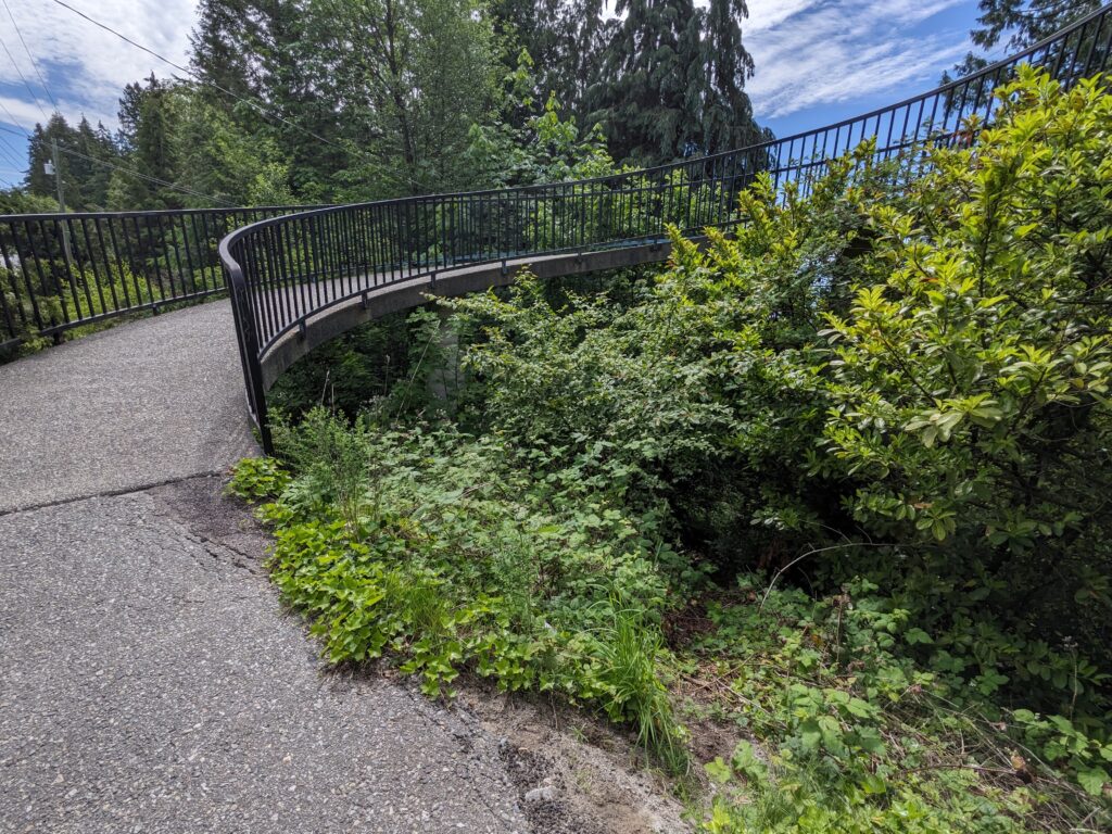
Some of it was rather silly. You might think we took the curved overpass in the image below, but we actually had just emerged from the bushes on the right.
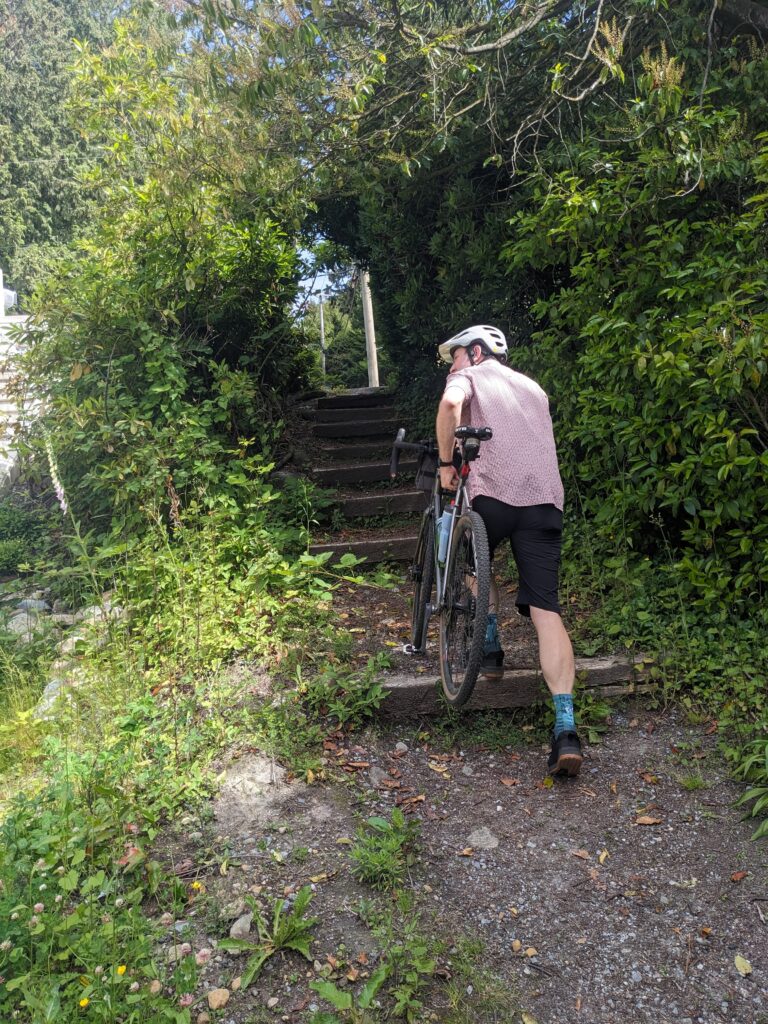
Off of Chippendale Rd we took a barely visible trail that snuck around the railing of a small bridge. This trail ascends along a ravine up to the Cypress Bowl Rd lookout point.
It’s good fun coming down, but it’s hike-a-bike going up.
The lupins were out in full force next to the lookout. From here we descended across a deep ravine knowing that a lovely trail awaited us on the other side. Well, mostly.
The above photos represent the traverse across on Millstream, but then it was time to start going up again. We climbed the Millstream fire access road until we reached Baden Powell.
Being aware that Baden Powell is no-bikes in this area, we hiked our bikes and didn’t ride even when the trail was enticingly rideable. And for the first stretch, it was enticing! Smooth and well maintained, not too steep. However this changed markedly as the trail went on, and soon carrying our bikes became rather exhausting. The sporadic older growth trees gave us life, though.
As we reached the sub-alpine a beautiful little pond appeared.
When we reached the top end of Baden Powell we were deposited into an open clearing; we were over 800m elevation now. From here we hopped onto the old Cabin road which led us westward towards Cypress Bowl Rd. The Cabin road is chunky, wet, and poorly maintained. Which is to say, it’s lovely.
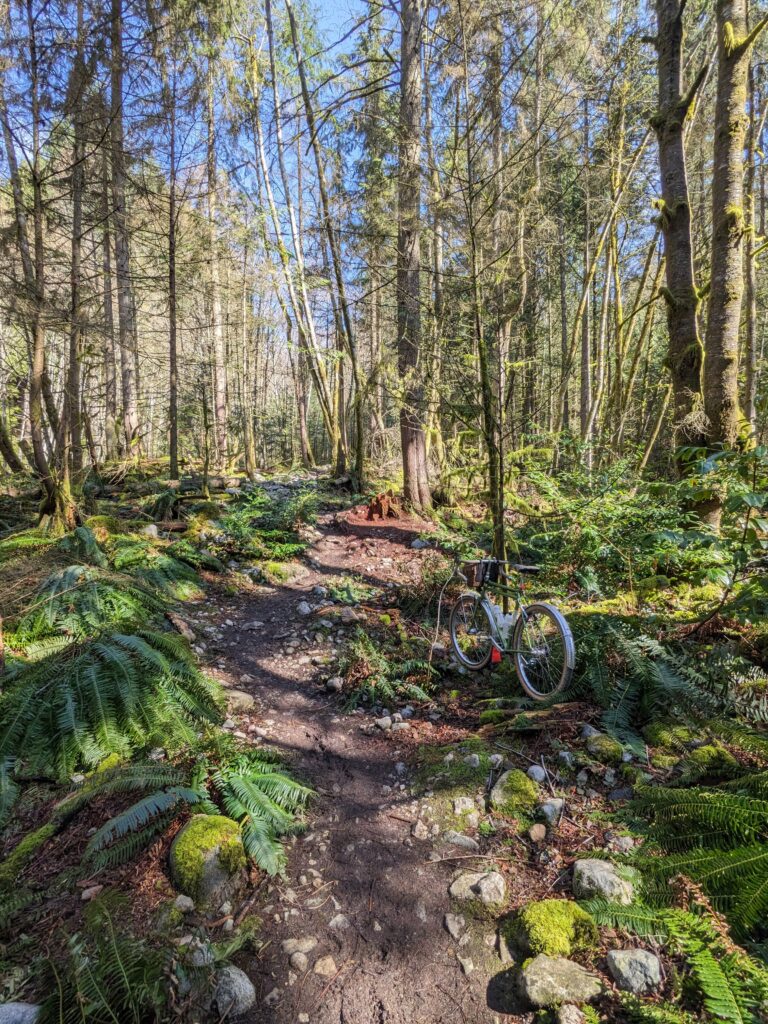
We crossed over Cypress Bowl Rd and onto a trail that only shows up in some maps, which traces the perimeter of the Old Growth Conservancy near Blind Skier. It exceeded our expectations, starting out as a well-maintained path to some old growth examples before petering off into a low-traffic loam trail that needled through the dense trees with exceptional skill.
This tree (below, left) is a comrade.
Some appreciation for this capable rig. The rim brakes weren’t performing at their best during some of the water-saturated descending, but otherwise I rarely thought about the bike because it just worked for everything. Light enough to be easy to carry through hiking trails, but capable enough to send a couple spicy rock rolls.
We took the BLT access road down past all the Cypress MTB trails, onto Fern trail which deposited us near the bottom of Cypress Bowl Rd. From there, we took Rob’s favourite fence line along the highway before descending back into the city.
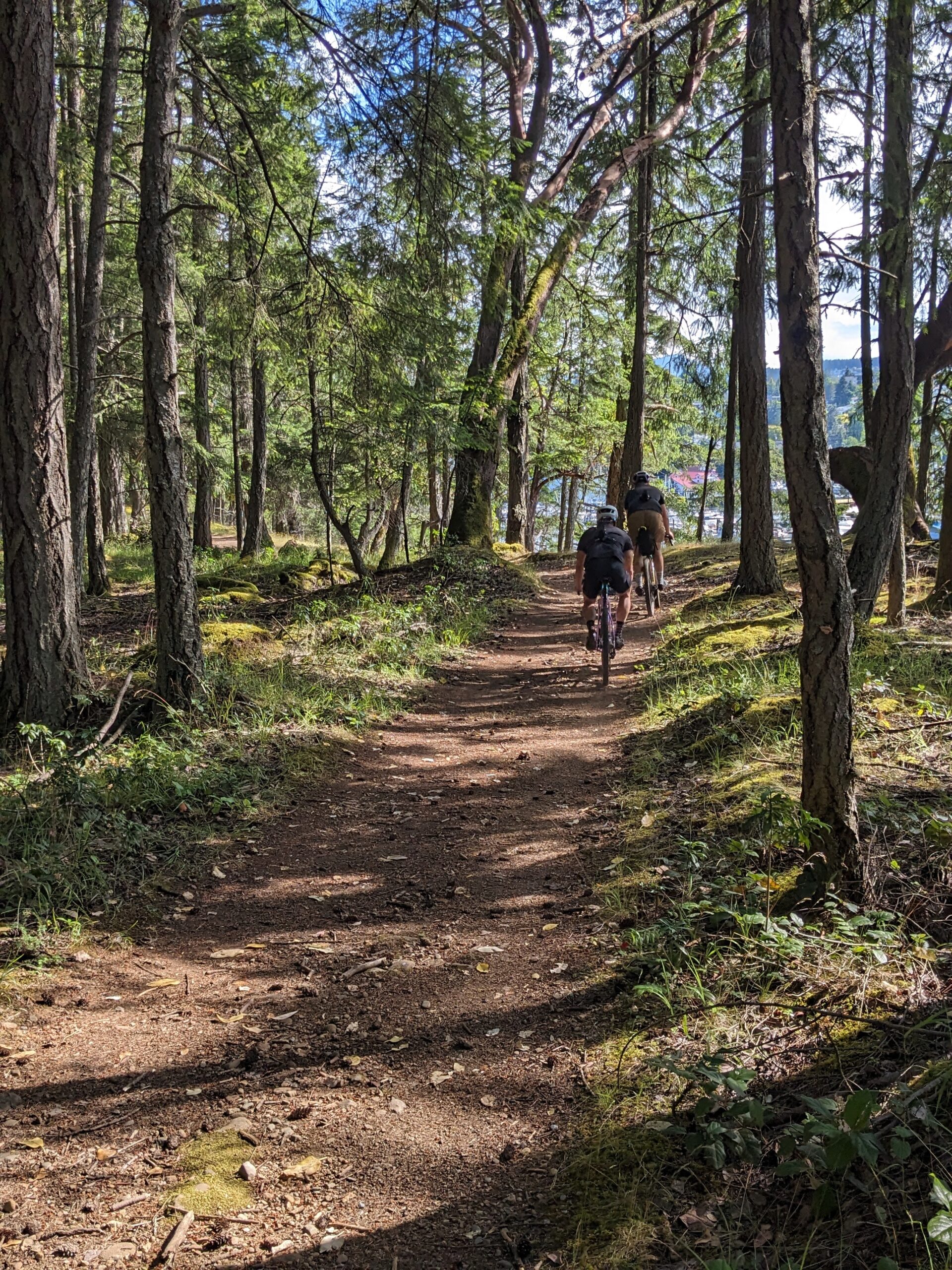
This year, local bike shop Kissing Crows hosted an official Swift Campout overnighter to Saysutshun (Newcastle) island just outside Nanaimo BC. I don’t typically camp in big groups but it’s really fun to do occasionally, and this was a really good group and a perfect destination for the large numbers.
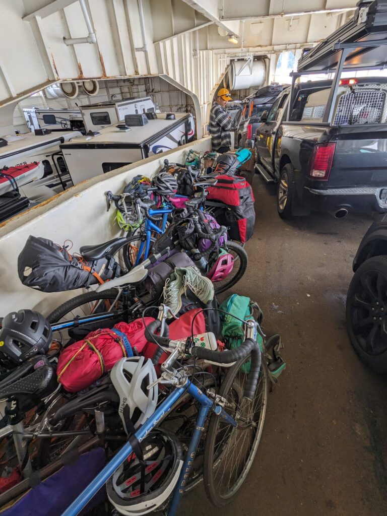
It was an early morning start to catch the nine-something in the morning ferry, with a lumpy 30km ride along West Vancouver to Horseshoe Bay ferry. This was nearly all the required riding to get to Saysutshun, as once the ferry landed in Nanaimo it was just a stone’s throw to the dock where our adorable little water taxi would take us to the little island.
As we waited for our taxi, the summer rains hit. Not forecasted, this caught a lot of us by surprise – but a BC bike-packer always has a rain jacket on hand!
The showers were intense but short-lived. Most bikes were transported in a dedicated bike boat, but a few stragglers were piled on the outer decks of the taxi while the humans all piled within with their bags.
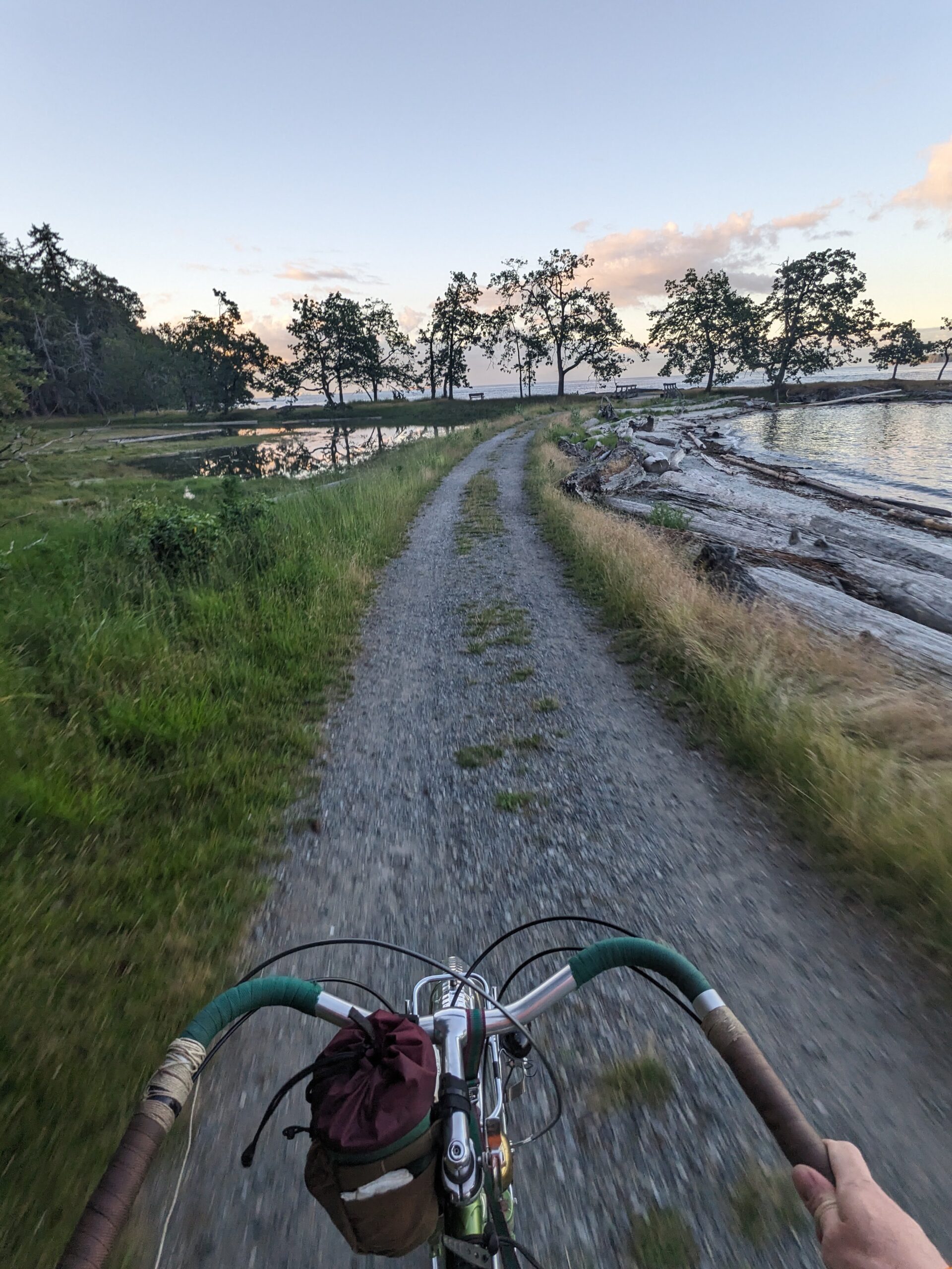
Once we dropped our stuff in the sprawling group camp area, we took off on a loop of the island. A small island, the perimeter trail is about 10 km long. The trail was smooth gravel in some sections but rooty and rocky in others. Beautiful riding all the way.
There is a distinct, unique feel that is common to all the gulf islands: the exposed rock, grassy knolls, proliferating arbutus trees jutting out at impossible angles. It brings me a deep joy to be on any of these islands.
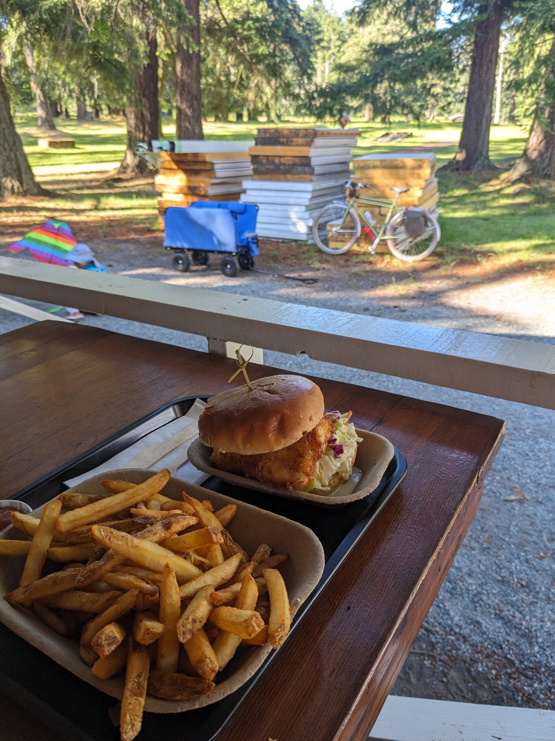
After the loop I was pleased to find the lone cafe was open, and enjoyed a rather delicious halibut sandwich. After this, I spent time exploring the extents of the camp ground.
Fifty people in a group site would usually be crowded, but the group sites on Saysutshun are so large that we were plenty spread out. I found a nice spot by some mature trees, away from the social area. I love being social but it’s not a full time thing for me!
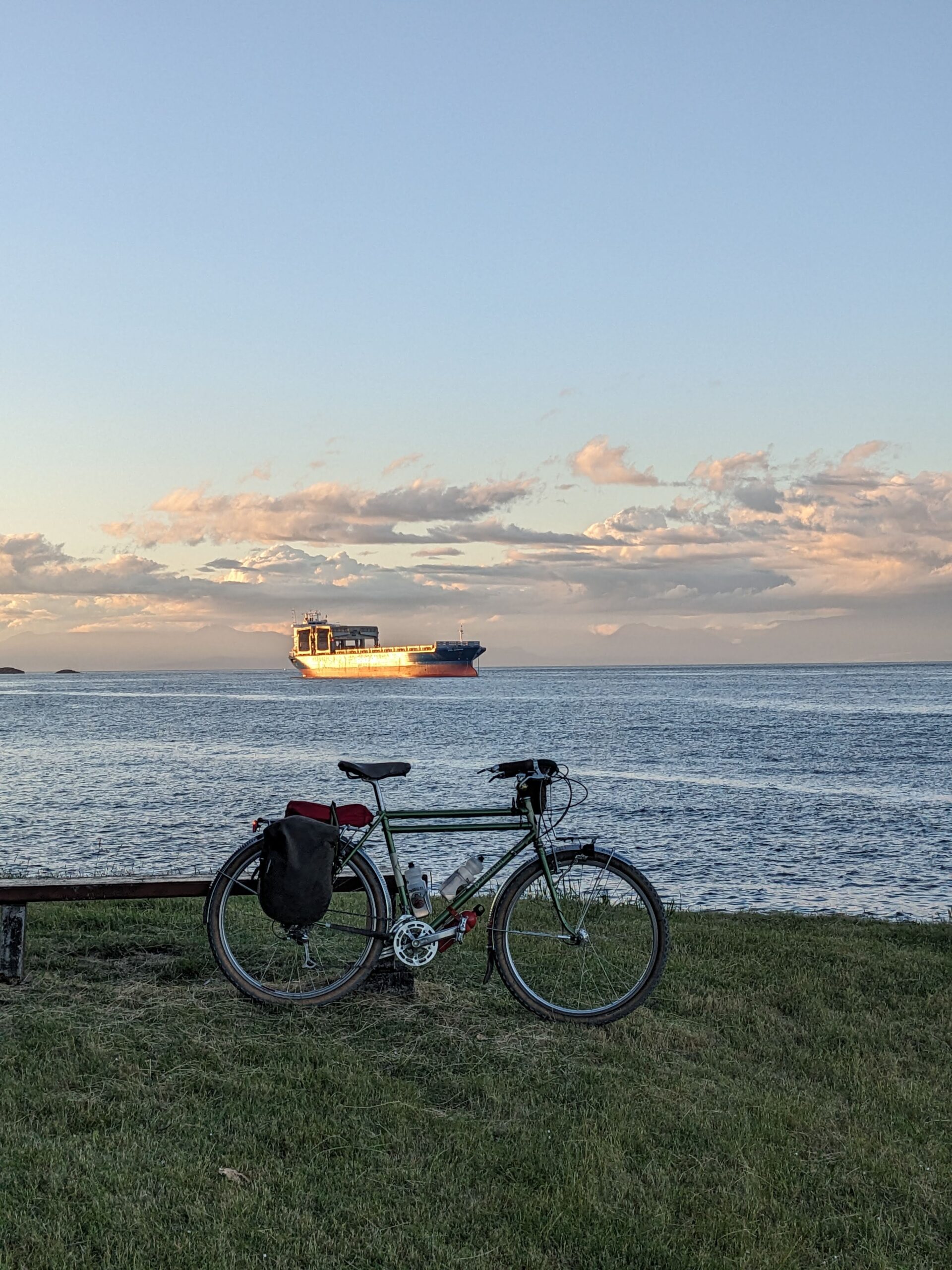
After hanging out for a while, having a beer and some dinner, as the light was starting to wane I made a spontaneous decision to do a second, solo loop of the island. Given the terrain it’s about an hour to complete the loop and the sun was already beginning to set.
I was able to get more photos of the loop this time around since I was travelling solo.
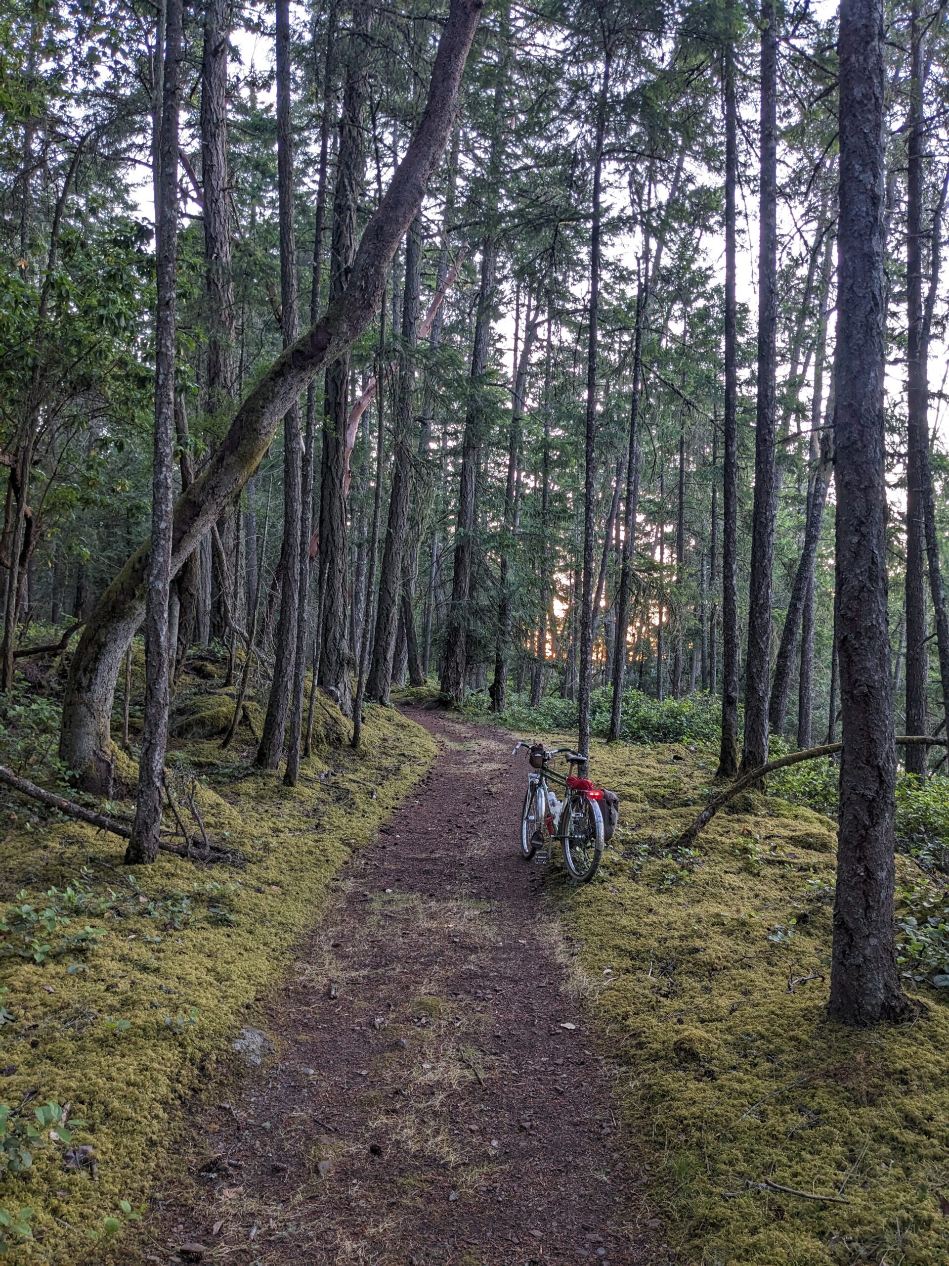
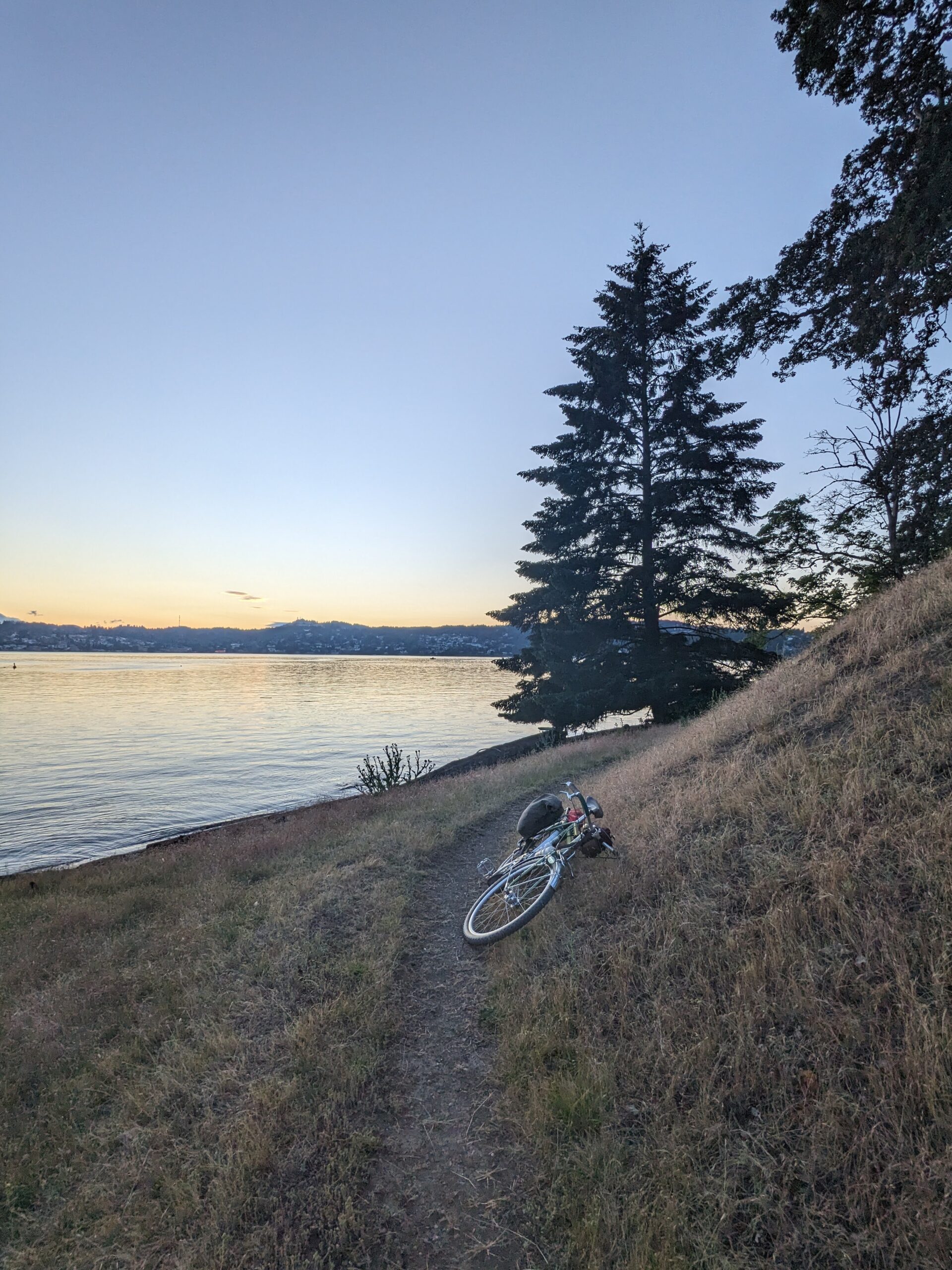
I returned to camp in the last bits of twilight and enjoyed some time around the fire. At right, being greeted by the morning sun the next day.
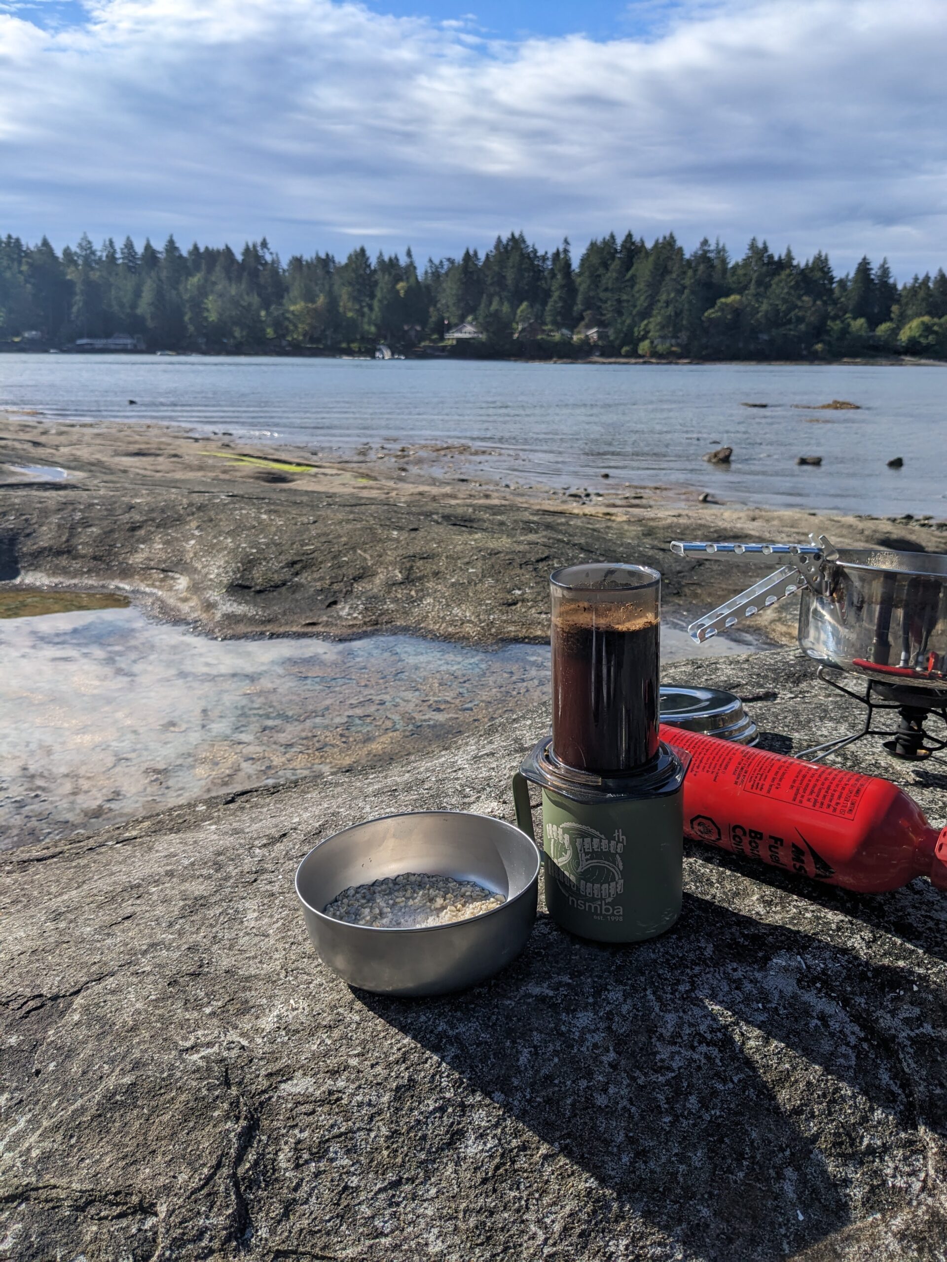
I was able to sleep in until around 7:45, and emerged to make coffee and oatmeal on the shoreline while deer wandered about the camp area.
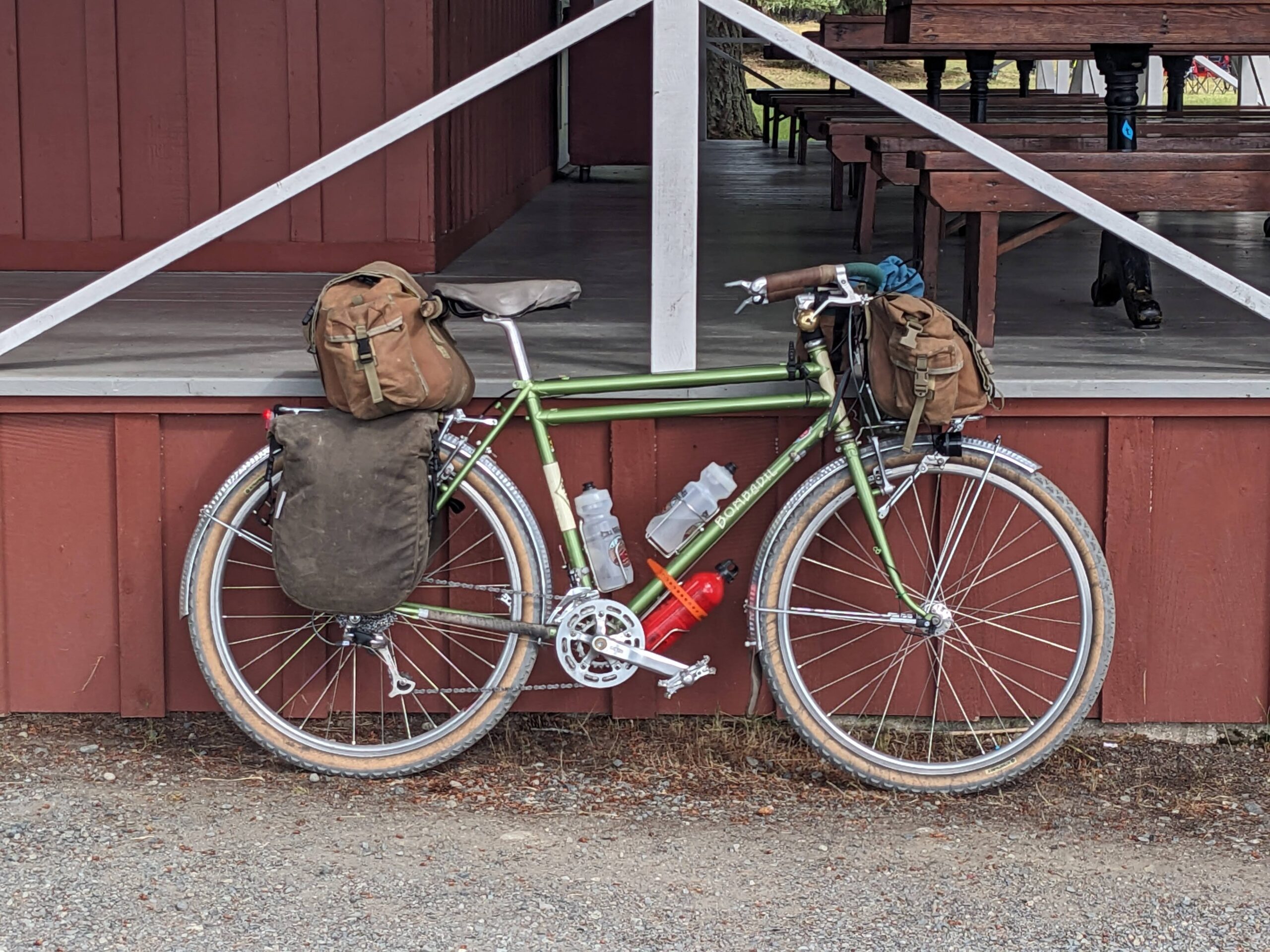
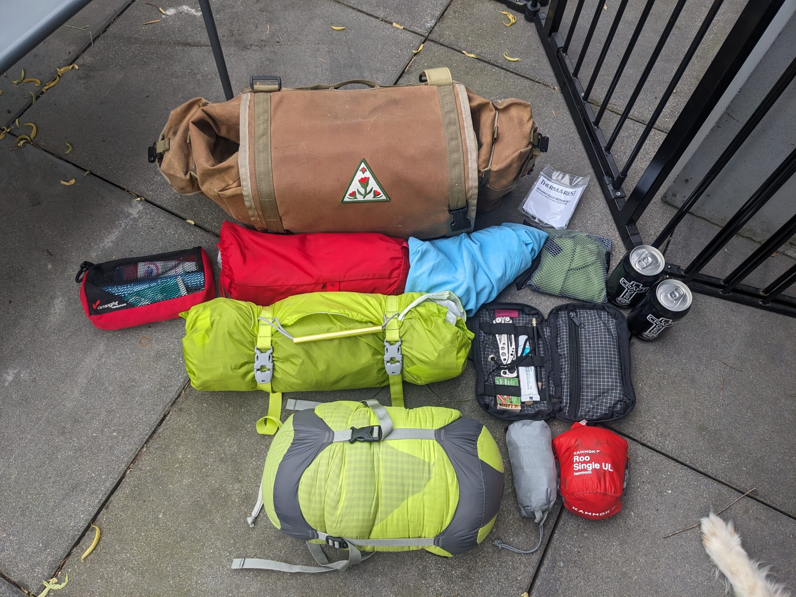
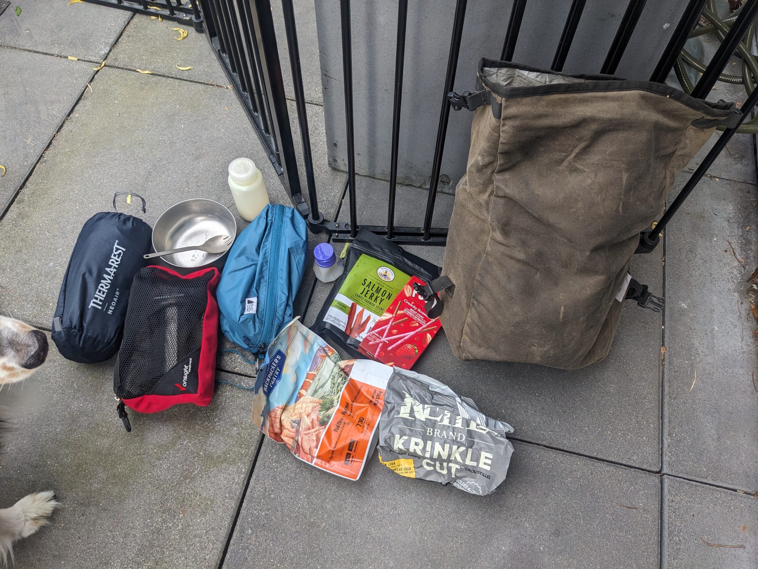
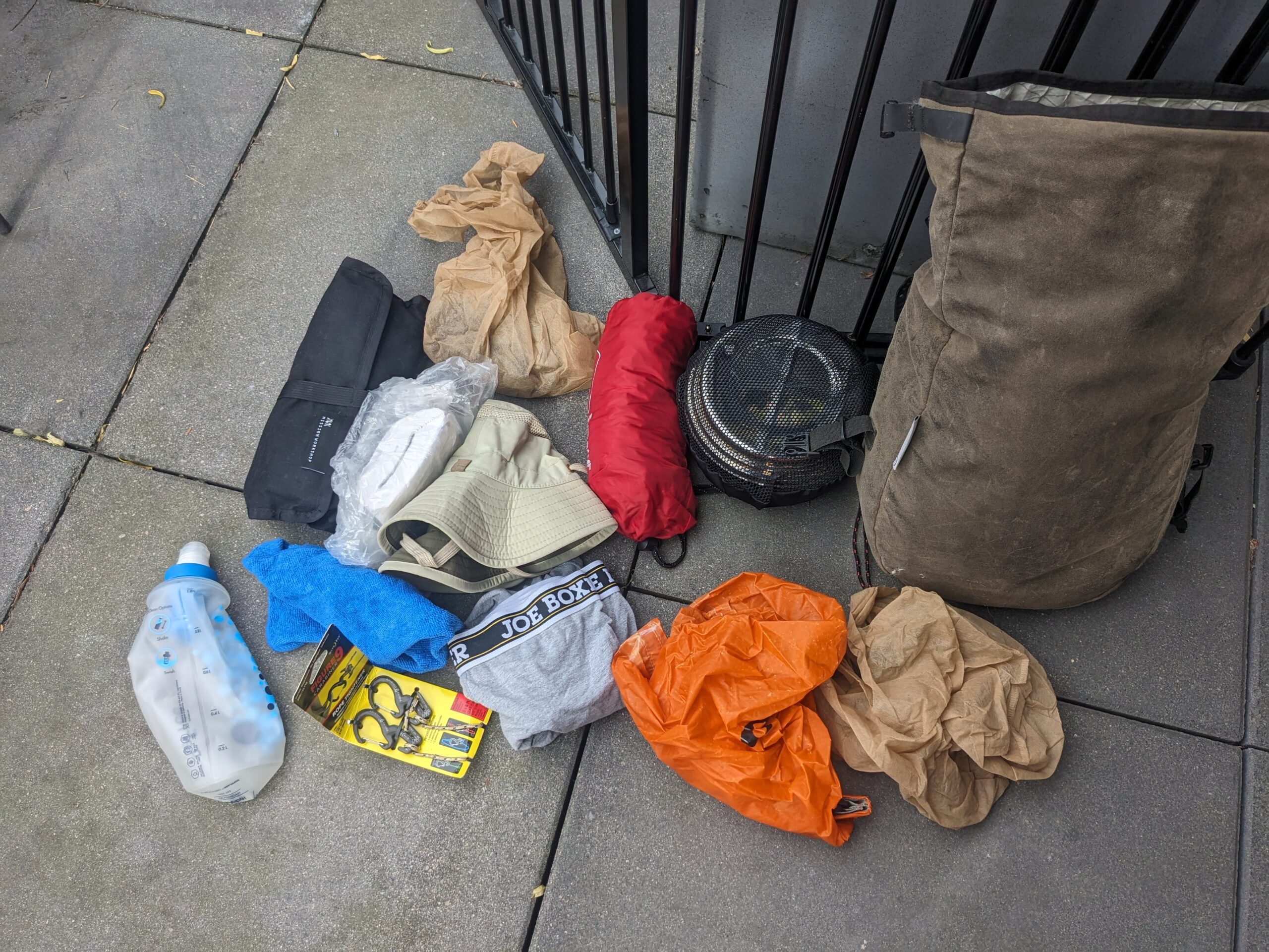
The rig, all packed up for the ride home:
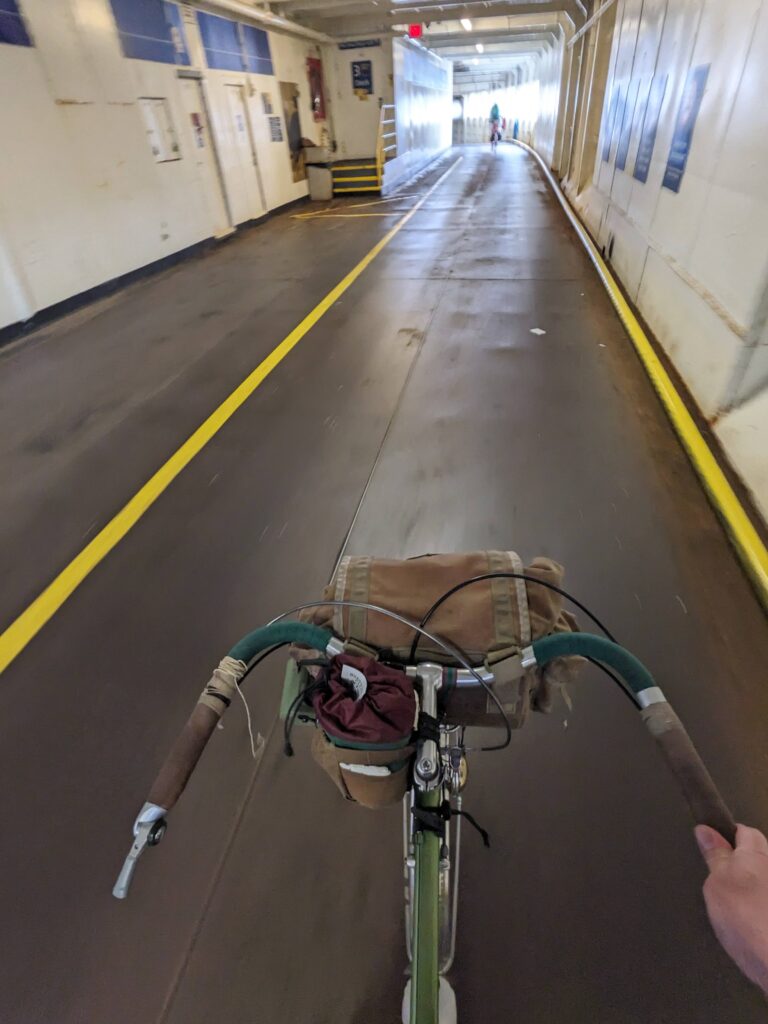
Riding onto the ferry never gets old.
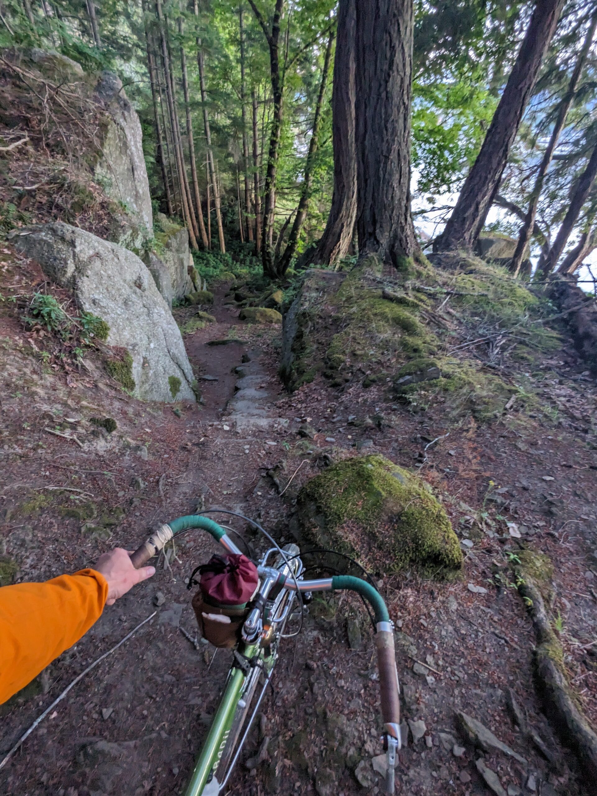
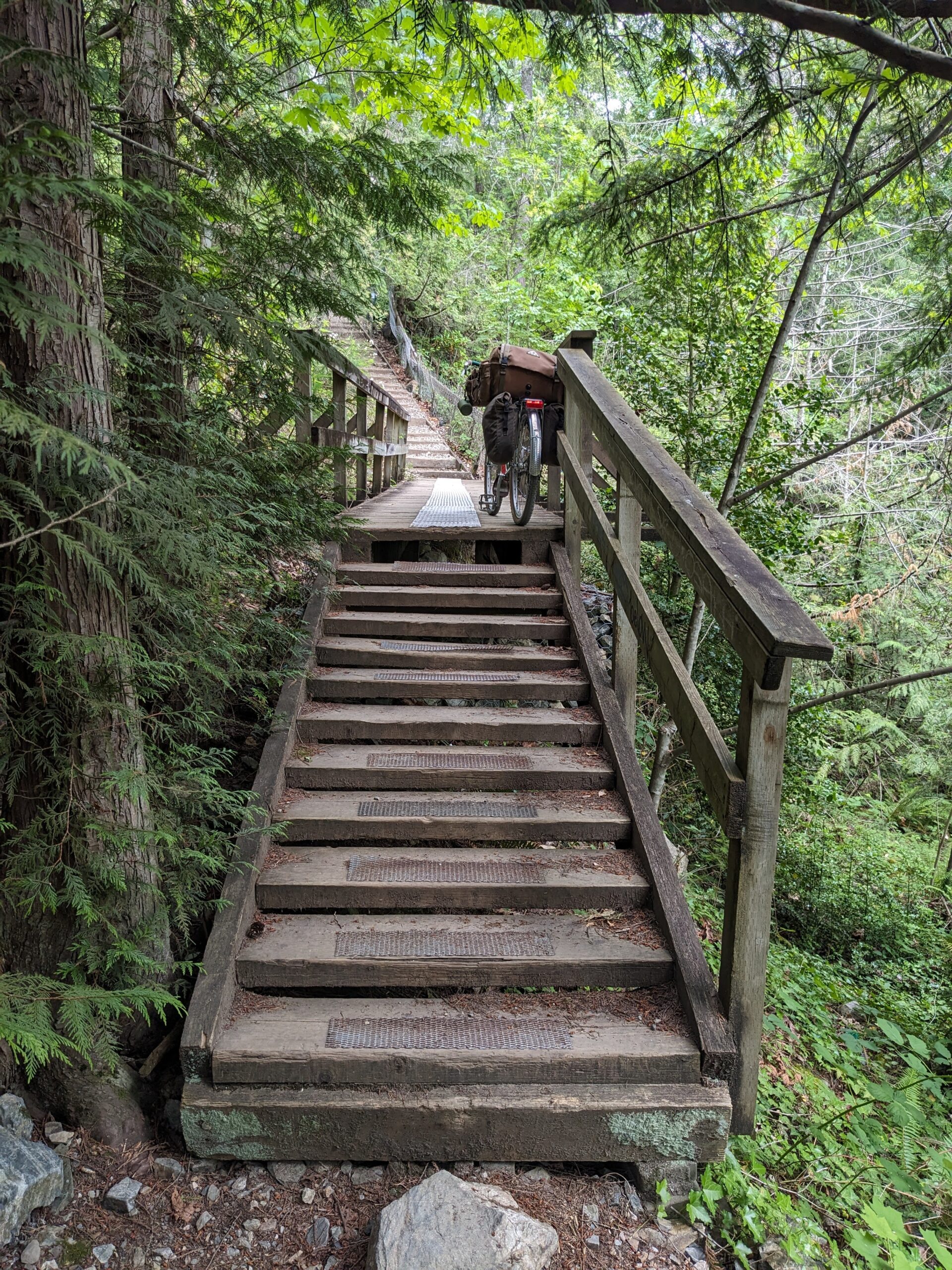
I chose to take the more challenging, but more lovely route home which includes some hike-a-bike. The heavy camp load made it quite a challenge, so I stopped halfway to enjoy my remaining beer over a deep ravine.
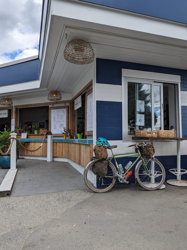
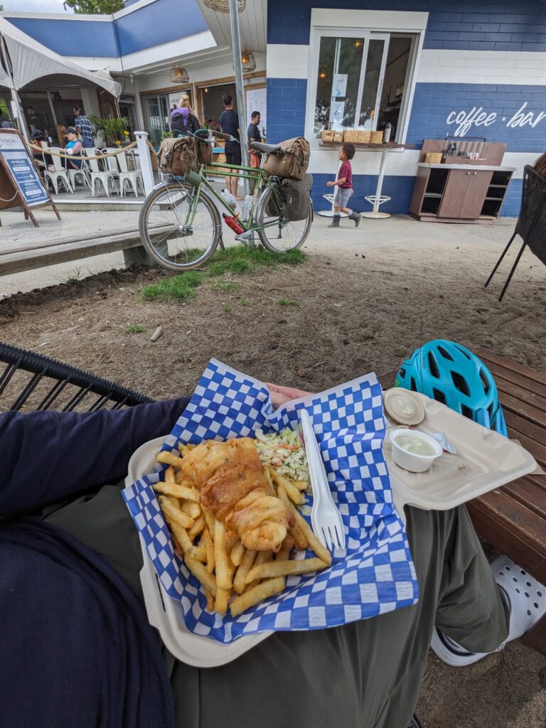
I started to get real hungry as I passed through West Vancouver so I stopped for one of my favourite long-ride meals – fish n chips at Ambleside, ordered from a take-out window. I wish there were more take-out windows you can ride up to around here!
Upon returning home, I emptied each bag and photographed its contents as a curiosity. This represents a hasty re-pack as well as things migrating around as I went about my day, and not how I’d have packed them when preparing for a trip.