I didn’t take a lot of photos this past week, but I rode every day and the weather’s been bright and sunny without being too warm. I’m trying to soak up every moment of this before the heat, draught, and wildfires become the reality.
Just about all my riding was on the Bombadil, except a 50km day on the Evasion and a couple short rides on the Twenty. That’s consistent with my year so far, too – the stats for year-to-date mileage are:
Bombadil: 982 km Evasion: 463 km Hillborne: 240 km Twenty: 216 km Scrambler: 0 … haven’t ridden it since Nov 30!
It’s a bit ironic that with my two new bikes coming this year, the Bombadil and Evasion are the two bikes going offline, given that I’ve been riding them the most. The Evasion frame set will be sold, but the Bombadil i’ll hang onto – just going into temporary storage due to space constraints.
The new bikes are a Stooge Rambler, which will be set up as a drop bar, all-surface adventure bike, and a Stridsland Beachcomber, which will be set up as a playful ATB. There’ll be a lot of overlap in terms of what terrain they’re suited for but their builds will be plenty distinct – the Rambler will be the go-to for camping trips and long rides, while the Beachcomber will be kept more minimal and light (by the way, it’ll be titanium!) so I can treat it like a big BMX bike as well.
There is the question in my mind all the time, if I only ride the Stooge Scrambler a handful of times per year, why not sell it and keep the Bombadil intact? While that seems most logical from a usage standpoint, I do cherish those few rides on the Scrambler – and the Beachcomber won’t be up to par for riding the steep and slippery north shore trails like the Scrambler is.
It’s Wednesday, and I took the rest of the week off work. I wasn’t planning to ride today, but while I had my coffee this morning, I started to think about going out into the woods. Specifically, I started thinking about the ‘Temple of Time’ grove mid-way up the Seymour valley that Tay and I failed to find a few weeks ago despite considerable effort.
The terrain we had experienced was steep and unforgiving, and being off-trail in a relatively remote area, not somewhere I felt comfortable being solo – but between my familiarity from last time and the research I’d done, I figured I’d poke my head into the woods and go from there.
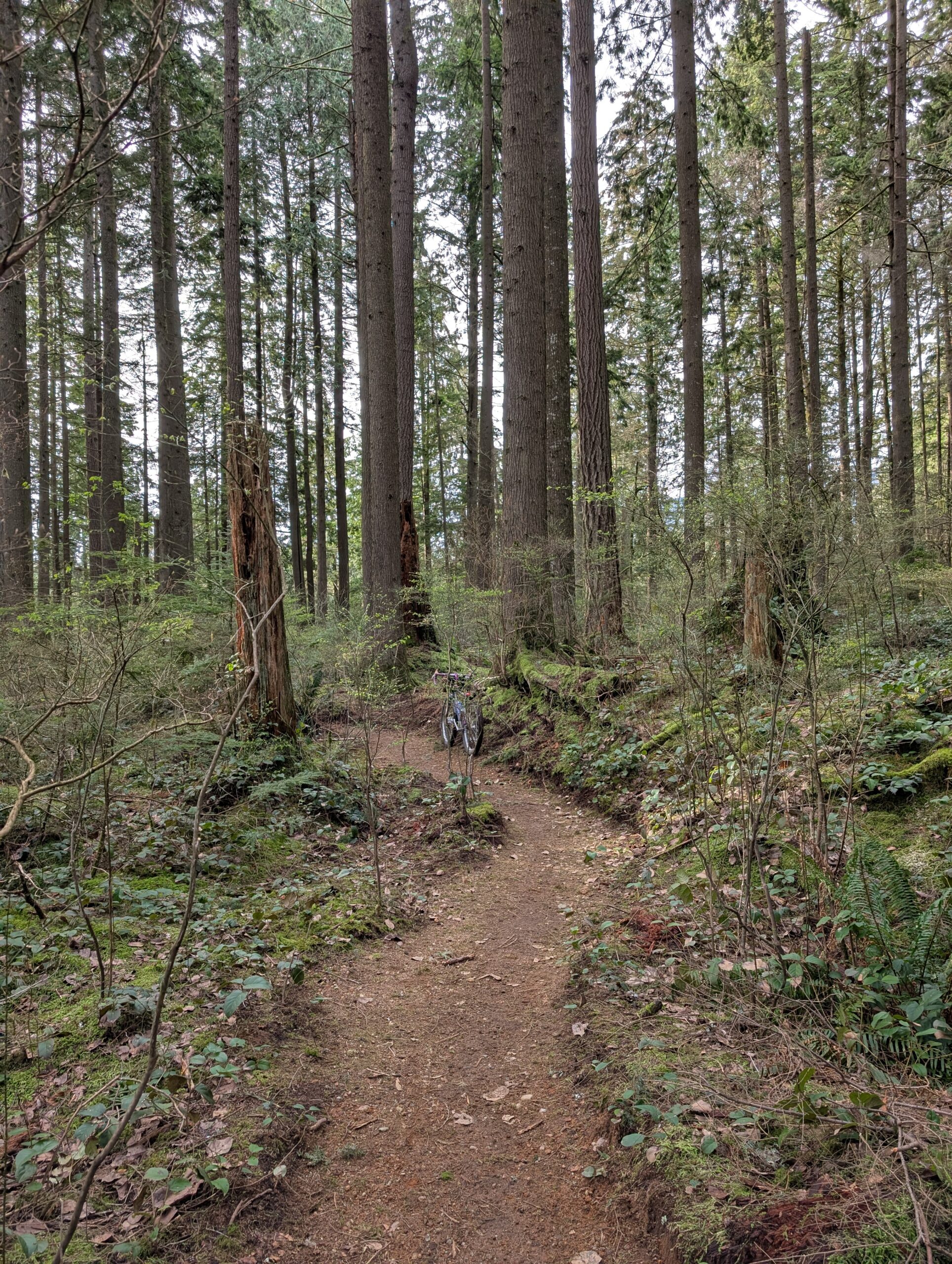
I rolled up the Seymour parkway, past the spot where Tay and I went in last time, and kept my eyes peeled for a good spot to climb in that corresponded with where I’d earmarked on the map. To my delight, I noticed a subtle trail in just the right spot. As I climbed into the forest canopy, it continued, and was supported by occasional flagging.
I do have to emphasize that the trail was subtle, and probably only gets a handful of footsteps a month. I ended up losing track of it on the way up, putting me about 100ft further south – but I knew the elevation I needed to be at and I studied the backdrop of the tree, so I was able to see a clearing in the distance that I was confident the tree would be in.
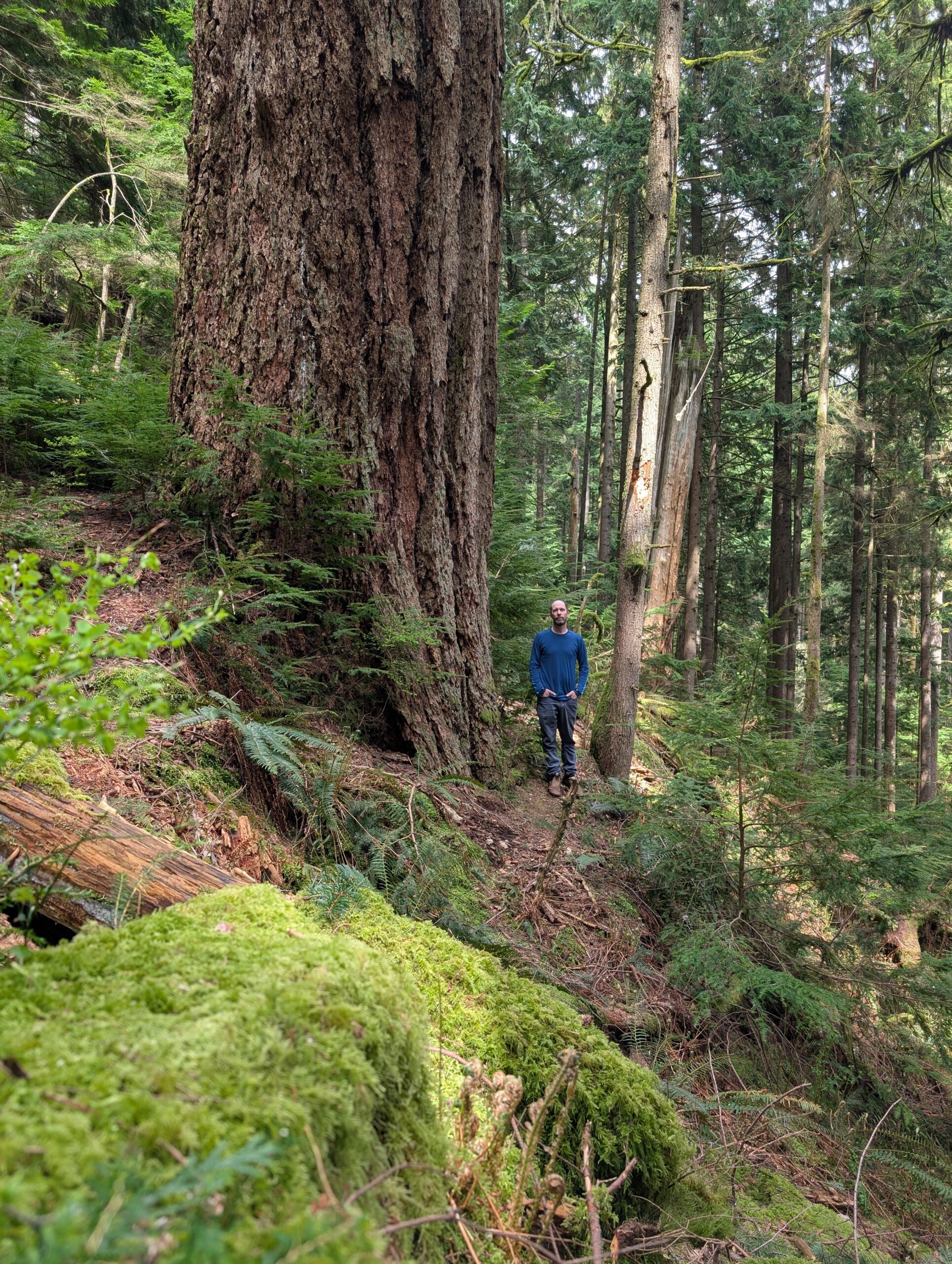
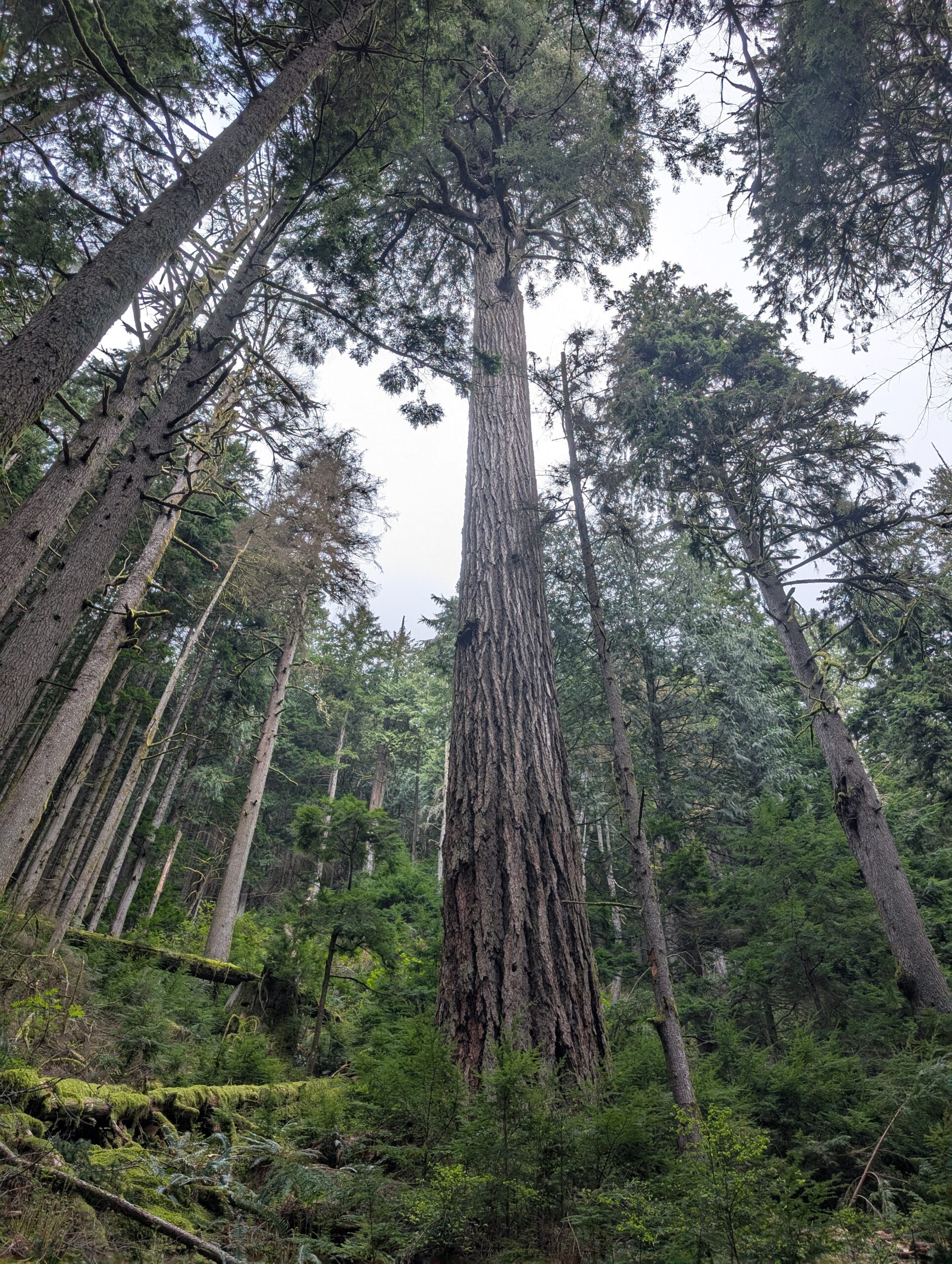
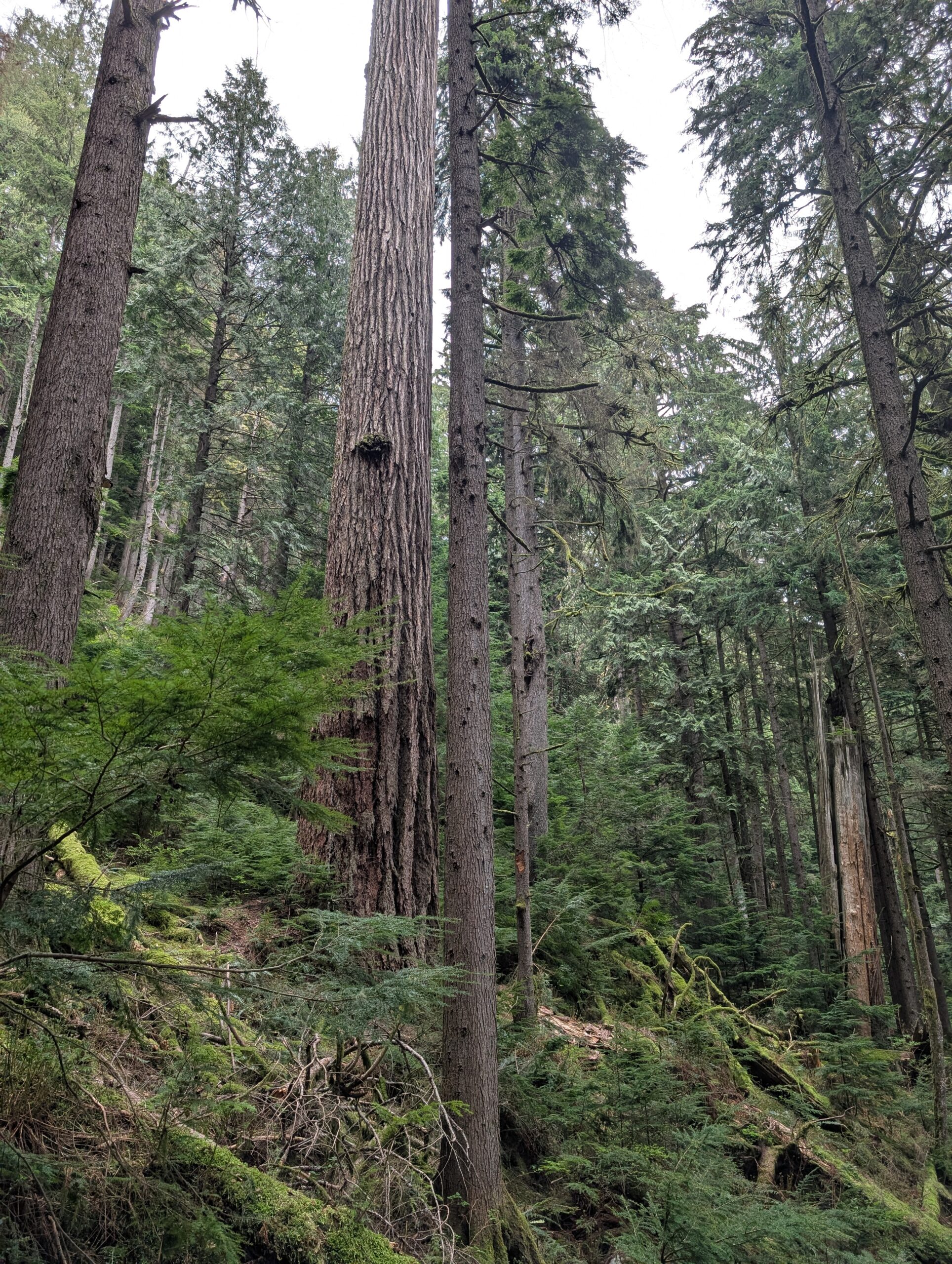
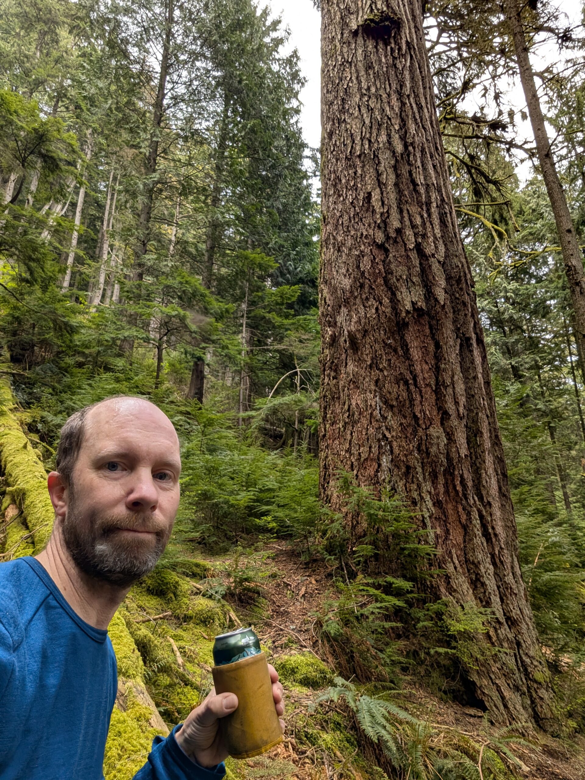
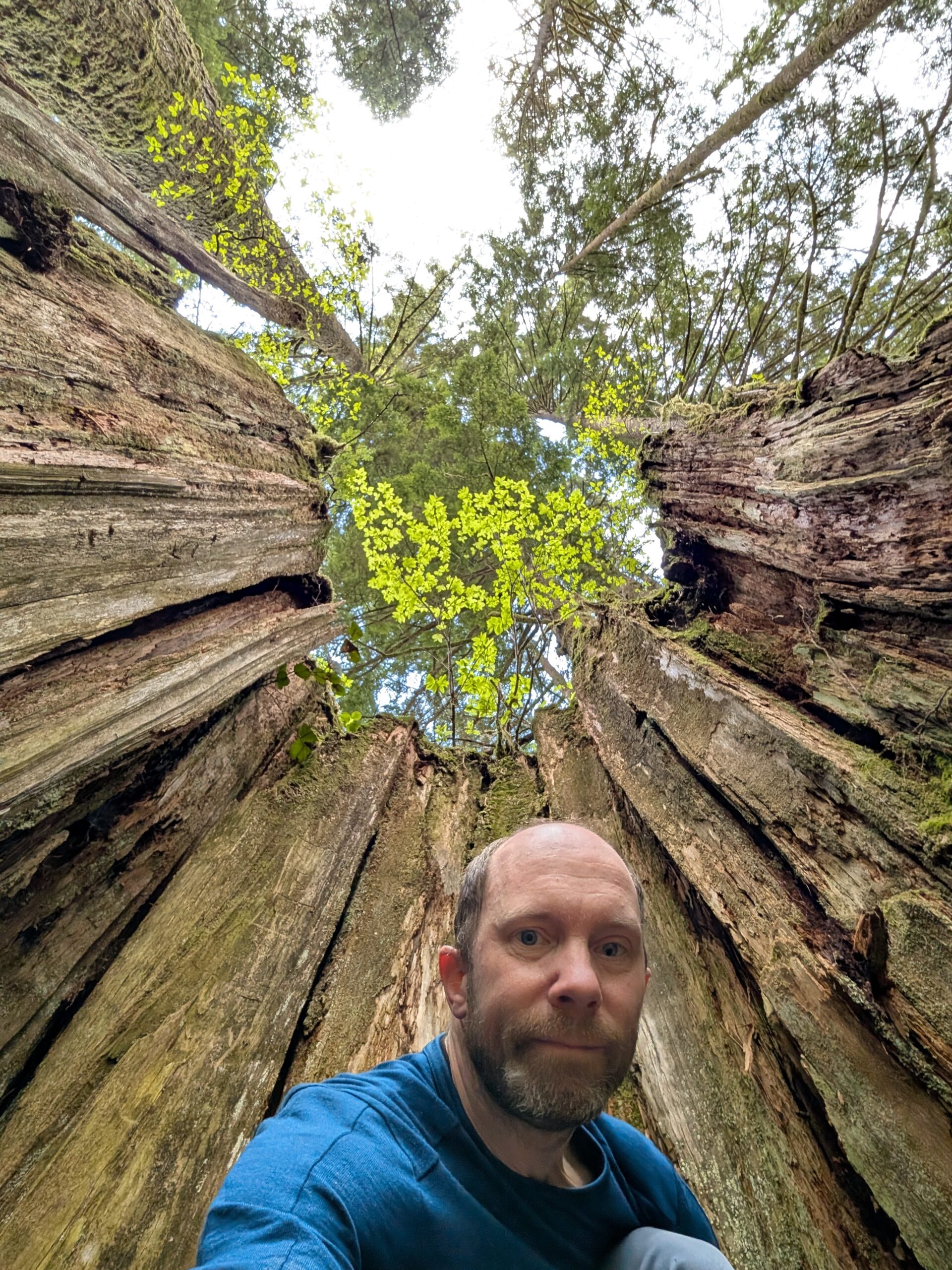
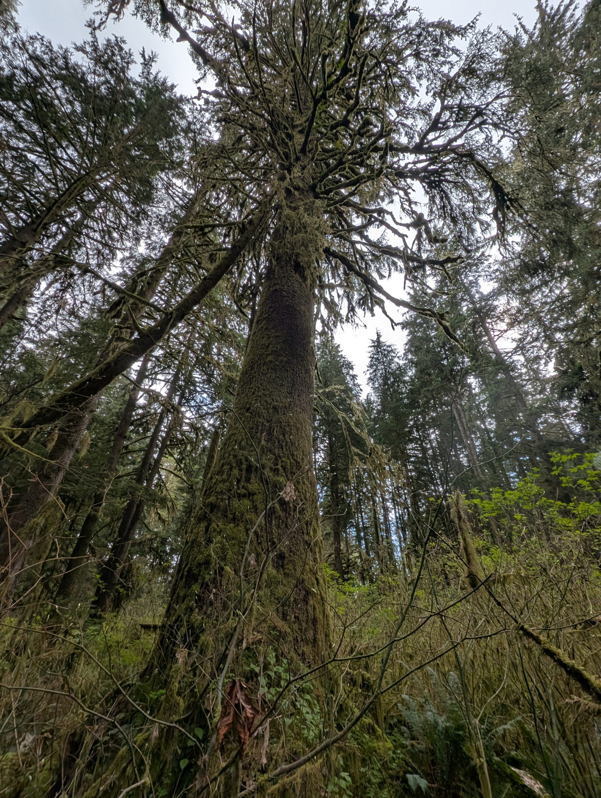
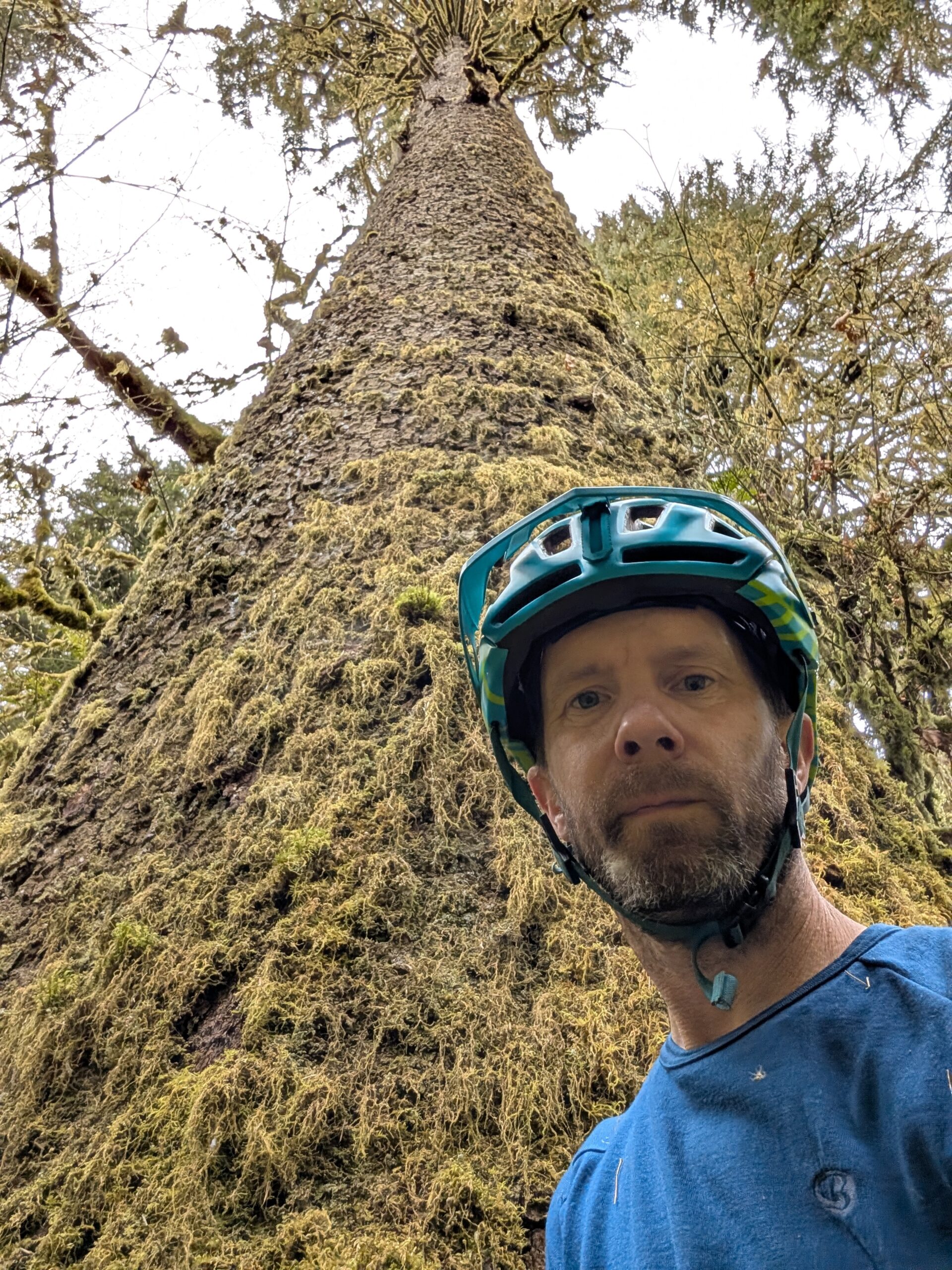
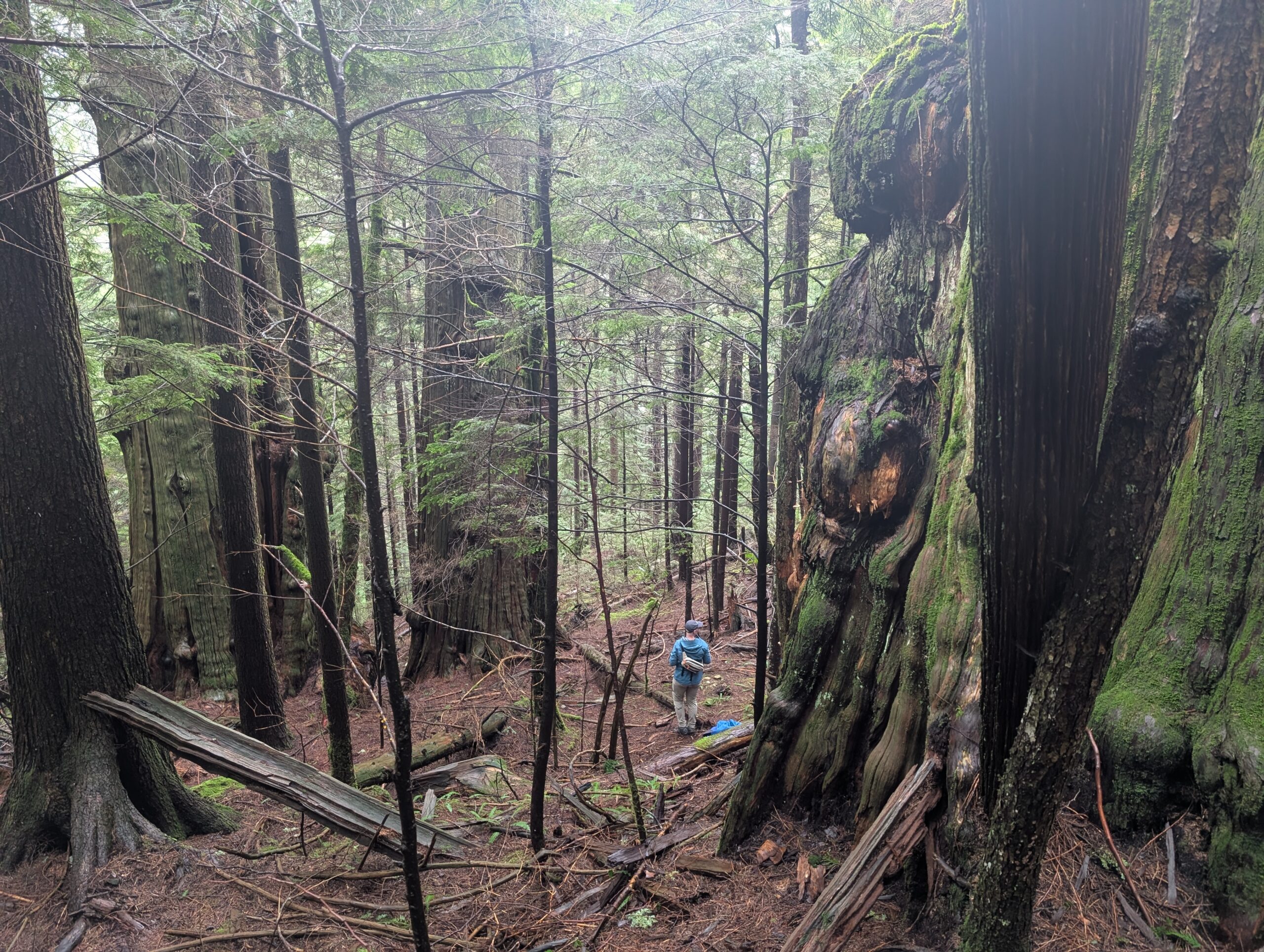
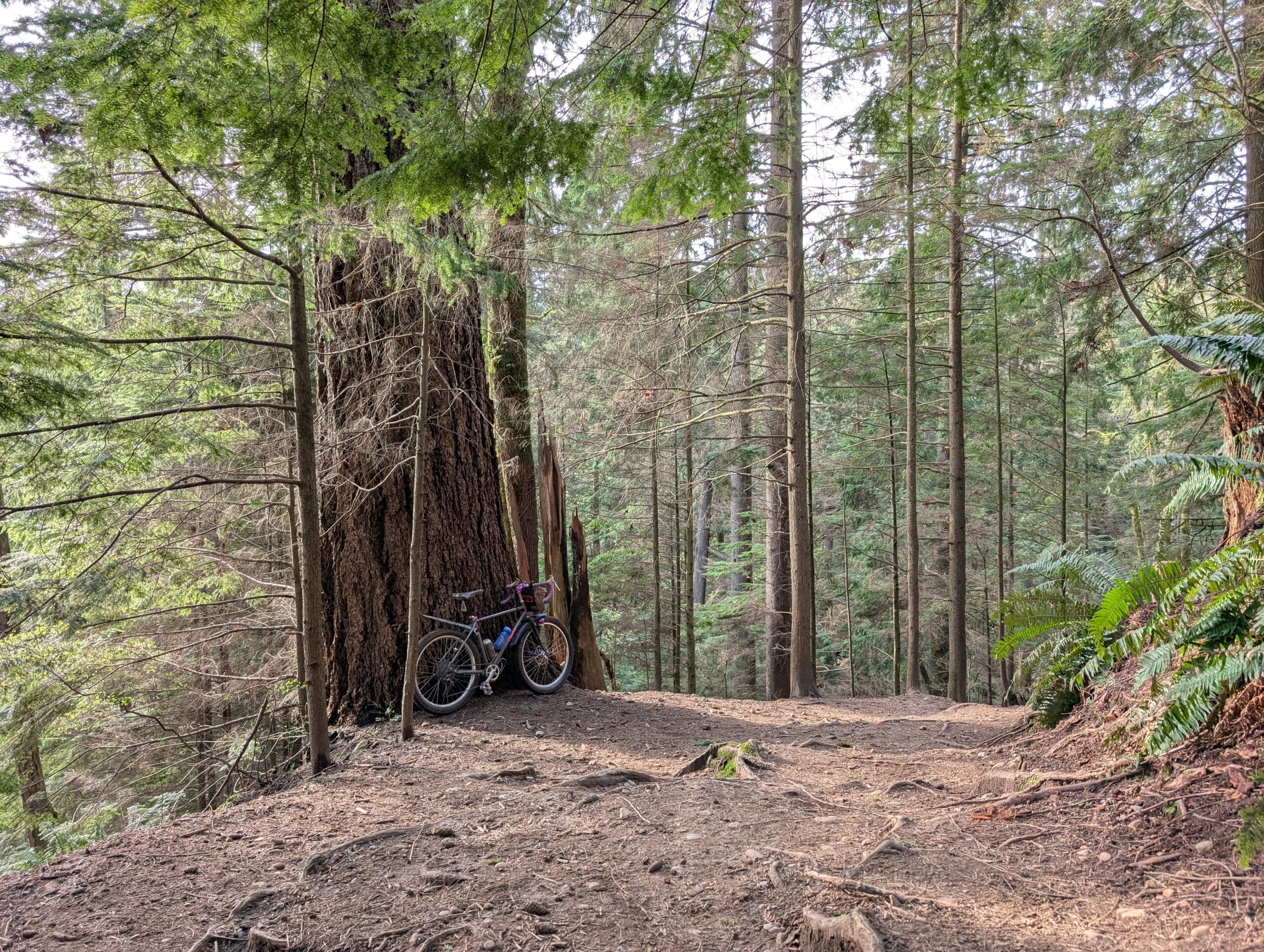
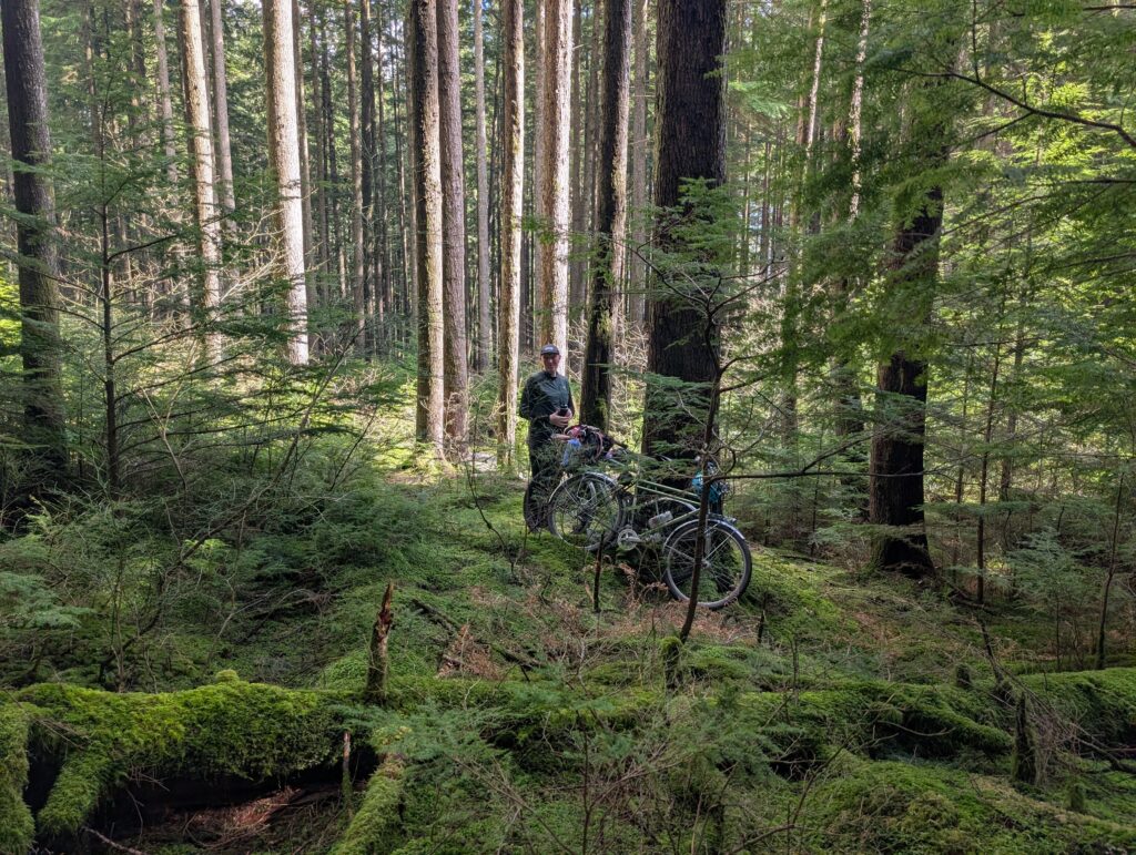
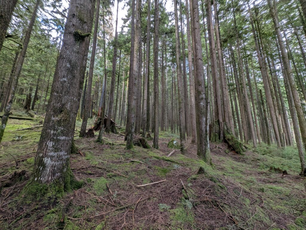
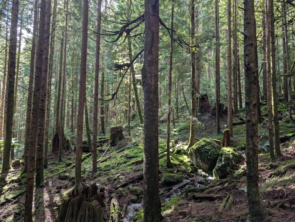
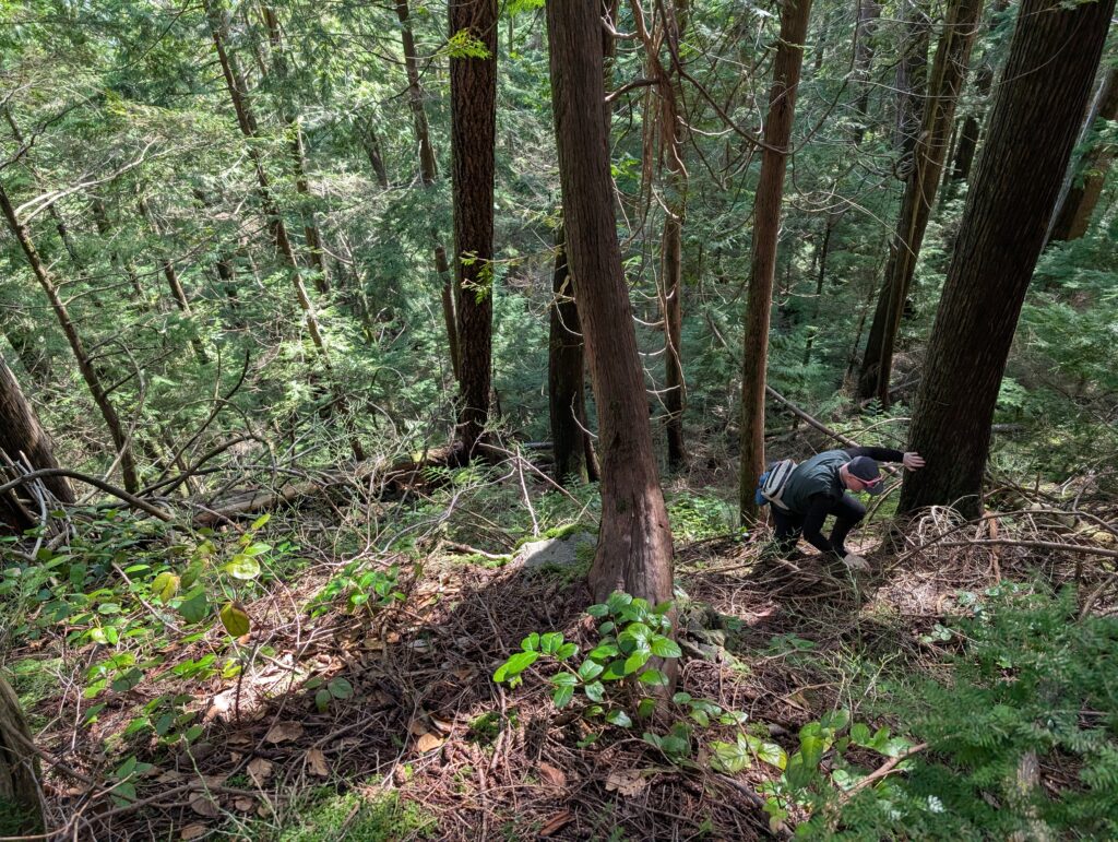
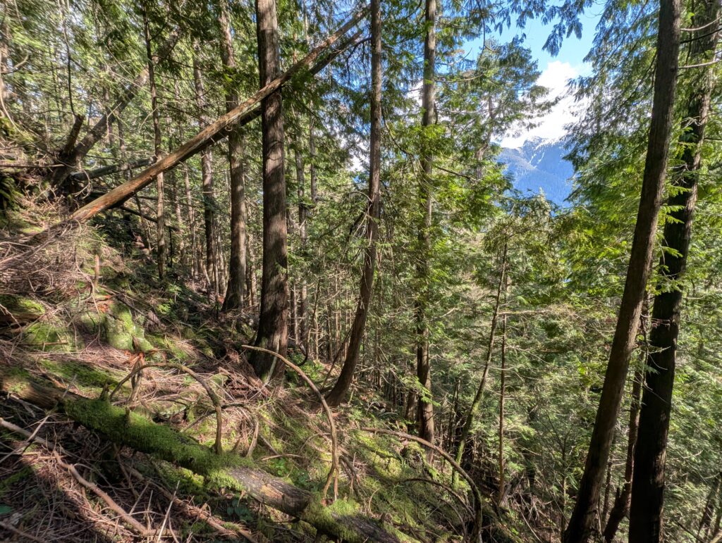
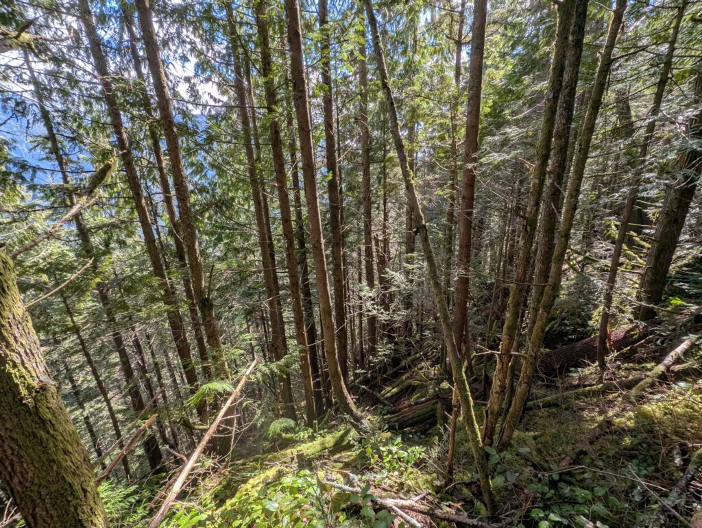
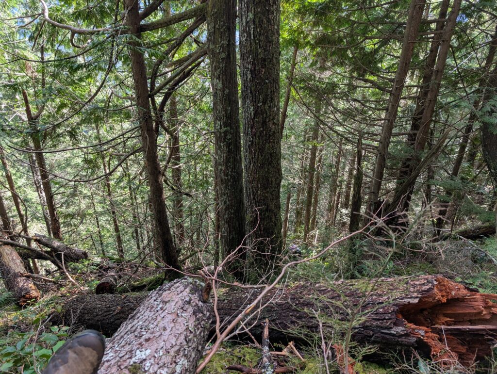
Being by myself this whole time, it had been a pretty silent hike, but as soon as I got a good view of the Temple Giant I was effusively complimenting it out loud. BC Tree Hunter has ranked it fifth in BC for Douglas Firs, with a diameter of about 10 ft, which is about 12-18″ larger diameter than the impressive Doug Fir we’d found a few weeks prior just to the south. Here are four photos of it from different angles, and myself for scale (taken with a 10s timer and a quick scramble from my perched phone):
There are several other notable trees nearby, but I am saving those for the next visit with Tay and perhaps others. The Temple Giant was remarkably easy to get to compared to our previous attempt; a moderately steep 15 minute climb where I only had to use my hands a few times. Compared to the maze of cliffs we contended with just to the south, this was a breeze, but it’s still proper hiking.
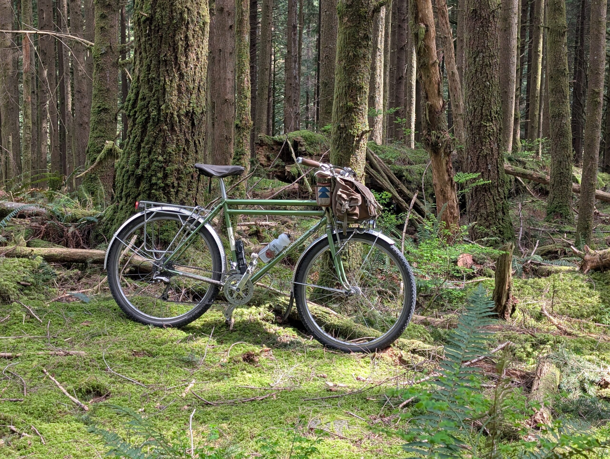
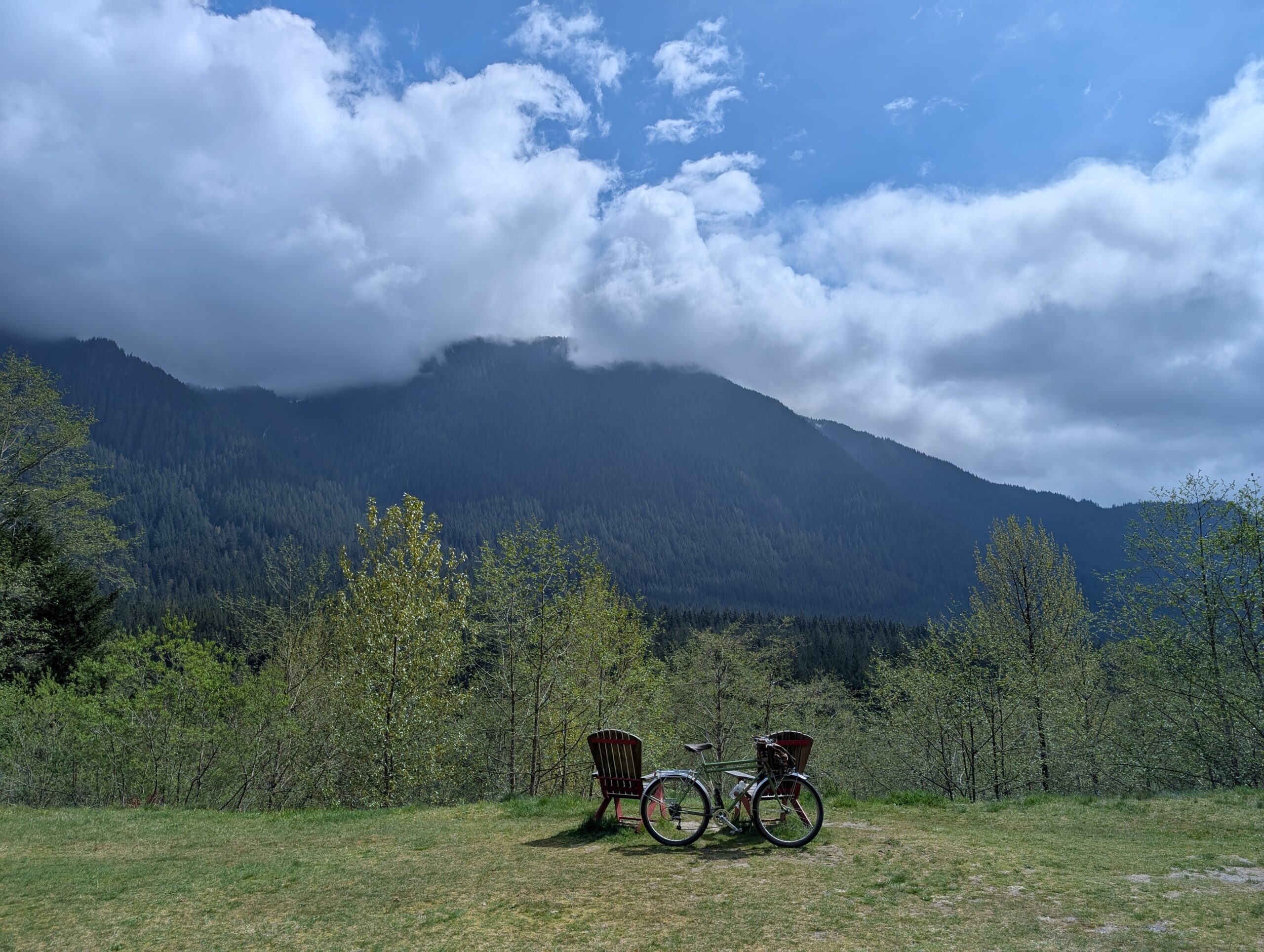
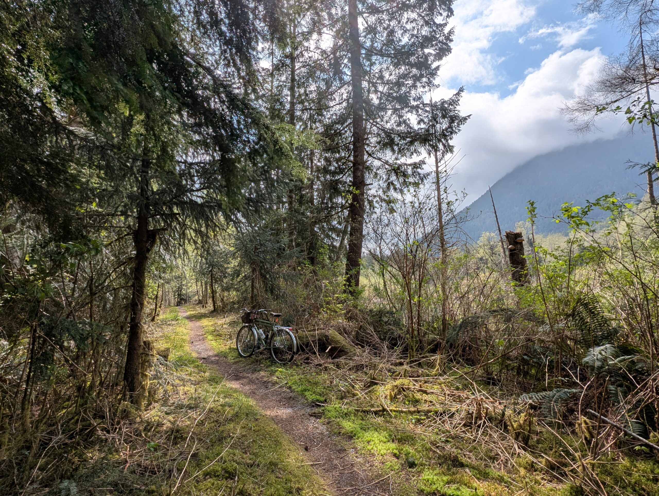
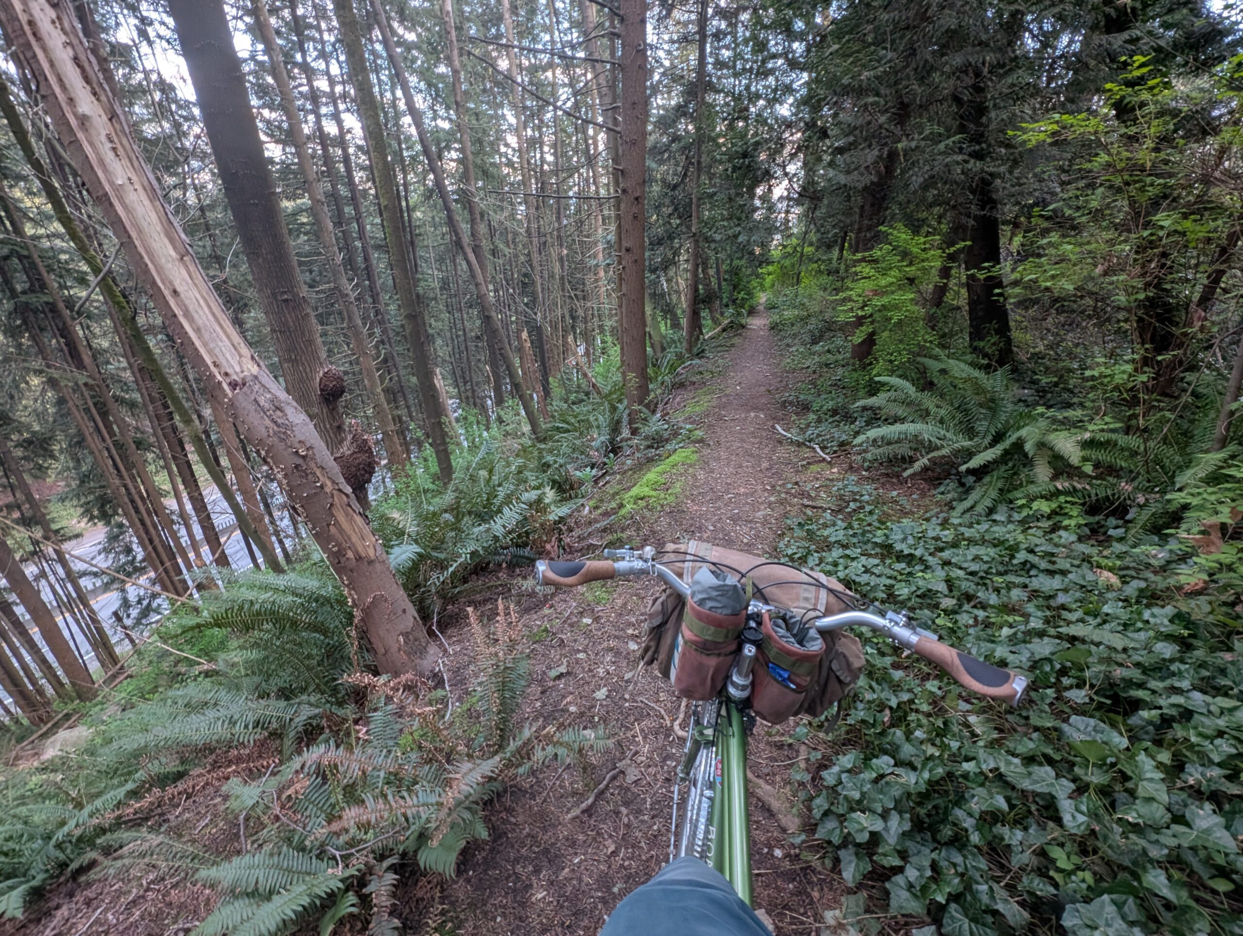
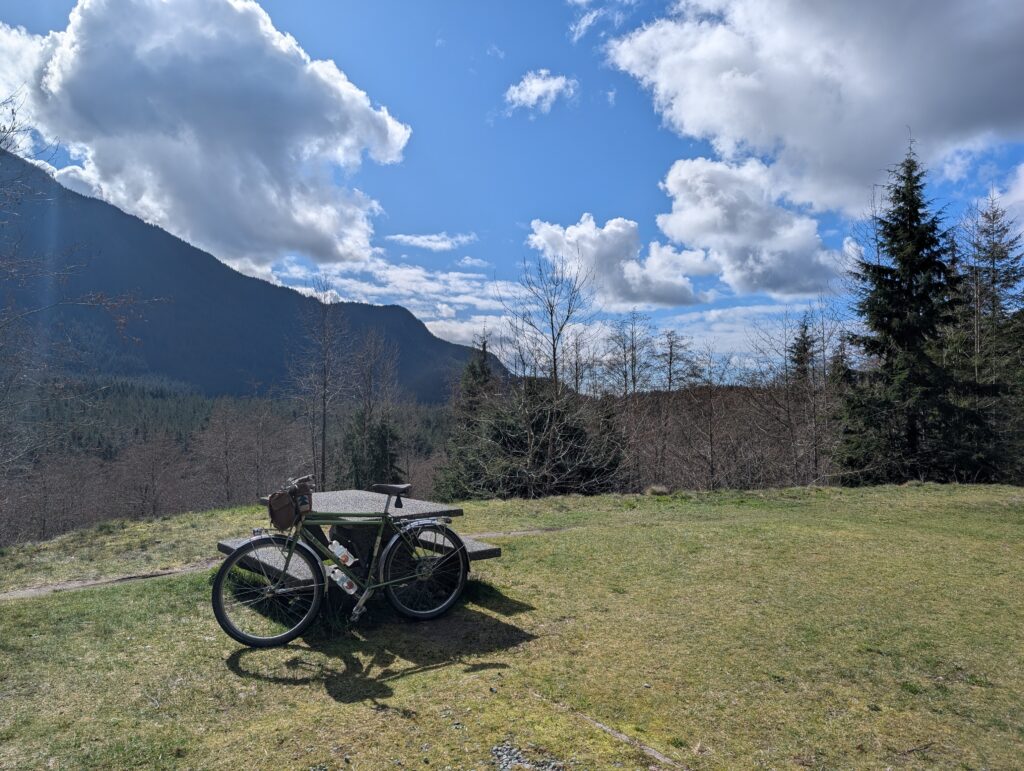
This little detour off the parkway is just a skip south of the Hydraulic Creek connector down to the mid-valley lookout, so a return via Fishermans this way made good sense. Here is the Bombadil on the connector trail, as well as at the lookout:
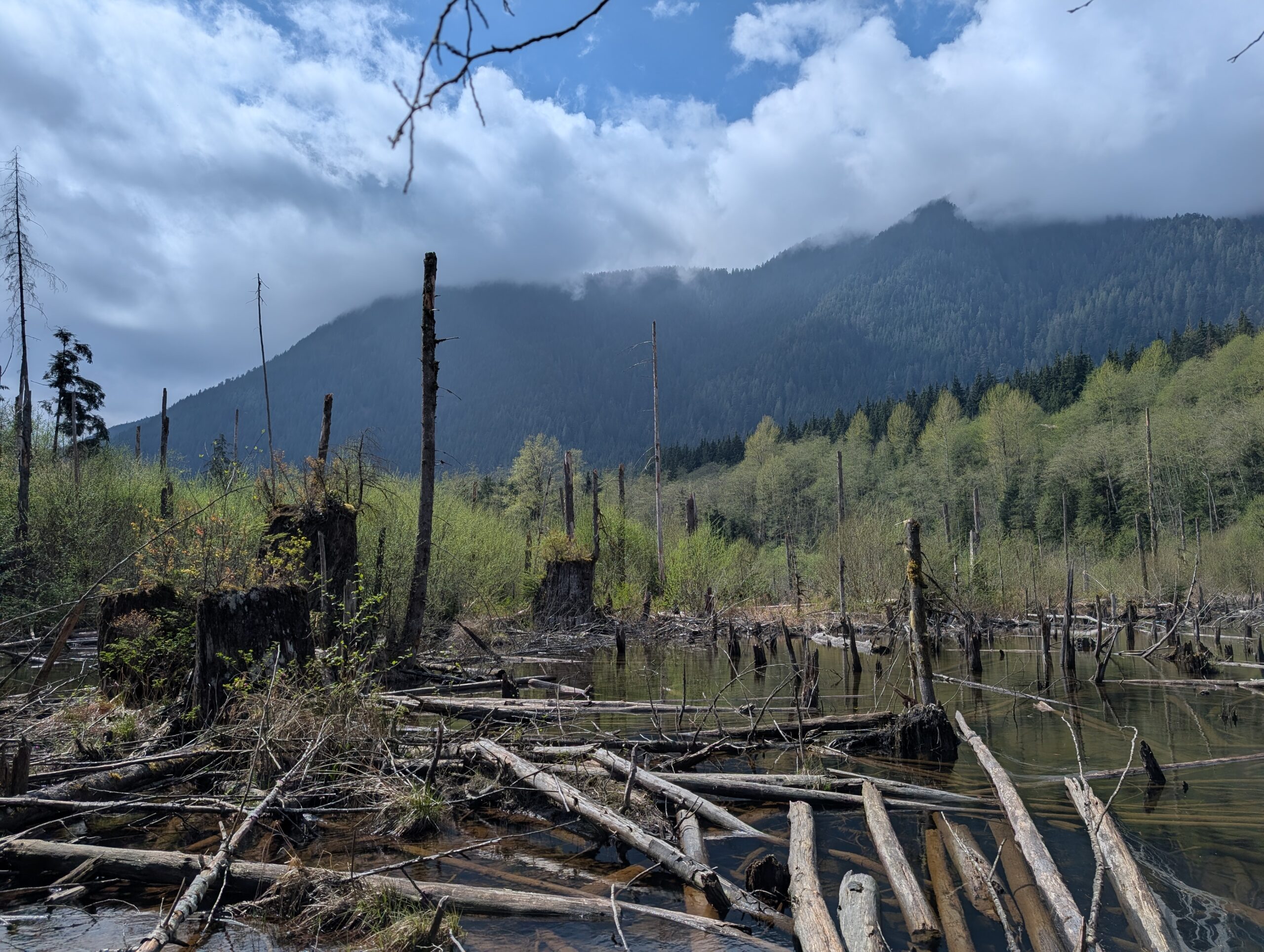
The day had gone from cloudy to sunny as well, even up the valley here which is notoriously worse weather than the city. I opted to take the nearby loop around the marsh as well:
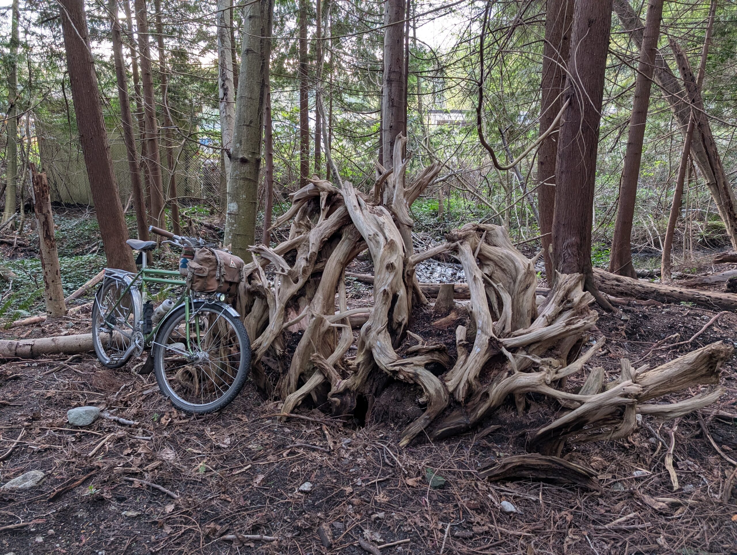
Continuing down Fisherman’s Trail, I let my curiosity get the best of me on a few occasions. One was a small path down to the river, where I found this massive hollow stump:
And the next was to bushwhack the 100 ft or so to this massive Sitka spruce I’d noticed off the trail before. It isn’t quite as big as the 500 year old examples on Rainbow Creek trail, but it’s pretty old! There is something extra special about old Sitkas to me with their mossy limbs and trunk.
No good pictures to support, but the end of Fisherman’s trail was blocked for construction so I had to make a large detour up the Baden Powell trail to the nearby plateau, which added to my already strong appetite – so when I rode past this patio, I couldn’t help but stop and get some happy hour food and beer. I loved that I could park my bike right beside my spot, and enter from the patio, never stepping foot indoors!
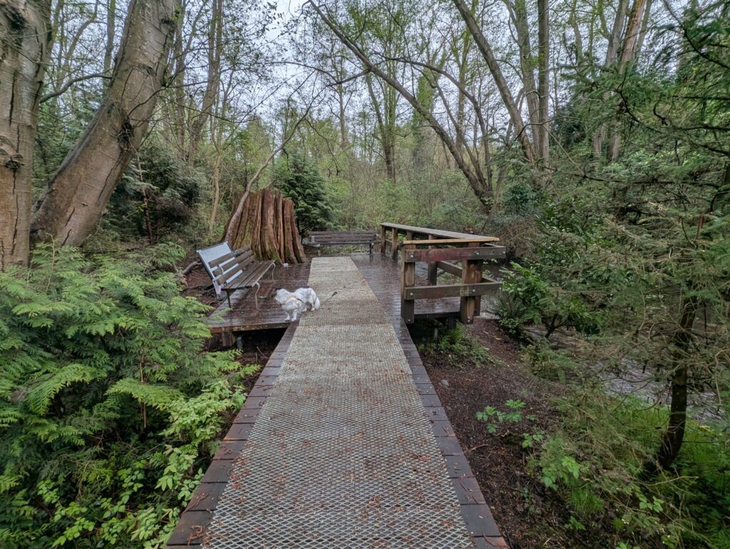
Another week flown by, a few good rides and lots of time outside with the dogs as the weather’s been quite nice. Well, Tuesday was pretty wet, but by the early evening it had stopped and I got out for a little outing with Sunny while running a car errand:
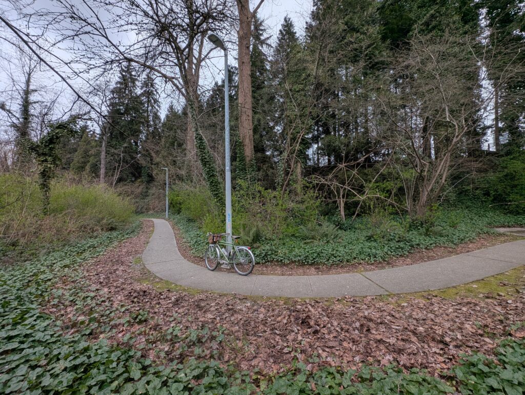
That was a new spot for me, in Renfrew Ravine. If I lived adjacent to this, I’d be down here with my morning coffee every day I think!
Wednesday I got out for a nice Deer Lake loop, what has become an established route for me, taking MUPs and small trails to connect up a largely car-free 25km figure-8 shaped loop. I wanted to go to Deer Lake in part because their rhodo-heavy garden should be coming into bloom now, and indeed it was looking pretty good:
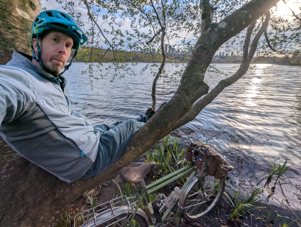
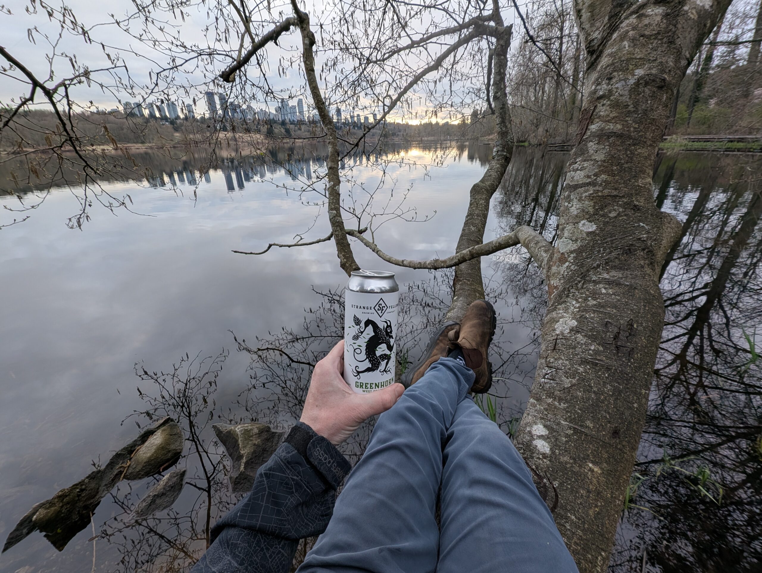
Years ago I found a tree that is actually remarkably comfortable to sit in, overlooking the lake. It’s become a spot for me to have a beverage on many occasions since.
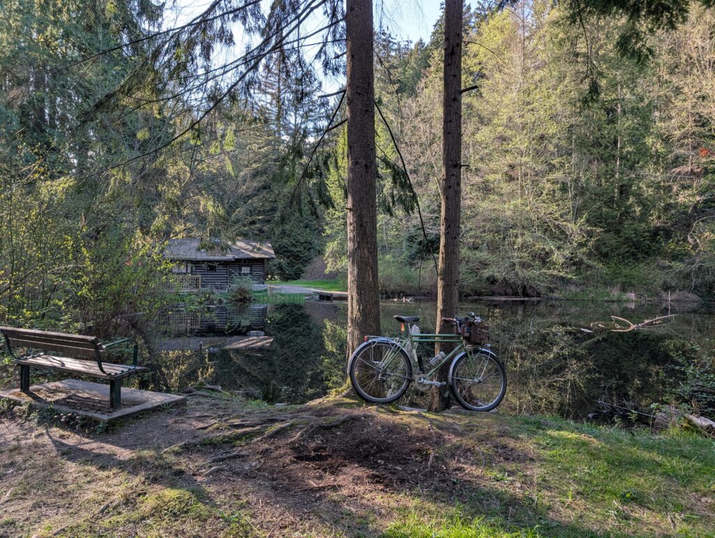
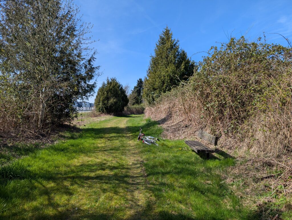
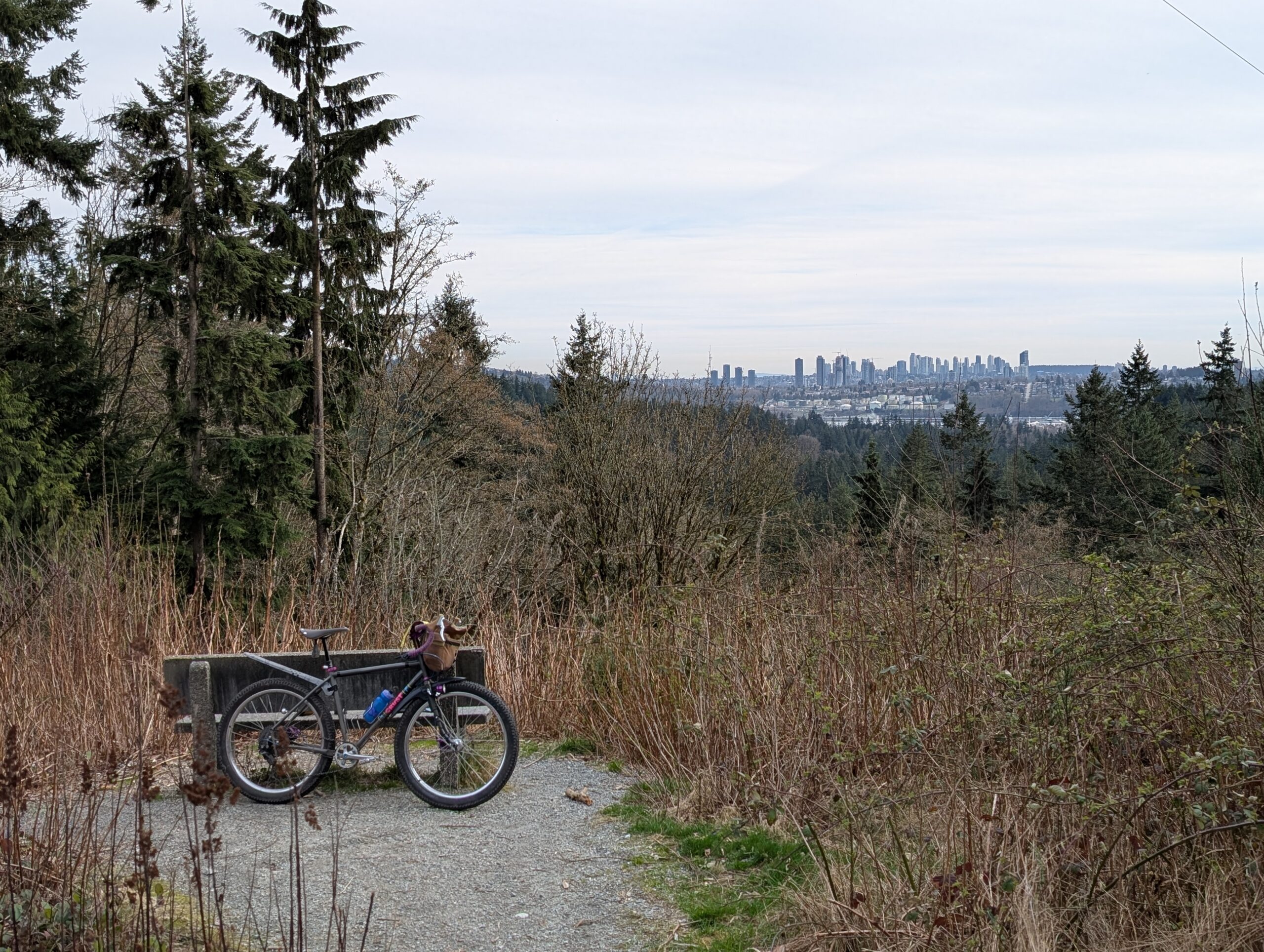
The following day I went back out on the Bombadil after work, this time for a two-bridge loop of North Van and up to the pond at Murdo Frazer Park for one of my favourite benches:
Sadly did not see any turtles today, and I even had my monocular with me. I took a series of trails that largely parallel the highway to get back east, a route that has become a favourite of mine – certainly more effort than required to get where I was going, but really enriches the ride.
By the time I was most of the way home, the light was starting to fail, and the sky was looking really good:
I took Friday off riding except for two short trips for a lunch meet and to pick up sushi, then Saturday was the Crescent 200 at Shaughnessy Park. It’s our version of LADDS500, essentially – riding around in a 0.6km loop for as many times as we wish, 200 being the “official” goal. I rode my Raleigh Twenty, in the spirit of bringing something less practical, and ended up doing somewhere around 70 laps? In the end it was 53km door to door, my second longest ride on the Twenty. I met some new people and saw lots of friends – a really great day.
I type this Sunday evening after a full day of birding, which followed a day of birding yesterday too. I took the weekend off riding because I was coming down with something, though feel largely better now. However, the week otherwise was rather full of bikes – I rode every day Monday thru Thursday to a total of 113km, so despite the weekend off, I’m on par with my average weekly mileage.
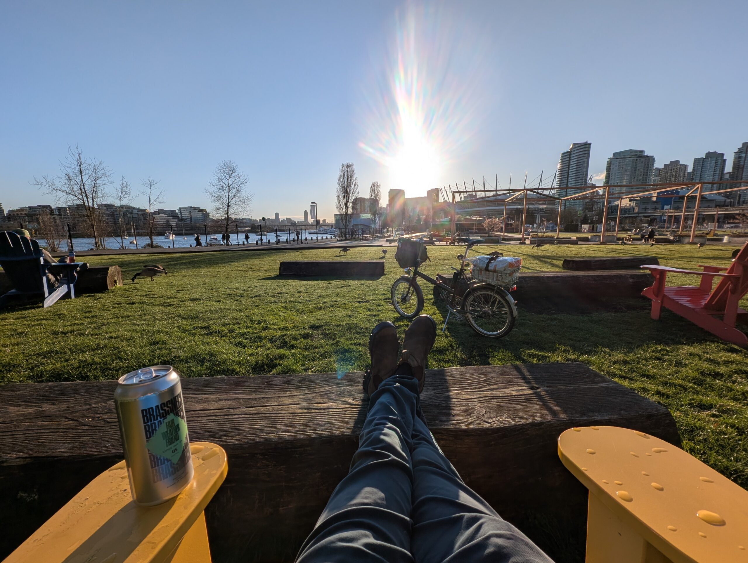
I started the week with a bike commute to work on Monday, and the weather was perfect. Not only that, but it was Easter Monday so school was out, making the roads much quieter and safer feeling too. On the way home I added over 10km of extra riding to enjoy the sun and also run a couple errands. I stopped at Choklit park, pictured below, for a beverage as well.
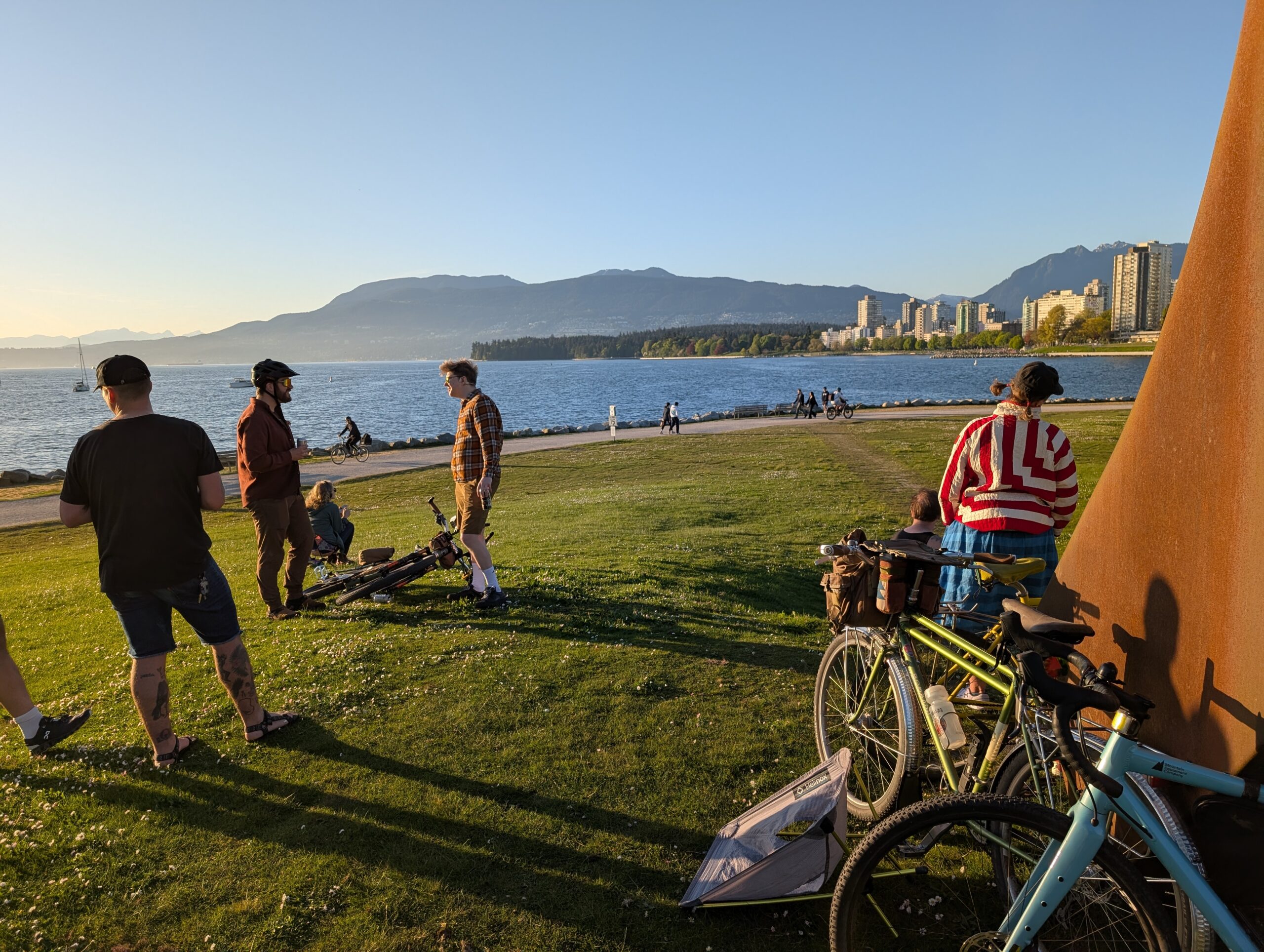
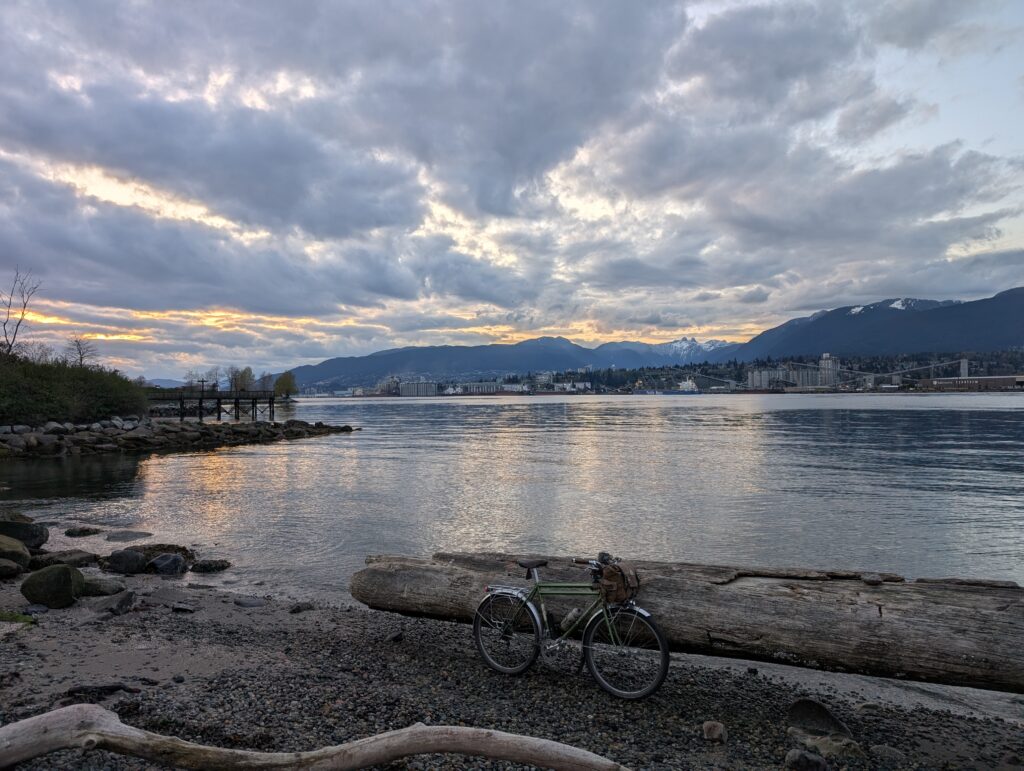
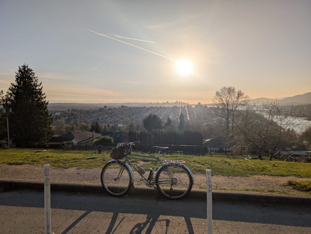
Tuesday I got out for a ~16km loop up to the lookout below. Sunset was still a ways off, but people were already congregating for it. This is one of the most popular sunset spots I know around town, and for good reason!
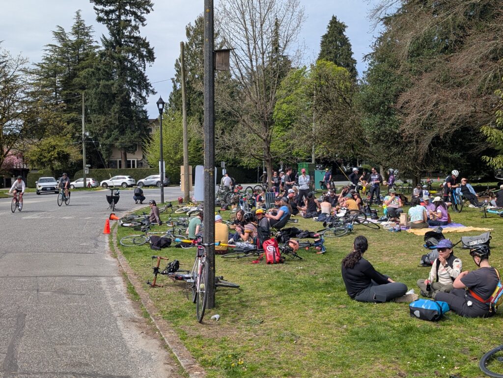
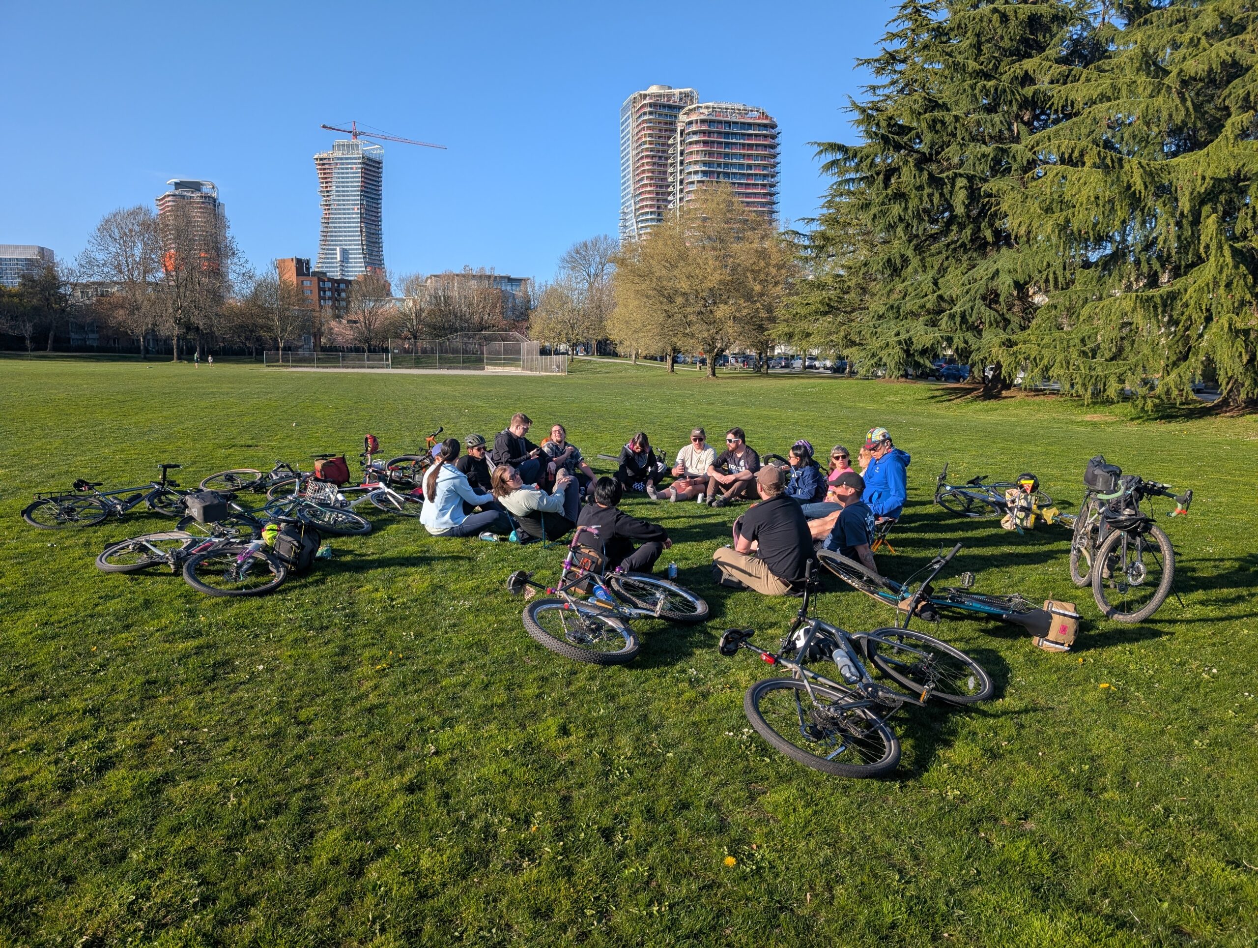
Wednesday was Parkbagging, and we had a good turnout thanks to the continued good weather this week. I rode the Evasion this time, hoping its original owner could make it out, but they weren’t able to. Doesn’t matter – this is a fun bike to ride so I was pretty happy.
I rode it again Thursday actually, this time for a TCR (tall can ride) with longtime pals out to Spanish Banks in the far west reaches of Vancouver. We then backtracked to the Strathcona park oval, where a 100 lap race was nearing completion. I regularly visit this park but I always assumed the gravel loop is just a running track, albeit a large one – turns out, it was a car race course in the late 50’s and early 60’s! Then hosted bike races more recently – so it’s good to see it getting used for its purpose again.
This weekend though I switched gear to birding. If you’ve read my previous posts you’ll know that I’m a novice birdwatcher and really only started taking it more seriously in the last week of 2025. I’m still very much new to this, but I am also the type to jump in the deep end on hobbies. Thankfully, I don’t cycle through (no pun intended) hobbies very quickly, which is good because I tend to invest in each one (see: two Rivendells, a Stooge, and a Crust).
Merlin and eBird really turbocharged my counting of birds – my interest was already there, but this facilitated goal setting that I didn’t get from my little field bird book. I started tracking my “lifer” birds in Merlin, and occasionally using eBird to fill out a checklist if I was making a point of having a birding session. Most of the time though I was simply stopping when I heard a call I didn’t recognize and trying to spot the bird.
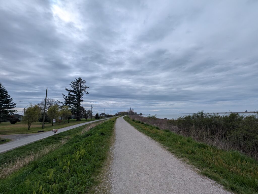
My “life list” is, as of today, at 70 species, and a rather astounding 9 of them were added today. I spent about the same amount of time birding yesterday but only added one to my life list – the difference today was that I went a) somewhere new to me and b) near the largest migratory bird sanctuary around here. I actually tried to go to the sanctuary (Reifel), but didn’t realize that it could, and did, book up full by midway through the day. I had driven almost an hour to get there, but I knew there were other good birding spots nearby so I went to the coastal dyke shown below. It was monotonous visually, but the bird activity was alive and highly varied.
Out in the water I spotted a Common Loon and a red breasted merganser to add to my life list – the former was so amazingly sleek looking, and the latter was eating a 5 or 6″ long fish as I spotted it from a near distance! The first bird I hear after I parked was a Killdeer – a bird I have been hearing regularly on my outings and never spotting – and still couldn’t find it. I also spent a great deal of time trying to spot a marsh wren that was loudly taunting me from some blackberry bushes only to walk away unsuccessful. But 100 ft later I saw a marsh wren just standing on a rock near the path, and before I got back to the car I also saw a killdeer properly finally!
I saw four different types of sparrows, two of which were new for me – savannah sparrow and swamp sparrow. The latter was more rounded and had more brown on its sides, foraging in a field next to a robin buddy. Brewer’s blackbird and barn swallow were two other new-to-me species today. Meanwhile, yesterday all I added was the American Herring gull, a pair of which I had noticed due to the black tail I wasn’t used to seeing on gulls. I still think gulls are very boring birds, which may change as I fall deeper yet down this rabbit hole.
I have a soft goal of seeing 100 BC local species this year, and was starting to feel like it was out of reach as it took so much time and energy to get from 55 to 60. But with the influx of summer residents and the realization I just need to move around town a bit more, I can see it happening. Only 30 to go and I’ve still got most of the year left!
The second of back-to-back 55km rides, this time a flatter and more pavement-heavy ride out to Iona island near the airport. This place is basically Disneyworld for birders, and given my recent uptick in birding interest, felt it was time to revisit while the spring action is taking place.
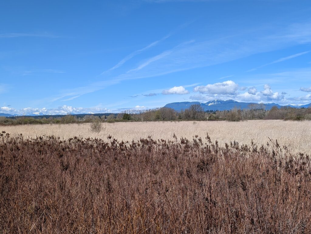
On the road in, a few kilometres long, there is a new separated bike path that is very lovely. Adjacent to that is this marshy, grassy path that was quite muddy in spots. Regrettably I chose the latter – beautiful though!
Back on the paved path, admiring this view to the north – just past these grasses is the Fraser River out of sight, then Vancouver beyond that.
Two examples of birds I saw while at Iona – a swallow (not sure if this fella is a tree or violet-green swallow, but mostly I saw tree swallows) and a golden-crowned kinglet, of which there were many in this spruce.
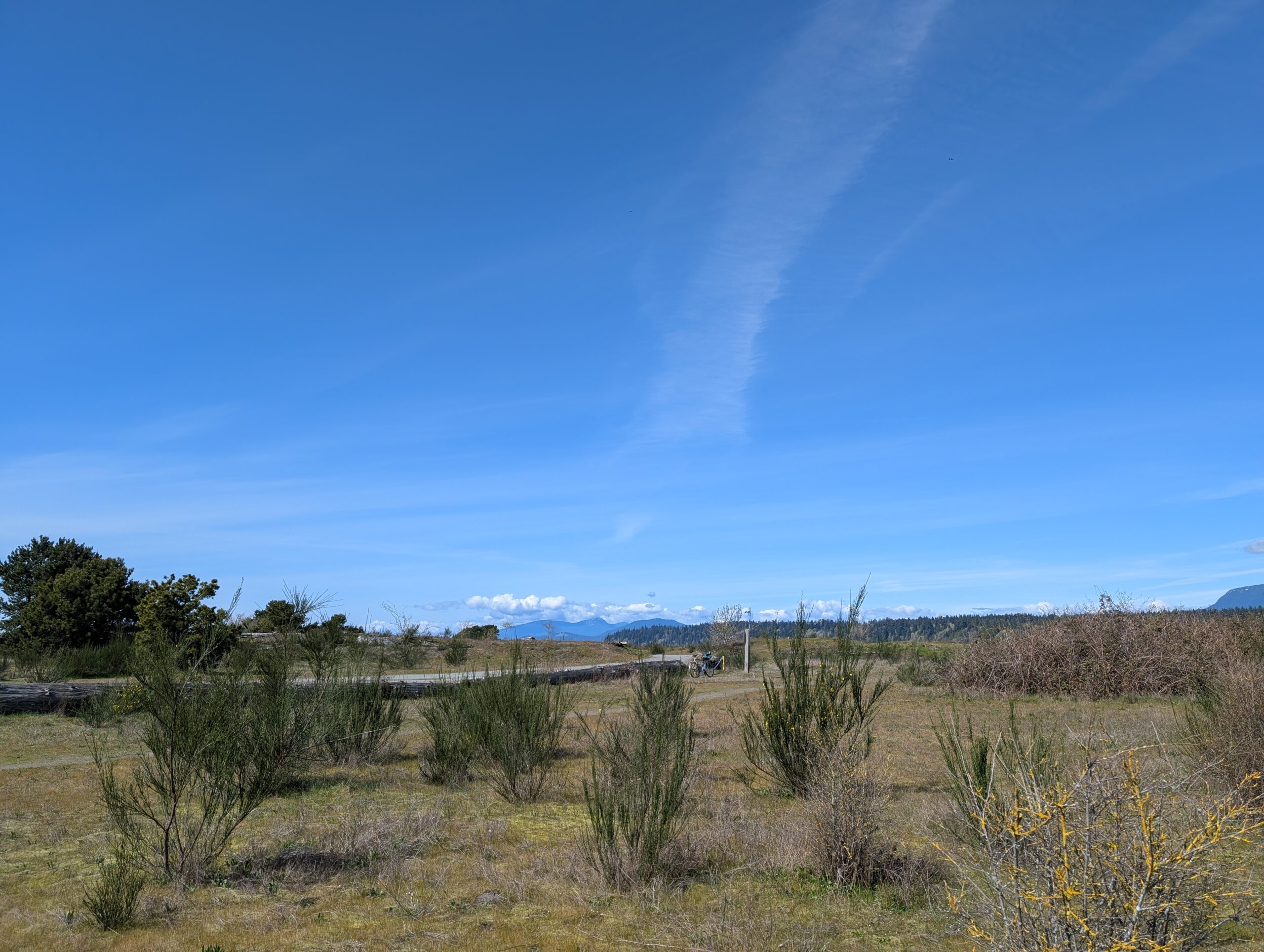
This is the area I wandered around trying to get a glimpse of two birds I was hearing (thanks to Merlin) – a common yellowthroat and at least one marsh wren. I didn’t spot either. Note the Bombadil off in the distance, locked to a post.
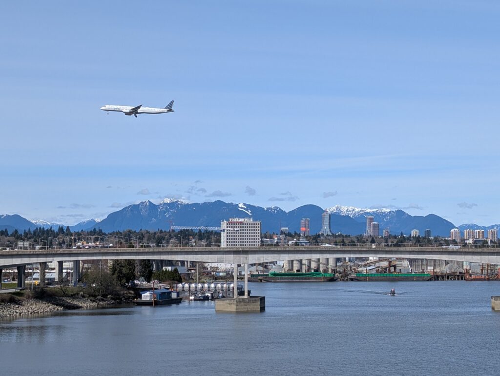
Coming over one of the bridges on the way home I got this multi-modal photo. I was hoping to see a Skytrain come over the bridge pictured at the same time for the trifecta, but no dice.
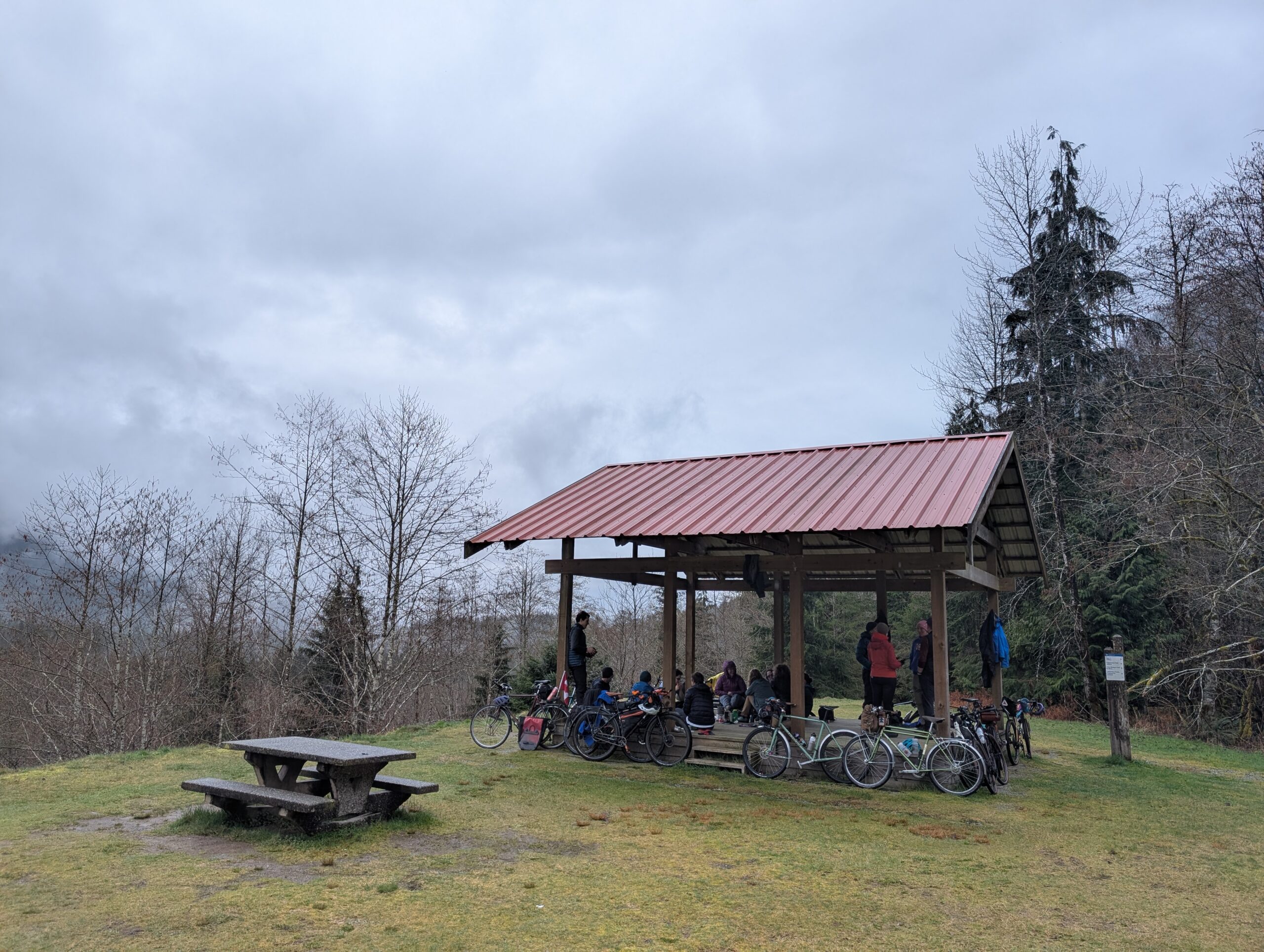
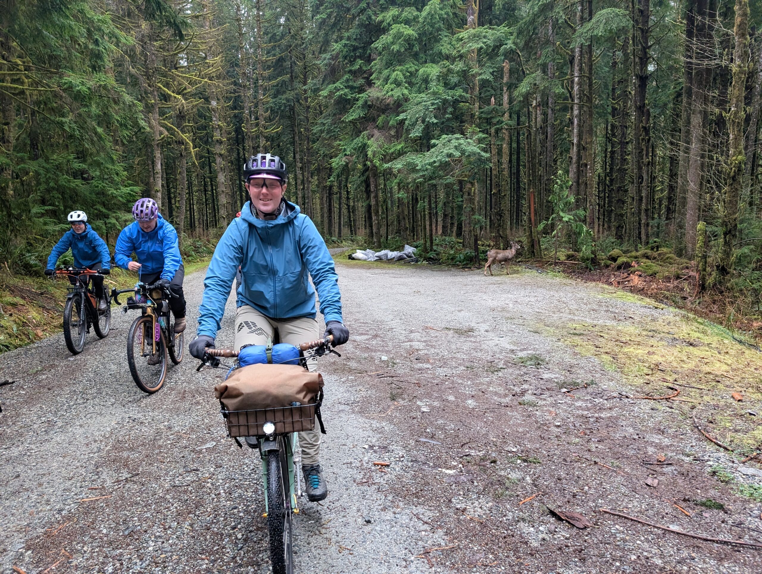
Every year on the holiday Friday of the Easter weekend for the past ten years now, our coffee outside club Camp Coffee Club has a ‘field trip’ to the mid-valley lookout in the Seymour valley. We do coffee and snacks for an hour or two, then groups set off on further rides at their discretion.
I rode up Fishermans with Tay to the spot. The day was cloudy and rain felt not far off, so I expected as we moved up the valley it would turn wetter as it usually does. However the rain never amounted to more than a sprinkle, and only occurred while we were under the protection of the gazebo. Lucked out!
There were about half as many people as last year, mostly due to the weather. Last year was beautifully sunny and we saw 30+ folks stop through. We got about 15 this year, which was a nice number too.
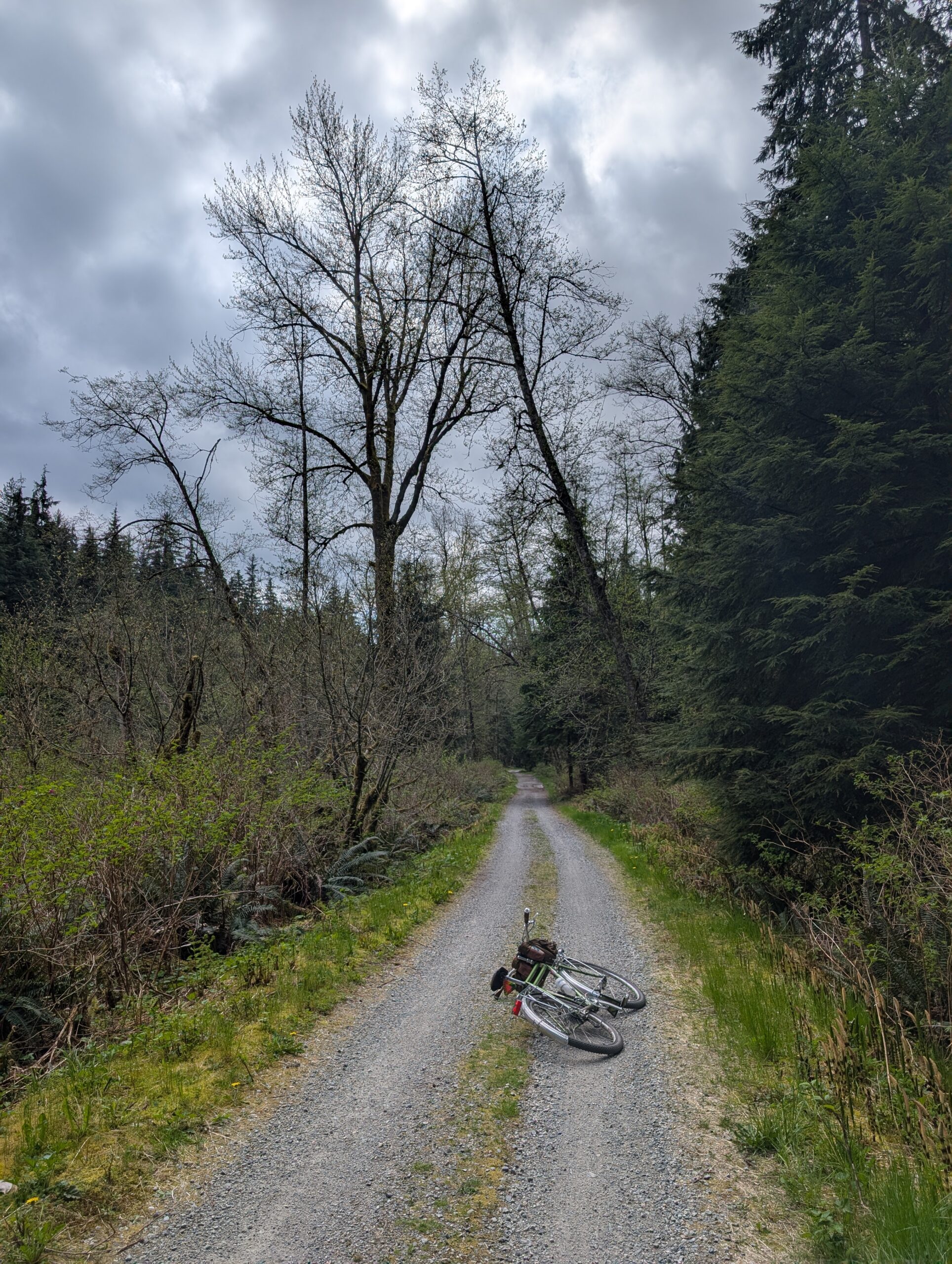
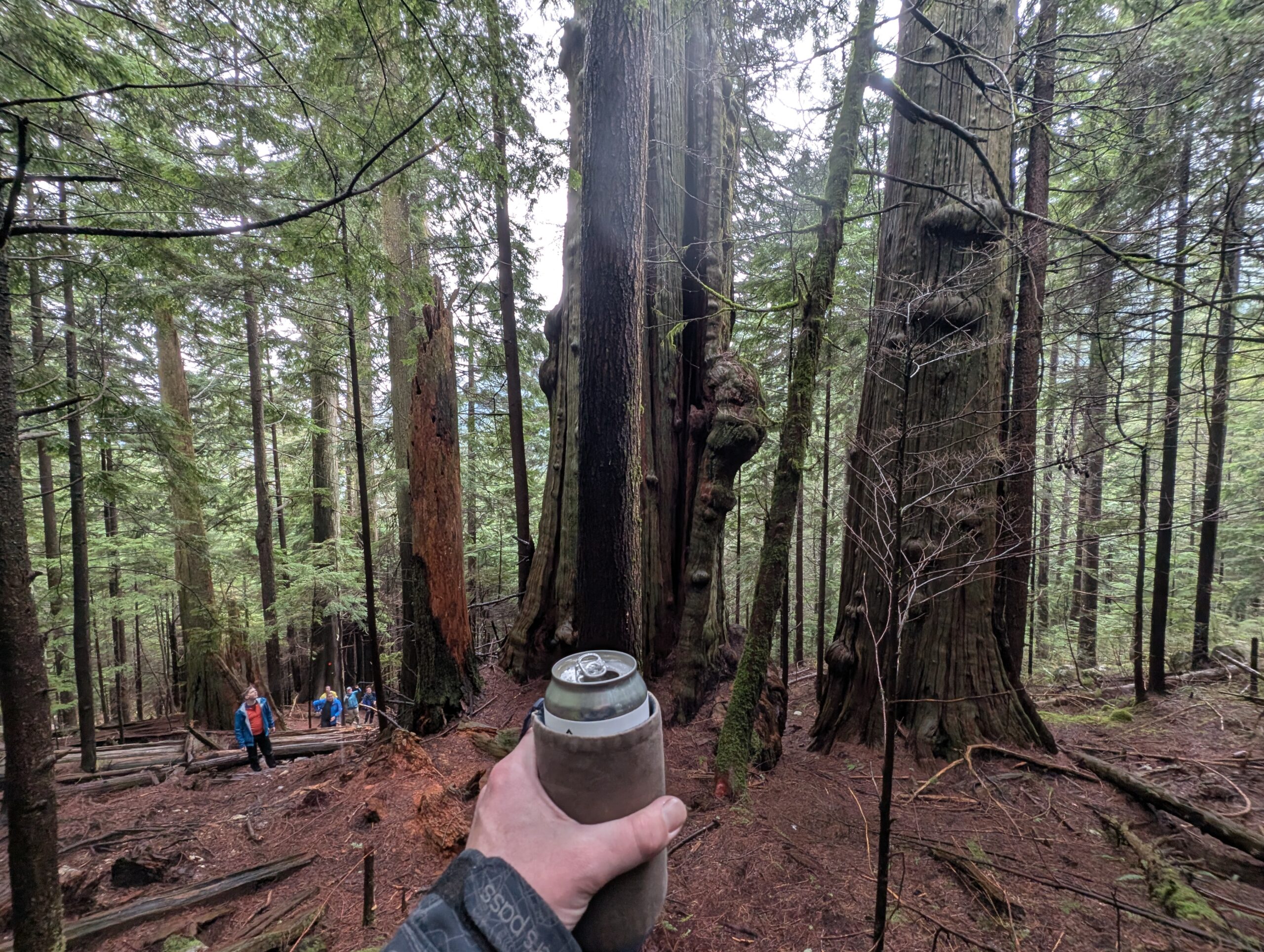
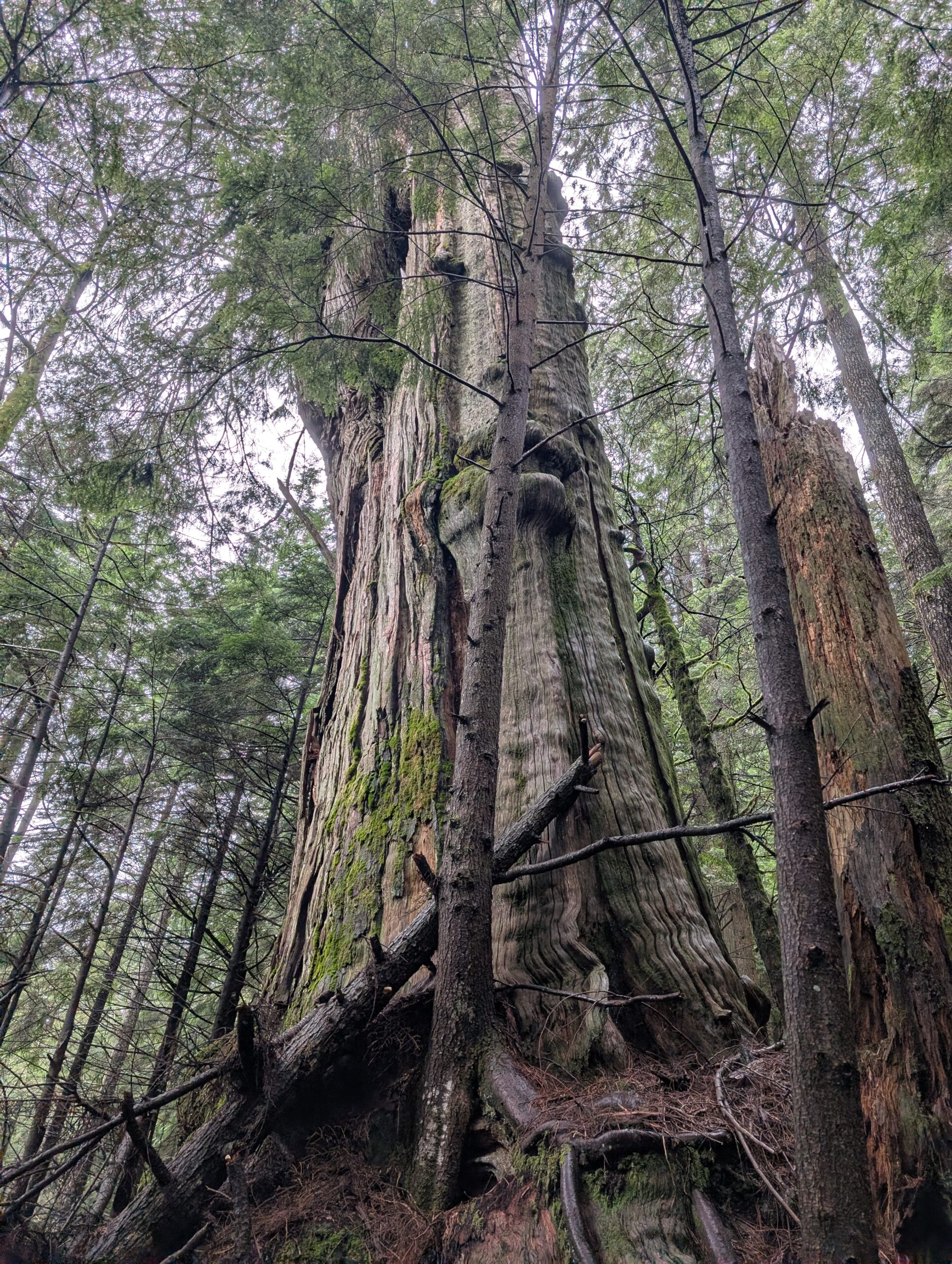
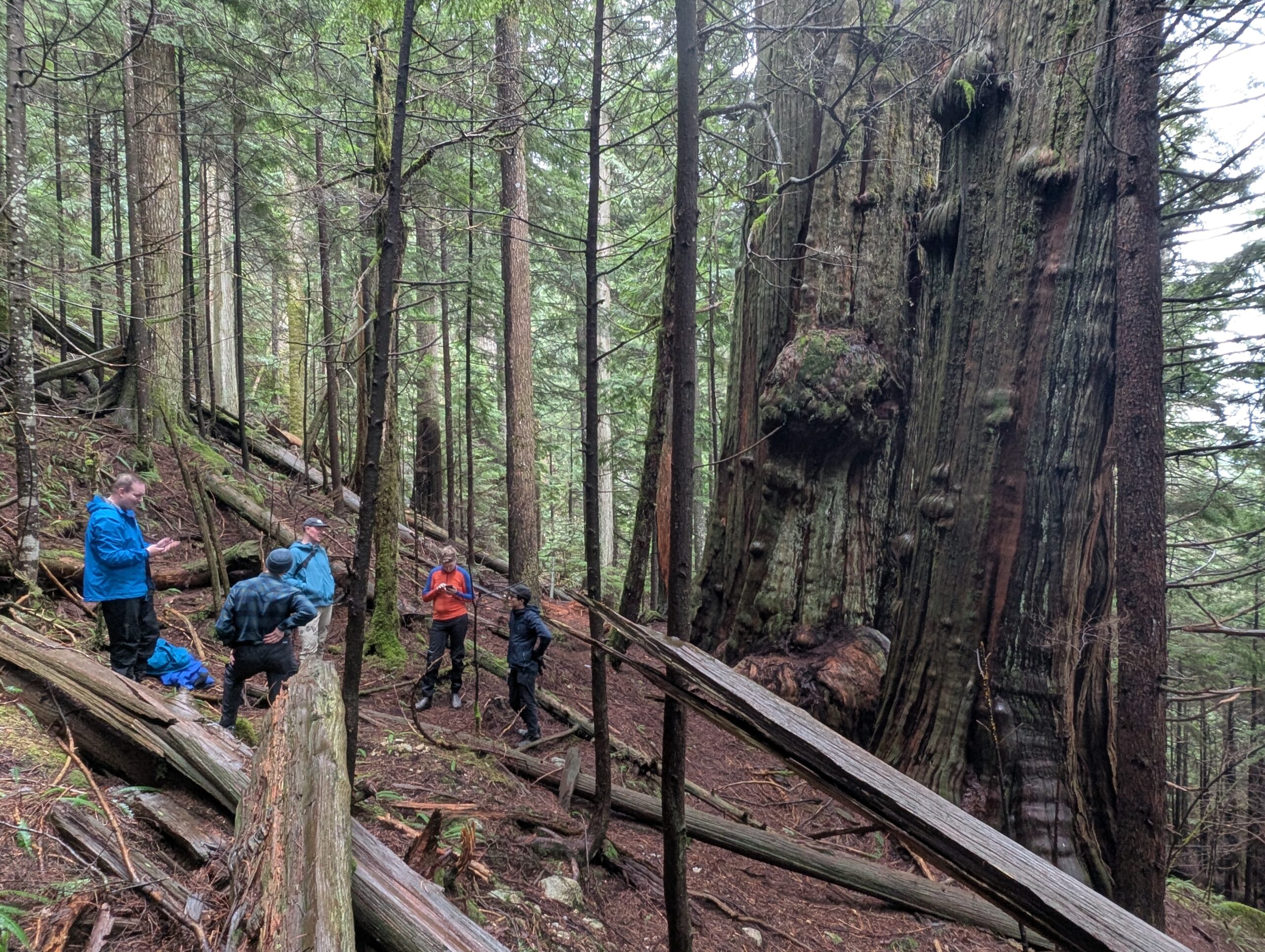
About half the crew joined on the old growth loop I had planned, which was essentially the Spur 4 loop I usually do with a couple short hike-in’s to see specific trees. First up were a pair of huge red cedars, a 15 minute hike up a semi-steep trail. We stashed the bikes in the trees near the start of the hike.
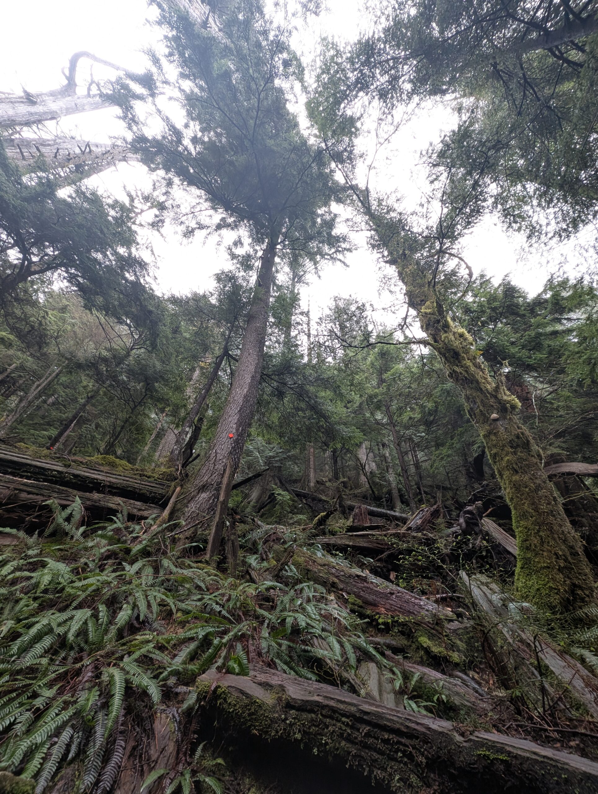
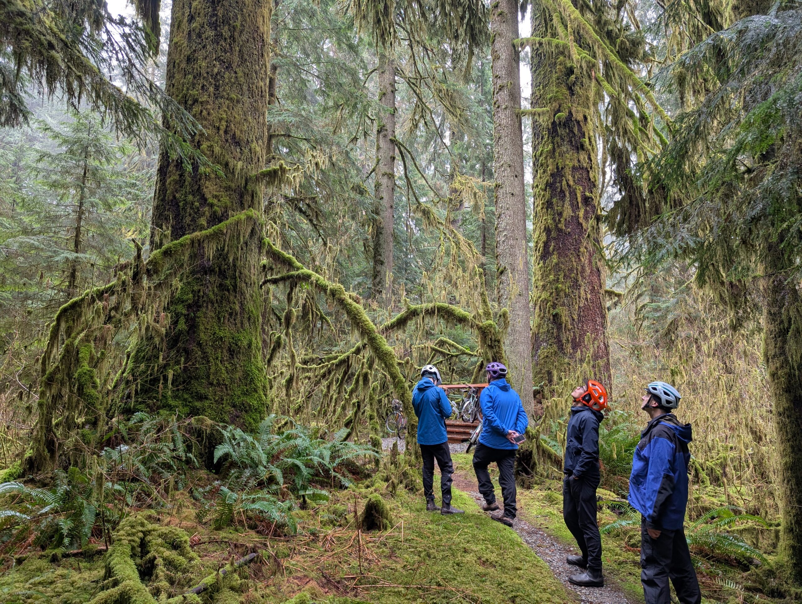
Then it was over to the pair of old growth Sitka that are heavily represented in my ride reports. I love these trees. They aren’t nearly the diameter of the cedars, but have an incredible presence.
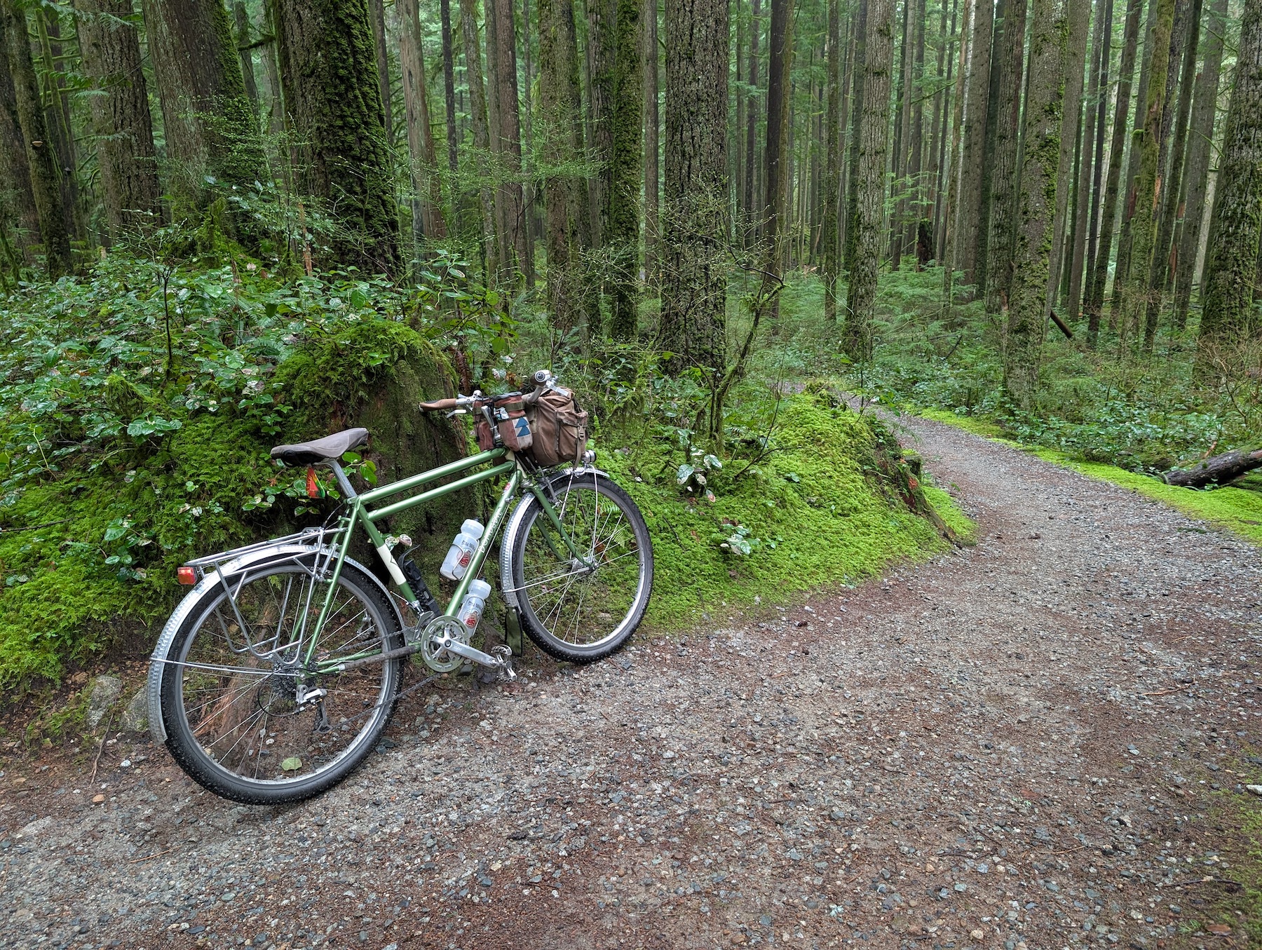
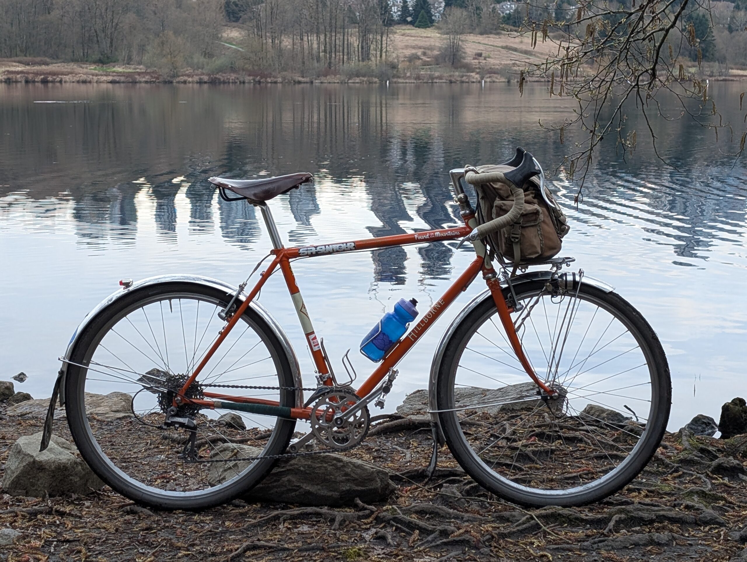
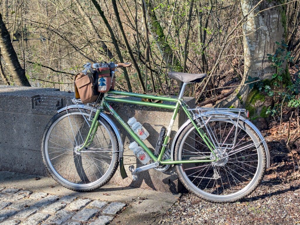
Tay and I split off near the end to check out some old stumps, which were neat but not on par with the trees above in terms of interest. Here’s the Bombadil, which has seen about 50% of my 2026 mileage so far (750 of 1500km, roughly). It’s pretty heavy but doesn’t feel like it when you’re riding; it’s a great all-rounder. I’ve been commuting on it, and while the Hillborne’s been offline it’s actually been my most road-friendly bike, funny enough.
This post is for the week of March 30 to April 2nd, but on April Fool’s I did get out for a nice forest walk with the dogs which is included in the mix here.
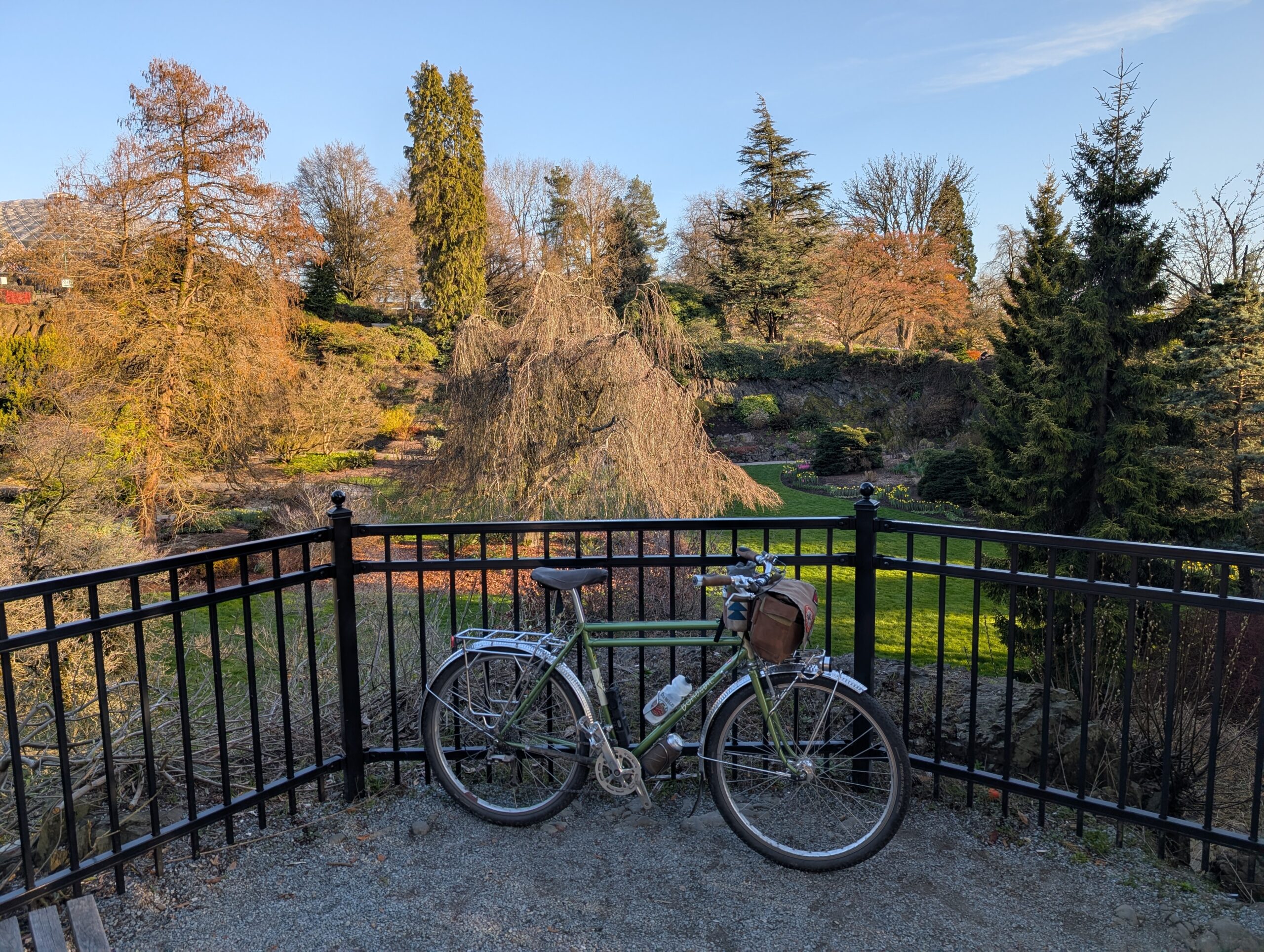
Starting with Monday, I biked up to the bike shop to grab some Newbaums and cables for the Hillborne, which has been sitting mostly-rebuilt for about a month now. I stopped at QE park, near the shop, because it’s beautiful:
Tuesday was a shorter ride to Home Depot for a couple things, and took the opportunity to also purchase some shears for trail maintenance. As it probably already known to anyone reading this, I tend to like the lesser used trails which are often overgrown by mid-spring.
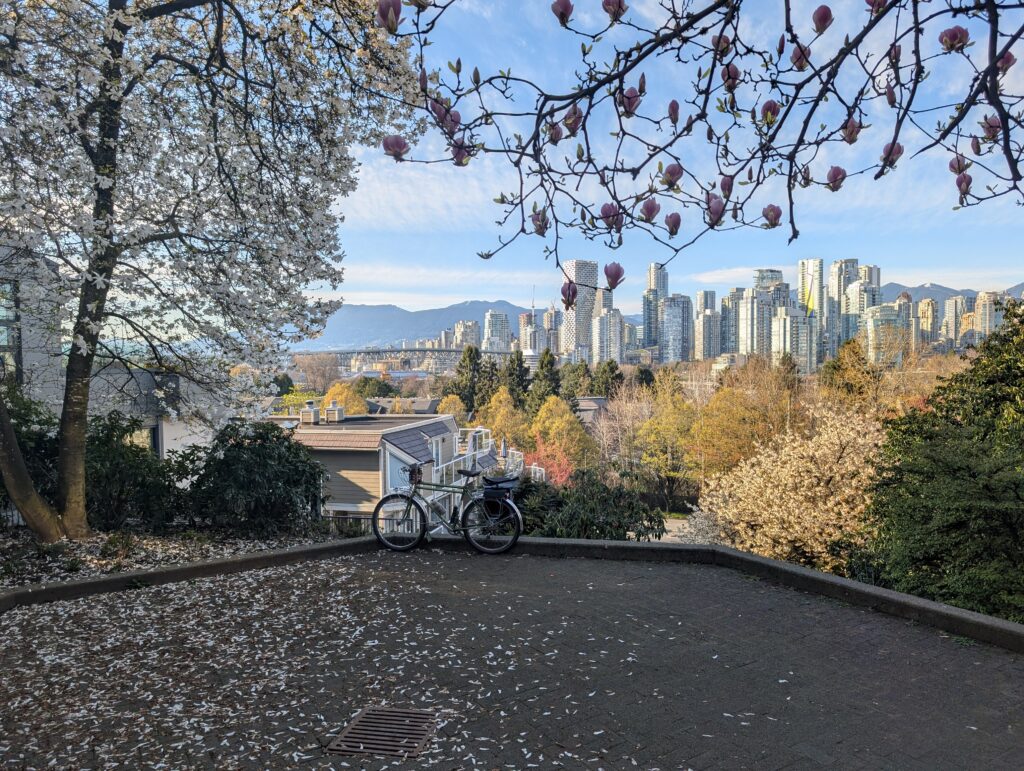
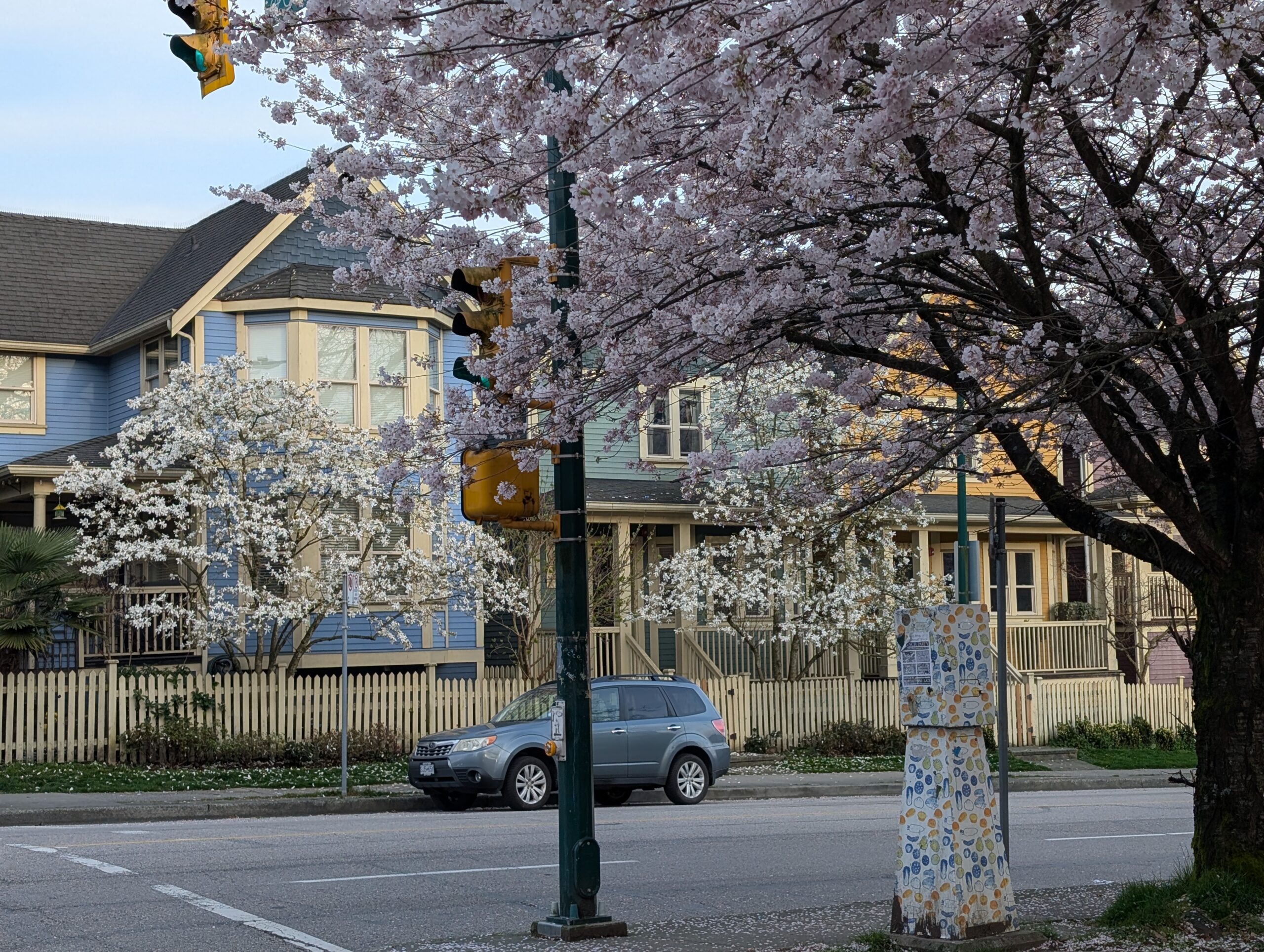
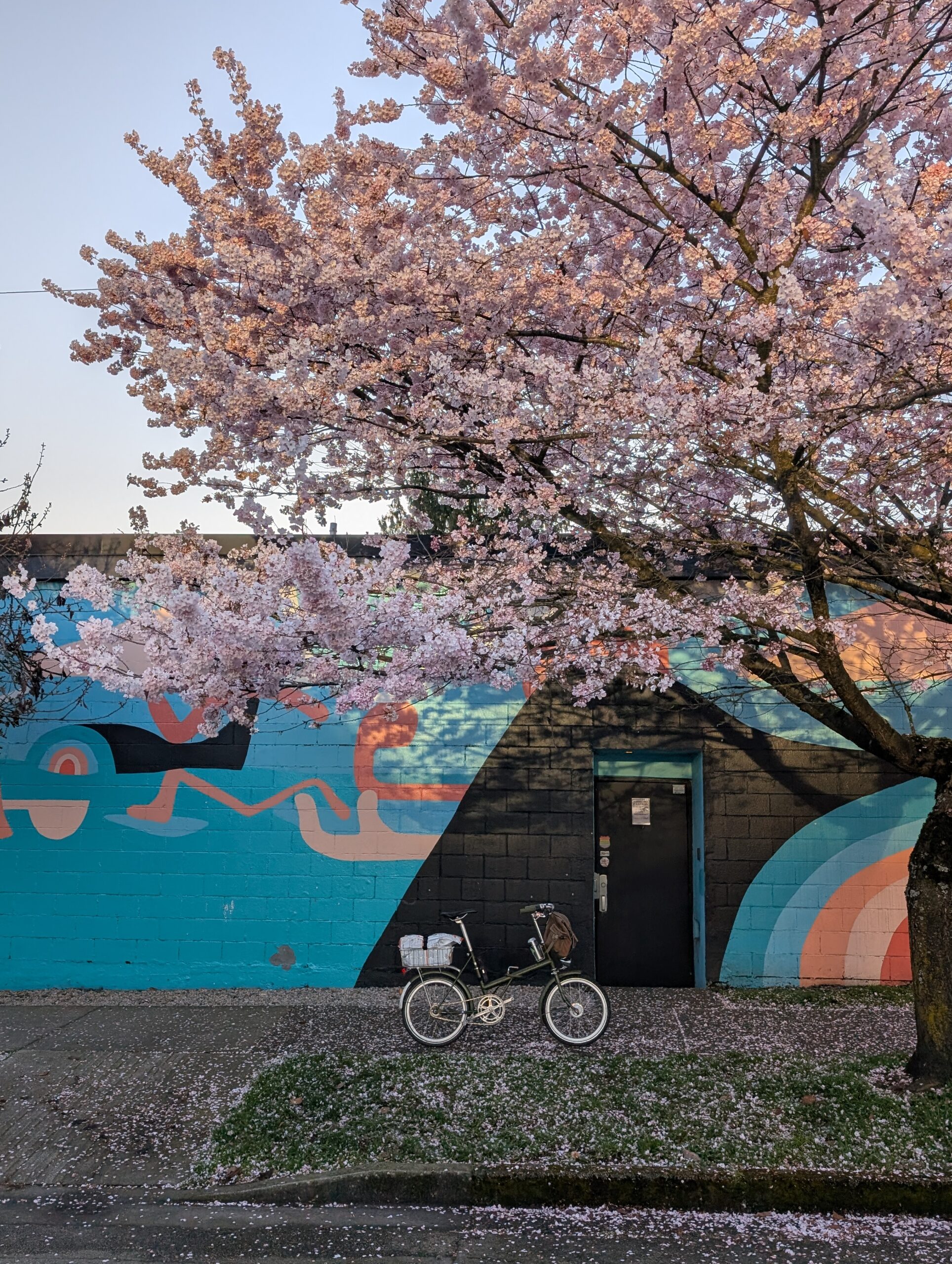
I always hope to get a photo of this scene, with the blossoms going, without a car in it. Alas, there’s always a car or two parked in the shot.
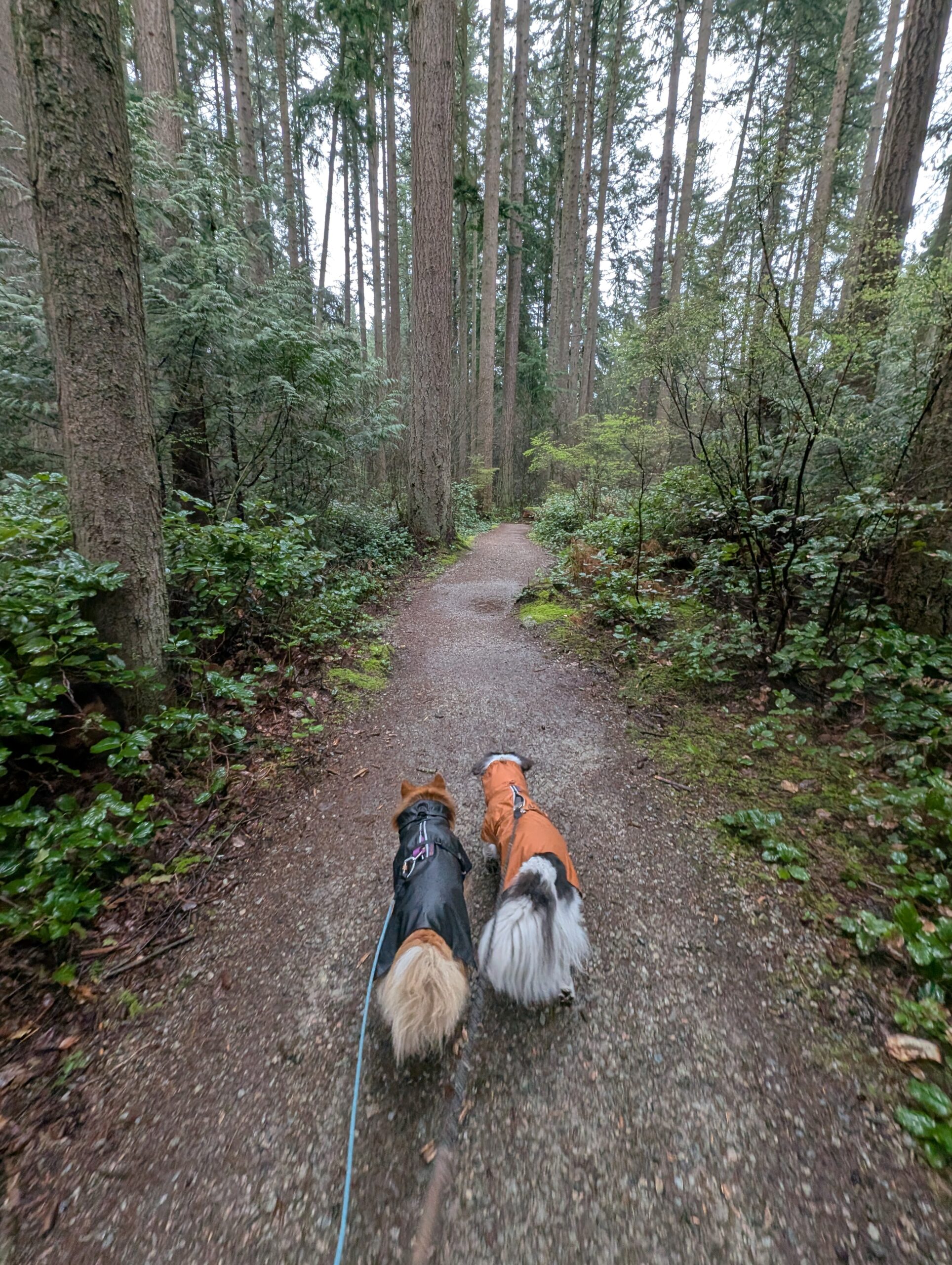
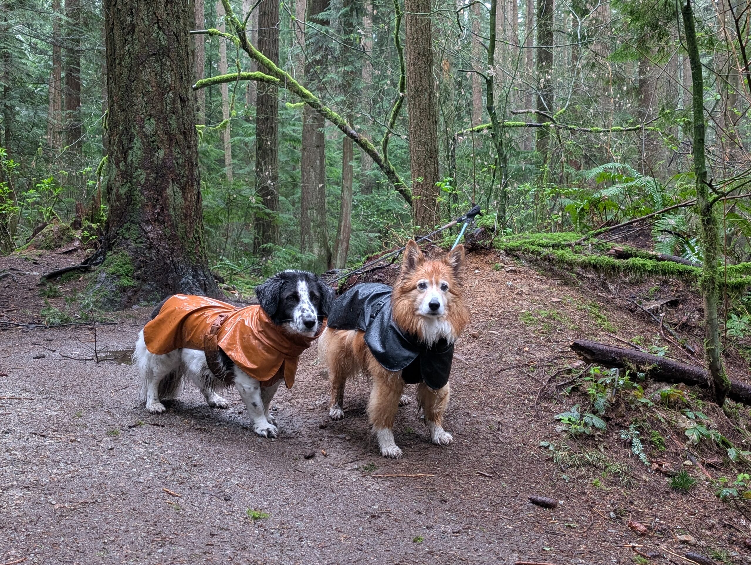
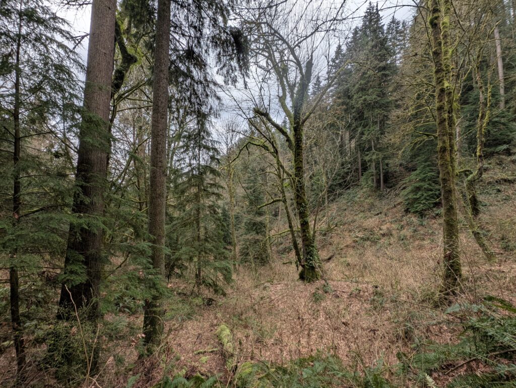
Wednesday I didn’t ride, but I did get a nice forest walk in with the girls while my partner was getting dental work nearby. This was Pacific Spirit Park, and there’s a loop I default to when Aimee’s at the dentist that tends to take just the right amount of time. I love to ride in PSP too, but these are no-bikes trails – which is pretty nice for dog walking. Dogs and bikes really don’t mix that well; I wish the park had better separation for each group’s sake.
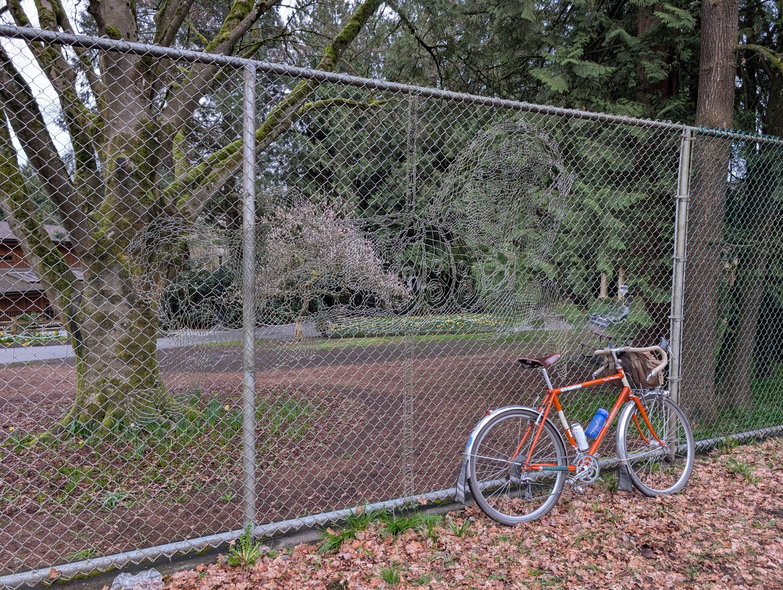
Thursday was the Friday of this week thanks to Good Friday, which I’ll make a separate post about. I got the Hillborne back running and took it for a ~27km loop to Deer Lake. It looks nice in this photo but I was a bit annoyed by the rear brake’s poor performance (friction somewhere, I think, probably the noodle) and some creaks and squeaks that are not unexpected for a bike with over 14,000 km on it and most parts with a few thousand more. I did a strip-and-rebuild, but didn’t replace too many parts; I think it’s time for some further maintenance.
Check out that fence closely! The wires have been augmented into the image of a horse and it’s most impressive up close.
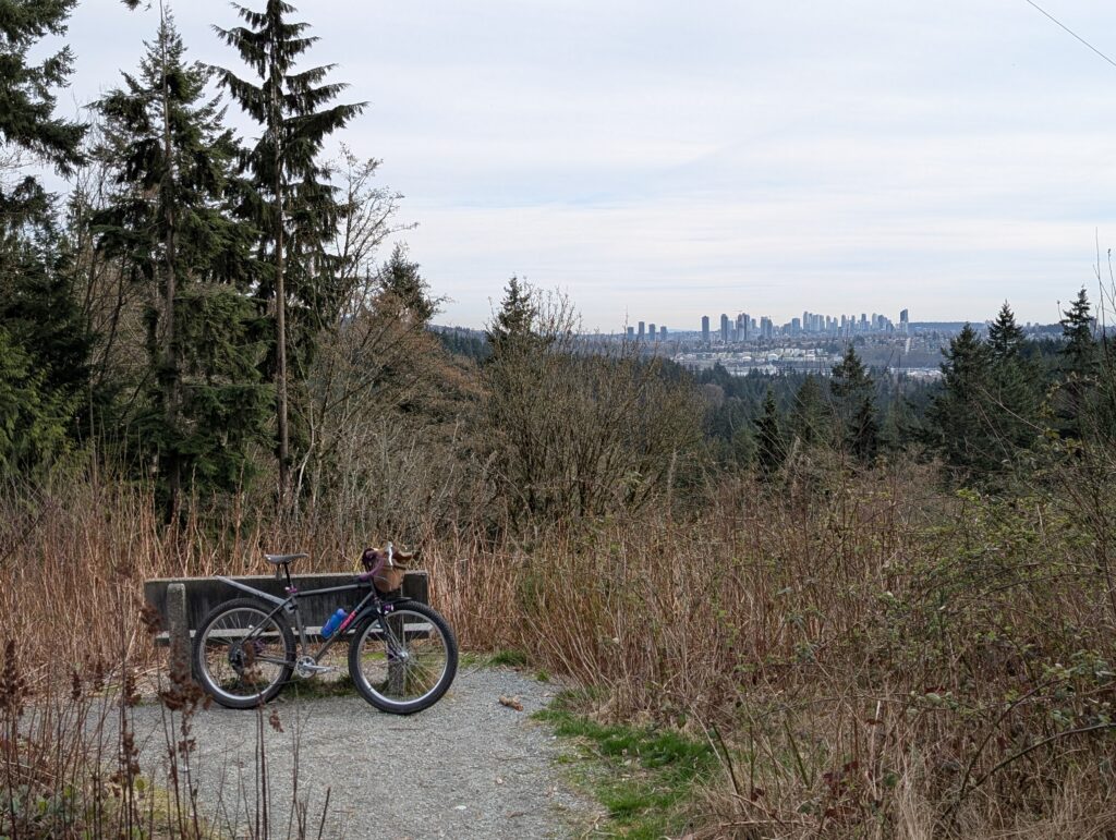
I keep a checklist of rides I want to do so that I can draw upon it for inspiration when it comes time to go for a ride, if I need help with deciding where to go. Two items on that list were riding out to an area about 20km east to try out some pathways I’d seen on google maps, and also to explore the north face of Burnaby Mountain a bit (with the stretch goal of a route from the upper trails to the lower trails). I combined them into one ride today aboard the Bombadil, and took one of my favourite paths to get out there, this old inter-urban rail trail that is basically unknown outside the locals who care for it:
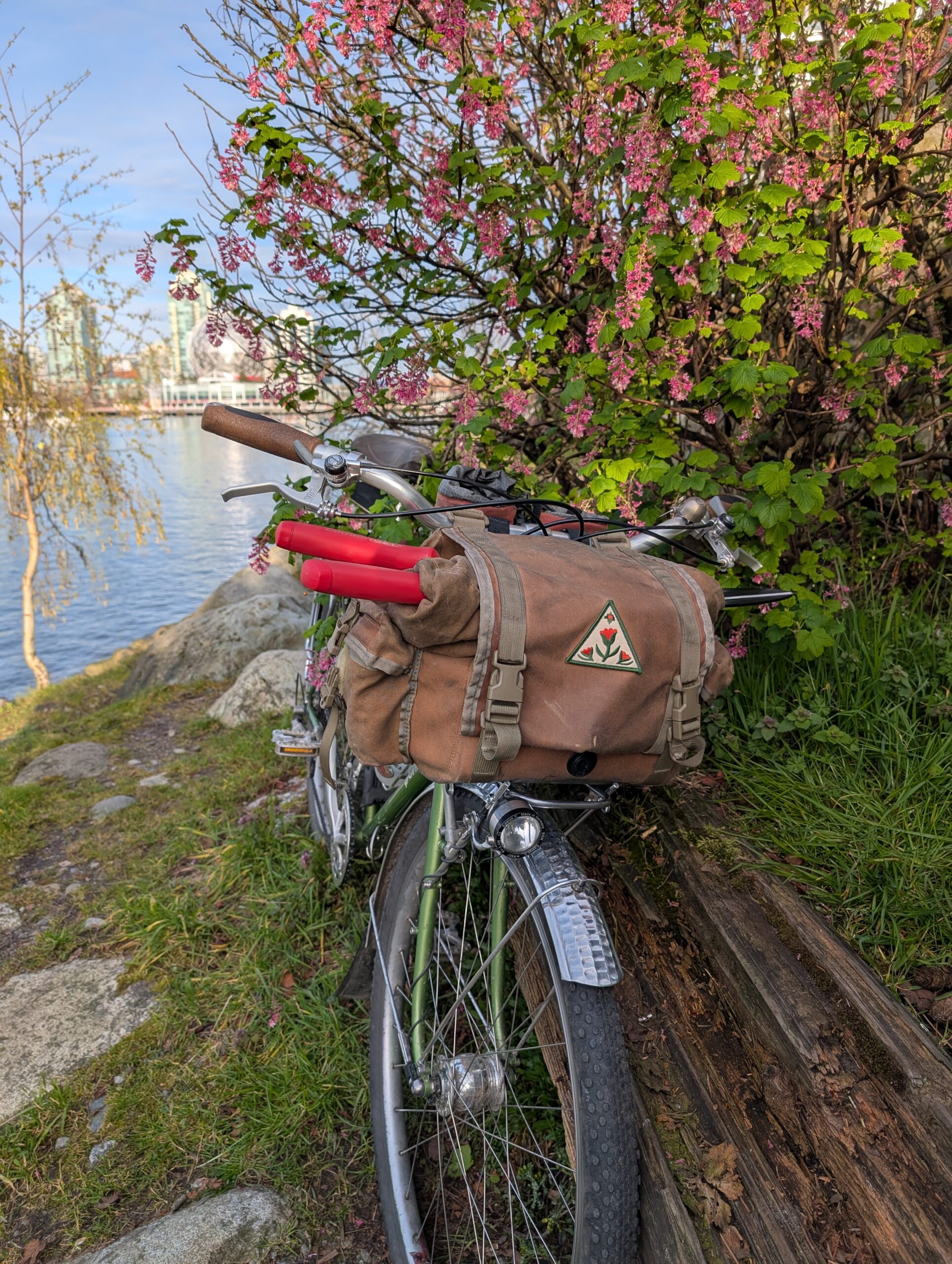
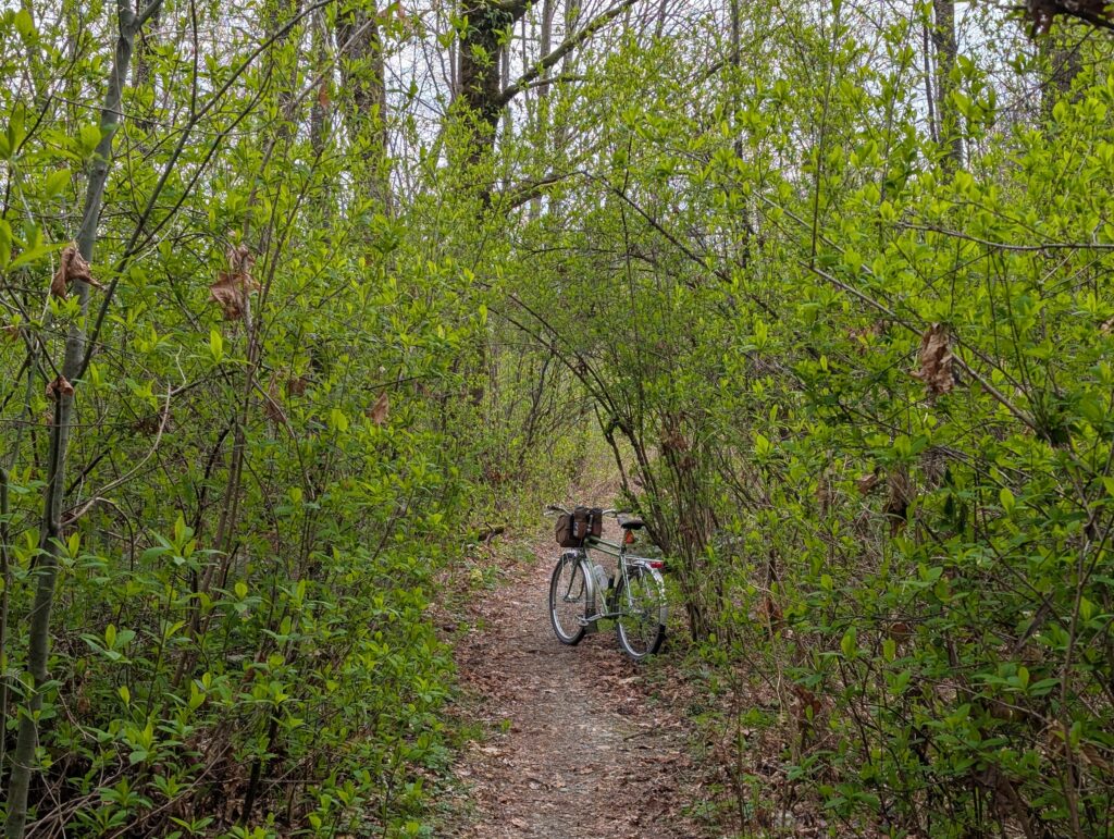
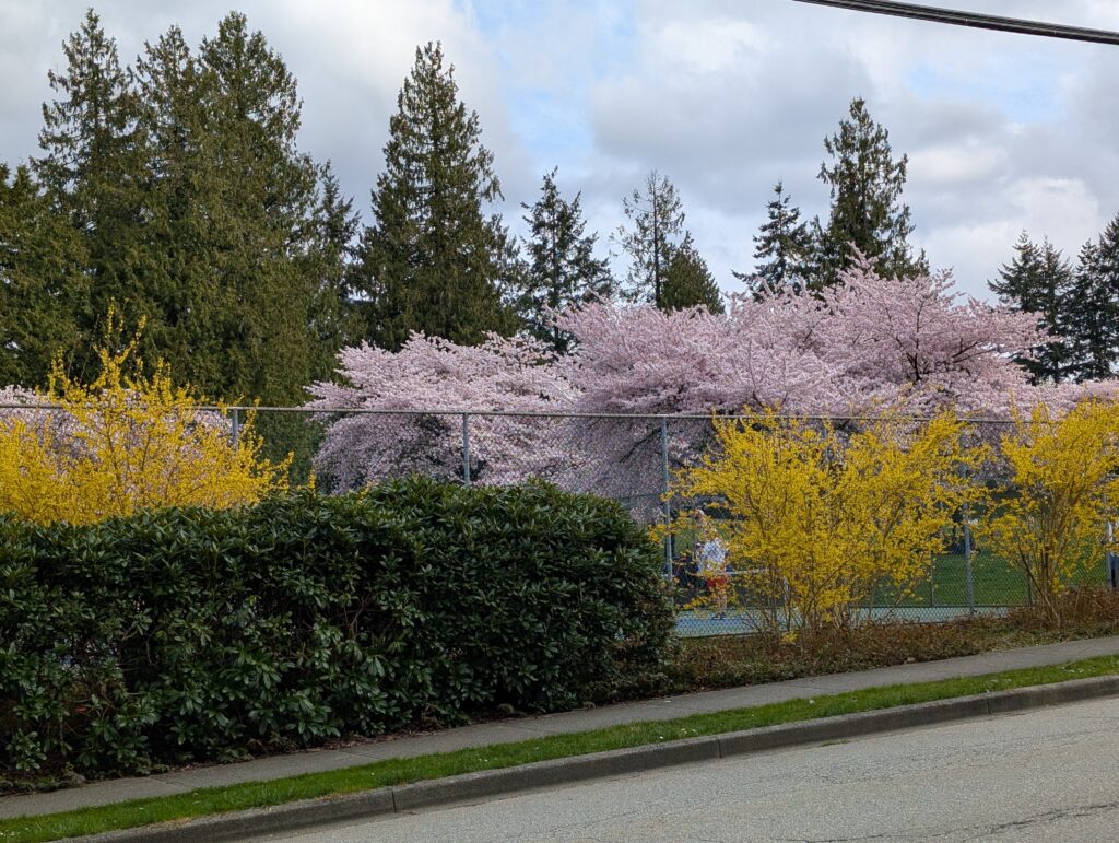
The cherry blossom trees that Vancouver is known for at this time of year is top of most people’s mind for what defines this time of year, but I think I’m more excited about the greening in of the shrubs that line these trails.
The path I wanted to check out is below. It’s a bit peculiar, starting in a busy strip mall before following along a narrow stand of trees between the highway and townhouse complexes. I have to imagine it doesn’t feel very safe at night, particularly if you’re a woman. That aside, it’s quite interesting – just seems like a weird thing to construct, this winding sidewalk in the trees.
After that I rode through a park and some neighbourhood streets to arrive at Dageraad brewing for a burger and a beer. Then I headed for the north slope of Burnaby Mountain to ride up Velodrome trail and look at the topology uphill.
I noticed a hint of a trail off the “real” trail into an open area and decided to follow it, carrying my bike until it was well concealed from the trail then locking it in place. To my surprise I found some pretty old Western red cedars pretty quickly; perhaps they are the reason for the off-shoot trail. I also came across a wide creek ravine, below, where I listened to some Varied Thrush make their distinctive call. I still haven’t seen one, despite hearing them on multiple occasions.
Below is another older cedar, and where I parked my bike. I realized as I clamoured through the woods without a trail that finding my bike could become less straightforward than ideal – but turned out fine, I was well bounded by the terrain.
On the way home, a couple photos below. Surprised by the flooding of a section of path next to Barnet Hwy – would be pretty unfortunate for walkers, being 4-6″ deep and no easy way to avoid it.
And finally, I’ve got to include the colour palette that defines late March in Vancouver: cherry blossoms and forsythia.
It’s still pretty cold, but the days are getting longer and I rode every day except Monday this week. Monday was pretty wet, and Tuesday started rainy also but by the evening it looked like this:
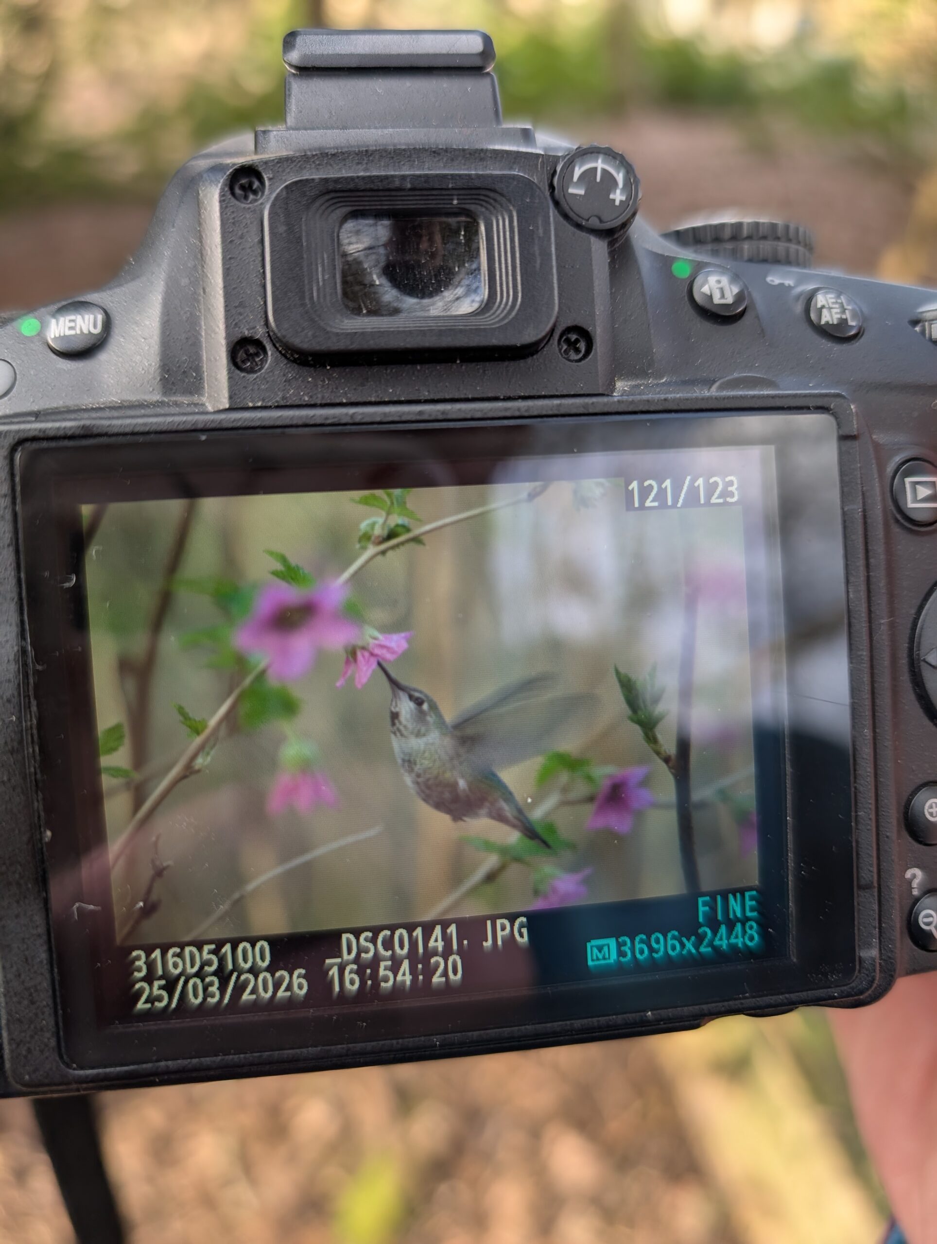
Which was a great excuse to go pick up dog food and beer with the Twenty. On Wednesday I just did a short ride, also on the Twenty, over to the nature sanctuary by PNE to see what birds I could drum up. I got photos of this hummingbird before my camera battery died, then I watched a Yellow Rumped Warbler for a while with my Nocs.
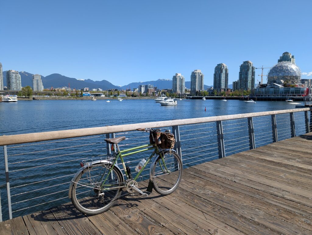
On Thursday I rode with a few friends, five of us total, on a TCR (tall can ride) to Deering Park down in the far southwest of Vancouver. It’s a small and featureless park along the river but it’s become a long-standing tradition among this social circle of mine. As tends to happen when I’m riding with others, I didn’t really take much for photos. Here is my Bombadil at Deering, though:
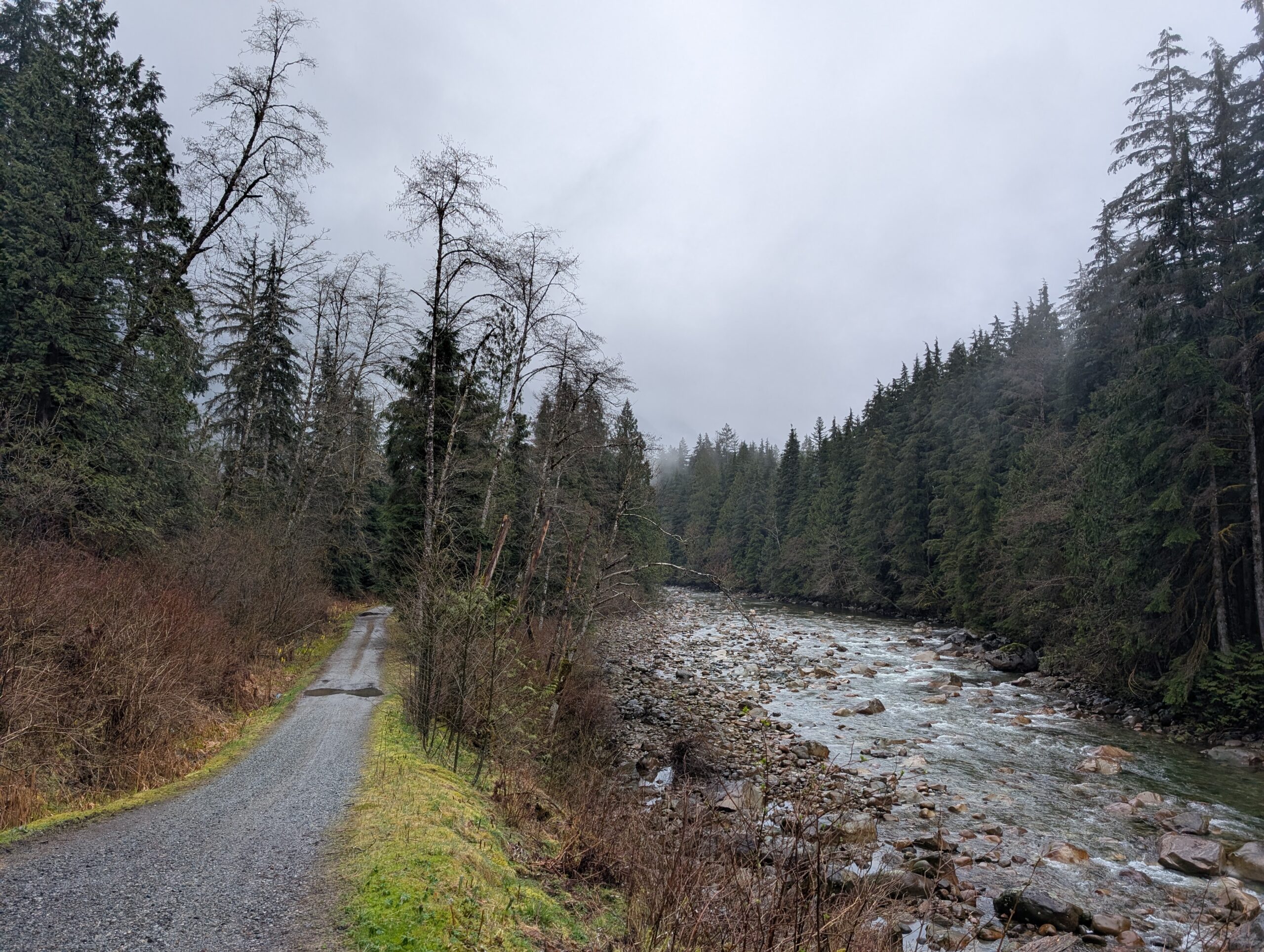
Then Friday, today, I went for a two-hour after work ride up to this lookout at the south end of Richard Juryn trail. I tried the trails down to the river to the west and the terrain was certainly steeper than I expected, resulting in some stairs, but overall good fun.
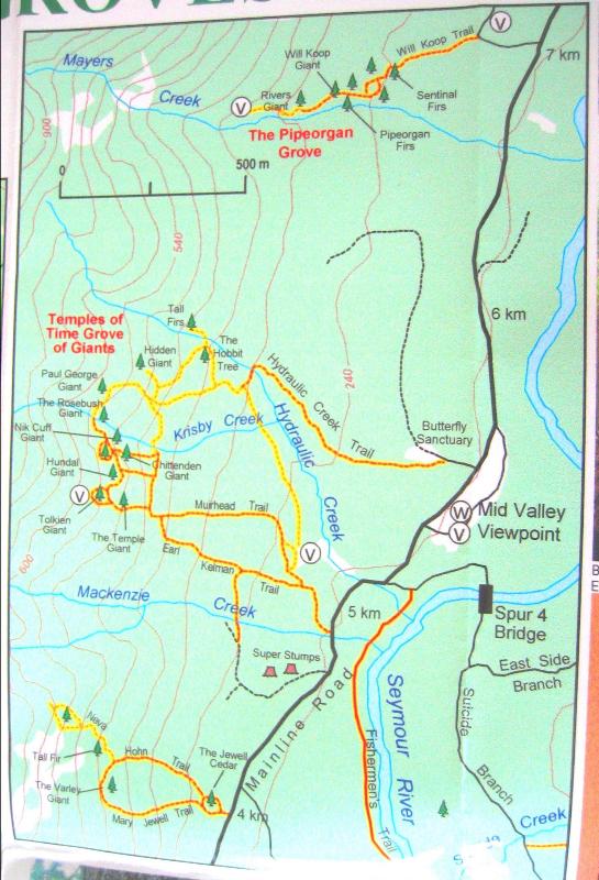
So, for a little while now I’ve been seeking out the oldest and biggest trees that are accessible from town via bike plus hike. I have some favourites in the Seymour valley and a few that I’m aware of but require a longer hike than I’ve been willing to make yet. A little while ago I found out about a grove of what I believe are old Douglas Firs on the east side of the Lynn mountain range, accessed off the LSCR parkway that I frequently ride, dubbed the Temple of Time.
This map was already going out of circulation in 2004, and is from before the paved parkway trail went in (in 2006/2007 I believe?) which is uphill from the Mainline Rd shown. I’ll say this from the outset: I underestimated the terrain based on this map. We knew there would not likely be any trace of the trails left, though perhaps some flagging could still be intact to lead us along. But I underestimated how steep it is after the first bit of the approach. It quickly becomes steep enough you’ve got to use your hands and hold onto things, and navigating between and around the cliffs become a bit of a puzzle.
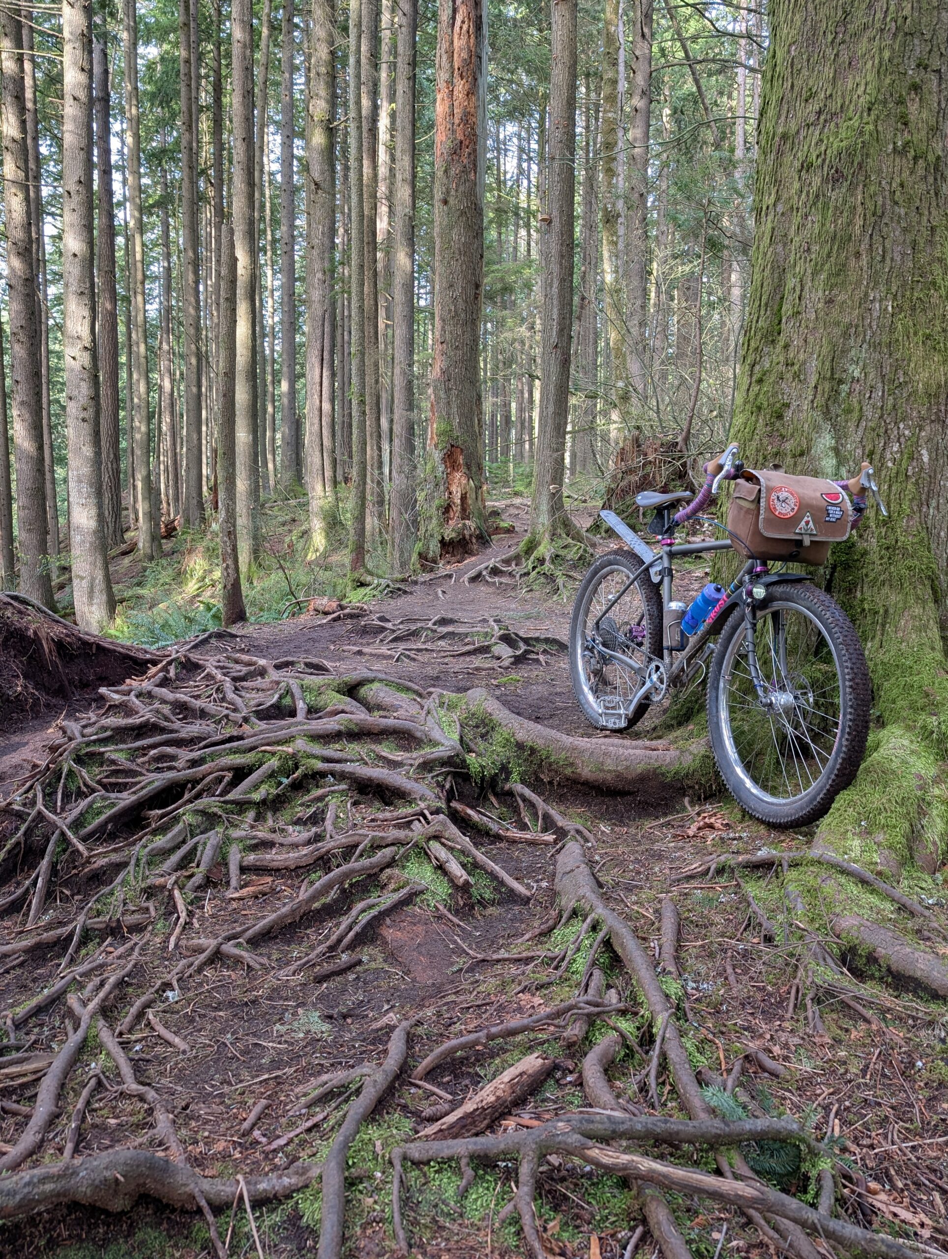
My bike of choice today was the Bombadil. Obviously by name it is very comfortable in the deep forest.
Below is the mid-valley lookout which was about 18 km into the ride and nearing the area where our hike would begin. Funny to think how small a fraction of the day’s effort this was.
We rode up the connector trail and looked for a good spot to jump into the forest from the parkway. This is where we stashed our bikes, locked to each other. The popular paved trail is visible just 20 ft or so behind Tay, but nobody would be looking into the woods here.
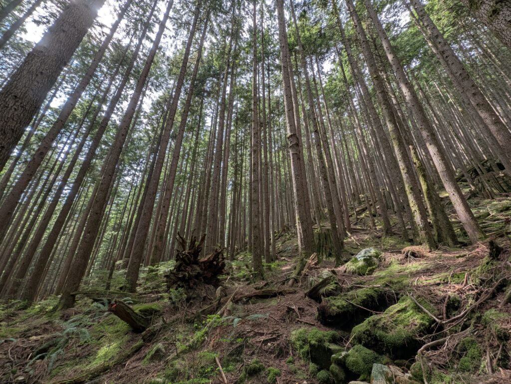
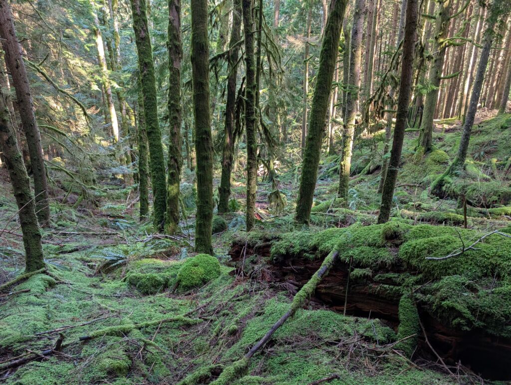
Where we locked our bikes was at 250m elevation. The trees we were looking for were in the 450-550m elevation range. Obviously 300m (about 1000 ft) is not inconsequential, but in my mind, this would be not too bad of a hike. The first stretch was like below – very chill and lovely. Soft ground, not too steep. This carried us up to about the 350m elevation mark.
And the sun would break through sometimes and make everything even more beautiful. There’s been a lot of rain lately so every stream was running, even the ones that are usually dry. The forest is simultaneously so full of beauty I can hardly stand it, but also such a young and recovering forest that would have been so much more impactful, awe inspiring, and healthy if it hadn’t been decimated by logging 100 years ago.
It was not unexpected that things got steeper after this. I was expecting some amount of steep. I was in perfectly good spirits about it, partly because we were starting to see some pretty old Douglas Firs and Hemlocks too. The payoff ratio was pretty good at this point.
From about 350m onwards, it got really steep. I was using my hands as much as my feet, and grabbing hold of whatever was available to scramble up the slope. It wasn’t quite steep enough to be considered exposure in itself, but getting pretty close.
But we were also discovering that sheer cliff faces were abound. The photo below doesn’t really show it, but the reason for that nice peek-a-boo view of the mountains across the valley is in large part due to the tall cliffs only a stone’s throw away.
Looking down at what we’d just clamoured up, below. Photos never do justice, of course. You have to point the lens downhill to get the terrain in view, which makes everything look flat. But taking that into consideration, I think you can probably tell that this is pretty much a “if you fall, you’ll keep going until you hit something” level of steep.
A “Where’s Waldo” type of game, can you see Tay below me as I rest on a fallen log above? At this point we were as high, or higher, than our elevation target but we couldn’t find a way to traverse to where we needed to be due to the aforementioned cliffs in our way. We were both acutely aware that any poor judgement in this terrain could put us in an unsafe situation.
We climbed up to 660m trying to get around the cliffs, and we found a section of the steep ravine that was maybe okay. I got about halfway across and started to get a bad feeling about it. As I turned around, I faced directly downhill, and I felt the blood drain from my face as I stared down a chute hundreds of feet long, steep enough that I wouldn’t stand a chance of stopping on. That was a clear “well, this was fun, time to go back” moment for me.
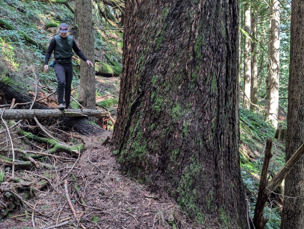
Tay was adamant, and smartly so, that we take the same route down – because otherwise, we don’t know what situation we could find ourselves in. As we made our way, we surveyed the terrain carefully and were able to identify some shortcuts that didn’t pose a risk. In doing so, we actually came across the biggest tree of the day, the ~9ft diameter Douglas fire shown below. What’s a bit ironic is that it’s located at 370m elevation and the approach from where we’d parked our bikes to this tree is quite tame versus what we’d just been through.
While we didn’t reach the trees on the map, we’d had a really good time being immersed and humbled by the forest.